The following is the preface for the Indian Trail Unified Development Ordinance.
If you are looking for the Town's municipal code, CLICK TO VIEW THE INDIAN TRAIL CODE OF ORDINANCES.
The online Development Code of Indian Trail, North Carolina began in-house in 2020 with the assistance of Municipal Code Corporation. This Development Code shall be cited as Indian Trail Unified Development Ordinance or "UDO" as an acronym.
UDO references found within the code maintain a structure by subject matter using a decimal numbering system which identifies the chapter and section (for example: 110.010). This complete set of numbers is designed to aid in searching and/or referencing the Development Code, and to assist in subsequent codification as new ordinances are added to the Development Code.
- The first number in the sequence (110.010) designates the DIVISION level, as written in the table of contents
- The second series of numbers (110.010) designates the Chapter level, as written in the table of contents
- The third series (110.010) designates the Section level, and is expressed using three numerical values
As shown in the Table of Contents, Division 1700 comprises of Appendices 1 through 8.
The legislation herein may be arranged as an alphanumeric ordered list A, 1, a, (1), (A), (a) to show hierarchal relationships. The legislation may also be arranged as an unordered list (using bullets, discs, squares, etc.) to show items without hierarchal relationships. These list structures assist in subsequent codification as new legislation is added. Vacant titles, chapters, or sections may be designed for future use and may be marked “Reserved” to ease internal expansion. The legislative history identifies the specific legal sources of a section as may be provided in footnotes. This Development Code is supplemented from time to time with amendments and additions made by Indian Trail, NC. The specific legal sources that comprise this Development Code have been adopted during the codification process from the original formatting of the official hard copy. In the event of discrepancies between the online Development Code and the official hard copy, the official hard copy governs. Municipal Code Corporation, provides a searchable database of the Development Code for easy reference and convenience. NOTICE: THE DEVELOPMENT CODE MAY NOT REFLECT ALL OR THE MOST CURRENT VERSION OF LEGISLATION ADOPTED BY THE TOWN COUNCIL THAT HAS YET TO BE UPDATED ONLINE. IN THE EVENT OF CONFLICT BETWEEN THE DEVELOPMENT CODE AND A WRITTEN ORDINANCE, THE ORDINANCE TYPICALLY GOVERNS. ALSO, THE DEVELOPMENT CODE MAY NOT REFLECT RULES OR OTHER REGULATIONS PROMULGATED UNDER THE AUTHORITY OF THE CODE, INCLUDING TECHNICAL SPECIFICATIONS. FOR MORE INFORMATION, CONTACT THE TOWN.
Chapter 120 General Rules Of Language And Interpretation
Chapter 130 Comprehensive Plan, Other Plans And Studies
Chapter 140 Zoning Districts
Chapter 150 Official Zoning Map
Chapter 160 Transitional Provisions
110.020 Authority And Purpose
110.030 Jurisdiction
110.040 Applicability
110.050 Effective Date
110.060 Minimum Requirements; Compliance With Other Applicable Regulations
110.070 Conflicting Provisions
110.080 Authorization Of Exemption
110.090 Relationship To The Comprehensive Plan
110.100 Severability
This ordinance shall be known and may be cited as the Indian Trail Unified Development Ordinance.
- This ordinance is adopted pursuant to the authority contained in North Carolina General Statutes, Chapter 160D, Article 18, and for the purpose of promoting the public health, safety, morals, and general welfare of the residents of the Town of Indian Trail.
- This ordinance adopted for the purposes of:
- Protecting and promoting the public health, safety and general welfare;
- Implementing adopted plans and policies;
- Enhancing residents’ quality of life;
- Protecting the character of established residential neighborhoods;
- Maintaining economically vibrant as well as visually attractive business and commercial areas;
- Retaining and expanding the Town’s business and employment base;
- Promoting mixed-use, pedestrian-oriented development patterns;
- Accommodating pedestrian, bicycle and transit use;
- Maintaining orderly and compatible development patterns that promote an appropriate mix of land uses and protect and conserve property values;
- Ensuring adequate light, air, privacy, and access to property;
- Promoting environmentally responsible development practices;
- Promoting rehabilitation and reuse of older buildings;
- Maintaining a range of housing choices and options;
- Establishing clear and efficient development review and approval procedures; and
- Accommodating the orderly and beneficial development of all parts of the Town in accordance with the preceding purposes.
- Whenever any provision of this ordinance refers to or cites a section of the North Carolina General Statutes and that section is later amended or superseded, the ordinance shall be deemed amended to refer to the amended section or the section that most nearly corresponds to the superseded section.
- This Unified Development Ordinance (ordinance) applies to all development, public or private, within the corporate limits of Indian Trail, North Carolina unless otherwise exempted or provided for in this Zoning Ordinance.
- Split Jurisdiction
- Exclusive planning and development regulation jurisdiction may be assigned if a parcel of land lies within the planning and development regulation jurisdiction of more than one local government.
- A mutual agreement between the jurisdictions involved pursuant to Article 20 of Chapter 160A and written consent of the landowner is required to assign the development regulation jurisdiction to one of the local governments.
- The mutual agreement shall only be applicable to development regulations and shall not affect taxation or other non-regulatory matters.
- For adoption and any remaining details, refer to G.S. 160D-203.
Except as provided under DIVISION 1400 of this ordinance (Nonconformities), no person may use, occupy, or sell any land or buildings or authorize or permit the use, occupancy, or sale of land or buildings under his/her control except in accordance with all of the applicable provisions of this ordinance. For purposes of this section, the "use" or "occupancy" of a building or land relates to anything and everything that is done to, on, or in that building or land.
The provisions in this ordinance were adopted on February 9, 2021 and became effective on February 10, 2021.
- The provisions of the ordinance are the minimum requirements deemed necessary to carry out the ordinance’s stated purpose and intent.
- In addition to the requirements of the ordinance, all uses and development must comply with all other applicable Town, county, state, and federal regulations.
- All new developments must comply with the Union County’s Adequate Public Facilities Ordinance adopted September 22, 2006 consistent with the memorandum of understanding between the Indian Trail Town Council and the Union County Board.
- All references in the ordinance to other Town, county, state, or federal regulations are for informational purposes only and do not constitute a complete list of such regulations. These references do not imply any responsibility for the Town to enforce county, state or federal regulations.
- Conflict with State or Federal Regulations If the provisions of this ordinance are inconsistent with those of the state or federal government, the more restrictive provision will control, to the extent permitted by law. The more restrictive provision is the one that imposes greater restrictions or more stringent controls.
- Conflict with Other Town Regulations If the provisions of this ordinance are inconsistent with one another, or if they conflict with provisions found in other adopted ordinances or regulations of the Town, the more restrictive provision will control. The more restrictive provision is the one that imposes greater restrictions or more stringent controls.
- Conflict with Private Agreements and Covenants This ordinance is not intended to interfere with, abrogate or annul any easement, covenant, deed restriction or other agreement between private parties. If the provisions of this ordinance impose a greater restriction than imposed by a private agreement, the provisions of this ordinance will control. If the provisions of a valid, enforceable private agreement impose a greater restriction than this the provisions of the private agreement will control. The Town does not enforce or maintain a record of private agreements.
- The Town Council may issue an “authorization of exemption” from the provisions of this Ordinance for publicly owned, tax supported facilities when the following exists:
- A request for authorization of exemption is heard in a public meeting; and
- The Town Council determines the provisions would result in an undue hardship for the publicly owned, tax supported facility; and
- The exemption of the provisions would not result in a threat to the public health, safety, morals and general welfare of the residents of the Town of Indian Trail.
- The following publicly owned facilities shall be deemed exempt by right from the provisions of this ordinance without the need for any exemption request or issuance of authorization of exemption by the Town Council:
- Union County Crooked Creek Wastewater Treatment Plant facility and any future onsite expansions to said facility located at 4015 Sardis Church Road and consisting of Tax Parcel Number 07066015B.
It is the intention of the Town Council that this ordinance implements the planning policies adopted by the Town Council for the Town as reflected in the Town of Indian Trail Comprehensive Plan. While the Town Council reaffirms its commitment that this ordinance and any amendment to it are in conformity with the adopted comprehensive plan, the Town Council hereby expresses its intent that neither this ordinance nor any amendment to it may be challenged on the basis of any alleged nonconformity with any planning document.
It is hereby declared to be the intention of the Town Council that the sections, paragraphs, sentences, clauses, and phrases of this ordinance are severable, and if any such section, paragraph, sentence, clause, or phrase is declared unconstitutional or otherwise invalid by any court of competent jurisdiction in a valid judgment or decree, such unconstitutionality or invalidity shall not affect any of the remaining sections, paragraphs, sentences, clauses, or phrases of this ordinance since the same would have been enacted without the incorporation into this ordinance of such unconstitutional or invalid section, paragraph, sentence, clause or phrase.
120.020 Tenses And Usage
120.030 Miscellaneous Terminology Rules
120.040 Conjunctions
120.050 Fractions
120.060 Headings And Illustrations
120.070 (Reserved)
120.080 Current Versions And Citations
120.090 Lists And Examples
120.100 Delegation Of Authority
120.110 Public Officials And Agencies
120.120 Commentaries
The language of the ordinance must be read literally. Regulations are no more or less strict than stated. Words defined in DIVISION 1600 have the specific meaning assigned, unless the context expressly indicates another meaning. Words that are not defined in DIVISION 1600 have the meaning given in the latest edition of Merriam-Webster’s Unabridged Dictionary.
- Words used in the singular include the plural. The reverse is also true.
- Words used in the present tense include the future tense. The reverse is also true.
- The words “must,” “will,” “shall” and “may not” are mandatory.
- The word "may" is permissive in nature, except when the context of the particular use is negative, and then it is mandatory.
- When used with numbers, “up to X,” “not more than X” and “a maximum of X” all include X.
- The word "person" includes a firm, association, organization, partnership, corporation, trust, and company as well as an individual.
- The word "lot" includes the word "plot" or "parcel" or “tract”.
- The words "used" or "occupied" as applied to any land or building shall be construed to include the words "intended, arranged, or designed to be used or occupied".
- The term "Town Council" shall mean the "Town Council of Indian Trail, North Carolina".
- The term "Planning and Zoning Board" shall mean the "Planning and Zoning Board of Indian Trail, North Carolina".
- The term "Street" shall mean any "road, street, roadway, alley, avenue, thoroughfare, boulevard, highway or interstate”.
- In the event of a conflict between the text of these regulations and any caption, figure, illustration, or table, the text of these regulations shall control.
- Any reference to a Division or Chapter shall mean a Division or Chapter of this Ordinance, unless otherwise specified.
- The term “Planning and Development Director”, shall mean the “Planning Director of Indian Trail, North Carolina” who is also the Zoning Administrator.
- The term "Engineering Director" shall mean the "Engineering Director Indian Trail, North Carolina," who is also the Stormwater Administrator.
- The term "days" shall mean "calendar days" unless stated otherwise.
Amended by Ord. O210209-347 on 2/8/2021
Amended by Ord. 397 on 3/26/2024
Amended by Ord. 410 on 12/10/2024
Unless the context otherwise clearly indicates, conjunctions have the following meanings:
- “And” indicates that all connected items or provisions apply; and
- “Or” indicates that the connected items or provisions may apply singularly or in combination.
The following rules apply to factional number unless otherwise expressly stated.
- Minimum Requirements When a regulation is expressed in terms of a minimum requirement, any fractional result of 0.5 or more must be rounded up to the next consecutive whole number. For example, if a minimum requirement calling for one tree to be provided for every 30 linear feet of frontage is applied to a 50-foot dimension, the resulting fraction of 1.67 is rounded up to 2 required trees.
- Maximum Limits When a regulation is expressed in terms of maximum limits, any fractional result will be rounded down to the next lower whole number. For example, if a maximum limit of one dwelling unit for every 5,000 square feet is applied to a 12,500 square foot lot, the resulting fraction of 2.5 is rounded down to 2 (allowed dwelling units).
Headings and illustrations are provided for convenience and reference only and do not define or limit the scope of any provision of this ordinance. In case of any difference of meaning or implication between the text of this ordinance and any heading, drawing, table, figure, or illustration, the text controls.
All references to other Town, county, state, or federal regulations in this ordinance refer to the most current version and citation for those regulations, unless expressly indicated otherwise. When the referenced regulations have been repealed and not replaced by other regulations, ordinance requirements for compliance are no longer in effect.
Unless otherwise expressly indicated, lists of items or examples that use “including,” “such as,” or similar terms are intended to provide examples only. They are not to be construed as exhaustive lists of all possibilities.
Whenever a provision appears requiring the head of a department or another officer or employee of the Town to perform an act or duty, that provision will be construed as authorizing the department head or officer to delegate that responsibility to others over whom they have authority. Delegation of authority is not allowed when the provisions of this ordinance expressly prohibit such a delegation.
All employees, public officials, bodies, and agencies to which references are made are those of the Town of Indian Trail unless otherwise expressly stated.
Commentaries are sometimes included in the ordinance as a means of clarifying certain provisions or providing supplemental information. Text marked as “Commentary” has no regulatory effect. It is intended solely as a guide for administrative officials and the public. Commentaries may be added to the ordinance by the Planning Director without the need for a formal ordinance amendment.
Commentary: When commentaries are provided, they will appear in this manner.
130.020 Other Plans And Studies
130.030 Adoption And Effect Of Plans
- Pursuant to 160D-501, a local government shall adopt and reasonably maintain a comprehensive plan as a condition of adopting and applying zoning regulations. The Town currently has an adopted comprehensive plan.
- A comprehensive plan sets forth goals, policies, and programs intended to guide the present and future physical, social, and economic development of the Town based on an analysis of present and future needs. Planning analysis may address inventories of existing conditions and assess future trends regarding demographics, economic, environmental, and cultural factors.
- A local government may prepare and adopt other plans as deemed appropriate.
- Other plans may include, but is not limited to, land use plans, small area plans, neighborhood plans, hazard mitigation plans, transportation plans, housing plans, and recreation and open space plans.
- Such plans shall be considered in review of proposed zoning amendments and development decisions based on the regulations in this ordinance.
- Plans shall be adopted by Town Council with the advice and consultation of the Planning and Zoning Board.
- Adoption and amendment of a comprehensive plan is a legislative decision and shall follow the process for zoning text amendments in Chapter 320.
- A plan amendment and a zoning amendment may be considered concurrently pursuant to G.S. 160D-605(a).
- When adopting or rejecting a proposed amendment, Council shall approve a brief plan consistency statement describing whether its action is consistent or inconsistent with the Comprehensive Plan. The requirement for this statement may also be met by making a clear indication in the meeting minutes as depicted under G.S. 160D-605.
- The required statement of reasonableness and the plan consistency statement may be approved as a single statement or separately pursuant to G.S. 160D-605(c).
- Plans shall be advisory in nature without independent regulatory effect and do not expand, diminish, or alter the scope of authority for development regulations adopted relative to the plans.
- If a plan is deemed amended by a Town Council statement of reasonableness and/or plan consistency statement pursuant to G.S. 160D-605 by virtue of adoption of a zoning amendment that is inconsistent with the plan, that amendment shall be noted in the plan.
- The Town may undertake planning activities in coordination with other governments, state agencies, or regional agencies pursuant to G.S. 160D-503.
140.020 General Use Districts
140.030 Conditional Zoning Districts
140.040 Overlay Districts
For the purpose of this ordinance, portions of the Town, as specified on the Town’s Official Zoning Map are hereby divided into the following zoning districts:
| Residential Zoning Districts | |
| RSF | Rural Single-Family |
| SF-1 | Single-Family, Low Density |
| SF-2 | Single-Family, Low to Medium Density |
| SF-3 | Single Family, Medium Density |
| SF-4 | Single-Family, Medium to High Density |
| SF-5 | Single-Family, High Density |
| MFR | Multi-Family Residential |
| Commercial Zoning Districts | |
| NBD | Neighborhood Business District |
| GBD | General Business District |
| RBD | Regional Business District |
| Downtown Districts* | |
| DCD | Downtown Core District |
| DTD | Downtown Transitional District |
| DTD-R | Downtown Transitional, Residential District |
| Industrial Zoning Districts | |
| L-I | Light Industrial |
| H-I | Heavy Industrial |
| Other Zoning Districts* | |
| CZ | Conditional Zoning (PD, TND, MXD, CUD)** |
| I | Institutional |
| Overlays | |
| O-MO | Mining Overlay |
| O-NSAC | Neighborhood Services Activity Center Overlay |
| O-MUAC | Mixed Use Activity Center Overlay |
| O-SRAC | Sub-Regional Activity Center Overlay |
* Note that previous special approvals such as PUD, PND, PRD, and CUD now use the designator CZ on the base zoning district since there are conditions involved and revision requests would require the CZ process to make any modifications.
** The following designation of TND is a design approach mentioned in this UDO, but is not to be used as a designator for a district or overlay.
Amended by Ord. O210209-347 on 2/8/2021
Adopted by Ord. 393 on 11/14/2023
Amended by Ord. 397 on 3/26/2024
Amended by Ord. 423 on 1/13/2026
Also known as base zoning districts, these represent the traditional residential, commercial, and industrial districts established above. They set uniform standards for uses in their district and are the governing standards unless overlaid with more restrictive standards as in the case of an overlay district. Note that the ordinance may include development standards that apply uniformly jurisdiction-wide rather than being applicable only in particular zoning districts pursuant to G.S. 160D-703 (d).
Applicants may apply for conditional zoning districts consistent with Chapter 330 of this UDO. Conditional Zones shall be established for all Planned Unit Developments, Traditional Neighborhood Developments, Mixed Use Developments, Cluster and Open Space Subdivisions. Conditional districts are classification where the property owner commits and agrees to limit the use of their property to a particular use or commits to subject their property to specific restrictions as a pre-condition to any rezoning. These conditions are limited to those that address the conformance of the development and use of the property to the goals and objectives of the Town’s UDO and comprehensive plan and to those impacts reasonably expected to be generated from the development or the use of the property.
Overlay districts are districts that are superimposed over properties that are also subject to other “underlying” zoning district requirements. An overlay district can affect the regulations applicable to properties within such districts in two ways. First, an overlay district can add to the regulations of the underlying district or make such regulations more restrictive. Second, an overlay district can alter the regulations of the underlying district so that they are less restrictive.
- The Mixed Use Activity Center Overlay, and the Sub-Regional Activity Center Overlay, are two such overlay districts.
- Overlay zoning districts shall appear on the Official Zoning Map.
- The previous Pre-existing Development (PED) Overlay districts were shown on previous UDOs, and Official Zoning Maps with labels PED1, PED2, etc. The base zoning districts under the PED district overlays now use the designator CZ since there are conditions involved and revision requests would require the CZ process to make any modifications.
Amended by Ord. O210209-347 on 2/8/2021
Adopted by Ord. 393 on 11/14/2023
Amended by Ord. 397 on 3/26/2024
150.020 Maintenance And Updates
150.030 District Boundaries
150.040 Interpretation Of Zoning District Boundaries
150.050 Incorporation Of State Or Federal Agency Mapping
A map which shall show the boundaries of all zoning districts within the Town's planning jurisdiction shall be known as the Official Zoning Map. The location and boundaries of the zoning districts established by this ordinance are shown on a geographic coverage layer entitled “Zoning” that is maintained as part of the Town’s geographic information system (GIS) under the direction of the Planning Director. This “Zoning” geographic coverage layer constitutes the Town of Indian Trail’s official zoning map. The official zoning map—together with all notations, references, data and other information shown on the map— is adopted and incorporated into this ordinance. It is as much a part of this ordinance as if actually depicted within its pages. The following includes general provisions for the official zoning map:
- The Official Zoning Map shall be generated in a digital format from which prints, or digital copies can be made, shall be kept in the Town Hall.
- The Official Zoning Map is adopted and incorporated herein by reference. Amendments to this map shall be made and notice in accordance with Chapter 310.
- Should the Official Zoning Map be lost, destroyed, or damaged, it can be generated in a digital format from which prints can be made, so long as no district boundaries are changed in this process.
- The Planning Director is responsible for directing revisions to the official zoning map to reflect its amendment as soon as possible after the effective date of zoning map amendments (rezonings). No unauthorized person may alter or modify the official zoning map. The Director of Planning and Development may authorize printed copies of the official zoning map to be produced, and must maintain digital or printed copies of superseded versions of the official zoning map for historical reference.
- Current and adopted zoning district maps shall be maintained for public inspection in the office or on the Town website in a digital, reproducible format pursuant to G.S. 160D-105 (a).
- When zoning district boundaries are based on officially adopted or promulgated by state and federal agencies and if the regulation provides that the zoning district boundaries are automatically amended to remain consistent with any agency map changes, a copy of the currently effective version shall be maintained in paper or digital format pursuant to G.S. 160D-105 (b). Examples of such maps may include flood insurance rate maps and watershed boundary maps.
When the ordinance establishing a zoning boundary identifies the boundary as following a particular feature, or reflects a clear intent that the boundary follows the feature, the boundary will be construed as following that feature as it actually exists. The official zoning map must note any such relationship between a zoning boundary and other mapped feature on the zoning map when entering the zoning boundary.
- Where uncertainty exists as to the boundaries of any district shown on the Official Zoning Map, the Planning Director shall employ the following rules of interpretation:
- Centerline Where a boundary line lies within and follows a street right-of-way, a railroad right-of-way, or utility easement, the boundary shall be construed to be in the center of such street right-of-way, railroad right-of-way, or utility easement. If such a street right-of-way, railroad right-of-way, or utility easement forming the boundary between two separate zoning districts is abandoned or removed from dedication, the district boundaries shall be construed as following the edge of the abandoned or vacated street bed or utility easement.
- Edge Line Where a boundary line follows the edge of a street or alley right-of-way, a railroad right-of-way, or utility easement, the boundary shall be construed to be in the edge of such street or alley right-of-way, railroad right-of-way, or utility easement. If such a street or alley right-of-way, railroad right-of-way, or utility easement forming the boundary between two separate zoning districts is abandoned or removed from dedication, the district boundaries shall be construed as following the edge of the abandoned or vacated road bed or utility easement.
- Town Limits Boundaries indicated as approximately following town limits shall be construed as following the town limits.
- Watercourses Boundaries indicated as approximately following the centerlines of streams, rivers, canals, lakes, or other bodies of water shall be construed to follow such center lines.
- Extensions Boundaries indicated as parallel to or extensions of street rights-of-way, channelized waterways, railroad rights-or-way, utility easements, lot lines, town limits, county lines, or extraterritorial boundaries shall be so construed.
- Scaling In a case where a district boundary does not coincide with any boundary lines as above and no distances are described by specific ordinance; the boundary shall be determined by the use of the scale appearing on the map.
- Interpretation In the event any uncertainty exists with respect to the intended boundaries as shown on the official zoning map, the Planning Director is authorized to interpret the boundaries. Where an individual is not in agreement with the interpretation, the Planning and Zoning Board convening as a quasi-judicial proceeding shall have the authority to hear appeals to said interpretation of zoning district boundaries in accordance with G.S. 160D-405 as per Chapter 230, "Planning and Zoning Board".
- Mapping information officially adopted by state or federal agencies may be incorporated at times into the official zoning map pursuant to G.S. 160D-105. An example of such mapping is the flood-insurance rate maps (FIRMs).
- The most recent officially adopted version of such mapping may be incorporated into the official zoning map with no need for an ordinance amendment.
- If such agency mapping is used, the town must maintain a current effective map for public inspection in paper or digital format.
160.020 Permits Issued Before February 9, 2021
160.030 Regulation Choice
160.040 Violations Continue
160.050 Nonconformities
160.060 2008 Zoning District Conversions
Complete applications that are pending approval before February 9, 2021 may be reviewed and approved in accordance with the ordinance in effect immediately before February 9, 2021. All development applications submitted on or after February 9, 2021 must be reviewed under the terms of this ordinance.
Any building, development or structure for which a final building permit was issued before February 9, 2021 may be completed in conformance with the issued building permit and other applicable permits and conditions, even if such building, development or structure does not fully comply with provisions of this ordinance. If building is not commenced and diligently pursued within the time allowed under the original permit or any extension granted, then the building, development or structure must be constructed, completed and occupied only in strict compliance with the standards of this ordinance.
Any violation of the previous ordinance will continue to be a violation under this ordinance and be subject to penalties and enforcement under DIVISION 1500, "Violations, Penalties and Enforcement". If the use, development, construction or other activity that was a violation under the previous ordinance complies with the express terms of this ordinance, enforcement action will cease, except to the extent of collecting penalties for violations that occurred before the effective date specified in Section 110.050. The adoption of this ordinance does not affect nor prevent any pending or future prosecution of, or action to abate, violations of the previous ordinance that occurred before the effective date specified in Section110.050.
- Any nonconformity under the previous ordinance will also be nonconformity under this ordinance, as long as the situation that resulted in the nonconforming status under the previous regulation continues to exist. If, however, a nonconforming situation under previous zoning regulations becomes conforming because of the adoption of this ordinance, or any subsequent amendment to it, then the situation will no longer be considered a nonconformity. A situation that did not constitute a nonconforming situation under the previously adopted ordinance does not achieve nonconforming status under this ordinance merely by repeal of the previous ordinance.
- The Planning Director has the discretion of declaring uses conforming that may have become unintentional non-conformities due to a change in nomenclature in this ordinance, or to a change in the new permitted use table found in DIVISION 500.
The original ordinance effective December 30, 2008 provided the following conversion table for zoning district classifications in effect before the effective date as follows:
| Pre-2008 UDO District | 2008 UDO New District | 2023 UDO Existing/New District |
| RESIDENTIAL ZONING DISTRICTS | ||
| RC-80 | (Eliminated) | (NA) |
| RA-40 | RSF | RSF |
| R-40 | RSF | RSF |
| RA-20 | SF-1 | SF-1 |
| R-20 | SF-1 | SF-1 |
| (NA) | SF-2 | SF-2 |
| (NA) | SF-3 | SF-3 |
| R-8 | SF-4 | SF-4 |
| R-6 | SF-5 | SF-5 |
| R-6 Multi-Family | MFR | MFR |
| COMMERCIAL AND INSTITUTIONAL ZONING DISTRICTS | ||
| O | NBD; CBD if located within the Downtown Overlay | NBD (CBD transitioned to Downtown Districts) |
| B-1 | CBD | (Eliminated - transitioned to Downtown Districts) |
| B-2 | NBD/CBD if located within the Downtown Overlay | NBD (CBD transitioned to Downtown Districts) |
| B-3 | NBD | NBD |
| B-4 | GBD | GBD |
| HC | RBD | RBD |
| B-6 | (Eliminated) | (NA) |
| (NA) | I | I |
| DOWNTOWN DISTRICTS | ||
| (NA) | (NA) | DCD |
| (NA) | (NA) | DTD |
| (NA) | (NA) | DTD-R |
| INDUSTRIAL DISTRICTS | ||
| LI | L-I | L-I |
| HI | H-I | H-I |
| OTHER DISTRICTS | ||
| (NA) | (NA) | Conditional Zoning District (CZ) plus Base Zoning District |
| OVERLAYS | ||
| Downtown Overlay | Downtown Overlay | (Eliminated) |
| Flood Plain/Floodway Overlay | Flood Plain and Floodway Overlay | Flood Plain and Floodway Overlay |
| Mining Overlay | Mining Overlay District | Mining Overlay |
| (NA) | Goose Creek Overlay | (Eliminated) |
| (NA) | Village Center Overlay | Mixed Use Activity Center Overlay |
| (NA) | Mobile Home Park Overlay | (Eliminated) |
| R-20 -Planned Unit Development | PED Overlay 1 | Conditional Zoning District (CZ) |
| R-20 - Planned Residential Development | PED Overlay 2 | Conditional Zoning District (CZ) |
| R-20 - Planned Neighborhood Development | PED Overlay 3 | Conditional Zoning District (CZ) |
| Conditional Use Districts | PED Overlay 4 | Conditional Zoning District (CZ) |
Chapter 220 Indian Trail Town Council
Chapter 230 Planning And Zoning Board
Chapter 240 Planning Director
Chapter 250 Engineering Director
Chapter 260 Technical Review Committee
Chapter 270 Town Staff Conflict Of Interest Standards
| Procedure | Planning Director | Engineering | Technical Review Committee | Planning and | Town Council |
| Town Council Decisions | |||||
| Annexation | Review | Review | Decision | ||
| Conditional Zoning | Review | Review | Review | Review | Decision |
| Official Map Amendments | Review | Review | Review | Review | Decision |
| Appeal of Any Denial of a Final Plat | Review | Review | Review | Review | Decision |
| Text Amendments | Review | Review | Review | Review | Decision |
| Comprehensive Plan Amendments | Review | Review | Review | Review | Decision |
| Specific Plans and their Amendments | Review | Review | Review | Review | Decision |
| Planning and Zoning Board Quasi-Judicial Decisions | |||||
| Administrative Appeals | Review | Review | Decision (Quasi-judicial proceedings) | ||
| Variances | Review | Review | Decision (Quasi-judicial proceedings) | ||
| Appeal of Any Denial of a Final Plat | Review | Review | Decision (Quasi-judicial proceedings) | ||
| Planning Director Decisions | |||||
| Final Plat, Major | Decision | Review | Review | Appeal (Quasi-judicial proceedings) | |
| Minor Plat | Decision | Review | Review | Appeal (Quasi-judicial proceedings) | |
| Site Plan Review | Decision | Review | Review | Appeal (Quasi-judicial proceedings) | |
| Written Interpretations | Decision | Review | Appeal (Quasi-judicial proceedings) | ||
| Ordinance Enforcement | Decision | Review | Appeal (Quasi-judicial proceedings) | ||
| Interpretation | Decision | Appeal (Quasi-judicial proceedings) | |||
| Development Agreement Notice of Breach | Decision | Appeal (Quasi-judicial proceedings) | |||
| Administrative Decisions | |||||
| Zoning Compliance Permits | Decision | Appeal (Quasi-judicial proceedings) | |||
| Sign Permits | Decision | Appeal (Quasi-judicial proceedings) | |||
| Master Sign Plan | Decision | Appeal (Quasi-judicial proceedings) | |||
| Stormwater Permits | Decision | Appeal (Quasi-judicial proceedings) | |||
| Temporary Use Permits | Decision | Appeal (Quasi-judicial proceedings) | |||
| All Other Administrative Permits | Decision |
220.020 Powers And Duties
220.030 Appointments
220.040 Legislative Approval Authority
220.050 Legislative Voting On Development Regulation
220.060 Town Council Jurisdiction Over Uses Otherwise Permissible With A Zoning Permit
The Town Council will be responsible for final actions regarding the powers and duties in this chapter.
- The Town Council may exercise any and all powers prescribed by North Carolina General Statutes and local law including this ordinance.
- The Town Council shall approve the rules of procedure and bylaws for all Town Boards and Commissions.
- The Town Council shall take final actions regarding the text of this ordinance, the official zoning map, decisions regarding Conditional Zoning Districts and appointments to the Planning and Zoning Board, and advisory committees.
- Planning and Zoning Board
- The Town Council will appoint all members of the seven-member Planning and Zoning Board, and each member must reside within the Town of Indian Trail.
- The Town Council may remove any member for cause.
- Text Amendments The Town Council, acting in its legislative capacity, will hear and approve, approve with modifications or deny proposed Text Amendments to this ordinance in accordance with Chapter 320, Procedures for Text Amendments.
- Official Zoning Map Amendments The Town Council, acting in its legislative capacity, will hear and approve, approve with conditions or deny proposed Official Zoning Map amendments for both general districts and conditional zoning district rezoning in accordance with Chapter 320, Amendments In General.
- Conditional Zoning The Town Council will review applications for conditional zoning approvals in accordance with Chapter 330. Conditional zoning applications will include all applications for planned developments approvals consistent with Chapter 340, Review and Approval of Planned Developments.
- Annexations
The Town Council, acting in its legislative capacity, will hear and approve or deny requests to annex property into the Town of Indian Trail town limits in accordance with G.S. 160D. - Appeals of Actions on Final Plats The Town Council will be responsible for hearing and taking action on any appeals of the Planning Director’s decisions on major final plats and minor subdivision plats.
- The Town Council must permit adoption of a legislative decision for development regulation on first reading by simple majority. Development regulation is defined in G.S. 160D-102 for regulations such as a unified development ordinance, zoning regulation, subdivision regulation, erosion and sedimentation control regulation, floodplain or flood damage prevention regulation, stormwater control regulation, and wireless telecommunication facility regulation.
- A development regulation shall be adopted by ordinance pursuant to G.S. 160D-601 (c).
230.020 Meetings Of The Planning And Zoning Board
230.030 Quorum
230.040 Participating And Voting
230.050 Powers And Duties Of The Planning And Zoning Board
230.060 Advisory Committees
- There will be a Planning and Zoning Board consisting of seven (7) regular members.
- Planning and Zoning Board regular members will be appointed for terms as designated by the Town Council.
- If a regular Planning and Zoning Board member moves outside the Town of Indian Trail that will constitute a resignation from the Planning and Zoning Board.
- All members appointed to the Planning and Zoning Board shall, before entering their duties, qualify by taking an oath of office pursuant to G.S. 160D-309.
- The Planning and Zoning Board will establish a regular meeting schedule and will meet frequently enough so that it can take action in conformity with Section 410.120, "Applications to be Processed Expeditiously".
- Primary Function as a Non-Quasi-Judicial Board
The Planning and Zoning Board will conduct its meetings so as to obtain necessary information and to promote the full and free exchange of ideas to provide sound recommendations to Town Council for non-quasi-judicial matters. - Secondary Function as a Quasi-Judicial Board
Some requests require the Planning and Zoning Board to exercise the broad, quasi-judicial, discretionary authority characteristic of a board of adjustment. The Planning and Zoning Board shall conduct its meetings strictly in accordance with the quasi-judicial procedures set forth in Section 310.080, "Special Requirements for Quasi-Judicial Hearings". - Tertiary Function as Tree Advisory Committee
The Tree Advisory Committee is a non-quasi-judicial function of the Planning and Zoning Board. As mentioned in Section 8110.010, "Modifications of DIVISION 800 LANDSCAPING", the Tree Advisory Committee makes recommendations to Planning Department staff regarding all alternate tree protection/planting plans, plant materials, planting standards, or reforestations. - Minutes must be kept of all board proceedings. Quasi-judicial minutes should be kept separate from the other Board minutes.
- All board meetings will be open to the public.
- Whenever the board is called upon to make recommendations concerning zoning map amendment proposals or decisions concerning appeal and variance proposals, notice must be given as provided in Section 310.030, "Required Notice for Public Hearings".
A quorum for the Planning and Zoning Board shall consist of four (4) members.
- Non-Quasi-Judicial Proceedings
- A majority of the Board members shall be required for any matter.
- A member shall not vote on any decision where the outcome of the matter being considered under the following circumstances:
- If the member is reasonably likely to receive a direct, substantial, and readily identifiable financial impact from the outcome of the matter at issue;
- If participation in the matter might give the appearance of a conflict of interest;
- If, during any zoning or text amendment, a member has such close family, business, or other associational relationship with the landowner or applicant that the member cannot reasonably be expected to exercise sound judgement in the public interest (Close family relationship includes spouse, parent, child, brother, sister, grandparent, or grandchild, including step, half, and in-law relationships.); or
- If a member was not present at the public hearing at which evidence relevant to the matter at issue was taken.
- If the member is reasonably likely to receive a direct, substantial, and readily identifiable financial impact from the outcome of the matter at issue;
- A majority of the Board members shall be required for any matter.
- Quasi-Judicial Proceedings
- The concurring vote of four-fifths of the Board members will be necessary to grant a variance. A majority of the members shall be required to decide any other quasi-judicial matter or to determine an appeal made in the nature of certiorari. For the purposes of this subsection, vacant positions on the Board and members who are disqualified from voting on a quasi-judicial matter shall not be considered members of the Board for calculation of the requisite majority.
- Once a member is physically present at a quasi-judicial meeting, any subsequent failure to vote will be recorded as an affirmative vote unless the member has been excused in accordance with paragraph "3." below.
- A member may be excused from participating in or voting on a particular issue by majority vote of the remaining members present under the following circumstances:
- If the member is reasonably likely to receive a direct, substantial, and readily identifiable financial impact from the outcome of the matter at issue;
- If participation in the matter might give the appearance of a conflict of interest;
- If a member has such close family, business, or other associational relationship with the applicant that the member cannot reasonably be expected to exercise sound judgement in the public interest (Close family relationship includes spouse, parent, child, brother, sister, grandparent, or grandchild, including step, half, and in-law relationships.); or
- If a member was not present at the public hearing at which evidence relevant to the matter at issue was taken.
- If the member is reasonably likely to receive a direct, substantial, and readily identifiable financial impact from the outcome of the matter at issue;
- The concurring vote of four-fifths of the Board members will be necessary to grant a variance. A majority of the members shall be required to decide any other quasi-judicial matter or to determine an appeal made in the nature of certiorari. For the purposes of this subsection, vacant positions on the Board and members who are disqualified from voting on a quasi-judicial matter shall not be considered members of the Board for calculation of the requisite majority.
- Resolution of Objection
The remaining members of the board shall, by majority vote, rule on an objection if raised to a board member's participation at or prior to the hearing or vote on a particular matter and that member does not recuse himself or herself.
The Planning and Zoning Board will have the following powers and duties:
- Tree Advisory Committee Members of the Planning and Zoning Board will serve as the Tree Advisory Committee. The Tree Advisory Committee will review and provide recommendations for Alternative Landscape Plans in accordance with DIVISION 800, "Landscaping", of this ordinance;
- Major Subdivision Preliminary Plats The Planning and Zoning Board will review and make recommendations to the Town Council on preliminary plat applications for major subdivisions when associated with Conditional Zoning Districts;
- Text Amendments The Planning and Zoning Board will review and make recommendations to the Town Council on amendments to the text of this ordinance;
- Official Zoning Map The Planning and Zoning Board will review and make recommendations to the Town Council on amendments to the Official Zoning Map;
- Conditional Zoning District The Planning and Zoning Board will review and make recommendations to the Town Council on applications for a Conditional Zoning District;
- Comprehensive Plan Administration The Planning and Zoning Board will be responsible for the preparation of a comprehensive plan and all plan amendments and will make recommendations to the Town Council on policies, ordinances, administrative procedures and other means for carrying out plans in a coordinated and efficient manner;
- Promoting Town Beautification Programs The Planning and Zoning Board will initiate, promote and assist in the implementation of programs of general community beautification in the Town’s planning jurisdiction;
- Community Design and Appearance The Planning and Zoning Board will provide leadership and guidance in matters of area or community design and appearance to individuals, and to public and private organizations and agencies;
- Studies The Planning and Zoning Board will prepare studies of the visual characteristics and problems of the planning jurisdiction, including surveys and inventories of an appropriate nature and will recommend standards and policies of design for the entire area, any portion or neighborhood thereof or any project to be undertaken;
- Plans The Planning and Zoning Board will prepare plans for the improved appearance of the planning jurisdiction, setting forth desirable standards and goals for the aesthetic enhancement of the municipality; of any part thereof within its area of planning and zoning jurisdiction, including public ways and areas, open spaces and public and private buildings and projects; and
- Quasi-Judicial Proceedings
The Planning and Zoning Board will hear and decide the following:- Appeals from any order, decision, requirement, or interpretation made by the Planning Director, as provided in Section 380.010, "Planning and Zoning Board Hearings on Appeals".
- Applications for variances, as provided in Section 380.020, "Planning and Zoning Board Hearings on Variances".
- Any other matter the Board is required to act upon by any other Town of Indian Trail ordinance.
- The Board may propose rules and regulations governing its procedures and operations not inconsistent with the provisions of this ordinance to be approved by Town Council.
- Appeals from any order, decision, requirement, or interpretation made by the Planning Director, as provided in Section 380.010, "Planning and Zoning Board Hearings on Appeals".
- Other Responsibilities The Planning and Zoning Board will have any other duties assigned by the Town Council.
- Staff The Planning Department will serve as staff to the Planning and Zoning Board for these board duties.
Amended by Ord. O210209-347 on 2/8/2021
Amended by Ord. 410 on 12/10/2024
Amended by Ord. 423 on 1/13/2026
- The Town Council may appoint one or more individuals, with respect to a particular subject area, to assist the Planning and Zoning Board. The Council may appoint advisory committees to consider the thoroughfare plan, housing plans, economic development plans, etc.
- Members of advisory committees may sit as nonvoting members of the Planning and Zoning Board lending their talents, energies, and expertise when relevant issues are being considered. All formal recommendations to the Town Council will be made only by members of the Planning and Zoning Board
- The Planning and Zoning Board may appoint such standing or ad hoc subcommittees of its own members to consider particular issues or types of issues and may also appoint ad hoc advisory committees consisting of non-planning and zoning board members to assist it in its work.
240.020 Responsibility
240.030 Powers And Duties
The Town Manager will designate the Planning Director for the Town of Indian Trail. Where this ordinance assigns a responsibility, power, or duty to the Planning Director, he or she may delegate that responsibility.
The Planning Director will have the primary responsibility for administering and enforcing this ordinance except as otherwise specifically provided.
The Planning Director will have the following powers and duties:
- To administer and enforce the provisions of this ordinance;
- To make written interpretations of this ordinance setting forth the reasons and explanation therefore, and forward same to the Town Attorney;
- To approve or disapprove zoning compliance permit applications;
- To review site plans and approve, approve with conditions or disapprove as Chair of the Technical Review Committee;
- To be responsible for all final decisions of the Technical Review Committee;
- To review minor subdivision plats and approve, approve with conditions, or deny them as Chair of the Technical Review Committee;
- To review final plats and approve, approve with conditions, or deny them as Chair of the Technical Review Committee;
- To review major subdivision preliminary plans and approve, approve with conditions, or deny them;
- To review requests for conditional zoning districts, official zoning map amendments, text amendments, and variances;
- To review planned development applications;
- To review temporary use permits and approve, approve with conditions, or deny them;
- To issue a zoning certification for all building permits;
- To review, approve, approve with conditions, or disapprove sign and master sign permits, and be responsible for administering and enforcing sign permits including:
- The issuance of a violation notice;
- The issuance of a compliance order for any sign or sign structure not corrected within the time allotted under the violation notice or for a prohibited sign or any temporary portable sign not permitted; and
- The issuance of an unsafe sign notice; and
- To periodically review development agreements and notify developers of any breach of the agreement in writing as indicated in Chapter 390, "Development Agreements";
- To perform other duties imposed under the provisions of this ordinance as appropriate.
260.020 Powers And Duties
The Town Manager will designate the Engineering Director for the Town of Indian Trail.
The Engineering Director will have the following powers and duties:
- To review and comment on all preliminary and final plats, both minor and major as a member of the Technical Review Committee;
- To issue all stormwater permits and watershed protection occupancy permits and also include the following:
- Keep a record of all permits on file and will be available for public inspection during regular office hours; and
- Undertake to monitor land use activities within the watershed areas to the extent reasonably practicable, to identify situations that may pose a threat to water quality and report all significant findings to the Stormwater Advisory Commission; and
- To review and make recommendations on major and minor site plans;
- To review all planned development applications associated with a conditional zoning request as a member of the Technical Review Committee;
- To inspect roads within the Town limits with the following authorities:
- Authority to inspect all roads and associated drainage facilities, both public and private, during construction and upon approval;
- Authority to require roads to be built to Town or NCDOT standards (whichever applies); and
- Authority to require an as-built survey upon completion and issue a final approval for roads.
- To inspect stormwater systems with the following authorities:
- Authority to inspect all stormwater systems, both public and private, during construction and upon approval; and
- Authority to require as-built survey for all stormwater systems.
- To administer bond program to ensure satisfactory completion of public and private road improvements within the Town limits.
270.020 Powers And Duties
The Technical Review Committee (TRC) will consist of Town staff which may include: Planning Director, Engineering Director, planning staff, engineering staff, other Town staff, and outside agency staff deemed necessary for the professional review of plans, so long as Planning and Engineering Departments are represented. Approvals issued by the Planning Director through the TRC shall be granted in conjunction with the Engineering Director and/or other departmental review and approvals where applicable.
The Technical Review Committee shall review and provide recommendations to the Planning Director and Engineering Director in the review of site plans, plats, and other plans and permit applications as determined by the Planning Director and/or Engineering Director. Approvals issued by the Planning Director through the TRC shall be granted in conjunction with the Engineering Director and/or other departmental review and approvals where applicable.
- Employees are expected to put forth their best efforts to the interests of the Town of Indian Trail and the conduct of its affairs.
- Employees are expected to provide full disclosure of potential conflicts of interest to the Department Director.
- Employees are expected to maintain confidentiality about the Town and information concerning the Town of Indian Trail and its customers.
- No employee may engage in outside work that will interfere with his or her primary job with the Town of Indian Trail. All outside employment, including self-employment, must be approved by the Department Director.
- Employees are expected to refrain from doing anything that might interfere with the success of the Town of Indian Trail.
- Employees may not accept a professional retainer, commission, consulting fee or any other fee arrangement or remuneration without prior full disclosure and approval by the Town Manager.
- Outside work may not be done during an employee's regularly scheduled work hours.
- The Town of Indian Trail facilities, equipment, labor, or supplies may not be used to conduct any outside activity.
- Any employee doing any professional outside work is under obligation to advise his or her client that the work is in no way by, for, or in the name of the Town of Indian Trail.
- Employees may not accept personal gifts or favors of substantial value (>$50).
- Employees may not disclose confidential information concerning the property, government, or affairs of the Town or use such information to advance financial or other private interest of themselves or others.
- Employees may not use information gained as an employee of the Town to advance financial or other private interest of themselves or others.
- Employees with memberships in professional organizations such as the American Planning Association (APA) or the American Society of Civil Engineers (ASCE) are expected to follow their respective Code of Ethics and related conflict of interest standards.
Chapter 320 Zoning Map And Ordinance Text Amendments
Chapter 330 Conditional Zoning Districts
Chapter 340 Annexations
Chapter 350 Sketch Plan Review
Chapter 360 Planned Development Review And Approval (PUD, TND, MXD, CSD And OSD)
Chapter 370 Subdivisions
Chapter 380 Site Plan Review
Chapter 390 Appeals And Variances
Chapter 3100 Development Agreements
310.020 Information Required For Sketch Plans, Preliminary Plans/Site Plans And Final Plats
- Required Hearings
Public hearings are held by Town Council and the Planning and Zoning Board convening as a quasi-judicial proceeding to officially render a decision on some applications. A public hearing will be required for the following applications to appear before the following approval bodies:
Table 300-1: Required Hearings by Application TypeApplication for Approval Planning and
Zoning BoardTown Council Official Map Amendment X Text Amendment X Appeal of Administrative Decision X Preliminary Plan Approval, Major Subdivision
(if associated with Conditional Zoning District)X Variance X Conditional Zoning District X Annexation X Development Agreement X Note: No Public Hearings held by Planning and Zoning Board when convened
for non-quasi-judicial proceedings. - Summary of Notice Required
Notice will be required for development review as shown in the Table below.
Table 300-2: Notice Requirements by Procedure TypeProcedure Published Posted Mailed Official Map Amendment (ZM) X X X Text Amendment (ZT) X Appeal of Administrative Decision X X Preliminary Plat Approval, Major Subdivision X X Conditional Zoning District (CZ) X X X Community Meeting (part of CZ process) X X X Variance, Major Subdivision X X X Annexation X* X* X* Development Agreement** X X X * Annexation to be advertised with ZM or CZ.
** See Chapter 390 Development Agreements for details. - Required Notice for Public Hearings
- Public hearing notifications shall be in accordance with the table in Section 310.020.
- A notice for any public hearing on any public hearing (including the zoning map amendments) will be published once a week for two (2) successive weeks in a newspaper having general circulation in the county. The notice will be published for the first time not less than ten (10) days and not more than twenty-five (25) days before the date fixed for the hearing. With respect to major map amendments, notification of such changes will be in accordance with G.S. 160D-601.
- Mailed notice for all public hearings shall:
- Be sent by the Town by first class mail to the applicant, the owner of the subject parcel of land, and the owners of all parcels of land and established Home Owner Associations that lie within 500 feet as measured from the exterior boundaries of the subject property.
- Property owners shall be identified from the county tax listings and notice mailed to the last addresses listed for such owners on the county tax abstracts.
- The notice shall be mailed ten (10) days prior to the proposed public hearing in accordance with 310.050. The person or persons mailing such notices will certify to the decision making authority that fact, and such certificate will be deemed conclusive in the absence of fraud. With respect to major map amendments, notification of such changes will be in accordance with G.S. 160D-601.
- Rezoning petitions proposing to change the zoning classification from one land use category to another, intensifying the use (e.g. Residential to Commercial, Commercial to Industrial), shall require:
- A 500-foot public hearing mail notification area mailed and processed as set forth herein; and
- One community meeting to be held prior to the petition being scheduled for discussion by the Planning and Zoning Board. The community meeting shall be advertised by sign posting of the subject property and notice mailed to owners of all parcels of land and established Home Owners Associations that lie within 500-feet as measured from the exterior boundaries of the subject property in the same manner as Section 310.030.C.
- A 500-foot public hearing mail notification area mailed and processed as set forth herein; and
- Be sent by the Town by first class mail to the applicant, the owner of the subject parcel of land, and the owners of all parcels of land and established Home Owner Associations that lie within 500 feet as measured from the exterior boundaries of the subject property.
- Request for mailed notification of a public hearing by parties not identified in 310.030.C shall be honored if written request has been submitted to the Planning Department prior to the 10 (ten)-day notification deadline.
- The Planning staff will also post notices of the public hearing in the vicinity of the property that is subject to a public hearing and will take any other action deemed by the planning staff to be useful or appropriate to give notice of the public hearing on any proposed amendment.
- The newspaper and mailed notice required or authorized by this section will:
- State the date, time, and place of the public hearing;
- Summarize the nature and character of the proposed project associated with the public hearing;
- If a proposed amendment involves a change in zoning district classification, reasonably identify the property whose classification would be affected by the amendment;
- State that the full text of an amendment or copies of application forms can be obtained from the planning department; and
- State that substantial change in the proposed amendment may be made following the public hearing.
- State the date, time, and place of the public hearing;
- The required posted notices will indicate the following:
- Type of application filed;
- Link to the Town website, containing the information for the time, date and place of the public hearing, as well as all information on the application filed.
- A phone number to contact the Town.
- Note - such public notice sign postings shall be placed on the affected property(ies) once a complete project application (i.e., conditional zoning, zoning map amendment, etc.) is received by the Town.
- Type of application filed;
- For quasi-judicial procedure, a board may continue an evidentiary hearing that has been convened without further advertisement. If an evidentiary hearing is set for a given date and a quorum of the board is not then present, the hearing shall be continued until the next regular board meeting without further advertisement pursuant to G.S. 160D-406 (b).
- Public hearing notifications shall be in accordance with the table in Section 310.020.
- Constructive Notice
Minor defects in the notice will not impair the notice or invalidate proceedings pursuant to the notice if a bona fide attempt has been made to comply with applicable notice requirements. Failure of a party to receive written notice will not invalidate subsequent action. In all cases, however, the requirements for the timing of the notice and for specifying the time, date and place of a hearing and the location of the subject property will be strictly construed. If questions arise at the hearing regarding the adequacy of notice, the decision-making body will make a formal finding regarding whether there was substantial compliance with the notice requirements of this ordinance before proceeding with the hearing. - Computation of Time
Whenever the Planning Director or other person is required to take certain action (e.g., mailing or publishing a notice) on or before a specified number of days prior to the occurrence of an event (e.g., a public hearing), then in computing such period, the day of the event shall not be included but the day of the action shall be included. For example, if notice of a public hearing is required to be published at least ten (10) days before the hearing, then notice published on the first of the month would be satisfactory for a hearing on the eleventh. - Modification of Application at Public Hearing
The applicant may agree to modify his application, including the plans and specifications submitted, in response to questions or comments by persons appearing at the public hearing or to suggestions or recommendations by the Town Council or Planning and Zoning Board.- Unless such modifications are so substantial that the approving authority cannot reasonably be expected to perceive the nature and impact of the proposed changes without revised plans before it, the approving authority may approve the application with the stipulation that the permit will not be issued until plans reflecting the agreed upon changes are submitted to the Planning Department.
- Where deemed appropriate by the affected decision-making body, modifications may be referred back to the recommending body for review, prior to further consideration. The decision-making body will choose one of the following options:
- Continue the hearing to a new date and time certain within 45 days in accordance with the provisions of below; or
- Close the hearing and re-publish notice of any future hearing in accordance with this section.
- Continue the hearing to a new date and time certain within 45 days in accordance with the provisions of below; or
- Unless such modifications are so substantial that the approving authority cannot reasonably be expected to perceive the nature and impact of the proposed changes without revised plans before it, the approving authority may approve the application with the stipulation that the permit will not be issued until plans reflecting the agreed upon changes are submitted to the Planning Department.
- Continuation of Public Hearings
A public hearing may be continued without further notification, so long as the motion to continue such hearing, made in open session, specifies the date and time when the hearing will be continued. However the following limitations and conditions have been adopted to prevent problems created by last-minute and repeated requests for continuances.- If an applicant wishes to request a continuance, then the Planning Director must receive a request for continuance and the reasons for the request, in writing, or have such request received in the mail at the Town of Indian Trail Planning Department, addressed to the attention of the Planning Director no less than seven (7) business days prior to the scheduled hearing.
- Upon receipt of such a properly filed request for a continuance, the Planning Director will have the authority to continue the case to a regularly scheduled meeting if the applicant establishes to the satisfaction of the Planning Director that there is just cause for granting a continuance. If the Planning Director denies a continuance, then the applicant can request a continuance from the Planning and Zoning Board based on just cause, but the applicant must be prepared to have the appeal heard if either of the Boards denies the request. Three votes of the Planning and Zoning Board in a quasi-judicial proceeding are required in order to grant a continuance and four votes of the Planning and Zoning Board in non-quasi-judicial proceedings are required.
- If the applicant wishes to file a second request for a continuance, or any subsequent request for a continuance, then the applicant must properly comply with the same procedure as stated above. However, the Planning Director will have the authority to request sufficient information from the applicant either justifying or corroborating such a request for a continuance and the applicant is expected to provide the information to the Planning Director before the day of the scheduled hearing. The applicant or the applicant’s representative must appear before the Planning and Zoning Board at the scheduled hearing to request a continuance. The Planning Director will be given an opportunity to report on the information provided by the applicant to support the granting of the continuance and the Planning Director will have the right to make a recommendation on the request. A vote of the majority of the Planning and Zoning Board members is required in order to grant a continuance. The Board will not grant the continuance unless there are exceptional, extenuating reasons justifying a continuance that must be stated in the minutes. In appearing before the Planning and Zoning Board, the applicant must be fully prepared to have the case proceed if the request for continuance is denied.
- If an applicant fails to properly comply with the procedure described herein, then the case must be heard as scheduled. If the applicant fails to appear for the hearing or appears and does not elect to proceed, then the application will be automatically be deemed to be denied. The applicant will be entitled to file an entirely new application and pay a new filing fee, as if no application had been filed before. If the application is an appeal of a notice of violation, and the 30 days have transpired since the date of the notice of violation, then the 30 days will have expired and the Planning and Zoning Board will not have jurisdiction to hear an appeal on the notice of violation. While the Planning and Zoning Board will not have jurisdiction if the 30 days have expired on an appeal from a notice of violation, in all other circumstances, the Planning and Zoning Board does retain authority for some extraordinary situations to grant a continuance to hear the case. In order to grant a continuance to hear such a case, there must be a majority of the vote by the Planning and Zoning Board finding either:
- That there are highly unusual circumstances justifying the Board to grant the continuance, and
- That there is a most compelling reason of justice to so hear the case or the Planning Director recommends that a continuance should be granted in the best interest of an efficient and effective way of dealing with the issues raised by the case.
- That there are highly unusual circumstances justifying the Board to grant the continuance, and
- If an applicant wishes to request a continuance, then the Planning Director must receive a request for continuance and the reasons for the request, in writing, or have such request received in the mail at the Town of Indian Trail Planning Department, addressed to the attention of the Planning Director no less than seven (7) business days prior to the scheduled hearing.
- Special Requirements for Quasi-Judicial Hearings
A public hearing on a variance request or administrative appeal will be considered a quasi-judicial hearing and must follow statutory procedures (G.S. 160D-102 (28)).- Participation of Parties with Standing
Parties with standing must be allowed to participate in the evidentiary hearing including presenting evidence, cross-examining witnesses, objecting to evidence, and making legal arguments. A party shall be considered with standing if they possess the following criteria:- An ownership interest, a leasehold interest, or an interest created by easement, restriction, or covenant in the subject property;
- An option or contract to purchase the subject property;
- The applicant requesting the hearing; or
- Any other person who will suffer special damages as a result of the possible decision.
- An ownership interest, a leasehold interest, or an interest created by easement, restriction, or covenant in the subject property;
- Evidence
- All persons who intend to present evidence to the Board (rather than arguments only) will be sworn.
- All findings and conclusions relevant to the permit or appeal decision (crucial findings) will be based upon reliable evidence. The hearing must be evidentiary to gather competent, material, and substantial evidence (evidence admissible in a Court of Law). Competent evidence shall, regardless of the lack of a timely objection, not include the opinion testimony of lay witnesses as to any of the following pursuant to S.L.2019-11, § 1.9:
- The use of property in a particular way would affect the value of other property.
- The increase in vehicular traffic resulting from a proposed development would pose a danger to the public safety.
- Matters about which only expert testimony would generally be admissible under the rules of evidence.
- The use of property in a particular way would affect the value of other property.
- The board chair shall rule on any objections and the chair's rulings may be appealed to the full board.
- Record
- A tape recording or other audio record will be made of all public hearings required by Section 310.010 and such recordings will be kept for at least two (2) years. Accurate minutes will also be kept of all such proceedings, but a transcript need not be made.
- All documentary evidence presented at a hearing as well as all other types of physical evidence will be made a part of the record and will be kept by the Town for at least two (2) years, whenever practical.
- A tape recording or other audio record will be made of all public hearings required by Section 310.010 and such recordings will be kept for at least two (2) years. Accurate minutes will also be kept of all such proceedings, but a transcript need not be made.
- Written Decision
- The board shall determine contested facts and make its decision within a reasonable time. Every quasi-judicial decision shall be based upon competent, material and substantial evidence in the record.
- Each quasi-judicial decision shall be reduced to writing and reflect the board’s determination of contested facts and their application to the applicable standards.
- A quasi-judicial decision is effective upon filing the written decision with the clerk to the board or such other office or official as the ordinance specifies.
- The decision of the board shall be delivered by personal delivery, electronic mail or by first-class mail to the applicant, property owner and to any person who has submitted a written request for a coy, prior to the date the decision becomes effective. The person required to provide notice shall certify that proper notice has been made.
- The board shall determine contested facts and make its decision within a reasonable time. Every quasi-judicial decision shall be based upon competent, material and substantial evidence in the record.
- Judicial Review of Quasi-Judicial Final Decisions
- Every final decision of a quasi-judicial body (i.e., Planning and Zoning Board in a quasi-judicial proceeding) shall be subject to review by the Superior Court by proceedings in the form of certiorari pursuant to G.S. 160D-102 and 160D-1402.
- The petition for the review shall be filed with the Union County Clerk of Superior Court by the later of thirty (30) days after or later of the following occurrences:
- A written copy of the quasi-judicial body has been given in accordance with 310.080 (D);
- When first class mail is used to deliver notice, three days shall be added to the time to file the petition.
- A written copy of the quasi-judicial body has been given in accordance with 310.080 (D);
- A copy of the writ of certiorari shall be served upon the Town of Indian Trail.
- Participation of Parties with Standing
Amended by Ord. O210209-347 on 2/8/2021
Amended by Ord. 397 on 3/26/2024
Amended by Ord. 410 on 12/10/2024
Amended by Ord. 423 on 1/13/2026
The sketch plans, preliminary plans/site plans and final plats shall depict or contain the information indicated in the following table. An X indicates that the information is required. All plans shall be in black lines and generated PDF files.
Table 300-3: Submittal Requirements by Plan Type
| Submittal Items | Sketch Plan | Preliminary Plat & Site Plans | Final Plat |
| GENERAL ITEMS | |||
| Cover sheet with index | X | X | |
| Title block | X | X | X |
| Name of subdivision (if applicable) | X | X | X |
| Name and contact information of owner/applicant and any professional office working on plans | X | X | X |
| Registration seals from professionals | X | X | |
| Vicinity map | X | X | X |
| Graphic bar scale (each sheet if applicable) | X | X | |
| Dates of preparation and submittal | X | X | X |
| Revision table in title block | X | X | |
| EXISTING CONDITIONS | |||
| Boundary survey | X | X | |
| Existing easements | X | X | X |
| Existing property lines, buildings, water courses, railroads, bridges, culverts, storm drains, other structures on the property or immediately adjacent | X | X | X |
| Corporate or jurisdictional boundaries (as applicable) | X | X | X |
| Parcel information on adjacent properties (parcel no., owner(s), acres) | X | X | X |
| Exact boundaries of flood hazard, floodway, or flood fringe areas from the community's FEMA maps or other approved maps | X | X | X |
| Wooded areas, heritage trees, marshes, rock outcroppings, ponds, lakes, streams, streambeds, and natural features | X | X | |
| Location and descriptions of all monuments, markers, or control points | X | X | |
| Historical properties identified on the National Register of Historic Places | X | X | X |
| SITE DATA TABLE | |||
| Tax parcel number(s) | X | X | X |
| Existing/approved zoning | X | X | X |
| Proposed zoning | X | X | |
| Existing and proposed use(s) | X | X | |
| Required minimum setbacks | X | X | X |
| Acreage/SF: total property, total lot area, parks/recreation space, non-residential use, average lot area | X | X | X |
| Total lots and/or units | X | X | X |
| Required and provided parking spaces | X | X | |
| Disturbed area | X | X | |
| Impervious area | X | X | |
| Floor area | X | ||
| Building height | X | X | |
| Linear feet in streets | X | X | |
| SITE PLAN ELEMENTS | |||
| Notes as applicable | X | X | X |
| Proposed lot lines, lot and block numbers all with exact dimensions | X | X | X |
| Adjacent roads, right-of-way, internal access roads, and required number of road ingress/egress points | X | X | X |
| Parking layout and dimensions, sidewalk along property frontage, pedestrian connection to site, loading space, and sight triangles | X | X | X |
| Easements (existing and proposed), floodplain, streams, and applicable buffers | X | X | X |
| Phasing (if applicable) | X | X | X |
| Amenities such as paths, playgrounds, open space usable areas, and common open space | X | X | |
| Mail kiosks with required parking spaces | X | X | |
| Trash enclosure | X | ||
| Fencing and retaining walls | X | ||
| Lots numbered consecutively | X | X | |
| Address numbers | X | ||
| Pedestrian or bicycle paths | X | X | |
| School sites | X | ||
| Land to be dedicated to public use | X | X | X |
| Areas to be used for non-residential use | X | X | X |
| Designation of ownership for common open spaces and recreation facilities | X | X | |
| LANDSCAPING PLAN | |||
| Existing and required landscaping (DIVISION 800) such as buffering, tree save, shading and screening | X | ||
| Parking lot and perimeter requirements, dimension of planting islands | X | X | |
| Landscaping strips adjacent to building | X | X | |
| Plant table with symbol, name/species, count, size and spacing (Use only approved species on UDO lists) | X | ||
| Location of existing and proposed lighting poles | X | ||
| Existing tree inventory (if applicable) (option to be on Existing Conditions sheet) | X | ||
| Tree save plan | X | ||
| STREET PLANS | |||
| Proposed streets | X | X | X |
| Existing and platted (access easements) streets | X | X | |
| Off-site street improvements due to TIA requirements | X | X | |
| Conditional zoning off-site street improvements due to TIA requirements | X | ||
| Right-of-way location/dimensions | X | X | |
| Pavement widths/typical sections | X | X | X |
| Approximate grades | X | ||
| Engineering data for corners and curves | X | ||
| Typical street cross sections | X | ||
| Street names (to be approved by County) | X | X | |
| GRADING AND DRAINAGE PLAN | |||
| Existing utilities and drainage systems | X | ||
| Contours at 2-foot intervals | X | ||
| Easements for grading on adjacent properties (if applicable) | X | X | |
| Detention facilities including rain gardens | X | X | X |
| Coordinate with NCDEQ to ensure proper erosion control | X | ||
| Show tree protection zone (TPZ) | X | ||
| Show area of disturbance (Note: area of disturbance should not encroach on tree save or tree buffer areas.) | X | ||
| Designation of ownership for common stormwater facilities and maintenance responsibility | X | X | |
| UTILITY LAYOUTS | |||
| Sanitary sewers | X | ||
| Storm sewers | X | ||
| Other drainage facilities | X | ||
| Water distribution lines | X | ||
| Natural gas lines | X | ||
| Telephone lines | X | ||
| Electrical lines | X | ||
| Cable TV | X | ||
| Fiber optics/other communication | X | ||
| Utility easements | X | X | X |
| LIGHTING PLAN | |||
| Location of existing and proposed poles | X | ||
| Photometric plan: Footcandles (fc) for the entire site taken to the property line (max 2.0 fc if adjacent to commercial and 1.0 fc if adjacent to residential) (See Section 1330.050 General Lighting Standards for additional requirements.) | X | ||
| Pole and fixture type | X | ||
| TRUCK MANEUVERING* (if applicable) | |||
| Turning template for truck ingress/egress and type of truck used | X | ||
| ARCHITECTURAL ELEVATIONS | |||
| Building design of each facade including type of materials used, roof pitch, and overall dimensions of lengths and height | X | ||
| Include elevations for all buildings including garages, storage buildings, and trash enclosures | X | ||
| EIFS calculations if applicable | X | ||
| Digital (PDF file) copy of color renderings | X | ||
| RESPONSE LETTER | |||
| Document showing responses to recent Town review comments for each round of review | x | x | x |
Amended by Ord. O210209-347 on 2/8/2021
Amended by Ord. 397 on 3/26/2024
Amended by Ord. 423 on 1/13/2026
320.020 Initiation Of Amendments
320.030 Planning And Zoning Board Consideration Of Proposed Amendments
320.040 Council Action On Amendments
320.050 Ultimate Issue Before Council On Amendments
- Amendments to the text of this ordinance or to the zoning map may be made in accordance with the provisions of this Chapter.
- The term "major map amendment" will refer to an amendment initiated by the Town Council, Planning and Zoning Board, or planning staff that addresses a zoning reclassification action directly affecting more than 50 different property owners. In the case of a major map amendment, notification shall be provided per G.S. 160D-601.
- Amendments to the Town’s comprehensive plan may be made in accordance with this Chapter. The Town Council may consider amendments to the comprehensive plan not in association with a zoning map amendment with a recommendation from the Planning and Zoning Board. The Town Council may also consider amendments to the Comprehensive Plan when zoning map amendments are in significant conflict with the plan, as determined by the Planning Director. When required, an application for a comprehensive plan amendment must be submitted and reviewed concurrently with an application for a zoning map amendment. Otherwise, in the event of inconsistency with the Comprehensive Plan, the Comprehensive Plan will be automatically amended as part of the rezoning action in accordance with G.S. 160D-604 and 160D-605.
An amendment to the text of this ordinance or to the zoning map or to the Town's comprehensive plan may be initiated by the Town Council, the Planning and Zoning Board, the planning staff, or any other interested person. If an amendment to the zoning map or the ordinance proposes to down-zone property, the request may only be initiated by the landowner(s) written consent or the Town pursuant to G.S. 160D-601 and S.L. 2019-111, Pt. I. A rezoning/zoning map amendment application must include:
- An application signed by the petitioner, who will indicate the capacity in which he/she filed the petition.
- In the event the party filing the petition is someone filing the same on behalf of the owner, such party must attach his authority to execute said petition on behalf of the owner to the petition.
- An application for rezoning must be accompanied by a survey and legal description of the property to be rezoned if the applicant is seeking to have rezoned less than an entire lot or tract or if the Planning Director determines that such information is otherwise necessary to provide sufficient public notice of the area requested for rezoning.
- Notice of the Planning and Zoning Board's consideration of a proposed minor map amendment must be sent to the owner of the property to be rezoned and to adjoining property owners as provided in subsection 310.030, C.
- Refer to Section 310.030 for refiling after a denial or withdrawl.
- Providing Actual Notice in Zoning Map Amendments. Except for a town-initiated zoning map amendment, when an application is filed to request a zoning map amendment and that application is not made by the owner of the parcel of land to which the amendment would apply, the applicant shall certify to the Town Council that the owner of the parcel of land as shown on the county tax listing has received actual notice of the proposed amendment and a copy of the notice of public hearing, as provided by NCGS 1A-1, Rule 4(J). If notice cannot with due diligence be achieved by personal delivery, registered or certified mail, or aby a designated delivery service authorized pursuant to 26 U.S.C. § 7502(f)(2), notice may be given by publication consistent with NCGS 1A-1, Rule 4(j1).
Amended by Ord. O210209-347 on 2/8/2021
Amended by Ord. 410 on 12/10/2024
Amended by Ord. 423 on 1/13/2026
- Every proposed map or text amendment or amendment to the comprehensive plan will be referred to the Planning and Zoning Board for its consideration, comments and provide a written recommendation to Town Council regarding adoption of the proposal.
- The Planning and Zoning Board shall advise and provide written comment on whether the proposed action is consistent with the adopted Comprehensive Plan and any other officially adopted plan that is applicable pursuant to G.S. 160D-604 (d). A Planning and Zoning Board recommendation that a proposed amendment is inconsistent with the Comprehensive Plan shall not preclude consideration or approval of the proposed amendment by Town Council.
- The Planning and Zoning Board will endeavor to review the proposed amendment in such a timely fashion that any recommendations it may have can be presented to the Town Council at the public hearing on the amendment. However, if the Planning and Zoning Board is not prepared to make recommendations at the public hearing, it may request the Town Council to delay final action on the amendment until such time as the Planning and Zoning Board can present its recommendations.
- The Town Council may not take final action approving a proposed amendment until it has received the recommendation of the Planning and Zoning Board or until 45 days have passed since the proposal was heard by the Planning and Zoning Board, whichever occurs first. However, the Town Council is not bound by the recommendations, if any, of the Planning and Zoning Board.
- At the conclusion of the public hearing on a proposed amendment, the Council may proceed to vote on the proposed ordinance, refer it to a committee for further study, or take any other action consistent with its usual rules of procedure.
- The Council is not required to take final action on a proposed amendment within any specific period of time, but it should proceed as expeditiously as practicable on petitions for amendments.
- When adopting or rejecting a proposed amendment, Council shall approve a brief plan consistency statement describing whether its action is consistent or inconsistent with the Comprehensive Plan. The requirement for this statement may also be met by making a clear indication in the meeting minutes as depicted under G.S. 160D-605.
- In addition to the consistency statement, a brief statement of reasonableness shall be approved by Council when adopting or rejecting an amendment. The statement may consider, among other factors:
- Size, physical conditions, and other attributes of any area proposed to be rezoned;
- Benefits and detriments to the landowners, neighbors, and surrounding community;
- Relationship between the current actual and permissible development and the development permissible under the proposed amendment;
- Why the action taken is in the public interest; and
- Any changed conditions warranting the amendment.
- The required statement of reasonableness and the plan consistency statement may be approved as a single statement or separately pursuant to G.S. 160D-605 (c).
- If the amendment is adopted and the action was deemed inconsistent with the adopted plan, the zoning amendment shall have the effect of also amending any future land use map in the approved plan and not an additional request or application for a plan amendment shall be required pursuant to G.S. 160D-605 (a).
- A comprehensive plan or other applicable plan amendment may be considered concurrently with a zoning amendment pursuant to G.S. 160D-605 (a).
- Voting on amendments to this ordinance will proceed in the same manner as other ordinances.
In deciding whether to adopt a proposed text amendment to this ordinance, the central issue before the Council is whether the proposed amendment is consistent with the Town of Indian Trail’s Comprehensive Plan or any specific area plan and whether the proposed amendment advances, and/or protects the public health, safety or welfare. When considering a proposed map amendment, the Town Council will evaluate:
- The range of uses that may occur under the proposed amendment versus the range of uses that may occur under the existing zoning classification. The Council will not rely upon any representations made by the petitioner that, if the change is granted, the rezoned property will be used for only one of the possible range of uses permitted in the requested classification.
- The impact of the proposed change on the public at large versus any advantages or disadvantages to the individual requesting the change.
- The existing land uses and the zoning classifications of property within the general vicinity of the subject property.
- The suitability of the subject property for the uses permitted under the existing zoning classification.
- The extent that the amendment may adversely affect the operation of public facilities or services including roadways, storm water management facilities, sewer and water services, schools, and police and fire protection.
- Consistency with the Indian Trail Comprehensive Plan and small area plans if applicable.
- Whether the proposed amendment advances, and/or protects the public health, safety, or welfare.
330.020 Application Procedures
330.030 Planning And Zoning Board Review
330.040 Town Council Decision
330.050 Effect Of Approval; Zoning Map Designation
Conditional zoning districts provide for orderly and flexible development under the general policies of the base district without the constraints of the general district standards. Because Conditional Zoning district developments are constructed in a comprehensive manner, they establish their own building, street, block, and lot pattern which may be unique from other surrounding blocks or neighborhoods. Conditional zoning affords a degree of certainty in land use decisions not possible when rezoning to a general district, called conventional zoning or zoning map amendments. Additional standards and regulations may be attached to a proposed development to ensure compatibility with the surrounding uses and with applicable adopted plans in accordance with requirements of this section.
- Each planned development identified in Section 340.030 will have a corresponding conditional zoning district.
- Conditional zoning districts will be designated only in accordance with the procedures and requirements set forth in this chapter.
- No use will be permitted within a conditional district except pursuant to the conditions imposed on the conditional zoning districts approval. The permitted uses must be uses that this Ordinance allows in the corresponding general use district. Although, the conditional zoning may include the request to rezone the property in order to achieve the district needed for a proposed use.
- All standards and requirements that apply to the corresponding general use or planned district will apply to the conditional zoning districts.
- A property may be rezoned to a conditional zoning district only in response to and consistent with a petition submitted by the landowner, a lessee or person holding an option or contract to purchase or lease land, or an authorized agent of the landowner.
- A petition for conditional zoning must include a site plan and supporting information and text describing the project, specifying the intended uses of the property, and describing the rules, regulations, and conditions that in addition to the general district use conditions, will apply to the proposed development.
All applications must include a conceptual plan, drawn to scale, and supporting text that, if approved, will become a part of the Ordinance amendment. The conceptual plan, drawn by an architect, landscape architect, professional surveyor, or engineer licensed to practice in North Carolina, shall include any supporting information and text that specifies the actual use or uses intended for the property and any rules, regulations, and conditions that are in addition to all Ordinance requirements, will govern the development and use of the property.
- The applicant shall, at a minimum, include as part of the application, each of the items listed below
- A boundary survey showing the total acreage, present zoning classifications, date, and north arrow.
- Legal description of the property(ies).
- The owners’ names, addresses, and the tax parcel numbers of all adjoining properties within five hundred (500) feet of the subject parcel. The information shall be provided in a digital format and typed on address labels.
- All existing or proposed easements, reservations, and rights-of-way on the property(ies) to be rezoned.
- Existing location of buildings on the parcel.
- Lot sizes for residential uses and proposed out parcels if applicable.
- Proposed principal uses: For residential uses this shall include the number of units and an outline of the area(s) where the structures will be located. For non-residential uses, designate the area(s) within the development where particular types of uses that will occur with reference made to the list of uses found in the applicable zoning district.
- Traffic impact analysis/study for the proposed service area as required by the Town’s Guide for the Preparation of Traffic Impact Studies document. In addition, traffic, parking, and circulation plans, showing the proposed locations and arrangement of parking spaces and access points to adjacent streets including typical parking space dimensions and locations (for all shared parking facilities) along with typical street cross-sections. The traffic impact analysis/study shall receive a preliminary approval by the Town prior to the community meeting being scheduled. The Engineering Director shall be authorized to require revisions to the preliminary approved TIA if it is determined that modifications to the proposed project (between the community meeting and public hearing) may result in other significant impacts.
- Detailed information on the number, height, size and location of structures.
- All proposed setbacks, buffers, screening and landscaping required by these regulations or otherwise proposed by the applicant shall be delineated on a conceptual plan. Actual approval of landscaping plans shall be part of the site plan review process.
- Generalized traffic, parking, and circulation plans.
- All existing and proposed points of access to public streets.
- A detailed description of all proposed phasing of development for the project.
- Number, location, type, and size of all signs proposed to be erected by the developer at entrances to the site. Additionally, a general description of other proposed signs including number, location, type and size of all commercial signs. Actual approval of signs shall be part of the site plan review process.
- Conceptual renderings of the proposed development delineating the exterior treatments of the principal structures including proposed materials and general architectural design shall be in compliance with the Statement of Integrity and Design. Actual approval of all proposed buildings shall be part of the site plan review process.
- Approximately identify all environment constraints on the subject property including but not limited to the following: flood plain, ponds, streams, and wetlands. Approximately delineate areas within the regulatory floodplain as shown on the official Flood Insurance Rate Maps (F.I.R.M.) published by the Federal Emergency Management Agency (F.E.M.A.).
- Existing and proposed topography at two-foot contour intervals or less.
- Scale and physical relationship of buildings relative to abutting properties. This may be accomplished by providing existing and proposed topographic elevation cross-sections of the site showing proposed structures relative to existing adjacent properties.
- Letter of water and sewer availability from Union County Public Works.
- Detailed information of measures that will be taken in order to comply with the Post Construction Ordinance. Prior to submitting an application for a conditional zoning district the applicant/property owner will need to have a consultation meeting with the Storm Water Administrator.
- School impact study for residential developments of fifty (50) lots/units or greater as required in UDO Chapter 13140.
- Conceptual Plans Conceptual plans, including all additional information shown on it, shall constitute part of the petition for rezoning to a conditional zoning district. No application shall be deemed complete unless the concept plans address all applicable minimum submittal requirements as outlined in Section 330.020,(A) and, accompanied by a digital PDF file copy of the application and fee in accordance with the fee schedule most recently adopted by the Town Council. The Planning Director may, on a case-by-case basis and within his/her sole discretion, specify if and how many paper copies of the conceptual plans the applicant must submit to initiate the review.
- Additional requirements When reviewing an application to rezone property to a conditional zoning district, the Planning and Zoning Board and/or Town Council may request additional information (in addition to that required in Section 330.020, as they deem necessary.
- Technical Review Committee The TRC shall review and comment on the proposed project to ensure all of the Town ordinances are being complied with. Once the TRC comments are addressed and the project is resubmitted the community meeting may be scheduled.
- Community Meeting
Once the conceptual plan and the required number of associated documents have been submitted to the Town and the required fees have been paid, the applicant shall schedule and hold a community meeting in coordination with the Town planning staff. Such meetings shall occur prior to the petition being scheduled on the Planning and Zoning Board agenda. The community meeting is designed to provide a framework for creating a shared vision with community involvement directed by the applicant in accordance with the following requirements:
- The applicant shall provide an agenda, schedule, location, and list of participants such as landscape architects, engineers, etc. to answer questions from citizens and service providers for the project in cooperation with the planning staff. This information shall be provided to the Town prior to the community meeting notification being mailed.
- The community meeting shall be a minimum of 4 hours. Two hours shall be scheduled during normal business hours to allow service providers (such as NCDOT, utilities, NCDENR) to participate as needed and to allow for citizens to drop in at a convenient time throughout the period. It is strongly recommended that this portion of the community meeting take place at the proposed development site. In addition, a 2 hour evening period shall be scheduled at the Indian Trail Town Hall or other nearby location agreed upon by the applicant and planning staff. This meeting shall also be conducted in a drop in format.
- Notice of community meetings shall at a minimum, be given as follows:
- A public notice shall be sent by the Town of Indian Trail to a newspaper having general circulation in the town not less than 10 days or more than 25 days prior to the date of the community meeting.
- A notice shall be sent by first class mail by the Town of Indian Trail to the property owner(s) affected by the proposed zoning change and to the owners of all properties that lie within 500 feet as measured from the exterior boundaries of the proposed development. The applicant shall furnish the Town with mailing labels that depict the names and addresses of the owners (or “Current Resident”) of all properties within said 500 foot area. Such notice shall be sent not less than 10 days prior to the date of the community meeting. The notification shall contain information regarding the community meeting time and location(s) as well as a general description of the proposal. The community meeting notice shall contain an information sheet with a general description of the conditional zoning process and timeline.
- A community meeting notification sign shall be posted by the Town in a conspicuous place at the property not less than 10 days prior to the community meeting.
- All conceptual plans submitted and reviewed during the community meeting process shall conform to all current Town Ordinances. In addition, a disclaimer statement shall be added to all community meeting notifications indicating that the proposed application and conceptual plan in no way has been endorsed or approved by the Town of Indian Trail.
- The applicant shall reimburse the Town for all expenses incurred to provide the notifications required by this Section.
- Town staff shall keep notes of citizen comments received during the community meeting. In addition, all service provider comments shall be recorded by the Town, including but not limited to, all correspondence, reports, and oral comments by service providers. After Town review, the information will be available at Town Hall and at subsequent meetings concerning the project. When practical, comments, ideas, and suggestions should be incorporated by the developer into the proposed development.
- Following the community meeting, the applicant shall have the opportunity to make changes to the application to take into account information and comments received. Revised copies of the conceptual plan in PDF file format shall be submitted to the Planning Director for review. No additional fee shall be required for making such changes provided the Planning Director receives the revised conceptual plan within 30 days following the community meeting. If a revised conceptual plan is not received within the 30 day period, or if the applicant otherwise notifies the Planning Director in writing that no revised conceptual plan will be submitted, the Planning Director shall review the original application submitted.
- Planning Director Review Within 30 days of the submission of a revised application or revised conceptual plan or within 60 days following the community meeting where no revised application is submitted, the Planning Director will make comments and suggestions for revisions. If the planning director does not forward comments to the applicant by the end of these time periods, the application shall be scheduled on the Planning and Zoning Board agenda. If the Planning Director provides the applicant with comments on the application, the applicant shall have 10 days after receiving those comments to inform the director whether the application will be further revised. If the applicant informs the Planning Director that the application will not be further revised, the director shall schedule the application on the Planning and Zoning Board agenda. If the applicant informs the director the application will be further revised, the director shall not submit the current application to the Planning and Zoning Board. Once the applicant submits a revised application, it shall be subject to review in accordance with this section.
Amended by Ord. O210209-347 on 2/8/2021
Amended by Ord. 397 on 3/26/2024
Amended by Ord. 410 on 12/10/2024
Amended by Ord. 423 on 1/13/2026
- The Planning and Zoning Board will review the application for consistency with this ordinance and all adopted town plans.
- The Planning and Zoning Board will consider applications in a timely fashion and will forward a written recommendation to the Town Council for its consideration within the time frame authorized.
- In response to suggestions made by the Planning and Zoning Board, the applicant may revise the application before it is submitted to Council.
- Conditional zoning district decisions are a legislative process subject to judicial review using the same procedures and standards of review as apply to legislative general use district zoning decisions. Conditional zoning district decisions shall be made in consideration of the adopted Comprehensive Plan and other adopted land use policy documents and/or ordinances. A statement analyzing the reasonableness of the proposed rezoning shall be prepared for each application for a rezoning to a conditional district. Once the public hearing has been held, the Town Council shall take action on the petition. The Town Council shall have the authority to:
- Approve the application as submitted.
- Deny approval of the application.
- Approve the application with modifications that are agreed to by the applicant.
- Submit the application to the Planning and Zoning Board for further study. The Planning and Zoning Board shall have up to thirty (30) days from the date of such submission to make a report to the Town Council. Once the Planning and Zoning Board issues its report, or if no report is issued within that time period, the Town Council may take action on the application.
- The Council is not required to take final action on a proposed amendment within any specific timeframe, but it should proceed as expeditiously as practicable on applications for amendments.
- Voting on amendments to an associated ordinance of a previously approved conditional zoning will proceed in the same manner as a new conditional zoning application.
- Town Council’s Public Hearing The Town Council shall conduct a public hearing on the application. Notice of the public hearing shall be as provided in Section 310.030. Once the public hearing is conducted, the Town Council shall be in a position to take action on the rezoning. Staff reports regarding the application shall be furnished to the applicant, the Planning and Zoning Board and Town Council prior to the Planning and Zoning Board and Town Council taking action on the application.
- Conditions of Approval for Petition
- In approving a petition for the reclassification of a piece of property to a conditional zoning district (CZ), the Planning and Zoning Board may recommend, and the Town Council may request that reasonable and appropriate conditions be attached to approval of the petition.
- If no specific request is made by the petitioner to change the development standards, and/or permitted uses from the underlying zoning district, or if the petition is silent on the point, it shall be understood that the underlying zoning district guidelines and standards shall apply.
- The petitioner will have a reasonable opportunity to consider and respond to any development to approval or denial by the Town Council.
- Such conditions may exceed any performance criteria or minimum requirements listed elsewhere in this ordinance that apply to that development.
- Statements that (1) analyze whether the rezoning is consistent with an adopted comprehensive plan and any other officially adopted plan, and (2) other matters that the Town Council deems appropriate and (3) why it considers the action taken to be reasonable and in the public interest shall be prepared and accompany each final decision relative to the conditional zoning request.
- The Town Council may not impose any condition(s) that are not agreed to by the applicant. The Planning Director must obtain the applicant's written consent to conditions in the rezoning of a property to a conditional zoning district.
If a petition for a conditional zoning district is approved, the development and use of the property shall be governed by the ordinance requirements applicable to the district’s zoning classification, the approved conceptual plan for the district, and any additional approved rules, regulations, and conditions, all of which shall constitute the zoning regulations for the approved district and are binding on the property as an amendment to these regulations and to the Zoning Map. Following the approval of the petition for a conditional zoning district, the subject property shall be identified on the Zoning Map by the appropriate district designation followed by the letters CZ. If a petition is approved, the Planning Director shall record with the Register of Deeds the approved conditional zoning district. The approved conditional zoning district attaches to and runs with the land.
- Changes to an Approved Conditional Zoning District
Except as provided in this section, a request to change the conceptual plan or the conditions governing an approved conditional zoning district shall be processed in accordance with this Ordinance as a new application to rezone property to a conditional zoning district. The Planning Director shall have the authority to approve an administrative amendment for minor modifications to an approved conditional zoning district conceptual plan or to the governing conditions without the requested change having to be approved as a new application in accordance with this ordinance. Such administrative amendments for minor modifications shall include only those changes that:
- Do not significantly alter the conceptual plan or its conditions;
- Do not significantly impact abutting properties and
- Do not increase the amount of residential development or the maximum number of allowed residential dwelling units.
- Any request for an administrative amendment shall be in writing, signed by the property owner, and it shall detail the requested change. The applicant must provide any additional information requested by the Planning Director. Accompanying the written request must be the applicable fee for administrative review that is required by the Town of Indian Trail fee schedule.
- Any decision by the Planning Director to approve or deny a request for an administrative amendment must be in writing and must state the grounds for approval or denial. The notice of this determination must be sent by personal delivery, electronic mail, or first-class mail to the property owner and the party seeking determination, if different from the owner. If the option for notification is in electronic format, the document should be in a file format with a PDF (Portable Document Format) extension as to protect the document from editing.
- The Planning Director shall always have the discretion to decline to exercise the authority delegated by this section if he or she is uncertain if the requested change would qualify as an administrative amendment or because the Planning Director determines that a public hearing and Town Council consideration is appropriate under the circumstances. If the Planning Director declines to exercise the authority delegated by this section, the applicant can only apply for a rezoning in accordance with this Chapter of this Ordinance.
- The administrative decision may be appealed to the Planning and Zoning Board in a quasi-judicial proceeding. An appeal may be filed within a 30-day period after the notice of determination. Town staff must presume that a notice sent by mail is received on the third (3rd) business day after the mailing.
- Revocation of Conditional Zoning District The purpose of this section is to put a time limit on the approval if the project does not move forward in a timely manner. The Town Council may act to revoke the conditional zoning district designation if the applicant fails to apply for the necessary building permits within two (2) years. The applicant may apply to the Town Council for approval to extend the two (2) year period, however, only one extension may be granted.
- Petition Withdrawal An applicant who has submitted a complete application for a conditional zoning district may withdraw the application prior to a final decision being rendered.
- Petition Resubmission Refer to Section 310.030 for refiling after a denial or withdrawal.
- Petitions for annexation shall be processed in accordance with G.S. 160D.
- Public hearing notification may be advertised with the public notification for the concurrent Zoning Map Amendment or Conditional Zoning request.
- Acceptance of jurisdiction, adoption of development regulations, and decisions on development approvals may be made concurrently and may have a common effective date as provided by G.S. 160D-204. If the annexation is running concurrently with a rezoning or conditional zoning request, the decision for annexation must be made first before a decision is made on the development's zoning and/or conditions.
350.020 Process
350.030 Impact Of Approval
The sketch plan review is an optional conceptual process allowing an exchange of information between the developer and the TRC. Sketch Plan Review is suggested prior to the submittal of the following development review procedures:
- Conditional Zonings
- Major Subdivisions Preliminary Plan
- By-Right Site Plan Reviews
This is not just an extra regulatory step but a point in the process that has the potential to save time and money on unnecessary revisions during further development of plans for rezoning or construction plan approval. It can also help to avoid denials from Town Staff and Town Council, where applicable. Note that a sketch plan review is also available for developers to get preliminary information about a concept they may or may not pursue for a prospective property. Note that even though sketch plan review also occurs in some processes with Union County, it does not necessarily mean that the two are best to occur concurrently. For example, if an applicant has not completed sketch plan review with the Town, early findings are known at times to find significant, site-altering issues that may severely affect a concurrent sketch plan submittal with Union County Water (and sewer) Department.
- Plan Requirements
Sketch Plan suggested data requirements are provided in Table 300-3: Submittal Requirements by Plan Type. The plans should be drawn on the same size paper and scale as required for construction plans or, if applicable, final plats. - Application and Fee
An application and fee are required. The fee is credited when fees are paid for the next developmental procedure step (see applicable developmental review procedures below). Digital PDF files of the completed and signed application, and sketch plan shall be submitted to the Planning Department as the application package. - Review
The TRC and developer shall review the project to evaluate its feasibility in light of the Town's development practices and requirements. If the review results in a "Not Approved" decision, then the applicant may resubmit revised plans along with a response letter addressing all Town comments. If requirements cannot be met by the developer or the TRC does not allow certain requirements to be met conditionally, the review will be considered "denied". - Next After Review Conclusion
Once the review process has been completed and the sketch plan is conditionally approved, the developer may continue by either submitting an application package for a rezoning (conventional or conditional), if required, or complete the site construction plan package to submit for review.
Sketch Plan Reviews may only receive a denial or conditional approval as a final staff determination. All approved sketch plans are automatically conditional as this is a Town input-only review requiring a primary approval under one of the development review procedures listed under 350.010 Purpose above. Review of the sketch design plan shall not in any way be construed as constituting an official action of approval for construction nor recording of the subdivision by the Town of Indian Trail.
360.020 Applicability
360.030 Submission Requirements
360.040 Approval Process
360.050 Site/Development Plan
360.060 Detailed Development Plan
360.070 Minor Changes To Detailed Development Plan
360.080 Development In A PD District
360.090 Performance Guarantee
Planned development is a concept that is intended to encourage innovative land planning and site design concepts that achieve a high level of environmental sensitivity, aesthetics, high quality development, and other community goals by:
- Reducing or eliminating the inflexibility that sometimes results from strict application of zoning standards that were designed primarily for individual lots;
- Allowing greater freedom in selecting the means to provide access, open space and design amenities; and
- Promoting quality urban design and environmentally sensitive development by allowing development to take advantage of special site characteristics, locations and land uses.
- The requirements of this Section and applicable requirements found in Division 600 will apply to all proposed Planned Development (PD). The PD is established as a conditional zoning district approved by the Town Council. These planned developments will be affixed to the Official Zoning Map only as CZ (Conditional Zoning) in accordance with the procedures in Chapter 330, "Conditional Zoning Districts", when an application for the respective development, meeting the requirements of this Section, is approved.
In order to qualify for a planned development zoning classification, a proposed development must first meet the following requirements:
- The proposed minimum standards for each type of Planned Development as follows:
Table 300-4: Planned Development Minimum Standards Section LocationPlanned Development Type Section Planned Unit Development Chapter 660 Traditional Neighborhood Development Chapter 670 Mixed Use Development Chapter 680 Cluster or Open Space Subdivision Chapter 1210 - A pre-application conference will be required.
Approval of a planned development shall be in accordance with Chapter 330, "Conditional Zoning Districts", of this UDO.
A suitable site/development plan will be submitted by the applicant for review by the Planning Director and the Planning and Zoning Board, and approval by the Town Council. Specifically, such plan will include the following elements, where applicable:
- Site Plan
The site plan (drawn to scale by a registered civil engineer, registered landscape architect, or registered architect) on sheet(s) no larger than 24 x 36 inches will include the following elements:
- the exact dimensions of the parcel of land under consideration including total acreage and current zoning classifications;
- zoning and current use classifications of adjacent properties and the identification of adjacent property owners;
- a schematic representation of general types and locations of land uses including parcel boundaries with acreage;
- the general density and intensity of the proposed uses including maximum gross density of the entire planned development and maximum and net densities of individuals parcels within the planned development;
- building setbacks for all parcels (both residential and nonresidential);
- proposed open spaces or parks and common open spaces with acreage delineations;
- storm drainage plan showing conceptual storm drainage system plan;
- utility plan showing conceptual water and wastewater system plan;
- phasing plan showing conceptual delineation of areas to constructed in phases or sections and the sequential order that will be followed in the development;
- hydrology plan showing streams, wetlands, floodplains, stream corridor buffers, proposed water bodies or impoundment areas.
- landscape concept plan;
- design guidelines for the development;
- vehicular and pedestrian circulation plan showing primary and secondary traffic circulation patterns with traffic volumes analysis, and all proposed sidewalk or greenways planned for the development; and
- any other information required by the Planning Director during the pre-application conference.
- Any information required by Section 330.020, "Application Procedures", under Chapter 330, "Conditional Zoning Districts".
Following the establishment of a planned development conditional zoning district and approval of the conceptual site plan, a detailed development plan must be reviewed and approved by the Planning Director in accordance with the procedures and requirements for the site plan process as set forth in Chapter 380 (Site Plan Review) and the following requirements:
- Detailed Development Plan Contents A detailed development plan must contain the same information required for a site plan or major subdivision plan, as set forth in Section 360.030.
- Subdivision Consistency Required The subdivision of lots will be consistent with the terms of the conditional zone.
- The Planning Director is authorized to approve minor changes to a detailed development plan issued pursuant to this Section. Minor changes include those that have no substantial impact on neighboring properties, the general public, or those intended to occupy or use the proposed development. All other changes are major changes and can only be approved by the Town Council pursuant to the provisions applicable to the issuance of the original Planned Development Conditional Zoning District. Without limiting the generality of the foregoing, changes in phasing schedules are minor changes, while the following constitute major changes:
- any proposed increase in density, floor area, or impervious surface area limitations;
- any changes in uses authorized under the planned development conditional zone;
- substantial changes in pedestrian or vehicular access or circulation plans;
- substantial changes in stormwater drainage plans.
- Following approval of the detailed development plan, any lot that is subdivided may be developed in accordance with the provisions of the conditional zone and other applicable provisions of this UDO upon issuance of a certificate of zoning compliance.
- All further development must conform to the standards adopted for the district regardless of any changes in ownership. Any proposed changes in the district will be treated as amendments to this UDO and must be considered in accordance with procedures set forth in this Section for initial establishment of the district.
- In any event where it is determined by the Town Council that development in the Planned District is not in accordance with the standards adopted for that district, the Town Council will be empowered to amend the Official Zoning Map to place parts or all of the property in the Planned District in another zoning classification deemed by the Town Council to be more appropriate.
Before approval of a Planned District, the Town Council may require a contract with safeguards satisfactory to the Town Attorney guaranteeing completion of the development plan in a period to be specified by the Council, but which period will not exceed five (5) years unless extended by the Town Council for due cause shown. Such guarantee may include the submission of a performance bond in an amount as set by the Town Council.
370.020 RESERVED
370.030 Preliminary Plan
370.040 Improvement Plans Approved Prior To Construction
370.050 Final Plat Review
370.060 Certifications Required From Applicant
370.070 Number Of Copies And Graphic Media
370.080 Plat Prepared By Licensed Surveyor
370.090 Administrative Fees
370.100 Content Required
370.110 Disposition Of Final Plats
370.120 Resubdivision Procedures
370.130 Minor Subdivisions, Lot Line Adjustments Or Lot Combinations/Recombinations
Major subdivision review is a 4-stage review process. These steps will include:
- Stage 1: Sketch Plan Review
First is the preparation and submittal of an informal sketch plan and the review of this plan by the Technical Review Committee (TRC). The purpose of this informal process is not to approve any plans but to provide an opportunity to exchange information between the developer and the TRC. - Stage 2: Preliminary Plan Submittal
A plan must be submitted in accordance with specific development standards as listed in subsection 360.030F. Initially, the plan is reviewed by the TRC to determine whether or not it complies with the requirements of the UDO.- Conditional Major Subdivision
If the preliminary plan is associated with a proposed Conditional Zoning District, it will be forwarded to the Planning and Zoning Board for a recommendation to the Town Council. After reviewing the comments from the TRC and Planning and Zoning Board, the Town Council shall approve, approve conditionally, or disapprove the plan. Refer to Chapter 330 for Conditional Zoning District requirements. - Conventional Major Subdivision
If the preliminary plan request is not associated with a Conditional Zoning district request and is permitted by-right in the Table of Permitted Uses, the proposed subdivision plat will be processed as a conventional subdivision. If a rezoning is required, the process will follow the Conventional Zoning process in Chapter 320 for Zoning Map Amendments (ZM). The Planning Director will approve or disapprove the plan. When site construction plans are submitted, the development must meet all requirements in this UDO.
- Conditional Major Subdivision
- Stage 3: Site Construction Plans Review
After approval of the preliminary plan, the applicant may submit the construction drawings for review and approval by the Indian Trail Planning Department. Prior to any development, all construction plans shall be approved by the proper regulatory agencies. A zoning certification will be issued upon receipt of all required approvals and such certification will authorize the construction to proceed. - Stage 4: Final Plat and As-Built Drawing
Within 24 months of the preliminary plan approval by the Town Council or Planning Director, the applicant shall submit a final plat and an as-built drawing showing completion of the subdivision according to the preliminary plan and construction drawings. The final plat shall be reviewed by the TRC and approved by the Planning Department. Only after the final plat has been approved by the Planning and Engineering Departments, and recorded by the applicant at the Union County Register of Deeds office shall any of the lots be transferred or conveyed. The plat must be recorded within 30 days after approval by the governing body. A PDF file of the recorded plat and an electronic drawing version (AutoCAD – .dwg or .dxf) shall be submitted to the Indian Trail Planning Department for their records. - Minor Subdivisions
In the case of minor subdivisions, as defined in Section 360.140B, applications may be processed under an abbreviated review procedure. The minor subdivision plat shall be reviewed and approved by the Planning Department. The applicant, if in disagreement with the decision of the Planning Director, may appeal the Director’s decision to the Indian Trail Town Council.
Amended by Ord. O210209-347 on 2/8/2021
Amended by Ord. 397 on 3/26/2024
Amended by Ord. 410 on 12/10/2024
Figure 300-1: Preliminary Plat (Major Subdivisions)
Preliminary plans may be referred to Town Council on appeal. Planning and Zoning Board review and recommendation as illustrated above is required for any subdivision approval that is part of an application for a conditional zoning district but is not required for conventional subdivision.
- Review Procedure
- If associated with a Conditional Zoning request, the applicant or authorized agent must submit PDF file copies of the preliminary plan to the Planning Department at least 21 days prior to a regular meeting of the Planning and Zoning Board. During this period, the TRC must evaluate the plan to determine whether or not it meets the requirements of this ordinance. The TRC may receive comments from other persons or agencies before making their final recommendations. After the TRC determines that the plan meets the requirements of this ordinance, it notifies the Planning Director that the Conditional Zoning Application may proceed in accordance with Section 330.020.D and ultimate consideration by the Town Council.
- If preliminary plan is associated with a Conventional Subdivision, the applicant or agent shall submit copies to the TRC for review and recommendation to the Planning Director.
- Number of Copies and Graphic Media Electronic PDF files of the proposed subdivision must be submitted as well as an electronic copy in an AutoCAD revision compatible with the Town’s CAD/GIS file projection.
- Scale and Size of Sheets The preliminary plan must be at a suitable scale to assure legibility and should be drawn on a sheet (s) with an outside dimension of not more than required by Union County Register of Deeds and shall include a 1-1/2” inch border on the left side and a 1/2” border on the remaining sides.
- Administrative Fees At the time of submission of the preliminary plan, the applicant must pay to the Town of Indian Trail a filing fee as established by the Town Council. In addition, the Town must be reimbursed by the applicant for all costs associated with the Town’s engineering and other related consulting services with respect to review of the preliminary plat prior to preliminary plat approval.
- TRC Submission to Director of Planning
The TRC shall evaluate the preliminary plan to determine whether or not it meets the requirements of this ordinance. After review by the TRC, the Planning Director shall approve, approve conditionally, or disapprove the preliminary plan for Conventional Subdivisions, or forward the recommendation of the TRC to the Planning and Zoning Board and Town Council if associated with a Conditional Zoning request. If approved or approved conditionally, the Planning Director or Town Council approval must be incorporated onto the drawings by the applicant and must provide the following:
- That the Indian Trail Planning Director or the Town Council approves or approves conditionally the subdivision. If approved conditionally, the specific conditions must be listed. Such approvals or conditional approvals must be signed and dated by the authorizing authority.
- Contents Required The preliminary plan shall depict or contain the information specified in Section 310.020 and Chapter 13140, unless previously submitted through a rezoning process. Plans not illustrating or containing the information required for Section 310.020 and Chapter 13140 shall be returned to the applicant or authorized agent for completion and resubmission.
- Disposition of Copies If the preliminary plan is approved or approved conditionally, approval and conditions must be noted on the plans and an electronic PDF file shall be sent to and retained by the Indian Trail Planning Department. If the preliminary plan is disapproved, the permitting authority shall specify the reasons for such action in writing. One copy of such reasons shall be returned to the applicant and one (1) copy retained by the Indian Trail Planning Department.
Amended by Ord. O210209-347 on 2/8/2021
Amended by Ord. 397 on 3/26/2024
Amended by Ord. 410 on 12/10/2024
All site improvements shall be in accordance with the Town of Indian Trail standards. Before a final plat is eligible for approval by the Planning Department, all improvements shall be installed and completed. All plans and specifications for site improvements, including but not limited to grading, drainage, sidewalks, utilities (water and sewer), and street improvements shall be inspected and approved by the proper agency prior to acceptance.
The Planning Director will approve all final plats provided that the final plat is consistent with the plat approved under the preliminary plat approval process. The final plat may include all or only a portion of the subdivision as proposed and approved on the preliminary subdivision plat, provided that all required improvements have been installed as called for in the approved preliminary plat or a surety bond or similar financial instrument has been approved by the Engineering Director in accordance with Chapter 1170, Improvement Guarantees for the subdivision.
Figure 300-2: Final Plat (Major and Minor Subdivisions)
- The Planning Director must determine whether or not the final plat substantially agrees with the approved preliminary plan. If substantial differences exist, the plat shall be resubmitted as a new preliminary plan. Prior to the approval of a final plat, the Planning Director will determine that:
- Any required sureties are in place;
- A letter of Public Works approval submitted;
- Any subdivision Code, Covenants, and Restrictions (CC&R’s) have been recorded.
- The Planning Director must approve or disapprove the final plat within 30 days after the Director has determined that a complete final plat application has been submitted.
Before the Planning Director accept a final plat, the following certifications shall appear on all copies of the final plat:
- Certificate of Ownership and Dedication
- The applicant must certify that they are the owner of the property shown and described, which is located in the Corporate Limits of the Town of Indian Trail and that the plan of subdivision establishes minimum building setback lines, and street dedications, walks, parks, and other sites and easements to public or private use as noted consistent with the requirements of this ordinance. Furthermore, the applicant must dedicate all sanitary sewer and water lines to the appropriate agency.
- All such certifications must be dated, signed, and notarized by a notary public.
- Certificate of Survey and Survey Accuracy
- The professional surveyor must certify as to the accuracy and detail of surveys of properties that are part of a subdivision and to the source of information for which the survey is based. The surveyor must certify that the survey map was prepared in accordance with G.S. 47-30 as amended.
- The surveyor must sign, seal, and date the survey and they must include their professional registration or license number.
- All signatures of professional surveyors must be witnessed by a notary public.
- Division of Highways District Engineer Certificate
- The District Engineer of the NC Division of Highways must certify that the streets on this plat designated as public are or will be in accordance with the minimum right-of-way and construction standards established by the Board of Transportation for acceptance on the state highway system.
- The District Engineer should further certify that the streets on the plat designated as private streets do not satisfy the minimum right-of-way and construction standards established by the Board of Transportation and that such streets will not be accepted on the state highway system.
- Certification NCDOT District Engineer and Town Engineering Director for Roads
- The District Engineer of the NC Division of Highways must certify that the streets on this plat designated as public are or will be in accordance with the minimum right-of-way and construction standards established by the Board of Transportation for acceptance on the state highway system.
- The Town Engineering Director should further certify that the streets on the plat designated as private streets have been designed to satisfy the minimum right-of-way and construction standards established by the Town of Indian Trail Land Development Standards for private streets. These streets will not be accepted on the Town roadway system the Town is not liable for the maintenance and repair of the streets.
- The Town Engineering Director for the Town of Indian Trail must certify that the streets on this plat are designated as public are or will be in accordance with the minimum right-of-way and construction standards established by the Town of Indian Trail in the Town Land Development Standards for acceptance on the Town roadway system.
- Certification by the Planning Director
- The Planning Director must certify that the final plat satisfies all the requirements of this Ordinance.
- The Planning Director must certify that all streets, utilities, and other required improvements shown on the plat have been installed or completed in a acceptable manner or that their installation or completion (within 24 months after the date below) has been assured by the posting of a performance bond or other sufficient surety, and that the subdivision shown on this plat is in all respects in compliance with the Town of Indian Trail specifications and standards, and the filing fee for this plat has been paid. The Planning Director will certify the approval of the final plat and such certification will be valid provided the plat is recorded with Union County Register of Deeds within 30 days.
The final plat must be drawn on a sheet with an outside dimension of not more than required by Union County Register of Deeds and shall include a 1 1/2" border on the left side and a 1/2" border on the remaining sides. Once the review is approved, the final plat must be submitted as a Mylar for Town signatures before the applicant takes it to Union County for recording or as an electronic document to be signed and recorded electronically with Union County. If printed for signatures and recording, the Mylar must be three (3) ml., suitable for reproduction and each Mylar copy must have original signatures. The final plat shall be submitted electronically in an AutoCAD version compatible with the Town’s software and in a PDF file version of the recorded plat. All mapping requirements shall be in compliance with this Chapter, Union County Mapping Requirements, and N.C. G. S. 47-30.
Amended by Ord. O210209-347 on 2/8/2021
Amended by Ord. 397 on 3/26/2024
Amended by Ord. 423 on 1/13/2026
The final plat must be prepared by a surveyor licensed and registered to practice in the State of North Carolina. The final plat will substantially conform to the preliminary plat as it was approved. It must also conform to the provisions of plats, subdivisions, and mapping requirements as set forth in General Statutes 47-30, as amended, and the "Standards of Practice of Land Surveying in North Carolina".
At the time of submission of the final plat, the applicant or his authorized agent must pay the Town of Indian Trail a filing fee as established by the Indian Trail Town Council. In addition, the Town must be reimbursed by the applicant for all costs associated with the Town’s engineering and other related consulting services with respect to review of the final plat and inspection of infrastructure improvements prior to final plat approval.
The final plat shall depict or contain the information specified in Section 310.020. Plats not illustrating or containing the information required in Section 310.020 shall be returned to the applicant or authorized agent for completion and resubmission.
Each final plat shall be signed and executed, as a Mylar copy or electronically, as required for recording by the Register of Deeds Office of Union County within 30 days after approval by the Planning Director. Contact the Register of Deeds Office for plat requirements. Electronically submit the final recorded plat in a PDF file format to the Indian Trail Planning Department.
Amended by Ord. O210209-347 on 2/8/2021
Amended by Ord. 397 on 3/26/2024
Amended by Ord. 423 on 1/13/2026
For any replatting or resubdivision of land, the same procedures, rules, and regulations shall apply as prescribed herein for an original subdivision.
- Purpose An abbreviated process shall be permitted to simplify and speed up the review procedure for handling minor subdivisions, lot line adjustments, or lot recombinations without undermining the objectives of the subdivision regulations. Minor subdivisions and lot line adjustments must have the standard certifications to be signed by the Planning Director and the Engineering Director if applicable. Lot recombinations are typically not subject to approval or disapproval by the Town however, in order for the combination or recombination to be equal to or exceed the standards of the Town and requirements of this UDO, combination and recombination plats will be reviewed but not certified on the plat when approved. This process will ensure that all plats are consistent with this section so accurate records are maintained by Union County and the Town of Indian Trail.
- Minor Subdivision
A minor subdivision is a subdivision of land that does not involve any of the following:
- The tract or parcel to be divided is not exempted under Section 1110.040.
- No part of the tract or parcel to be divided has been divided under this subsection in the 10 years prior to division.
- The entire area of the tract or parcel to be divided is greater than five (5) acres.
- The creation of more than a total of five (5) lots since 1978.
- After division, all resultant lots comply with all of the following:
- All lot dimension size requirements of the applicable land-use regulations, if any.
- The use of the lots is in conformity with the applicable zoning requirements, if any.
- A permanent means of ingress and egress is recorded for each lot.
- All lot dimension size requirements of the applicable land-use regulations, if any.
- The creation of any new public streets or street right-of-ways;
- The extension of water and sewer system facilities operated by the Union County Public Works Department;
- The installation of drainage improvements through one (1) or more lots to serve one or more other lots;
- The installation of a private wastewater plant or a private water supply system for more than one lot or building site.
- The tract or parcel to be divided is not exempted under Section 1110.040.
- Lot Line Adjustment or Combination/Recombination
- A lot line adjustment is the relocation of an existing lot line or lines to a new location that does not result in:
- the creation of a new lot in addition to the existing lots;
- the modification of an existing lot to a new configuration that does not meet the minimum standards of this ordinance.
- A recombination or combination of portions of previously subdivided and recorded lots where the total number of lots is not increased and the resultant lots are equal to or exceed the standards of the municipality.
- A lot line adjustment is the relocation of an existing lot line or lines to a new location that does not result in:
- Procedure
- The developer shall submit a sketch development plan to the TRC. At this stage the TRC and the developer shall informally review the proposal.
- After this initial review has been completed, the applicant or authorized representative shall prepare a final plat as specified in Section 360.140E and submit it to the TRC.
- Before granting an approval, the TRC Chairman shall refer the application to the Union County Public Works or the Union County Environmental Health for a written approval as to the proposed water supply and sewage treatment systems as well as the other appropriate county departments and agencies for their review. All such agencies shall be given a reasonable period to submit their recommendations to the TRC Chairman.
- The TRC shall approve or disapprove the plat.
- If the applicant is denied, the chairman of the TRC shall promptly furnish the applicant with a written statement of the reasons for disapproval. If the applicant disagrees with the decision of the Planning Director the applicant may appeal to the Indian Trail Town Council at their next regular meeting.
- Certification In the abbreviated procedure, the certifications for the final plats shall be the same as required in the normal review procedure as specified in Section 370.060. The certification of approval shall appear on the plan or plat sheet and include certification from the Planning Director that the minor subdivision, lot line adjustment, or lot recombination shown on the plat is in compliance with the Indian Trail Unified Development Ordinance and such certification will be valid provided the applicant records the subdivision in the Office of the Union County Register of Deeds within 30 days. The applicant shall email a PDF file of the recorded plat to the Planning Department.
- Final Plat
Planning Director will approve or disapprove subdivision final plats in accordance with the provisions of this section.
Figure 300-3: Final Plat (Major and Minor Subdivisions)
- The applicant for subdivision final plat approval will submit to the Director a final plat, drawn to scale and otherwise acceptable to the Union County Register of Deed's Office for recording purposes. When more than one (1) sheet is required to include the entire subdivision, all sheets will be made of the same size and will show appropriate match marks on each sheet and appropriate references to other sheets of the subdivision. The applicant will also submit six (6) prints of the plat.
- In addition to the appropriate endorsements, as provided in Section 370.060, the final plat will contain the information required in Section 310.020.
- The Planning Director must approve the proposed plat unless she/he finds that the plat or the proposed subdivision fails to comply with one or more of the requirements of this ordinance or that the final plat differs substantially from the plans and specifications approved in conjunction with the compliance permit that authorized development of the subdivision.
- If the final plat is denied by the Planning Director, the applicant must be furnished with a written statement of the reasons for the disapproval.
- Approval of a final plat is contingent upon the plat being recorded within 90 days after the approval certificate is signed by the Planning his/her designee. Upon final plat approval the Planning Director or their designee the applicant will have the plat recorded in the Union County Registry and a fee will be paid by the applicant to the Town of Indian Trail.
- Appeal of Planning Director’s Decision Appeals from the decision of the Planning Director will be taken to the Indian Trail Town Council. The person filing the appeal may not file a revised preliminary plan for the portion of the subject site affected by the appeal until the completion of the appeal to the Town Council or any final judicial determination. The Planning Director may approve a preliminary plan for that portion of the property not affected by the action of the appeal.
Amended by Ord. O210209-347 on 2/8/2021
Amended by Ord. 397 on 3/26/2024
Amended by Ord. 423 on 1/13/2026
380.020 Pre-Application Conference
380.030 Application Requirements
380.040 Review Comments, Responses And Approvals
Once a site plan application is determined complete, all proposed development will be consistent with the approved site plan. The Planning Director, upon recommendation of the Technical Review Committee, will approve all site plans, with or without conditions.
Figure 300-1: Site Construction Plans Review Process
Prior to the submission of an application for site plan approval, all potential applicants are strongly encouraged to request a pre-application conference with Town staff. The purpose of the conference is to respond to any questions which the applicant may have regarding any application procedures, standards, or regulations required by this UDO. Upon receipt of such request, the Town staff will afford the potential applicant an opportunity for such a pre-application conference at the earliest reasonable time. The Planning Director has the authority to require a pre-application conference based on anticipated impacts the project may have on surrounding properties.
The required details for a site plan will be consistent with those required by Section 310.020 of this ordinance. The Planning Director may also require the following when deemed necessary:
- Traffic Impact Analysis A traffic impact analysis may be required in accordance with the Town of Indian Trail’s Traffic Impact Analysis policy and Chapter 1340.
- Environmental Impact Analysis An environmental impact analysis may be required if it is determined sensitive resources may be impacted as a result of the development.
- School Impact Study A school impact study for residential developments of fifty (50) lots/units or greater as required in UDO Chapter 13140 shall also accompany the application unless previously submitted through the rezoning approval process.
- Waiver of Application Requirements The Planning Director will have the authority to waive any of the application requirements when he determines that the requisite information is not necessary to understand the application and the application complies with this UDO.
- Payment of Review Fees
After an application is deemed complete, the fees must be paid before Town Staff issues review comments. - Review Comments
After Staff determines that the application package is complete, the Planning Director and/or the Engineering Director will review site plans submitted under this Section. After the review of the plans and if the plans are not approved, the Town will issue a letter containing review comments. The applicant shall submit a response to each of the comments and, if applicable, any revised plans or documents to the Town. - Approval by Planning Director
Site plans submitted for review under this Section will be processed and the applicant notified in writing of such approval, approval with conditions, not approved with continuing review (see B, Review Comments), or denial. In the case of a denial, the applicant may appeal this denial to the Planning and Zoning Board in a quasi-judicial procedure. The Planning Director may grant approval with conditions only to the extent that such conditions specify the actions necessary to bring the application into complete compliance with this UDO. If the proposed site plan is determined to be consistent with all applicable provisions of this UDO, the Planning Director will approve the site plan and so advise the applicant in writing. The site plan development approval is attached to and runs with the land unless the approval expires. - Expiration of Approval
If a site plan approval expires, the Planning Director will provide the property owner notification in writing. An approved site plan will expire two (2) years from the date of approval unless the proposed development is pursued as set forth below:- A complete building permit application has been submitted or, if no building permit is required, a certificate of occupancy has been issued; or
- In case of projects that are to built out in phases, the applicant may submit a schedule for construction subject to review and approval by the Planning Director. The Director may approve a schedule if it is determined that the applicant will comply with the intent of this Section and the Director determines that the applicant plans to diligently pursue the development.
390.020 Planning And Zoning Board Hearings On Variances
390.030 Hearings On Appeals Or Variances
390.040 Reconsideration Of Planning And Zoning Board Action
- An appeal from any final order, interpretation or decision of the Planning Director may be taken to the Planning and Zoning Board by any person with standing pursuant to G.S. 160D-1402 (d). An appeal is taken by filing with the Town Clerk a written notice of appeal specifying the grounds therefore.
- The official who made the decision shall give notice to the owner of property that is the subject of the decision and to the party who sought the decision, if different from the owner.
- The owner or other party shall have 30 days from receipt of the written notice within which to file an appeal. Town staff shall presume that a notice sent by mail is received on the third (3rd) day after the mailing.
- It shall be conclusively presumed that all persons with standing to appeal have constructive notice of decision from the date a sign containing the words “Zoning Decision” or “Subdivision Decision” in letters at least six (6) inches high and identifying the means to contact an official for information about the decision is prominently posted on the property that is the subject of the appeal. The posting of signs is not the only form of constructive notice. Any such posting shall be the responsibility of the landowner or applicant. Verification of the posting shall be provided to the official who made the decision. Absent an ordinance provision to the contrary, posting of signs shall not be required.
- Whenever an appeal is filed, the official making the decision must, at once, transmit to the Planning and Zoning Board all the documents and exhibits constituting the record relating to the action appealed from. The official shall also provide a copy of the record to the appellant and to the owner of the property that is the subject of the appeal if the appellant is not the owner.
- Pursuant to G.S. 160D-405 (f), an appeal of a notice of violation or other enforcement order stays enforcement of the action appealed from and accrual of any fines assessed unless the official who made the decision certifies to the Board after notice of appeal has been filed that because of the facts stated in an affidavit, a stay would cause imminent peril to life or property or because the violation is transitory in nature, a stay would seriously interfere with enforcement of the development regulation. In that case, enforcement proceedings shall not be stayed except by a restraining order, which may be granted by a court. If enforcement proceedings are not stayed, the appellant may file with the official a request for an expedited hearing of the appeal, and Board shall meet to hear the appeal at the next scheduled meeting after such a request is filed. Notwithstanding the foregoing, appeals of decisions granting a development approval or otherwise affirming that a proposed use of property is consistent with the development regulation shall not stay the further review of an application for development approvals to use such property; in these situations the appellant or Town may request and the board may grant a stay of a final decision of development approval applications, including building permits affected by the issue being appealed.
- Subject to the provision of subdivision (F) of this subsection, the Planning and Zoning Board shall hear and decide the appeal within a reasonable time.
- Planning Department Staff shall submit the required public hearing notifications in accordance with the table in Section 310.010.B Summary of Notice Required and applicable paragraphs in Section 310.010.C Required Notice for Public Hearings.
- The official who made the decision shall be present at the hearing as a witness. The appellant shall not be limited at the hearing matters stated in the notice of appeal. If any party or the Town would be unduly prejudiced by the presentation of matters not presented in the notice of appeal, the board shall continue the hearing.
- The Planning and Zoning Board may reverse or affirm (wholly or partly) or may modify the order, requirement or decision or determination appealed from and will make any order, requirement, decision or determination that in its opinion ought to be made in the case before it. To this end, the board will have all the powers of the officers from whom the appeal is taken.
- When hearing an appeal pursuant to G.S. 160D-947 (e) or any other appeal in the nature of certiorari, the hearing shall be based on the record and the scope of review shall be as provided G.S. 160D-1402 (k).
- The parties to an appeal that has been made under this subsection may agree to mediation or other forms of alternative dispute resolution. The ordinance may set standards and procedures to facilitate and manage such voluntary alternative dispute resolution.
Amended by Ord. O210209-347 on 2/8/2021
Amended by Ord. 397 on 3/26/2024
Amended by Ord. 410 on 12/10/2024
- An application for a variance to the Planning and Zoning Board will be made by filing a copy of the completed application in the office of the Planning Director.
- A variance may be granted by the Planning and Zoning Board after a public hearing has been held in a quasi-judicial manner and advertised in accordance with Section 310.030. When unnecessary hardships would result from carrying out the strict letter of the Unified Development Ordinance, the Planning and Zoning Board shall vary any of the provisions on the ordinance upon a showing of all of the following:
- Unnecessary hardship would result from the strict application of the regulation. It shall not be necessary to demonstrate that, in the absence of the variance, no reasonable use can be made of the property; and
- The hardship results from conditions that are peculiar to the property, such as location, size, or topography. Hardships resulting from personal circumstances, as wells as hardships resulting from conditions that are common to the neighborhood or the general public, may not be the basis for granting a variance. A variance may be granted when necessary and appropriate to make a reasonable accommodation under the Federal Fair Housing Act for a person with a disability; and
- The hardship did not result from actions taken by the applicant or the property owner. The act of purchasing property with knowledge that circumstances exist that may justify the granting of a variance shall not be regarded as self-created hardship; and
- The requested variance is consistent with the spirit, purpose and intent of the regulation, such that public safety is secured and substantial justice is achieved.
- No change in permitted uses may be authorized by a variance.
- Appropriate conditions may be imposed on any variance, by the Planning and Zoning Board, provided that the conditions are reasonably related to the variance. Any other ordinance that regulates land use for development may provide for the variances consistent with the provisions of the subsection. A variance may be issued for an indefinite duration or for a specified duration only.
- The nature of the variance and any conditions attached to it must be entered on the face of the zoning permit, or the zoning permit may simply note the issuance of the variance and refer to the written record of the variance for further information. All such conditions are enforceable in the same manner as any other applicable requirement of this ordinance.
Amended by Ord. O210209-347 on 2/8/2021
Amended by Ord. 410 on 12/10/2024
Amended by Ord. 423 on 1/13/2026
The Planning and Zoning Board will hear and decide all appeals, and variance requests, as expeditiously as possible, consistent with the need to follow regularly established agenda procedures, provide notice in accordance with Section 310.030, and obtain the necessary information to make sound decisions.
- Burden of Proof in Appeals and Variances
- When an appeal is taken to the Planning and Zoning Board in accordance with Chapter 390 (Appeals and Variances), the Planning Director will have the initial burden of presenting to the board sufficient evidence and argument to justify the order or decision appealed from. The burden of presenting evidence and argument to the contrary then shifts to the appellant, who will also have the burden of persuasion.
- The burden of presenting evidence sufficient to allow the Planning and Zoning Board to reach the conclusions set forth in Section 390.020B, as well as the burden of persuasion on those issues remains with the applicant seeking the variance.
- The applicant has the burden of producing competent, material, and substantial evidence establishing that the applicant's proposed use will not substantially injure the value of adjoining or abutting property and will be in general conformity with the comprehensive plan, thoroughfare plan, or other plans or policies officially adopted by the Town Council. The burden of proof will be on anyone in opposition of the application to establish by competent, material, and substantial evidence that the applicant's use will materially endanger the public health or safety and will not be in harmony with the area in which it is to be located.
- Board Action on Appeals and Variances
- With respect to appeals, a motion to reverse, affirm, or modify the order, requirement, decision, or determination appealed from will include, insofar as practicable, a statement of the specific reason or findings of facts that support the motion. If a motion to reverse or modify is not made or fails to receive the votes necessary for adoption, then a motion to uphold the decision appealed from will be in order.
- Before granting a variance, the board must take a separate vote and vote affirmatively on each of the six required findings stated in Section 390.020B. Insofar as practicable, a motion to make an affirmative finding on each of the requirements set forth in Section 390.020B will include a statement of the specific reasons or findings of fact supporting such motion. Said approved variance shall be recorded at the Union County Registrar of Deeds within 60 days from the date of approval.
- A motion to deny a variance may be made on the basis of findings regarding any one or more of the criteria set forth in Section 390.020B. Insofar as practicable, such a motion will include a statement of the specific reasons or findings of fact that support it.
- Whenever the Planning and Zoning Board disapproves an application for a variance, on any basis other than the failure of the applicant to submit a complete application, such action may not be reconsidered by the respective board for at least twelve (12) months or unless the applicant clearly demonstrates that:
- Circumstances affecting the property that is the subject of the application have substantially changed; or
- New information is available that could not with reasonable diligence have been presented with as part of the previous application. A request to be reheard on this basis must be filed with the Planning Director within the time period specified within the rules of procedure of the Planning and Zoning Board.
- Notwithstanding Subsection A above, the Town Council or Planning and Zoning Board may at any time consider a new application affecting the same property as an application previously denied if the new application is one that differs in some substantial way from the one previously considered.
3100.020 Process
3100.030 Content Required
3100.040 Effect Of Approval
- To better structure and manage development approvals for projects occurring in multiple phases over several years and ensure their proper integration into the Town capital facilities programs, the Town may negotiate and enter into development agreements with developers pursuant to G.S. Chapter 160D, Article 10. Development Agreements.
- A development agreement must be approved by Town Council following the hearing subsection "B" under section 390.020 Process.
- The Town or any other local government may not exercise any authority or make any commitment not authorized by general or local act and may not impose any tax or fee not authorized by otherwise applicable law pursuant to G.S. 160D-1001 (b).
- The development agreement is supplemental to the powers conferred upon local governments and does not preclude or supersede rights and obligations established pursuant to other law regarding development approvals, site-specific vesting plans, phased vesting plans, or other provisions of law (G.S. 160D-1001 (c)).
- The development agreement shall not exempt the property owner or developer from compliance with the State Building Code or State or local housing codes that are not part of the Town's development regulations (G.S. 160D-1001 (c)).
- The provisions of plan consistency, G.S. 160D-605 (a), apply when the Town Council approves the rezoning of any property associated with a development agreement (G.S. 160D-1001 (c)).
- Development authorized by a development agreement shall comply with all applicable laws, including all ordinances, resolutions, regulations, permits, policies, and laws affecting the development of property, including laws governing permitted uses of the property, density, intensity, design, and improvements (G.S. 160D-1001 (d)).
- Size and Duration. The Town may enter into a development agreement with a developer for the development of property for developable property of any size pursuant to G.S. Chapter 160D, Article 10. Development Agreements. Development agreements shall be of a reasonable term specified in the agreement.
- Options for Consideration
- The development agreement may, by ordinance, be incorporated, in whole or in part, into any development regulation adopted by the Town.
- A development agreement may be considered concurrently with a zoning map or text amendment affecting the property and development subject to the development agreement.
- A development agreement may be concurrently considered with and incorporate by reference a sketch plan or preliminary plan required under a subdivision regulation or a site plan or other development approval required under a zoning regulation.
- If incorporated into a conditional district, the provisions of the development agreement shall be treated as a development regulation in the event of the developer's bankruptcy.
- Hearing
- Before entering into a development agreement, the Town shall conduct a legislative hearing on the proposed agreement.
- The notice provisions applicable to zoning map amendments shall be followed for this hearing. The notice must specify the location of the property subject to the development agreement, the development uses proposed on the property, and a place where a copy of the proposed development agreement can be obtained.
- Recordation
- The developer shall record the agreement with the Union County Register of Deeds within 14 days after the local government and developer execute an approved development agreement pursuant to G.S. 160D-1011. The developer shall provide the Town with a digital and hard copy version of the recorded agreement.
- No development approvals may be issued until the development agreement has been recorded.
- A development agreement shall, at a minimum, include all of the following pursuant to G.S. 160D-1006 (a):
- A description of the property subject to the agreement and the names of the legal and equitable property owners.
- The duration of the agreement. The parties are not precluded from entering into subsequent development agreements that may extend the original duration period.
- The development uses permitted on the property, including population densities and building types, intensities, placement on the site, and design.
- A description of public facilities that will service the development.
- The description shall include who provides the facilities, the date of any new public facilities that may be constructed, and a schedule to assure public facilities are available concurrent with the impacts of the development.
- In the event that the development agreement provides that the Town shall provide certain public facilities, the agreement shall provide that the delivery date of such public facilities will be tied to successful performance by the developer in implementing the proposed development (such as meeting defined completion percentages or other performance standards).
- A description, where appropriate, of any reservation or dedication of land for public purposes and any provisions agreed to by the developer that exceed existing laws related to protection of environmentally sensitive property.
- A description, where appropriate, of any conditions, terms, restrictions, or other requirements for the protection of public health, safety, or welfare.
- A description, where appropriate, of any provisions for the preservation and restoration of historic structures.
- A development agreement may also provide that the entire development or any phase of it be commenced or completed within a specified period of time (G.S. 160D-1006 (b)).
- If required by ordinance or in the agreement, the development agreement shall provide a development schedule, including commencement dates and interim completion dates at no greater than five (5)-year intervals; provided, however, the failure to meet a commencement or completion date shall not, in and of itself, constitute a material breach of the development agreement pursuant to G.S. 160D-1008 but must be judged based upon the totality of the agreement.
- The developer may request a modification in the dates as set forth in the agreement.
- If more than one local government is made party to an agreement, the agreement must specify which local government is responsible for the overall administration of the development agreement. A local or regional utility authority may also be made a party to the development agreement (G.S. 160D-1006 (c)).
- The development agreement also may cover any other matter including the following pursuant to G.S. 160D-1006 (d)):
- Defined performance standards, not inconsistent with G.S. 160D-1006.
- Mutually acceptable terms regarding provision of public facilities and other amenities and the allocation of financial responsibility for their provision, provided any impact mitigation measures offered by the developer beyond those that could be required by the Town pursuant to G.S. 160D-804 shall be expressly enumerated within the agreement, and provided the agreement may not include a tax or impact fee not otherwise authorized by law.
- Consideration of a proposed major modification of the agreement shall follow the same procedures as required for initial approval of a development agreement. What changes constitute a major modification may be determined by ordinance adopted pursuant to section 3100.020 Process or as provided for in the development agreement. (G.S. 160D-1006 (e))
- Any performance guarantees under the development agreement shall comply with the subdivision regulations in G.S. 160D-804 (d) for recreation areas and open space. (G.S. 160D-1006 (f))
- Vesting
- Unless the development agreement specifically provides for the application of subsequently enacted laws, the laws applicable to development of the property subject to a development agreement are those in force at the time of execution of the agreement. This subsection on vesting is from G.S. 160D-1007.
- The Town may not apply subsequently adopted ordinances or development policies to a development that is subject to a development agreement except for grounds specified in G.S. 160D-108 (e).
- In the event a State or federal law is changed after a development agreement has been entered into and the change prevents or precludes compliance with one or more provisions of the development agreement, the Town may modify the affected provisions, upon a finding that the change in State or federal law has a fundamental effect on the development agreement.
- This vesting does not abrogate vested rights otherwise preserved by law.
- Breach of Agreement and Cure
- If at any time the Town finds and determines that the developer has committed a material breach of the agreement, the Town shall notify the developer in writing setting forth with reasonable particularity the nature of the breach and the evidence supporting the finding and determination, and providing the developer a reasonable time in which to cure the material breach pursuant to G.S. 160D-1008.
- If the developer fails to cure the material breach within the time given, then the Town unilaterally may terminate or modify the development agreement; provided, the notice of termination or modification may be appealed to the Planning and Zoning Board in a quasi-judicial proceeding.
- A development agreement may specify other penalties for breach in lieu of termination, including but not limited to, penalties allowed for violation of a development regulation.
- A development agreement shall be enforceable by any party to the agreement notwithstanding any changes in the development regulations made subsequent to the effective date of the development agreement. Any party to the agreement may file an action for injunctive relief to enforce the terms of a development agreement.
- Amendment or Termination
A development agreement may be amended subject to subsection "E" of Section 3100.030 Content Required or terminated by mutual consent of the parties. - Change of Jurisdiction
- Except as otherwise provided by Article 10 of G.S. Chapter 160D, any development agreement entered into by a local government, such as Union County, before the effective date of a change of jurisdiction shall be valid for the duration of the agreement, or eight (8) years from the effective date of the change in jurisdiction, whichever is earlier.
- A local government assuming jurisdiction may modify or suspend the provisions of the development agreement if the local government determines that the failure of the local government to do would place the residents of the territory subject to the development agreement, or the residents of the local government, or both, in a condition dangerous to their health or safety, or both. (G.S. 160D-1010 (b))
- Applicability of Procedures to Approve Debt.
In the event that any of the obligations of the Town in the development agreement constitute debt, the Town shall comply, at the time of the obligation to incur the debt and before the debt becomes enforceable against the Town, with any applicable constitutional and statutory procedures for the approval of this debt pursuant to G.S. 160D-1012
Chapter 420 Certificate Of Zoning Compliance
Chapter 430 Master Signage Plans
Chapter 440 Temporary Use Permit
Chapter 450 Special Event Permits
Chapter 460 Grading Only Permit
410.020 Staff Consultation Before Formal Application
410.030 Application Forms And Fees
410.040 Who May Submit Permit Applications
410.050 Applications Must Be Complete
410.060 Staff Consultation After Application Submittal
410.070 Use, Occupancy, Or Sale Before Completion Of Development
410.080 Completing Developments In Phases
410.090 Expiration Of Permits
410.100 Effect Of Permit On Successors And Assigns
410.110 Amendments To And Modifications Of Permits
410.120 Applications To Be Processed Expeditiously
410.130 Vested Rights: Site Specific Vesting Plan
410.140 Vested Rights: Development Approvals, Determinations And Building Permits
410.150 Revocation Of Permits
410.160 Regulation Choice Due To Amendment Or Multiple-Permit Development Project
- The use made of property may not be substantially changed (i.e. change from one use classification to another) and no substantial clearing, grading or excavation may be commenced if such activity is undertaken for purposes of preparing a lot for development other than a single-family detached residence. No buildings or other substantial structures may be constructed, erected, moved, or substantially altered except in accordance with and pursuant to a zoning permit, and/or associated development permit issued by the Planning Director or other Planning or Engineering Department staff (Administrative).
- Zoning permits, development permits and other administrative permits are issued under this ordinance only when a review of the application submitted, including the professional plans contained therein, indicates that the development will comply with the provisions of this ordinance if completed as proposed. Such plans and applications as are finally approved are incorporated into any permit issued, and except as otherwise provided in Section 410.110, all development must occur strictly in accordance with such approved plans and applications.
- Physical improvements to land to be subdivided may not be commenced except in accordance with a development permit after preliminary plat approval by the Town Council for a major subdivision and by final plat approval or minor subdivision approval by the Planning Director.
- A zoning permit, development permit, or other administrative permit must be issued in the name of the applicant (except that applications submitted by an agent will be issued in the name of the principal), will identify the property involved and the proposed use, will incorporate by reference the plans submitted, and will contain any special conditions or requirements lawfully imposed by the permit-issuing authority.
- Preconstruction Meeting
All major and minor residential subdivisions, and non-residential developments require a preconstruction meeting prior to any work on the property. - Permit Review Site Visit
Pool permit requests require a site visit as a part of the review by a member of the Engineering Department prior to permit issuance. The homeowner and applicant/contractor will both need to be present at this site visit. - See DIVISION 1500 for violations and penalties if this or any area of this ordinance is not followed.
- To minimize development planning costs, avoid misunderstandings or misinterpretations, and ensure compliance with the requirements of this ordinance, pre-application consultation between the developer and the staff is encouraged or required as provided in this section.
- Before submitting an application for a development permit authorizing a development that consists of or contains a major subdivision, the developer must submit to the Planning Director a sketch plan of such subdivision, drawn to scale. The developer will electronically submit the sketch plan in PDF file format to facilitate the sketch plan review process. The sketch plan will contain:
- Vicinity Map A sketch vicinity map showing the location of the subdivision in relation to neighboring tracts, subdivisions, roads and waterways.
- Boundaries The boundaries of the tract and the portion of the tract to be subdivided.
- Acreage The total acreage to be subdivided.
- Use of Land The existing and proposed uses of the land within the subdivision and area adjoining it.
- Street and Lot Layout The proposed street and lot layout with lot sizes and widths.
- Owner Information The name, address and telephone number of owner(s).
- Zoning The zoning classification(s) of the tract and of adjacent properties.
- Other Information Any other information the developer believes necessary to obtain the informal opinion of the planning staff as to the proposed subdivision's compliance with the requirements of this ordinance.
- Following a review of the sketch plan and other materials by the planning staff, the Union County Health Department, the Union County Schools System, the Union County Public Works Department, and the NC Department of Transportation, the planning staff will advise the developer of the results of this review. The application for a development permit for a project requiring sketch plan review may not be submitted until after the staff has provided the developer with its comments and recommendations based upon this review.
- Before submitting an application for any other type of permit, developers are strongly encouraged to consult with the staff concerning the application of this ordinance to the proposed development.
The following regulations will apply to all applications with authority given to the Town pursuant to G.S. 160D-402 (b).
- Applications required under this UDO will be submitted on forms and in such numbers as required by the Town.
- Reasonable fees sufficient to cover the costs of administration, inspection, publication of notice and similar matters may be charged to applicants for zoning permits, sign permits, development permits, zoning amendments, zoning certification, variances and other administrative relief. The amount of the fees charged shall be as set in a fee schedule adopted by the Town Council.
- All required fees will be made payable to "The Town of Indian Trail";
- Fees shall be used for no other purpose than support, administration, and implementation of programs pursuant to G.S. 160D-402 (d); and
- An applicant who has paid an appropriate fee pursuant to the submission of an application, but who chooses to withdraw such application prior to any review or action taken, will be entitled to a refund of the total amount paid upon written request to the Town. Once review has begun, no refund will be available.
- Penalty for Not Obtaining a Permit
Once an applicant seeks a permit after building or taking some action without a required permit, the penalty fee and/or order to demolish or remove the structure may be imposed by the Planning or Engineering Departments if permit request is denied. The penalty fee is indicated on the Town’s Fee Schedule.
- Applications for zoning, development, variances, or sign permits or preliminary or final subdivision plat approval will be accepted only from persons having the legal authority to take action in accordance with the permit or the plat approval. By way of illustration, in general this means that applications should be made by the owners or lessees of property, or their agents, or persons who have contracted to purchase property contingent upon their ability to acquire the necessary permits under this ordinance, or the agents of such persons (who may make application in the name of such owners, lessees, or contract vendees).
- The administrator may require an applicant to submit evidence of his authority to submit the application in accordance with Subsection A above whenever there appears to be a reasonable basis for questioning this authority.
- All applications for permits must be submitted in a complete form before the permit issuing authority is required to consider the application.
- Subject to Subsection A above, an application is complete when it contains all of the information that is necessary for the permit issuing authority to decide whether or not the development, if completed as proposed, will comply with all of the requirements of this ordinance.
- Detailed or technical design requirements and construction specifications relating to various types of improvements (streets, sidewalks, etc.) are set forth in the Indian Trail Land Development Standards (ITLDS). It is not necessary that the application contain the type of detailed construction drawings that would be necessary to determine compliance with the ITLDS, so long as the plans provide sufficient information to allow the permit issuing authority to evaluate the application in the light of the substantive requirements set forth in this text of this ordinance. However, whenever this ordinance requires a certain element of a development to be constructed in accordance with the detailed requirements set forth in the ITLDS, then no construction work on such element may be commenced until detailed construction drawings have been submitted to and approved by the Planning and Engineering Departments. Such detailed construction drawings must be produced and stamped by a professional Engineer, Surveyor or Architect. Failure to observe this requirement may result in permit revocation, denial of final subdivision plat approval, or other penalty as provided in DIVISION 1500, Violations, Penalties, and Enforcement.
- The presumption established by this ordinance is that all the information set forth in this UDO and the ITLDS are necessary to satisfy the requirements of this section. However, it is recognized that each development is unique, and therefore the permit issuing authority may allow less information or require more information to be submitted according to the needs of the particular case. The applicant may rely on the recommendations of the Planning Director, planning staff or Engineering Director as to whether more or less information should be submitted.
- The Planning Director or planning staff will make every effort to develop application forms, instructional sheets, checklists, or other techniques or devices to assist applicants in understanding the application requirements and the form and type of information that must be submitted. In classes of cases where a minimal amount of information is necessary to enable the Planning Director or planning staff to determine compliance with this ordinance, such as applications for single-family homes or applications for sign permits, the Planning Director or planning staff will develop standard forms that will expedite the submission of the necessary plans and other required information.
- Upon receipt of a formal application for a zoning, planned development, or development permit, or major/minor subdivision plat approval, the administrator or planning staff, as applicable, will review the application and confer with the applicant to ensure that he/she understands the staff's interpretation of the applicable requirements of this ordinance, that they have submitted all of the information that he/she intends to submit, and that the application represents precisely and completely what they propose to do.
- If the application is for an approval requiring a public hearing, the administrator or planning staff, as applicable, will place the application on the agenda of the appropriate board when the applicant indicates that the application is as complete as the applicant intends to make it.
- Issuance of a zoning permit or other approval authorizes the recipient to commence the activity resulting in a change in use of the land or, (subject to obtaining a building permit), to commence work designed to construct, erect, move, or substantially alter buildings or other substantial structures or to make necessary improvements to a subdivision. However, except as provided in this Section, the intended use may not be commenced, no building may be occupied, and in the case of subdivisions, no lots may be sold until all of the requirements of this ordinance and all additional requirements imposed pursuant to the issuance of a permit have been complied with.
- In circumstances where factors (e.g. natural disasters, bad weather, or fire) beyond the control of applicants for zoning permits or other approvals, make it unreasonable to require the permit recipient to comply with all of the requirements of this ordinance before commencing the intended use of the property , the permit issuing board or the Planning Director may authorize the commencement of the intended use or the occupancy of buildings (insofar as the requirements of this ordinance are concerned) if the permit recipient provides a performance bond or other security satisfactory to the board or the Planning Director to ensure that all of these requirements will be fulfilled within a reasonable period (not to exceed six (6) months) established by the board or the Planning Director.
- When the Planning and Zoning Board in a quasi-judicial proceeding or Town Council imposes additional requirements upon the permit recipient in accordance with this UDO or when the developer proposes in the plans submitted to any permit issuing authority (Planning Director, Planning and Zoning Board not in a quasi-judicial proceeding, or Planning and Zoning Board in a quasi-judicial proceeding) to install amenities beyond those required by this ordinance, the permit issuing authority or the Planning Director may authorize the applicant to commence the intended use of the property or to occupy any building before the additional requirements are fulfilled or the amenities installed. The early commencement of the use or occupancy of the building will occur only if permit issuing authority or Planning Director specifies a date by which or a schedule according to which such requirements must be met or each amenity installed and if authority or Planning Director concludes that compliance will be ensured as the result of any one or more of the following:
- A performance bond or other security satisfactory to the board or Planning Director is furnished;
- The nature of the requirements or amenities is such that sufficient assurance of compliance is given by DIVISION 1500, "Violations, Penalties and Enforcement" and Chapter 110, "Certificate of Zoning Compliance";
- Completion of such improvements has been delayed because of weather conditions or other factors beyond the control of the developer/applicant; or
- It would be unreasonable to require the completion of such improvements before granting final plat approval, and if the developer/applicant provides a performance bond or other security in accordance with Chapter 1170, "Improvements Guarantees".
- If a development is constructed in phases or stages in accordance with this section, then, subject to Subsection 410.080, the provisions of Section 410.070 (No Occupancy, Use, or Sale of Lots until Requirements Fulfilled) and Section 410.110 (Amendments to and Modification of Permits) will apply to each phase as if it were the entire development.
- A development containing 25 acres or more is considered a "multi-phased development" pursuant to G.S. 160D-108 (d)(4). A multi-phased development requires that more than one phase is submitted for construction site plan approval and is subject to a master development plan with committed elements, including a requirement to offer land for public use as a condition of its master development plan approval.
- As a prerequisite to taking advantage of the provisions of Subsection 410.080, the developer will submit plans that clearly show the various phases or stages of the proposed development and the requirements of this ordinance that will be satisfied with respect to each phase or stage.
- If a development that is to be built in phases or stages includes improvements that are designed to relate to, benefit, or be used by the entire development (such as recreational amenities, transportation improvements (on-site and off-site) or landscaping (on-site or off-site), then, as part of his application for development approval, the developer will submit a proposed schedule for completion of such improvements. The schedule will relate completion of such improvements to completion of one or more phases or stages of the entire development. Once a schedule has been approved and made part of the permit by the permit issuing authority, no land may be used, no buildings may be occupied, and no subdivision lots may be sold except in accordance with the schedule approved as part of the permit. The developer shall comply with the provisions of Chapter 1170, "Improvement Guarantees".
- Modifications in approved phasing schedules may be approved in the same manner as other permit modifications (see Section 410.110).
- Zoning permits or approvals not otherwise specified in this ordinance (i.e. sign permits, residential zoning permits, accessory structure permits, etc.) are valid for six (6) months.
- Unless otherwise specified in this ordinance for individual permit or approval types, the permit issuing authority may extend for a period up to six (6) months from the date when a permit would otherwise expire pursuant to this Chapter if it concludes that:
- The permit has not yet expired;
- The permit recipient has proceeded with due diligence and in good faith; and
- Conditions have not changed so substantially as to warrant a new application. Successive extensions may be granted for periods up to six (6) months upon the same findings. All such extensions may be granted without resorting to the formal processes and fees required for a new permit.
- For purposes of this section, the permit within the jurisdiction of the Town Council or resulting from quasi-judicial proceedings of the Planning and Zoning Board is issued when the Town Council or Planning and Zoning Board in a quasi-judicial proceeding votes to approve the application and issue the permit. A permit within the jurisdiction of the Planning Director is issued when the earlier of the following takes place:
- A copy of the fully executed permit is delivered to the permit recipient, and delivery is accomplished when the permit is hand delivered or mailed to the permit applicant.
- The Planning Director notifies the permit applicant that the application has been approved and that all that remains before a fully executed permit can be delivered is for the applicant to take certain specified actions, such as having the permit executed by the property owner, so it can be recorded if required.
- Notwithstanding any of the provisions of DIVISION 1400, "Nonconformities", this section will be applicable to permits issued prior to the date this section becomes effective.
- Zoning, conditional zoning districts and sign permits authorize the applicant to make use of land and structures in a particular way. Such permits are transferable. However, so long as the land or structures or any portion thereof covered under a permit continues to be used for the purposes for which the permit was granted, then:
- No person (including successors or assigns of the person who obtained the permit) may make use of the land or structures covered under such permit for the purposes authorized in the permit except in accordance with all the terms and requirements of that permit; and
- The terms and requirements of the permit apply to and restrict the use of land or structures covered under the permit, not only with respect to all persons having any interest in the property at the time the permit was obtained, but also with respect to persons who subsequently obtain any interest in all or part of the covered property and wish to use it for or in connection with purposes other than those for which the permit was originally issued, so long as the persons who subsequently obtain an interest in the property had actual or record notice of the existence of the permit at the time they acquired their interest.
- Small or minor deviations from the permit (including approved plans) are permissible and the Planning Director may authorize such small or minor deviations. A deviation is insignificant if it has no discernible impact on neighboring properties, the general public, or those intended to occupy or use the proposed development.
- Minor design modifications or changes in permits (including approved plans) are permissible with the approval of the Planning Director. Such permission may be obtained without a formal application, public hearing, or payment of any additional fee. For purposes of this section, minor design modifications or changes are those that have no substantial impact on neighboring properties, the general public, or those intended to occupy or use the proposed development.
- All other requests for changes in approved plans will be processed as new applications. If such requests are required to be acted upon by the Planning and Zoning Board in a quasi-judicial proceeding, new conditions may be imposed in accordance with Section 330.050 (Effect of Approval; Zoning Map Designation), but the applicant retains the right to reject such additional conditions by withdrawing his request for an amendment and may then proceed in accordance with the previously issued permit.
- The administrator will determine whether amendments to and modifications of permits fall within the categories set forth in subsections A and B above.
- A developer requesting approval of changes must submit a written request for such approval to the Planning Director, which request will identify the changes. Approval of all changes must be given in writing.
- Recognizing that inordinate delays in acting upon appeals or applications may impose unnecessary costs on the appellant or applicant, the Town of Indian Trail will make every reasonable effort to process appeals and permit applications as expeditiously as possible, consistent with the need to ensure that all development conforms to the requirements of this ordinance.
- The Town Council determines that a conditional zoning district will be regarded as a “site specific vesting plan” under the provisions of G.S. 160D-108 (d)(3) and 160D-108 (f). Therefore, once a conditional zoning district has been issued, the permit recipient will have a “vested right” to complete the development authorized by such approval in accordance with its terms, irrespective of subsequent amendments to this UDO, to the extent provided in G.S. 160D-108. The term "vested right" is defined in G.S. 160D-102. For development agreement vesting rights, see Chapter 390, "Development Agreements".
- The Town Council further determines that certificates of zoning compliance and site plan approval should be entitled to the same protections as recipients of a conditional zoning district.
- A vested right under this subsection commences upon the approval of the conditional zoning district in question.
- A vested right for a site specific vesting plan as provided above will remain vested for a period of two (2) years, unless upon request by the applicant, the Town Council finds it appropriate to grant a longer vesting time period not exceeding five (5) years as allowed under G.S. 160D-108 (d). This vesting will not be extended by any amendments or modifications to a site-specific vesting plan that are not processed as new applications, unless expressly provided for by the approval authority at the time the amendment or modification is approved. The extension mentioned above beyond the two (2) years but not exceeding the five (5) years must be warranted by the size and phasing of development, the level of investment, the need for the development, economic cycles and market conditions, or other considerations.
- As provided in G.S. 160D-108 (d)(3)(b), a right that has been vested in accordance with this subsection will terminate at the end of the applicable vesting period with respect to buildings and uses for which no valid building permit applications have been filed.
- Nothing in this subsection will prohibit the revocation of a permit, and the vesting of rights provided for under this subsection will be terminated upon such revocation.
- A multi-phased development established in Section 410.080 shall remain vested for a period of seven (7) years from the time a site plan approval is granted for the initial phase. The vesting shall be for the entire development with the zoning regulations, subdivision regulations, and unified development ordinances in place at the time a site plan approval is granted for the initial phase of the multi-phased development.
- Exceptions are provided pursuant to G.S. 160D-180 (f).
- A site specific vesting plan vested right, once established, precludes any zoning action by the Town that would change, alter, impair, prevent, diminish, or otherwise delay the development or use of the property as set forth in an approved vested right, except for the following:
- With the written consent of the affected landowner;
- Upon findings, after notice and an evidentiary hearing, that natural or man-made hazards on or in the immediate vicinity of the property, if uncorrected, would pose a serious threat to the public health, and safety, and welfare if the project were to proceed as contemplated in the approved vested right;
- To the extent that the affected landowner receives compensation for all costs, expenses, and other losses incurred by the landowner, including, but not limited to, all fees paid in consideration of financing, and all architectural, planning, marketing, legal, and other consultant's fees incurred after approval by the Town, together with interest as is provided in G.S. 160D-106. Compensation shall not include any diminution in the value of the property that is caused by such action;
- Upon findings, after notice and an evidentiary hearing, that the landowner or their representative intentionally supplied inaccurate information or made material misrepresentations that made a difference in the approval by the Town of the vested right; or
- Upon the enactment or promulgation of a State or federal law or regulation that precludes development as contemplated in the approved vested right, in which case the Town may modify the affected provisions, upon a finding that the change in State or federal law has a fundamental effect on the plan, after notice and an evidentiary hearing.
- The establishment of the vested right shall not preclude the application of overlay zoning or other development regulation that imposes additional requirements, but does not affect the allowable type or intensity of use, or ordinances or regulations that are general in nature and are applicable to all property subject to development regulation by the Town, including, but not limited to, building, fire, plumbing, electrical, and mechanical codes.
- Any provisions in this section shall not preclude, change or impair the authority of the Town to adopt and enforce development regulation provisions governing nonconforming situations or uses.
- A site specific vesting plan vested right, once established, precludes any zoning action by the Town that would change, alter, impair, prevent, diminish, or otherwise delay the development or use of the property as set forth in an approved vested right, except for the following:
As provided in G.S. 160D-108, amendments, modifications, supplements, repeal or other changes in the regulations set forth in this UDO or zoning district boundaries will not be applicable or enforceable without consent of the owner with respect to buildings and uses for which a building permit has been issued pursuant to G.S 160D-403 prior to enactment of the ordinance making the change or changes, so long as the permit remains valid and unexpired pursuant to G.S. 160D-403 (c) and unrevoked pursuant to G.S. 160D-403 (f) and 160D-1113. See Chapter 1520.070, "Revocation of Development Approvals," for revoked development approvals such as rezonings as well as permitted projects.
- A permit described in this Chapter may be revoked by the permit-issuing authority in accordance with this subsection if the permit recipient fails to develop or maintain the property in accordance with the plans submitted the requirements of this UDO, or any additional requirements lawfully imposed by the permit issuing authority.
- Before a permit may be revoked, notice requirements equal to those imposed on the permit issuance must be complied with. Such revocation will require a public hearing, where one was required for the original approval. The notice will also inform the recipient of the alleged grounds for the revocation.
- The burden of presenting evidence sufficient to authorize the permit-issuing authority to conclude that a permit should be revoked will be upon the party advocating that position. The burden of persuasion will also be upon that party.
- A motion to revoke a permit will include, to the extent practicable, a statement of the specific reasons or findings of fact that support the decision.
- Before a permit which does not require a public hearing can be revoked, the Planning Director will give the permit recipient ten (10) days notice of intent to revoke the permit and will inform the recipient of the alleged reasons for the revocation and of their right to obtain an informal hearing on the allegations. If the permit is revoked, the Planning Director will provide to the applicant a written statement of the decision and the reasons for such decision.
- No person may continue to make use of land or buildings in the manner authorized by any permit described in this Chapter after such permit has been revoked in accordance with this subsection. See Section 1520.070, "Revocation of Development Approvals," for applicable regulations for permits and other development approvals.
- General Requirements for Regulation Choice
- If a land development regulation is amended between the time a development permit application was submitted and a development permit decision is made or if a land development regulation is amended after a development permit decision has been challenged and found to be wrongfully denied or illegal, the rules for regulation choice applies pursuant to G.S. 143-755.
- G.S. 143-755 allows that if a development permit applicant submits a permit application for any type of development and a rule or ordinance is amended, the applicant may choose which version of the development regulation will apply to the application pursuant to G.S. 143-755. If the applicant chooses the version of the rule or ordinance applicable at the time of the application submittal, the applicant shall not be required to await the outcome of the amendment to the rule, map, or ordinance prior to acting on the application request.
- Discontinuance of Regulation Choice and Activation of Current Regulations
- If a permit application is placed on hold by the applicant for a period of six (6) consecutive months or more, or the applicant fails to respond to comments or provide additional information reasonably requested by the local or State government for a period of six (6) consecutive months or more, the application review is discontinued and the development regulations in effect at the time permit processing is resumed apply to the application pursuant to G.S. 143-755; G.S. 160D-108 (b); and S.L. 2019-111, Pt. I.
- Regulation Choice for Multiple-Permit Development Projects
- An applicant requiring multiple development permits to complete a development project may choose the version of development regulations at the time each permit application is submitted pursuant to G.S. 143-755; G.S. 160D-108 (b); and S.L. 2019-111, Pt. I.
- This provision is applicable only for those subsequent development permit applications filed within 18 months of the date following the approval of an initial permit.
- An erosion and sedimentation control permit or a sign permit are not initial development permits applicable to this section for regulation choice.
420.020 Application For A Certificate Of Zoning Compliance
420.030 Interim Certificate
420.040 Standards For Interim Certificates
420.050 Final Certification Removing Interim Status
A completed application form for a zoning permit will be submitted to the Planning Director by filing a copy of the application with the Planning Director in the Planning Department.
The Planning Director will issue the zoning permit unless he/she finds, after reviewing the application and consulting with the applicant that:
- The requested permit is not within his jurisdiction according to the Table of Permissible Uses; or
- The application is incomplete; or
- If completed as proposed in the application, the development will not comply with one or more requirements of this ordinance (not including those requirements for which a variance has been granted; circumstances where the Town Council or Planning and Zoning Board in a quasi-judicial proceeding have granted discretionary approvals; or circumstances where the applicant is not required to comply as specified in DIVISION 1400, Nonconformities).
- No building hereafter erected or structurally altered or changed in use will be used or occupied until a certificate of zoning compliance has been issued by the Planning Director.
A certificate of zoning compliance may only be issued after written application for same has been made in which the applicant has stated that the building or structure erected or altered or changed complies in all respects with this Ordinance and the zoning permit previously issued. If the application for certificate of compliance is for any building, the application will include a scaled, dimensional plat drawn by and certified as accurate by a surveyor or engineer registered in the State of North Carolina which affirmatively shows that the building or structure was erected in compliance with this Ordinance and the zoning permit previously issued. The as built/physical survey must meet current requirements of N.C. Board of Examiners for Professional Engineers and Professional Land Surveyors for:
- House site/out-building/garages;
- Offset distances to property lines;
- Minimum setback lines, all easements, wells, power poles and overhead utilities;
- Acreage or square footage if under one acre;
- The location of designated flood plains and a description of first floor elevations in relation to flood elevations;
- Storm drainage structures (pipes & boxes);
- Porches, sidewalks, and driveways;
- Roadside sidewalk inside/outside of public/private road right-of-way;
- Fences;
- Pools;
- Town limits lines, if such lines apply.
The Planning Director may authorize the issuance of an Interim Certificate of Zoning Compliance for occupancy prior to the completion of required improvements associated with the development when the following situation exists:
- The subject property is located adjacent to a public right-of-way and is within or associated with a non-residential center or park; and
- The required improvements to be deferred are limited to off-site improvements located within the public right-of-way. Examples of off-site improvements may consist of but are not limited to curb, gutter, storm drain, sidewalks, and traffic medians; and
- The deferment of the improvements is restricted to a maximum time period of one (1) year from the date that the Interim Certificate of Zoning Compliance is issued; and
- The deferment of the improvements will not result in a threat to the public health, safety, morals and general welfare of the residents of the Town of Indian Trail.
The issuance of an Interim Certificate of Zoning Compliance may only occur after the applicant/property owner has complied with the following:
- The applicant/property owner must submit an application for issuance of an Interim Certificate of Zoning Compliance accompanied by the construction schedule; and
- A security has been received from the applicant in the amount of 125% of the required improvements to be deferred in compliance with the provisions of Chapter 1170, Improvement Guarantees; and
- All on-site improvements have been constructed to the satisfaction of the Planning Director or permit authorizing agent;
- Proof of all off-site improvements right-of-way acquisitions have been completed to the satisfaction of the Planning Director or the permit authorizing agent; and
- An as-built survey is provided consistent with Section 420.020.
The applicant/responsible party must obtain a final Certificate of Zoning Compliance within one (1) year from the date of issuance of the Interim Certificate of Zoning Compliance. Expiration of the Interim Certificate of Zoning Compliance will result in the Town’s action to call in the security. The applicant/responsible party will be subject to the same penalties after expiration of the Interim Certificate of Zoning Compliance as the applicant/responsible party would be subject to if the Certificate of Zoning Compliance had not been ever issued. The applicant/responsible party may request a time extension from the Town Council.
A master signage plan will be submitted to the Town for developments containing more than one lot, tenant, or principal structure. Within a development the coordination of styles and colors will be used to ensure continuity. A master signage plan will include the following in booklet form:
- Detailed designs of all proposed signs including the size, height, copy, materials, and colors of such signs.
- Proposed number and location of signs.
- Sign illumination plans.
- Provisions for shared usage of freestanding sign(s).
- A master signage plan will be part of any development plan/site plan or other plan required for development and shall be processed simultaneously with such plan(s). A master signage plan will be approved prior to the issuance of sign permit(s).
- A master signage plan may be amended by filing a new plan, which complies with all the requirements of this Ordinance provided that the new plan is accompanied with the necessary processing fees.
- After approval of a master signage plan, no sign will be erected, affixed, placed, painted or otherwise established except in conformance with such plan and such plan may be enforced in the same way as any other provisions of this Ordinance. In case of any conflict between the provisions of such a plan and any other provisions of this Ordinance, the Ordinance will control.
Figure 400-1: Master Signage Plan
440.020 Types Of Temporary Uses
440.030 Submission Requirements
440.040 Approval Criteria And Standards
440.050 Expiration And Lapse Of Approval
440.060 Appeals
Temporary uses must obtain a temporary use permit from the Planning Director that outlines conditions of operations to protect the public, health, safety and welfare. All such permits will be subject to the following conditions:
- Activities related to temporary use are limited to non-residentially zoned properties unless otherwise authorized herein.
- Sales activities cannot be located in any required setback, right of way, sight triangle, or required buffer.
- Event lasts no more than five (5) days, including setup and break down, unless otherwise noted.
- Only one sales event is allowed per tax parcel at any one time.
- No more than three (3) events are allowed per calendar year on any one lot.
- Adequate parking must be provided.
- Written permission from the property owner must be provided.
- All licenses and/or permits required by other agencies must be obtained prior to issuance of Temporary Use Permit from Town of Indian Trail planning staff.
Examples of temporary non-residential uses include the following and are subject to the specific regulations of DIVISION 700, Supplementary Use Regulations:
- Food Vendors (or Food Vending Units) Please see Chapter 7240, Mobile Food Vending Unit and Food Vendors.
- Grand opening sales - Grand openings shall only be approved if applied for within six (6) months of receiving a Certificate of Occupancy.
- Grand re-opening sales - Grand re-opening sales shall only be approved if renovations exceed 50% of current building or lease space.
- Tent sales - Tent sales are to be associated with a local business located in a permanent structure on the same property. The total floor area of the tent sale shall not exceed 40% of floor area of permanent location. Anything larger shall be considered a Special Event and subject to provision of Chapter 450 of this UDO. In addition, specific to auto dealership types of uses that have tent sales can exceed the time limit requirement of the UDO Section 440.010C, provided that the maximum time limit that can be set for such an extension shall be no more than 32 days in time frame, for a maximum of three (3) allowable such time periods per calendar year, for such sales. Anything in excess of this maximum time limitation shall be reviewed to be approved by the Planning Director.
- Outdoor seasonal sales - Outdoor seasonal sales such as pumpkin patches or holiday tree lots are allowed for a maximum of 45 consecutive days including setup and break down.
- Fundraiser sponsored by school, church, or government lasting more than two days.
- Athletic fundraiser such as a 5K run.
- Parades excluding wild animals.
- Temporary uses will include short-term or seasonal uses not otherwise allowed by the zoning district regulations of this UDO.
- Temporary sales or construction trailers associated with an approved residential or non-residential development permit. Temporary trailers shall be permissible for a period not to exceed one year or as otherwise authorized by the Planning Director:
- Trailers shall meet all required setbacks for the associated lot and zone and must be ADA accessible; and
- Underpinning and crawl spaces shall be screened and landscaped; and
- Off-street parking shall be provided; and
- Pods or Seatainer type of construction storage trailers shall be screened or stored out of general view within all residential developments.
An application for a temporary use permit will include a written description of the proposed use or event, the duration of the use or event, the hours of operations, anticipated attendance, and any buildings/structures signs or attention-attracting devices used in conjunction with the event, as well as a response to each of the criteria established in Section 440.040 below. In addition, permit may only be processed if the applicant complies with the following:
- Written permission is submitted to the Planning Department from the property owner of the site from which a temporary use or event will take place;
- Building permits or approval by the Building Official and Fire Code Inspector are submitted if the temporary use involves use of a temporary structure or tent. Also, any applicable approvals must be obtained in writing from the Union County Health Department for any temporary use or event involving food service.
- Application should be made at least 10 working days in advance of the requested start date for a temporary use. The Planning Director will make a determination whether to approve, approve with conditions or deny the permit within 10 working days after the date of application.
- Any applicant denied a permit by the Planning Director will be notified in writing of the reasons for the denial and of the opportunity to appeal the denial to the Planning and Zoning Board in a quasi-judicial proceeding.
- The temporary use must be compatible with the purpose and intent of this UDO and the zoning district in which it will be located.
- The duration and hours of operation of the temporary use must be consistent with the intent of the event or use and compatible with the surrounding land uses. The duration and hours of operation will be established by the Planning Director at the time of approval of the temporary use permit.
- The temporary use, as determined by the Engineering Director, will not cause undue traffic congestion or accident potential given anticipated attendance and the design of adjacent streets, intersections and traffic controls.
- Adequate off-street parking will be provided for the temporary use, and it will not create a parking shortage for any of the other existing uses on the site.
- The temporary use will be compatible in intensity, appearance and operation with surrounding land uses in the area, and it will not impair the usefulness, enjoyment or value of adjacent property due to the generation of excessive noise, dust, smoke, glare, spillover lighting, or other forms of environmental or visual pollution.
- The Planning Director will review all signage in conjunction with the issuance of the temporary use permit for compliance with the sign requirements set forth in DIVISION 900, Sign Regulation.
- The Planning Director may establish any additional conditions deemed necessary to ensure land use compatibility and to minimize potential adverse impacts on nearby uses, including, but not limited to, time and frequency of operation, temporary arrangements for parking and traffic circulation, requirements for screening/buffering, and guarantees for site restoration and cleanup following the temporary use.
If the use described in the temporary use permit has not begun within 90 days from the date of issuance, the temporary use permit will expire and be of no further effect.
Appeals of temporary use permits denied by the Planning Director will be taken to the Planning and Zoning Board in a quasi-judicial proceeding within 30 days of mailing of the denial, in accordance with the procedures in Chapter 380.
Figure 400-2: Temporary Use Permit
450.020 Activities Eligible For Permits
450.030 Criteria And Standards
450.040 Performance Guarantee May Be Required.
450.050 Fees For Municipal Services
450.060 Permit Applications
Special events include but are not limited to fairs, circuses, carnivals, or rodeos. The duration of such events typically lasts longer than one day and attracts substantial crowds. Special events will be subject to the following requirements:
- The maximum period for a special event is 14 days.
- All special events will require a permit from the Planning Department.
Types of special events are subject to the general restrictions of Section 450.030 and include the following:
- A circus – A circus is typically held in a large tent featuring a traveling company of performers and trained animals.
- A carnival, festival, or street fair or other gathering of people to display or trade produce or other goods, to parade or display animals, and to enjoy associated entertainment.
- A flea market or swap meet- A flea market or swap meet is a place where vendors come to sell or trade merchandize that is typically inexpensive and range in quality.
- A rodeo – A rodeo consist of roping, riding, and racing contests featuring ranch animals such as horses, broncos, bulls, steer, or calves.
- A tent sale where the sales area exceeds 40% of floor area of the business it is associated with.
In the review of permit applications for a special event, the Planning Director will review the standards of this chapter, and the Director shall ensure that, (if the special event is conducted at all):
- The proposed hours of operation are compatible with the uses adjacent to the activity.
- Food vendors have secured permits from appropriate state and county agencies including but not limited to N.C. Department of Environmental Quality, N.C. Department of Agriculture and Consumer Services, or Union County Environmental Health.
- Any applicable approvals must be obtained in writing from the ABC Board for any temporary use or event involving the sale of alcohol products.
- A safety/security plan which contemplates the hiring of off-duty law enforcement and/or first responder medical personnel shall be required as needed depending on the nature of the event. Said plans shall be reviewed and approved by the Union County Sheriff Office.
- The amount of noise and lighting generated will not disrupt the activities of adjacent land uses.
- The applicant will guarantee that all litter generated and temporary structures constructed by the special event be removed at no expense to the Town or any governmental entity. The applicant must restore property to original condition within 10 days of event completion or be subject to fines levied by the Town.
- The parking generated by the event can be accommodated without undue disruption to or interference with the normal flow of traffic or with the right of adjacent and surrounding property owners to use and operate their businesses and activities without disruption.
- Events will not substantially interrupt vehicular or pedestrian traffic in the immediate area.
- Events will not block traffic lanes or close streets during peak hours on non-holiday weekdays.
- Concentrations of participants will not unduly interfere or place undue responsibility on emergency personnel.
- The event will not have adverse impacts on surrounding properties.
- The event will not interfere with any previously issued permit.
- The event will provide adequate safety equipment/personnel and sanitation facilities.
- Only three (3) permits will be allowed per tax parcel within a 12-month period.
In cases where it is deemed necessary, the Town may require the applicant to post a bond to ensure compliance with the conditions of the special event permit.
If the permit applicant requests the Town or any governmental entity to provide extraordinary services or equipment, the applicant shall be required to pay to the Town or Union County, as appropriate, a fee sufficient to reimburse the entity for the costs of these services. This requirement shall not apply if the event has been anticipated in the budget process and sufficient funds have been included in the budget to cover the costs incurred.
Applications for special event permits shall include the following:
- Name, address, and phone number of applicant and event organizer.
- Proposed location.
- Letter of approval from the property owner.
- A statement of fees to be charged at special event.
- Dates and times the event is to be conducted.
- Hours of operation.
- Approximate number of people, animals, and vehicles to be used.
- A site plan detailing location of structures, parking, plans for returning site to original condition, etc.
- Proof of insurance or statement to release the Town from any and all liability.
- Sale of alcoholic beverages to be provided.
- Security measures and/or traffic control measures as needed.
460.020 Submittal Requirements
460.030 Duration, Renewal And Expiration
A Grading Only Permit allows an applicant to begin grading work on a site before a Site Plan Review has been completed. No person or entity shall undertake any land disturbing activity subject to this ordinance without first obtaining a permit from the Planning Department. Before the submittal of a Grading Only Permit application, 1) civil plans are required to be submitted for Site Plan Review, 2) the Planning and Engineering Departments have completed one round of Site Plan Review, and 3) both departments determine there are no significant issues from the first review requiring revisions.
- Upon receipt of one round of Site Plan Review comments, the applicant may submit an application and fee for a Grading Only Permit.
- NCDOT Temporary Access Permit approval.
- NCDEQ approval letter (as required).
- Set of plans in electronic PDF format with the following information:
- Grading plan,
- Erosion control,
- Tree protection,
- Concept plan.
- Permit Expiration
If no work has occurred on the site for six (6) months, see Section 410.090 Expiration of Permits. - Permit Duration
If the work authorized by a Grading Only Permit has not been completed within one year from the date of issuance, the permit is null and void unless renewed. - Permit Renewal
The Grading Only Permit may be renewed for an additional 180 days by making a written request to the Planning Director for approval or denial, justifying the need for the permit renewal. No fee is required for renewal of the Grading Only Permit but applicable surety must remain in effect.
Chapter 520 Residential Districts
Chapter 530 Business And Commercial Zoning Districts
Chapter 540 Industrial Zoning Districts
Chapter 550 Institutional District
Chapter 560 Downtown Zoning Districts
Chapter 570 Permitted Uses
The Table of Permitted Uses Chapter 570 identifies permitted, permitted with conditional zoning, prohibited and other uses authorized within the zoning districts identified. The uses identified are subject to compliance with all other applicable standards or requirements of this ordinance.
- Permitted Uses
Uses identified with a "P" are permitted by-right in the subject zoning district, subject to compliance with all other applicable standards of this ordinance. - Permitted with Conditional Zoning Uses
Uses identified with a "C" may be allowed if reviewed and approved in accordance with the conditional zoning procedures of this ordinance and subject to compliance with all other applicable standards of this ordinance. - Prohibited Uses
Uses identified with a "-" are expressly prohibited. Uses that are not listed in the table are also prohibited. - Use Standards
The use standards column of the following Use Tables identifies use-specific standards that apply to some uses. Compliance with such standards is required regardless of whether the use is "Permitted" or "Conditional Zoning".
520.020 Allowed Uses In Residential Districts
520.030 Development Types
520.040 Lot And Building Standards
520.050 Other Applicable Regulations
520.060 Landscape And Screening
520.070 Signs
520.080 Accessory Uses And Structures (Including Fences)
520.090 Flag Lots
The “R” residential zoning districts are intended to create, maintain, and promote a variety of housing opportunities for individual household and to maintain the desire physical character of the Town’s existing neighborhoods. While the districts primarily accommodate residential use types, certain nonresidential uses such as schools, churches, parks and other uses that are compatible with residential neighborhoods are also allowed.
- RSF, Rural Single-Family District The RSF, Rural Single-Family Residential district is intended to accommodate low-density residential uses, including single-family dwellings, and Class A and B manufactured homes, served by individual wells and sewage disposal systems. Rural Single-Family Districts are in locations characterized by large lot, agricultural activities, and limited public services or utilities. RSF Districts are consistent with "Conservation Area" and “Rural Mix” designations on the Town of Indian Trail Comprehensive Plan: “Indian Trail Framework Plan” (Figure 4.1.1). The preservation of open space and natural features will be achieved through the use Rural Single-Family District designation.
- SF-1, Single-Family Residential District The SF-1, Single-Family district is established to provide a low density area for single-family dwellings under conventional or planned development controls. These areas are typically serviced by public or community water and/or public sewer systems, plus the governmental and other support facilities necessary to service urban levels of development.
- SF-2, Single-Family Residential District The SF-2, Single-Family Residential district is intended to accommodate low- to moderate-density residential development, including single-family dwellings constructed under conventional or planned development controls, and serviced by public or community water and/or public sewer systems, plus the governmental and other support facilities necessary to service urban levels of development.
- SF-3, Single-Family District The SF-3, Residential district is intended to accommodate moderate intensity residential uses, generally consisting of single family dwellings, under conventional or planned development controls. These districts are typically serviced by public water and sewer plus the governmental and support facilities necessary to service urban levels of development.
- SF-4, Single-Family Residential District The SF-4, Residential district is intended to accommodate a variety of moderate intensity of single-family development under conventional or planned development controls. SF-4 Districts shall be serviced by public water and sewer services, plus the governmental and support services necessary for urban levels of development.
- SF-5, Single-Family District The SF-5, Residential district is intended to accommodate a variety of moderate to high intensity residential uses, including single-family homes and attached single-family homes under conventional or planned development controls. Land designated SF-5 shall be serviced by public water and sewer services, plus the governmental and support services necessary for such levels of urban development.
- Multifamily Residential District (MFR) This district is designed to create and maintain higher density residential neighborhoods composed primarily of multifamily dwellings and, as uses approved through conditional zoning, those service, institutional, public and other compatible uses that are so designed, constructed and maintained that they do not detract from the quality of the neighborhood as a place for peaceful, quiet and aesthetically- pleasing residential living. When evaluating an application for the MFR zoning district, emphasis shall be given to the location of the proposed district relative to adjoining developed property to ensure that such district is carefully located and achieves a satisfactory relationship with the surrounding properties.
The use table shown in Chapter 570 identifies permitted, permitted with conditional zoning, and prohibited uses within the zoning districts identified. The uses identified are subject to compliance with all other applicable standards or requirements of this ordinance.
Different development options are offered in the R districts as a way of promoting a wide variety of housing options and lifestyle choices. The development options described in this section may be used at the property owner’s election.
- Conventional Development “Conventional development” is a term used to describe lot-by-lot development on lots that have been lawfully established. It is, in effect, any development that occurs outside of an approved open space development, cluster development or master planned development. Lot and building standards for conventional development can be found in Section 520.040 (Table 500-1).
- Open Space Development The open space development option allows smaller lots and other flexible lot and building standards in exchange for the provision of common open space that is not typically provided in a conventional development. An open space development shall be reviewed and approved in accordance with Chapter 330 “Conditional Zoning District” and the requirements of DIVISION 1200. Lot and building standards for open space development can be found in Section 520.040 (Table 500-1). Additional open space development standards are included in the Subdivision Review Chapter.
- Cluster Development The cluster development option allows even greater flexibility in exchange for the provisions of a greater amount of common open space than required for open space developments. A cluster development shall be reviewed and approved in accordance with Chapter 330 “Conditional Zoning District” and the requirements of DIVISION 1200. Lot and building standards for cluster development can be found in Section 520.040 (Table 500-1). Additional cluster development standards are included in the Subdivision Review Chapter.
- General
- This section establishes basic lot and building standards for all development in residential districts. The standards that apply vary on the basis of zoning, building type and development type.
- All residential and nonresidential development in residential districts must comply with the lot and building standards of Table B, except as otherwise expressly provided in this ordinance.
- Rules for measuring compliance with the lot and building standards established in Table 520.040B and applicable exceptions to the standards can be found in General Review Procedures Chapter.
- Lot Size, Density, Setback and Height Table
Table 500-1: Residential Lot, Density, Setback and Building Height Standards
(1) See Chapter 710. Accessory Uses and Structures for additional information.Lot and Building
StandardsRSF SF-1 SF-2 SF-3 SF-4 SF-5 MFR CONVENTIONAL
DEVELOPMENTLot Size Lot Area (minimum sq. ft.) 40,000 20,000 15,000 12,000 10,000 8,000 NA Lot Area Per Unit (minimum sq. ft.) 40,000 20,000 15,000 12,000 10,000 8,000 3,350 Lot Frontage (minimum feet) 120 100 80 80 60 60 NA Lot Depth to Width Ratio (maximum) 4 NA NA NA NA NA NA Lot Coverage (maximum) 24% 24% 35% 35% 50% 50% NA Front Setback - Boulevards and
Thoroughfares (minimum feet)50 50 40 40 40 30 30 Front Setback -
All Other Streets (minimum feet)40 40 30 30 30 25 25 Rear Setback (minimum feet) 40 40 40 40 40 30 30 Side Setback (minimum feet) 15 15 12 12 10 10 10 Side Setback - Corner Lot
Street Side (minimum feet)20 20 17 17 15 15 15 Accessory Structure Setback
(minimum feet from side and rear
property lines) (1)5 5 5 5 5 5 - Accessory Structure Setback -
Corner Lot Street Side (minimum
feet from side and rear property
lines) (1)10 10 10 10 10 10 - Maximum Building Height 35 35 35 35 35 35 40 CLUSTER DEVELOPMENT
(* See Chapter 1210)Overall Site Area Site Area (minimum acres) 10 10 10 10 NA NA NA Open Space (minimum % of site)* 15%/20% 15%/20% 15%/20% 15%/20% NA NA NA Site Area Per Unit (minimum sq. ft.) 40,000 20,000 15,000 12,000 NA NA NA Lot Size Lot Area (minimum sq. ft.) 30,000 15,000 12,000 10,000 NA NA NA Lot Frontage (minimum feet) 100 80 70 60 NA NA NA Lot Coverage (maximum) 24% 24% 35% 35% 50% 50% NA Front Setback - Boulevards and
Thoroughfares (minimum feet)40 40 30 30 NA NA NA Front Setback - All Other Streets
(minimum feet)20 20 20 20 NA NA NA Rear Setback (minimum feet) 20 20 20 20 NA NA NA Side Setback (minimum feet) 12 12 12 12 NA NA See
Section
1210.060Side Setback - Corner Lot Street
Side (minimum feet)17 17 17 17 NA NA See
Section
1210.060Accessory Structure (feet from side
and rear property lines) (1)5 5 5 5 5 5 - Accessory Structure - Corner Lot
Street Side (feet from side and rear
property lines) (1)10 10 10 10 10 10 - Maximum Building Height 35 35 35 35 NA NA NA OPEN SPACE DEVELOPMENT Overall Site Area Site Area (minimum acres) 25 25 25 25 NA NA NA Open Space (minimum % of site) 25% 25% 25% 25% NA NA NA Site Area Per Unit (minimum sq. ft)
on Community Water and Waste
Water20,000 15,000 12,000 10,000 NA NA NA Site Area Per Unit (minimum sq. ft)
on Private Water and Waste Water20,000 15,000 12,000 10,000 NA NA NA Lot Size Lot Area (minimum sq. ft.) 20,000 15,000 12,000 10,000 NA NA NA Lot Frontage (minimum feet) 100 75 60 60 NA NA NA Lot Coverage (maximum) 24% 24% 35% 35% 50% 50% NA Front Setback - from Boulevards
and Thoroughfares (minimum feet)40 40 30 30 NA NA NA Front Setback - from All Other
Streets (minimum feet)20 20 20 20 NA NA NA Rear Setback (minimum feet) 20 20 20 20 NA NA NA Side Setback (minimum feet) 12 12 6 6 NA NA NA Side Setback - Corner Lot Street
Side (minimum feet)17 17 11 11 NA NA See
Section
1210.060Accessory Structure Setback
(minimum feet from side and rear
property lines) (1)5 5 5 5 5 5 - Accessory Structure Setback -
Corner Lot Street Side (minimum
feet from side and rear property
lines) (1)10 10 10 10 10 10 - Maximum Building Height 35 35 35 35 NA NA NA
Uses and development in R districts are subject to other standards including the following:
- Parking, Loading, and Vehicle/Equipment Storage
Refer to Section 1020.030 for requirements related to Parking, Loading, and Vehicle/Equipment Storage for Household Living.
(See Landscaping and Screening, DIVISION 800)
(See Sign Regulation DIVISION 900)
(See Supplementary Use Regulations, DIVISION 700 )
The creation of new flag lots may be considered only in compliance with 1110.080 H.
530.020 Business And Commercial Zoning Districts
530.030 Allowed Uses In Business And Commercial Districts
530.040 Lot And Building Standards
530.050 Floor Area Limits For Commercial Establishments When Applicable
530.060 Other Applicable Regulations
- The Business and Commercial zoning districts are intended to accommodate retail, service, and commercial uses and to ensure that business and commercial-zoned areas are conveniently located so as to provide goods and services to Town residents and so that new business and commercial development is compatible with the character of existing neighborhoods.
- NBD, Neighborhood Business District The NBD, Neighborhood Business District is intended to allow for small scale retail and business service uses in close proximity to residential neighborhoods. The NBD district is intended to allow for “convenience” shopping and services close to home without the need to travel long distances.
- GBD, General Business District The GBD, General Business District is intended to provide for businesses that provide goods and services to the entire Town. These districts provide for a wide variety of commercial, financial, business service, and office uses. The service area of businesses in the GBD will be primarily from residents of the Town. The standards that apply in the district are intended to create and maintain an appealing shopping environment for the community.
- RBD, Regional Business District The RBD, Regional Business District is intended to establish suitable development standards for the provision of convenience goods, groceries, and services at locations along major transportation routes to the motoring public, both local and transient. The RBD District should always be located with access directly from major or minor thoroughfares, never local residential streets.
- Business/Commercial Overlays
The overlays provide an additional level of regulation on top of the underlying district’s requirements. The overlays correspond to planning directions within the Comprehensive Plan- O-NSAC (Neighborhood Services Activity Center), O-MUAC (Mixed Use Activity Center) and O-SRAC (Sub-Regional Activity Center) Overlays The Neighborhood Services, Mixed Use and Sub-Regional Activity Center Overlays designate areas within the Town where mixed-use centers may be established at the intersection of boulevards and thoroughfares. The O-NSAC is smaller than the O-MUAC and O-SRAC since the location serves a smaller population and may also be located at smaller street intersections where they can be commercially viable. These overlays may be established with different mixes of land uses and different densities consistent with the broad guidelines established by the Comprehensive Plan. The location of these overlays will be consistent with the locations identified in the Comprehensive Plan. The only Sub-Regional Activity Center Overlay is located at the Sun Valley Commons area.
- No Overlay Impacts Over Downtown Districts
No overlays impact the Downtown Districts. This includes the Old Monroe Road MUAC that is adjacent to the Downtown Districts area.
Amended by Ord. O210209-347 on 2/8/2021
Adopted by Ord. 393 on 11/14/2023
Amended by Ord. 397 on 3/26/2024
Amended by Ord. 423 on 1/13/2026
*See Chapter 7220 for existing car wash uses within the Old Monroe Mixed Use Activity Center Overlay. New car wash uses in Mixed Use and Sub-Regional Activity Center Overlays are otherwise prohibited.
The use table shown in Chapter 570 identifies permitted, permitted with conditional zoning, and prohibited uses within the zoning districts identified. The uses identified are subject to compliance with all other applicable standards or requirements of this ordinance.
All residential and nonresidential development in business districts must comply with the lot and building standards of Table 500-2, except as otherwise expressly provided. Rules for measuring compliance with the lot and building standards established in Table 500-2 and applicable exceptions to the standards can be found in the Development Review Procedures, DIVISION 300.
- Lot Size, Density, Setback and Height Table
Table 500-2: Business and Commercial Lot, Density, Setback and Building Height Standards
(1) See Residential Lot Standards Table for Residential Uses Permitted in Non-Residential Districts.Lot and Building
Standards (1)NBD GBD RBD O-NSAC, O-MUAC and
O-SRACLOT SIZE Lot Area (minimum sq. ft.) 6,000 6,000 8,000 NA Lot Area Per Dwelling Unit (minimum sq.ft.) 6,000 6,000 6,000 NA Lot Width (minimum feet) 60 60 60 NA BUILDING SETBACKS AND HEIGHT Front Setback
(minimum feet unless range provided) (2)25; 15 if parking is
located
behind
building25; 15 if parking is located behind building 40; 20 if parking is
located
behind
building0 -15 (max.) Rear Setback - Not Abutting
Residential (minimum feet)12.5 12.5 20 NA Rear Setback - Abutting
Residential (minimum feet)15 20 20 15 Side Setback - not abutting residential (minimum feet
unless range provided)10 10 10 0-10 Side Setback - abutting residential district
(minimum feet)15 20 20 15 Side Setback - abutting a street (minimum feet) 25; 15 if parking is located behind building 25; 15 if parking is located behind building 40; 20 if parking is located behind building 0-15 (max.) Maximum Height (feet) 50 50 70 70 (45 for single family detached & attached residential) Maximum Building Area
(Gross Floor Area (GFA) for individual establishments/ uses on a single building
floor level) (3)15,000
square feet35,000 square feet None 15,000
square feet
(2) Maximum front setback may be modified by the Planning Director based on impacts from planned road widenings, locations of utilities, and the character of the existing and proposed development.
(3) For NBD, GBD, and O-VCD listed GFA maximums do not include Grocery Stores, Convention Facilities, Banquet Halls, Indoor Recreation Facilities, Hotels, Apartments, and Theaters. - Building Height
- Except as provided for in this Section, a building in any non-residential district may be erected to a height in excess of its maximum height limit, provided the minimum yard setbacks are increased one (1) foot for every two (2) feet of building height in excess of the limit.
- A building which abuts a residential use or residential zoning district may not be erected to a height in excess of its limit, unless the minimum yard setbacks abutting the residential use or zoning district is increased one (1) foot for every foot of building height in excess of the limit.
- The height limitation established in subsection (1) above shall not apply to public or private utility poles, fixtures and lines, skylights, lighting for sports fields, water tanks, and roof structures for elevators, stairways, tanks, heating, ventilation and air-conditioning equipment, or similar equipment for the operation and maintenance of a building, and any device used to screen such structures and equipment. Refer to DIVISION 700 for height limits associated with Wireless Communication Towers.
Amended by Ord. O210209-347 on 2/8/2021
Adopted by Ord. 393 on 11/14/2023
Amended by Ord. 397 on 3/26/2024
Amended by Ord. 423 on 1/13/2026
- NBD District Commercial establishments in the NBD district may not include more than 15,000 square feet of gross floor area.
- GBD District Commercial establishments in the GBD district may not include more than 35,000 square feet of gross floor area on any single floor. Food stores (groceries) are not subject to this floor area limit.
- RBD District No floor area limit applies to commercial establishments in RBD district.
- Neighborhood Services, Mixed Use and Sub-Regional Activity Center Overlays Commercial establishments in the O-NSAC, O-MUAC and O-SRAC overlays may not include more than 15,000 square feet of gross floor area.
Amended by Ord. O210209-347 on 2/8/2021
Adopted by Ord. 393 on 11/14/2023
Amended by Ord. 397 on 3/26/2024
Amended by Ord. 423 on 1/13/2026
Uses and development in the NBD, GBD, RBD districts; Mixed Use Activity Center Overlay; and Sub-Regional Activity Center Overlay are subject to other standards including the following:
- Parking and Loading (See Parking, DIVISION 1000)
- Landscaping and Screening (See Landscaping Standards, DIVISION 800)
- Non-Residential Design Standards (See Integrity and Design Standards, Chapter 1320)
- Signs (See Sign regulations, DIVISION 900)
- Accessory Uses and Structures (Including Fences) (See Supplementary Use Regulations, DIVISION 700)
Amended by Ord. O210209-347 on 2/8/2021
Adopted by Ord. 393 on 11/14/2023
Amended by Ord. 397 on 3/26/2024
540.020 Allowed Uses In Industrial Districts
540.030 Lot And Building Standards
540.040 Other Applicable Regulations
The Industrial districts are intended to accommodate industrial park development, manufacturing, warehousing, and wholesaling in locations with good access to highways and arterial roads. The Industrial districts are intended to promote job retention and job creation and such districts are intended to promote expansion of the Town’s employment base and access to jobs in close proximity to people’s homes.
- L-I, Light Industrial District The L-I, Light Industrial district is established to provide regulations for the development of areas generally devoted to light manufacturing, processing and assembly uses, warehousing, distribution and servicing enterprises and office and ancillary service activities controlled by performance standards to limit the effect of such uses on uses within the district and on adjacent districts. Development in this district under the planned development process is encouraged. The L-I, Light Industrial district is consistent with the Industrial designation on the Indian Trail Comprehensive Plan.
- H-I, Heavy Industrial District The H-I, Heavy Industrial district is established to produce areas for intensive manufacturing, processing and assembly uses, controlled by performance standards to limit the effect of such uses on adjacent districts. The H-I, Heavy Industrial District is consistent with the industrial designation on the Indian Trail Comprehensive Plan.
- O-MUAC (Mixed Use Activity Center) and O-SRAC (Sub-Regional Activity Center) Overlays The Mixed Use and Sub-Regional Activity Center Overlays designate areas within the Town where mixed-use centers may be established. Mixed Use and Sub-Regional Activity Center Overlays may be established with different mixes of land uses and different densities consistent with the broad guidelines established by the Comprehensive Plan. The location of Mixed Use and Sub-Regional Activity Center Overlays will be consistent with the locations identified in the Comprehensive Plan.
The use table shown in Chapter 570 identifies permitted, permitted with conditional zoning, and prohibited uses within the zoning districts identified. The uses identified are subject to compliance with all other applicable standards or requirements of this ordinance.
- Basic Standards
All development in I districts must comply with the lot and building standards of Table 500-3, except as otherwise expressly provided. Rules for measuring compliance with the lot and building standards established in the Rules for Measurements and applicable exceptions to the standards can be found in the Development Review Procedures, DIVISION 300. - Lot Size, Setback and Height Table
Table 500-3: Industrial and Institutional Lot, Setback and Building Height Standards
(1) Maximum front setback may be modified by the Planning Director based on impacts from planned road widenings, locations of utilities, and the character of the existing and proposed development.Lot and Building Standards
(Industrial and Institutional Districts)L-I District H-I District I District LOT SIZE Minimum lot area (square feet) NA NA NA Minimum lot width (feet) 100 100 100 BUILDING SETBACKS AND HEIGHT Front Setback (1) 50 50 50 Rear Setback - not abutting residential 50 50 50 Rear Setback - abutting residential 60 60 60 Side Setback - not abutting residential 20 20 20 Side Setback - abutting residential district 25 25 25 Maximum permitted building height 100 100 100
Uses and development in I districts are subject to other standards including the following:
- Parking and Loading
- Vehicular access, parking, and circulation areas for day care center establishments within the L-I district must be designed to minimize conflicts with the access, parking, and circulation for industrial establishments within the business park.
- Pedestrian circulation routes for day care center establishments must be provided between parking areas and entrances to buildings so as not to conflict with vehicular truck or other service traffic associated with industrial establishments within the business park.
- See Parking 1000 for additional requirements.
- Landscaping and Screening (See Landscaping Standards, DIVISION 800)
- Signs (See Sign Regulations, DIVISION 900)
- Floor Area Limits for Ancillary Service Establishments Ancillary service establishments located within business parks in the L-I district may not include more than 20% of the total cumulative gross floor area of all establishments within the park. For example, if a business park has a cumulative total gross floor area of 100,000 square feet, (for all establishments), the total permitted gross floor area of ancillary service establishments within the park may not exceed 20,000 square feet. Ancillary service establishments are not permitted in standalone structures located outside of a business park.
- Locational Requirements for Day Care Centers
- Day care center establishments within the L-I district shall not be located in the vicinity of existing, incompatible industrial establishments. Incompatible industrial establishment are those that produce excessive amounts of light, noise, odor, truck or service traffic, and similar use characteristics that will be harmful to day care attendees, parents/guardians, or staff.
- Day care center establishments within the L-I District shall not be located in a building designed for or occupied by multiple tenants.
- Accessory Uses and Structures (See Supplementary Use Regulations, DIVISION 700)
- Future Infrastructure Considerations
Future light or heavy industrial developments should consider the possibility of the fleet changing to electric heavy-duty vehicles. See Section 7260.030 Considerations for Heavy-Duty Vehicles.
550.020 Lot And Building Standards
The I, Institutional district is intended to provide a transition zone between residential and business or industrial districts and to accommodate a moderate to high intensity mixture of institutional uses. Within this district, uses such as schools, hospitals, government buildings, churches, and public utility buildings may be allowed. Land designated I, Industrial District shall normally be served with public water and sewer services and has direct access to major or minor thoroughfares.
The use table shown in Chapter 570 identifies permitted, permitted with conditional zoning, and prohibited uses within the zoning districts identified. The uses identified are subject to compliance with all other applicable standards or requirements of this ordinance.
All institutional development must comply with the lot and building standards below and combined with the Industrial District in Table 500-3 under Section 540.030,B ("Lot and Building Standards") of Chapter 540, "Industrial Zoning Districts". Rules for measuring compliance with the lot and building standards and applicable exceptions to the standards can be found in the Development Review Procedures, DIVISION 300. Refer to Chapter 7250, "Union County Public Schools Design Standards," for public school development.
- Building Size
Buildings with total floor area of more than 25,000 square feet shall require conditional zoning approval. - Building Design Standards New buildings must comply with the Integrity and Design Standards, 1320.040C.
- Signs All signs shall comply with the standards the Sign Regulations, DIVISION 900.
- Lighting Outdoor lighting shall comply with the requirements of lighting standards see Chapter 1330.
- Parking and Loading Areas Off-street parking and loading area shall be subject to all parking/loading area design, construction and landscaping standards of DIVISION 1000.
- Community Open Space Each development within the I, Institutional district shall contribute to the establishment or enhancement of community open spaces providing at least 10% on-site open space.
560.020 Allowed Uses In Downtown Districts
560.030 Lot And Building Standards
560.040 Floor Area Limits For Downtown Commercial Establishments When Applicable
560.050 Other Applicable Regulations
The Downtown zoning districts are intended to accommodate a mix of uses including residential, commercial, office, food, retail, and service uses. Each Downtown district provides a distinct treatment of uses based on the Downtown Master Plan.
- DCD, Downtown Core District
The DCD district is intended to implement the policies of the Town’s Downtown Master Plan that calls for a dense mix of uses to promote a pedestrian oriented central area serving not only the businesses and residents of the district but a destination for all residents of Indian Trail and others visiting the Town. The “mix of uses” includes multifamily residential, single-family attached residential, commercial, office, retail, and personal services; and mixed-use design with residential living over businesses on the main floor. - DTD, Downtown Transitional DistrictThe DTD district is intended to implement the policies of the Town’s Downtown Master Plan that calls for a mix of uses transitioning from outside the Downtown through to the Downtown Core district. The “mix of uses” includes multifamily residential, single-family attached residential, commercial, office, retail, and personal services.
- DTD-R, Downtown Transitional, Residential DistrictThe DTD-R district is intended to implement the policies of the Town’s Downtown Master Plan that calls for residential land use transitioning from outside the Downtown through to the Downtown Core district.
The use table shown in Chapter 570 identifies permitted, permitted with conditional zoning, and prohibited uses within the zoning districts identified. The uses identified are subject to compliance with all other applicable standards or requirements of the ordinance.
All residential and nonresidential development in business districts must comply with the lot and building standards of Table 500-_, except as otherwise expressly provided. Rules for measuring compliance with the lot and building standards established in Table 500-4 and applicable exceptions to the standards can be found in the Development Review Procedures, DIVISION 300.
- Lot Size, Density, Setback and Height
Table 500-4: Downtown Lot, Density, Setback and Height Standards
(1) See Chapter 710. Accessory Uses and Structures for additional information. (2) Maximum front setback may be modified by the Planning Director based on impacts from planned road widenings, locations of utilities, and the character of the existing and proposed development.Lot and Building Standards DCD DTD DTD-R LOT SIZE Lot Area NA NA NA Lot Area Per Dwelling Unit (min. sq. ft.) NA NA 8,000 Lot Width (min. ft.) NA NA 50 BUILDING SETBACKS AND HEIGHT Front Setback (min. ft.) None 10 25 Rear Setback – Not Abutting Residential (min. feet) None 15 30 Rear Setback – Abutting Residential (feet) 15 max. 30 min. 30 min. Side Setback – Not Abutting Residential (feet) 10 max. 10 min. 10 min. Side Setback – Abutting Residential (feet) 15 max. 15 min. 15 min. Side Corner (min. ft.) None 10 10 Accessory Structure Setback (min. feet from side and rear property lines) (1) 5 5 5 Accessory Structure Setback - Corner Lot Street Side
(min. feet from side and rear property lines) (1)5 10 10 Maximum Height (feet) 50 50 50 Maximum Building Area (Gross Floor Area (GFA) for
individual establishments/ uses on a single building floor level) (3)15,000 sq. ft. 20,000 sq. ft. NA
(3) For DCD and DTD districts, listed GFA maximums do not include Grocery Stores, Convention Facilities, Banquet Halls, Indoor Recreation Facilities, Hotels, Apartments, and Theaters. - Building HeightThe height limitation established in the table in A above shall not apply to public or private utility poles, fixtures and lines, skylights, lighting for sports fields, water tanks, and roof structures for elevators, stairways, tanks, heating, ventilation and air-conditioning equipment, or similar equipment for the operation and maintenance of a building, and any device used to screen such structures and equipment. Refer to DIVISION 700 for height limits associated with Wireless Communication Towers.
- DCD
Commercial establishments in the DCD district may not include more than 15,000 square feet of gross floor area. - DTD
Commercial establishments in the DTD district may not include more than 20,000 square feet of gross floor area. - DTD-R
No floor area limit applies since there are no commercial establishments in DTD-R district.
Uses and development in the DCD, DTD, and DTD-R districts are subject to other applicable regulations throughout the UDO such as the following:
- Accessory Uses and Structures (Including Fences) (See Chapter 710 in the Supplementary Use Regulations)
- Landscaping (See landscaping standards, DIVISION 800)
- Signs (See sign regulations, DIVISION 900)
- Parking and Loading (See parking regulations, DIVISION 1000)
The use table at the link below identifies uses authorized or prohibited within the zoning districts identified in DIVISION 500. The use codes are as follows: P = Permitted Use; C = Conditional Zoning; and "-" = Prohibited Use/Not Permitted.
Click Here for Table 500-5: Table of Permitted Uses.
Adopted by Ord. O210209-347 on 2/8/2021
Amended by Ord. 03-08-2022-373 on 3/8/2022
Adopted by Ord. 393 on 11/14/2023
Amended by Ord. 397 on 3/26/2024
Amended by Ord. 404 on 9/10/2024
Amended by Ord. 423 on 1/13/2026
Chapter 620 RESERVED
Chapter 630 Activity Center Overlays
Chapter 640 Downtown Master Plan Districts
Chapter 650 Flood Plain And Floodway Overlay District
Chapter 660 Planned Unit Development District Standards
Chapter 670 Traditional Neighborhood Development (TND) Standards
Chapter 680 Mixed Use Development (MXD)
Chapter 690 Mining Overlay District
630.020 Purpose And Intent
630.030 Rezoning Procedures
630.040 Development Standards
630.050 Additional Requirements
The Mixed Use and Sub-Regional Activity Center Overlays are hereby established to provide for the designation of areas within the Town where mixed-use centers may be established. Mixed Use and Sub-Regional Activity Center Overlays may be established with different mixes of land uses and different densities consistent with the broad guidelines established by the Comprehensive Plan. The location of Mixed Use and Sub-Regional Activity Center Overlays will be consistent with the locations identified in the Comprehensive Plan.
- Applicability This Chapter applies to all new development within the boundaries of the Mixed Use and Sub-Regional Activity Centers as defined within the Indian Trail Comprehensive Plan. No development may occur on a property that falls in part or whole within these overlays unless in accordance with this article.
- Exemptions
This Chapter does not apply to land or to development which:
- Is part of an approved final plat, preliminary plat, or approved site plan for a commercial center where such approval was granted before December 31, 2008; or
- Is covered by an unexpired zoning certification permit issued before December 31, 2008 in accordance with the Town of Indian Trail zoning ordinance in effect prior to the effective date of this UDO; or
- An existing use in an Industrial zoning district within the Mixed Use or Sub-Regional Activity Center Overlays that has been in continuous operation on or before June 30, 2016 shall be exempt. Said uses shall also be exempt from Chapter 630.050. Any future additions or expansions, however, shall be subject to the requirements of Chapter 630 in place at the time of the addition or expansion; or
- Is in the Downtown Districts.
This Chapter is intended to implement the Town of Indian Trail Comprehensive Plan that calls for the establishment of Neighborhood Services, Mixed Use and Sub-Regional Activity Center overlays at strategically located intersections within the Town. The purpose of this Chapter is to create a classification consistent with the Town’s comprehensive plan. It is also the purpose of this Chapter to establish a classification that allows for mixed residential, commercial and industrial development that meets a higher standard of design and site planning.
The Town shall process Neighborhood Services, Mixed Use and Sub-Regional Activity Center Overlay requests in the same manner as set forth by Chapter 320 for all other rezoning requests.
The following standards apply to buildings located on lots fronting public or private collector roads, boulevards, or thoroughfares.
- Parking lots must be located at the side or rear of buildings. No parking lots may be located at the front of commercial or residential buildings. For uses located within Industrial zoning districts, parking lots may be located at the front of the building provided it meets landscaping requirements of Section 810.180.
- Where parking lots are located at the side of buildings, including those located within Industrial zoning districts, such parking areas must meet the perimeter landscaping requirements of Section 810.180.
- For uses located within a commercial, institutional, or residential zoning district, at least 60% of a building’s front façade that faces a street or sidewalk must be transparent (windows and doors) between an elevation of four (4) feet and 10 feet above grade.
- Exterior Insulation and Finish Systems (EIFS) such as the brand Dryvit is not permitted as the primary building material and metal buildings are also prohibited. Buildings will meet the design standards of 1320.020, "Facade Materials".
- Neighborhood Services, Mixed Use and Sub-Regional Activity Centers will incorporate pedestrian improvements that connect all building and uses consistent with the requirements of Section 810.200.
- Light Industrial (L-I) uses shall only be permitted in the following activity center overlays: Old Monroe and the secondary Sun Valley Sub-Regional Activity Center Overlay.
- Separation requirements: Uses in L-I within Mixed Use and Sub-Regional Activity Center Overlays involving manufacturing, production, wholesaling and freight movement shall be located a minimum of 250 feet from any residential or institutional district or from property used for residential, religious institution or school purpose. Uses may locate closer than 250 feet from a residential or institutional district or from property used for residential, religious or institutional or school purposes when approved through a conditional rezoning per Chapter 330.
- Outdoor storage uses are not permitted within Neighborhood Services, Mixed Use and Sub-Regional Activity Center Overlays.
- Odors and Other Nuisances: Uses in L-I within Mixed Use and Sub-Regional Activity Center Overlays shall not produce odors, gas, dust or any other pollutants detrimental to the health, safety or general welfare of persons living or working in the surrounding properties.
- Noise: Uses in LI within Mixed Use and Sub-Regional Activity Center Overlays shall not create any unreasonably loud, disturbing or unnecessary noise that is detrimental to the health, safety, or general welfare of persons living or working in the surrounding properties. Any mechanical equipment which produces excessive noise, including but not limited to compressors, pumps, generators, vacuums, and similar equipment shall be located inside the building or within an enclosed structure equipped with noise dampening materials.
- Site Access: Vehicular access to uses located in the L-I District within a Mixed Use and Sub-Regional Activity Center Overlay shall not be permitted using a street or drive primarily intended to serve a residential community.
Amended by Ord. O210209-347 on 2/8/2021
Amended by Ord. 397 on 3/26/2024
Amended by Ord. 423 on 1/13/2026
640.020 Purpose And Intent
640.030 Development Standards
The Downtown Districts (DCD, DTD and DTD-R) is hereby established to encourage the development of a mixed-use, pedestrian-oriented downtown business district, with retail, financial, service, office, governmental, cultural and entertainment uses, along with residential options. Within these districts, the applicant may use property in accordance with the Table of Permissible Uses for the Downtown Master Plan Districts.
This Section is intended to implement the Town of Indian Trail’s Downtown Master Plan that calls for development of a downtown mixed-use core and surrounding downtown transitional area.
- Minimum Standards and criteria are set forth herein and within the adopted Downtown Master Plan, Indian Trail Land Development Standards (ITLDS), and comprehensive plan.
- All projects within the Downtown Master Plan Districts shall provide open space as follows:
Table 600-1: Downtown Districts Open Space RequirementsType of Development Density Minimum Open Space/Gross Lot Area DTD-R Residential Developments Single-Family 5% DTD Residential Developments Multiple-Family 10% DTD Commercial/Office 5% DCD All Uses 5% Open Space is defined as Parks, Greenways, Playgrounds, Attached and Detached Squares, Plazas, Forecourts, and Green Roofs.
650.020 Construction Within Floodways And Floodplains Restricted
650.030 Setbacks From Streams Outside Designated Floodplains
As used in this Section, the terms floodplain and floodway refer in the first instance to certain areas whose boundaries are determined and can be located on the ground by reference to the specific fluvial characteristics set forth in the definitions of these terms. These terms also refer to overlay zoning districts floodplains shown on the maps referenced in Section 150.010, which boundaries are intended to correspond to the actual, physical location of floodways and floodplains. Therefore, the administrator and Engineering Director are authorized to make necessary interpretations as to the exact location of the boundaries of floodways or floodplains if there appears to be a conflict between a mapped boundary and actual field conditions. Such interpretations, like other decisions of the administrator, may be appealed to the Planning and Zoning Board in a quasi-judicial proceeding in accordance with the applicable provisions of this ordinance.
See the rules and regulations of Chapter 1140.
In any area that is located outside a designated floodplain but where a stream is located, no building or fill may be located within a distance of the stream bank equal to twenty feet on each side.
660.020 Planned Unit Development Master Plan
660.030 Nonresidential Development Restrictions
660.040 Perimeter Setback Required
660.050 Building Separation
660.060 Screening And Buffering
660.070 Common Recreation And Open Space
660.080 Deviations
Planned unit developments are permissible only on tracts of at least five contiguous acres and shall require Town Council approval of a Conditional Zoning District. The general review procedures and criteria in Chapter 330 shall apply.
All PD development shall adhere to the following maximum percentages of listed land uses:
Table 600-2: Maximum Percentage of Listed Land Uses
| Land Use | Maximum Percentage |
| Detached Single-Family Residential | No limit. |
| Attached Single-Family Residential | 40 |
| Two Unit Residential and Multifamily | 40 |
| Public, Civic, and Institutional | 15 |
| Commercial, Office, and Retail | 15 |
The proposed Planned Unit Development Master Plan shall indicate the particular portions of the lot that the developer intends to develop for each of the elements described above. See Chapter 330 for the information and analysis required as part of the submittal for PD approvals. In addition the PD Master Plan must also illustrate:
- Neighborhood character and identity; and
- A mixture of land uses, including commercial and residential.
The nonresidential portions of any Planned Unit Development may not be occupied until all of the residential portions of the development are completed or where the phase is completed within a phased development project. The intent of this provision is to ensure that the Planned Unit Development procedure is not used, intentionally or unintentionally, to create nonresidential uses in areas generally zoned for residential uses except as part of an integrated and well-planned, primarily residential, development.
A minimum 25-foot setback along the entire development perimeter is required, except where single-family residential lots on lots of the standard required square footage of the district in which they are located abut a similar single-family development. The setback from any street bordering the PD tract is 35 feet unless a greater setback is required by this UDO.
A minimum separation between single-family and multifamily buildings of 60 feet is required. Building to building relationships are otherwise specified the setback and yard requirements of this UDO.
No required buffer shall be intruded on by any building, parking area or access drive. Reservation of significant natural features shall be documented in the required permit application materials, along with landscaping appropriate to the site, uses and building locations.
A minimum of 25% of the gross land area in the PD Master Plan shall be reserved for common recreation area and/or usable open space.
Any requested deviation from the standards otherwise applicable in this UDO shall be set forth in the documentation approved as part of the Conditional Zoning request.
Traditional neighborhood development is an option provided to encourage a compact housing within a comprehensively planned development that incorporates the principles of new urbanism. Traditional neighborhood developments are permissible only on tracts of at least 40 contiguous acres. Request to develop a TND will be processed as a Conditional Zoning District in accordance with Chapter 330 of this UDO. The following general standards and criteria shall also be met:
- TND Master Plan
In addition to the requirements in Chapter 330, the TND Master Plan shall illustrate:
- A town center which is memorable with a square, green and/or transit stop, with retail and office uses connected to the mix of residential uses in a practical way;
- Conformance with a general development pattern employing a grid pattern for a majority of development, with back alleys and garages and parking at the rear of buildings;
- Identifiable neighborhoods that have a variety of dwelling types;
- Shops and offices located at the edge of the neighborhoods;
- Interconnection of the town center and neighborhoods with pedestrian ways and streetscapes;
- Common areas and meeting places within the general design of development, including churches and schools;
- Relatively narrow streets, with trees and sidewalks on both sides;
- A network of open space serving the entire development and providing internal connections within the project;
- Prominent sites reserved for civic and other important community buildings; and
- Resulting land use patterns that promote and expand opportunities for pedestrian activity, public transportation and an efficient compact network of streets.
- Perimeter Setback Required A 25-foot setback along the entire development perimeter is required, except where single-family homes on 12,000 square foot lots abut similar development. Any required screening and buffering, as provided for in DIVISION 800, Landscaping Standards, shall be within this perimeter setback. Parking and access drives may encroach within the perimeter setback but not by more than 10 feet and then only within the ten feet farthest from the development perimeter.
- Screening and Buffering The screening requirements that would normally apply where a multifamily development adjoins a single-family development shall not apply within the traditional neighborhood development, but all screening requirements shall apply between the development and adjacent lots. Preservation of significant natural features shall be documented in the required permit application materials, along with landscaping appropriate to the site, uses and building locations.
- Public Facilities
- The TND Master Plan shall establish public squares and meeting places that connect uses.
- The development may deviate from the Town’s road width standards, so the development achieves installation consistent with neo-traditional or new urban design principles as deemed appropriate by the Town Council.
- Common Recreation and Open Space A minimum of 35% of the gross land area in the TND Master Plan shall be reserved for common recreation and usable open space.
- Minimum Building Separation Minimum building separation is specified and approved as part of the project development plan.
- Traditional Neighborhood Development Guidelines
- A central community gathering place, surrounded by civic and nonresidential or mixed uses should be developed as focal point of the development.
- Residential densities in a traditional neighborhood development should range from five to eight single family units per net acre, and from 15 to 25 multifamily units per net acre.
- Single-family homes with accessory dwelling units, as defined in DIVISION 1600, may make up to 10% of the housing stock of the development.
- Blocks within the development should range from 200 to 400 feet deep, and 400 to 800 feet long.
- A hierarchy of streets should be developed that includes collectors with two 12-foot travel lanes, subcollectors with two 10-foot travel lanes, local streets with two 10-foot lanes, and alleys with one 12-foot lane.
- Shared parking is encouraged, and a base ratio of one space per 500 square feet of mixed use development should be applied.
- Architectural standards should be incorporated that are responsive to the community’s context. The standards should include site design issues such as building orientation and location on the site, location of parking areas, and mixing of uses.
- Deviations Any requested deviation from the standards otherwise applicable in this UDO shall be set forth in the documentation approved by the Town Council as part of the Conditional Zoning Request.
Mixed use developments are permissible only on tracts of at least 10 contiguous acres for residential and 25 acres for non-residential mixed use development. These developments shall be processed as a Conditional Zoning District pursuant to Chapter 330 and subject to the following standards:
- Required Development Mix
A minimum of three of the use categories listed below shall be included in any MXD Conditional Zoning:
- Flex Space;
- Office/Institutional;
- Research, technology, and industrial;
- Commercial;
- Cultural; and
- Residential (Maximum of 50% of MXD, and then, at no more density than permitted in Section 520.040, B for MFR. No detached single-family residential is permitted).
- MXD Master Plan The proposed Mixed Use Development Master Plan shall indicate the particular portions of the lot that the developer intends to develop for each of the elements described above. See Section 330.020 for the information and analysis required as part of the submittal for MXD Conditional Zoning approvals.
- Perimeter Setback Required A minimum 50-foot setback along the entire development perimeter is required unless located within the Mixed Use or Sub-Regional Activity Center Overlays. The setback from any street bordering the MXD tract shall be 35 feet unless a greater setback is required by this UDO.
- Building Setback and Separation Building setbacks and building to building relationships are otherwise specified in Section 530.040.
- Screening and Buffering No required buffer shall be intruded on by any building, parking area or access drive. Screening and buffering between uses within the MXD shall be in conformance with DIVISION 800, Landscaping Standards. Reservation of significant natural features shall be documented in the required permit application materials, along with landscaping appropriate to the site, uses and building locations.
- Public Facilities Where residential uses are proposed, the MXD Master Plan shall establish public squares and meeting places that connect uses.
- Common Recreation and Open Space A minimum of 5% of the gross land area in the MXD Master Plan shall be reserved for common recreation and usable open space unless otherwise stated herein this UDO.
- Mixed Use Guidelines
- The mixed use development should contain some buildings that are vertically mixed in use.
- Retail uses should be placed at street level, while office and residential uses should be placed in the rear or on the upper stories.
- Any limitation on residential density should be a function of parking demands, vehicular traffic generation, adequate utility service, building height, and lot coverage.
- Streets should interconnect within the development and with adjoining development. Streets should be planned with due regard to the designated corridors shown on the Thoroughfare Plan.
- Mid-block and rear alleys should be utilized for access to parking, service and loading areas to minimize the number of driveways along the main pedestrian spaces.
- To facilitate transit usage and circulation, mixed use development should provide transit stops at key nodes with easy access to the surrounding thoroughfares along routes through the development planned to accommodate the technical requirements of bus operations.
- Locate buildings close to the street, with parking behind and/or beside buildings. If the building is located at a street intersection, place the main building, or part of the building, at the corner. Parking, loading or service may not be located at an intersection.
- Pedestrian circulation should be an integral part of the initial site layout. Organize the site so that the buildings frame and reinforce pedestrian circulation, and so that the pedestrians walk along building fronts rather than along or across parking lots and driveways.
- Deviations Any requested deviation from the standards otherwise applicable in this UDO shall be set forth in the documentation approved by the Town Council as part of the Conditional Zoning request.
Amended by Ord. O210209-347 on 2/8/2021
Adopted by Ord. 393 on 11/14/2023
Amended by Ord. 397 on 3/26/2024
The mining (M) overlay district is hereby established as a "floating zone" since the precise location of areas within which mineral extraction (including quarrying, open-pit drilling, tunneling, etc.) should be encouraged cannot generally be predetermined. Within this district, the applicant may use property in accordance with the regulations applicable to the underlying zoning district, except that the property may also be used for mining purposes upon issuance of a conditional zoning district by the Town Council in compliance with the following standards:
- Before the mining overlay district classification is applied to any property, the applicant for rezone to the conditional zoning district shall first have obtained a mining permit from the appropriate state and federal agencies. A copy of such permit together with such documents as were required to obtain such permit, including, but not limited to, any site plans, operations plans, approved for rezoning. Also attached to the petition for rezoning shall be a written report from a registered mining engineer to the effect that there are minerals located on the property of such a nature and in quantity as to justify commercial extraction.
- The area for which the State or federal mining permit is granted must be greater than ten (10) acres; mining shall be on an industrial extraction basis only and shall not be permitted by hobbyists or others not engaged in the mineral extraction business.
- The edges of any extraction area where mining is allowed shall be at least 50 feet from all property lines and at least 150 feet from any residence.
- Fencing shall be required as determined by the Planning Director and shall be erected and maintained to keep the site safe and secure.
- If at any time the state and/or federal agencies revoked any of the required permits it has issued for the mining operation, said revocation shall cause the conditional zoning approval to become null and void.
- The conditional zoning shall be valid for a period of two (2) years from the date of the same is granted or provided Town Council shall have the authority to extend the time from two (2) years to any longer period where the nature of the use or other pertinent circumstances justify a longer period, for example, for so long as it is commercially feasible to operate. In the event the property owner desires to continue the mining operation thereafter, the owner shall again petition Town Council for a new conditional zoning approval.
Chapter 720 Adult Use Regulations
Chapter 730 Agribusiness Uses
Chapter 740 Bed And Breakfast
Chapter 750 Cemeteries
Chapter 760 Commercial Greenhouses And Nurseries
Chapter 770 Electric Substations
Chapter 780 Home Occupations
Chapter 790 Off-Premises Signs (RBD District)
Chapter 7100 Livestock And Horse Stables
Chapter 7110 Apiaries/Domestic Beekeeping
Chapter 7120 Backyard Chicken Coops
Chapter 7130 Landfills Other Than County Owned And/Or Operated
Chapter 7140 Non-Accessory Golf Driving Ranges And Golf Courses
Chapter 7150 Vehicle Sales And Rental Lots
Chapter 7160 Wireless Communication Antennas And Towers
Chapter 7170 Indoor Firearm Shooting Range Facilities
Chapter 7180 Outdoor Storage And Sales
Chapter 7190 Alcohol Beverage Control (ABC) Store
Chapter 7200 Second Hand Thrift/Consignment Sales And Antique Shops
Chapter 7210 Breweries, Distilleries And Wineries
Chapter 7220 Existing Car Washes Within The Old Monroe Mixed Use Activity Center Overlay
Chapter 7230 Body Piercing/Tattooing, Electronic Gaming And Tobacco/Vape Operations
Chapter 7240 Mobile Food Vending Unit And Food Vendors
Chapter 7250 Union County Public Schools Design Standards
Chapter 7260 Electric Vehicle Charging Stations
Chapter 7270 Flex Space
710.020 Time Of Construction
710.030 Subordinate Nature
710.040 Lot And Building Standards
710.050 Fences And Walls
710.060 Fences Or Walls In Residential Zoning Districts
710.070 Accessory Apartment, Temporary Health Care Structure And Prohibited Dwelling Units Standards
710.080 Accessory Residential Uses In Non-Residential Zoning Districts And Downtown Land Uses
710.090 Short-Term Rentals Accessory Use, Whole House
Accessory uses and structures are permitted in connection with any lawfully established principal use unless otherwise expressly provided in this ordinance, Also, unless otherwise expressly stated, accessory uses and structures are subject to the same regulations as the principal use or structure.
Accessory structures must be constructed in conjunction with or after the principal building. They may not be built prior to the construction of the principal building. Refer to Section 410.090, Expiration of Permits, for permit duration and associated requirements.
- Accessory uses must be subordinate and clearly incidental to the principal use of the property. Refer to Table 700-1 for accessory structure floor area requirements.
- Accessory structures must be of secondary importance and subordinate to the principal building on the property.
- Accessory structures shall be constructed of similar building materials as the primary home. Refer to “G. Accessory Structure Materials” in Section 710.040 for accessory structure lot and building material standards. See Section 1310.040, Building Material Standards for All Site-Built and Modular Housing, for primary home material standards.
- General The lot and building standards of the base zoning district apply to accessory structures unless otherwise expressly stated.
- Interior and Rear Yard Accessory Structure Setbacks In the RSF district, detached accessory buildings must be set back at least 35 feet from all interior lot lines. In all other residential districts, detached accessory buildings must be set back at least five (5) feet from all interior and rear-yard lot lines if they are located behind the rear plane of the primary dwelling.
- Exterior Accessory Structure Setbacks (Street-side for Corner Lots) Street-side setback standards apply to accessory buildings in corner lots. In addition, no accessory building may be located closer to the street than the principal building.
- Separation Detached accessory buildings must be separated by a minimum distance of five (5) feet from all other accessory and principal buildings. Pergolas, gazebos, or other structures that are not enclosed (screened-in structures are considered enclosed) and that are placed adjacent to a rear door and patio, are exempt from this standard.
- Height of Accessory Structures Accessory structures may not exceed 12 feet in height, or the height of the principal building on the same lot, whichever is less. Request for heights beyond the 12-foot maximum shall require a setback from both the side and rear yard setback of two (2) feet for every extra one (1)-foot in height. Example: A 15-foot accessory structure will require a minimum setback of 11 feet from both side and rear yards (15 feet - 12 feet = 3 extra feet; 3 feet x 2 feet = 6 feet additional setback; 5 feet minimum setback + 6 feet additional setback = 11 feet total setback).
- Accessory Structure Maximum Size and Number
Size and number allowances for accessory structures may be found in the table below. In the event a conflict occurs between these provisions and the maximum lot coverage standards (DIVISION 500) then the more restrictive standard will control. Accessory structures exceeding these provisions may be permitted via a Conditional Zoning approval in accordance with this ordinance. In the RSF district, accessory structures associated with permitted agricultural uses may exceed these provisions only after the proposal is reviewed and approved by the Planning Director.
Table 700-1: Accessory Structure Maximum Size and Number of Structures Allowed
* Permanently constructed in-ground pools are considered primarily an improvement and shall not count as a structure towards the maximum limit of structures. All in-ground pools shall not count in the calculation of lot coverage and above ground pools shall count in the calculation of lot coverage so a pool may impact permit approval. All surrounding in- or above-ground pool deck surfaces (ex. Concrete, wood, composite, etc. materials) shall count in the calculation of lot coverage with the exception of above-ground pool decking (ex. Wood or composite materials) that is "slatted" with some gap between the material slats.Lot Size
(acres)Maximum Footprint* Maximum
No. of
Structures*Less than 0.35 Lesser of 1,200 sf or 50% of the square footage of ground floor area of the principle structure as identified by tax parcel records. A minimum 400-sf structure is allowed regardless of home size. 1 0.35 to 1.0 Lesser of 1,800 sf or 50% of the square footage of ground floor area of the principle structure as identified by tax parcel records. A minimum 600 square-foot structure is allowed regardless of home size. Aggregate size shall not exceed 5% of the square footage of the lot, when multiple structures are proposed. 2 1.1 to 2.0 Aggregate size shall not exceed 5% of the square footage of the lot, when multiple structures are proposed; in no case shall a single accessory structure be more than 70% of the heated square footage of the principle structure. 3 2.1 to 3.0 Aggregate size shall not exceed 5% of the square footage of the lot, when multiple structures are proposed; in no case shall a single accessory structure be more than 80% of the heated square footage of the principle structure. 3 3.1 to 5.0 Aggregate size shall not exceed 5% of the square footage of the lot, when multiple structures are proposed; in no case shall a single accessory structure be more than 90% of the heated square footage of the principle structure. 3 5.1 or more Aggregate size shall not exceed 5% of the square footage of the lot, when multiple structures are proposed; in no case shall a single accessory structure be more than 125% of the heated square footage of the principle structure. 5 - Accessory Structure Materials
Accessory structures other than accessory apartments shall be constructed of the similar building materials as the primary home if it is visible from a street on any side of the property and not screened. If screened or not visible from a street view, accessory structures in residential and commercial properties may be materials consistent with the neighborhood or area businesses. Wall materials not allowed are CMU block and sheet metal or as determined by the Planning Director. Accessory apartments shall be constructed of same building materials as the primary home.
Amended by Ord. O210209-347 on 2/8/2021
Amended by Ord. 397 on 3/26/2024
Amended by Ord. 423 on 1/13/2026
- General
The general regulations of this subsection apply to all fences and walls, regardless of the zoning district in which they are located.
- Fences or walls shall:
- Be maintained and kept in a reasonable condition and vertical position, and any missing or deteriorated slats, pickets, other fencing material, or structural elements must be replaced in a timely manner with the same quality of material and workmanship.
- All fence support structures must be located on the inside of the fence covering material.
- Be constructed of materials manufactured and marketed for construction of permanent fences.
- Meet the intersection visibility standards of Section 1350.030, "Intersection Visibility Triangles" and follow applicable sections of the Indian Trail Land Development Standards (ITLDS) such as in "Prohibited Obstructions" under II. STREETS,E.,1.,iv.
- Fences shall be located on the property owner’s property unless otherwise directed by a homeowners or business park association. See the fence perimeter property line setback under the “Animal Services” requirement for outdoor perimeter animal runs in the Table of Permitted Uses.
- Fences or walls shall not:
- Be bright colors such as orange, yellow or red.
- Be used to display any sign or advertising material other than a small (maximum one (1) square foot) placard identifying the sign contractor/manufacturer.
- No fence shall be constructed within a storm drainage easement which may result in the impediment of the flow of the storm water runoff without the approval of the Engineering Director.
- No fences shall be constructed with chain-link material unless buffered with landscaping. See exception in No. 3 below.
- No fences shall be constructed in the public right-of-way or in stormwater easements.
- Exemptions and Prohibitions
- Fences or walls around tennis courts, swimming pools and other similar recreational facilities are expressly exempt from otherwise applicable fence or wall height limitations. Such fences or walls must comply with any other requirements of the Town code.
- Electrically charged and barbed-wire fences are prohibited except in the RSF district, where they may be used in conjunction with bona-fide farming activities.
- Barbed wire fencing may also be approved when deemed necessary to protect health and safety in association with utility structures, landfills, airports, or similar facilities. Barbed wire fencing is permitted in industrial districts, but shall be located behind the front building wall, and must be located at least seven (7) feet above grade.
- Powder-coated chain-link fence material may be used on the sides and rear of the property line, but not on a corner side property line. Note that lots in a property owners association (POA) for residential subdivisions or businesses may prohibit fence treatments allowed in this ordinance.
- Restricted Wire Fencing
Barbed wire, razor wire, concertina wire, and similar materials may only be used in the following instances:- Correctional institutions
- Public safety facilities including potable water storage or treatment
- Enclosing livestock
- Correctional institutions
- Underground electric fencing is allowed to contain domestic animals.
- Fences or walls shall:
The regulations of this subsection apply to all fences or walls in residential zoning districts.
- Fences or walls in residential zoning districts may not exceed four (4) feet in height when located in required front yards.
- No fence or wall located in the interior side yard setback, between the front and rear building plans (facades) of principal structure, shall be built to a height greater than six (6) feet above grade.
- No fence or wall located in the required rear yard setback shall exceed eight (8) feet in height.
- No fence or wall shall be constructed within a storm drainage easement which may result in the impediment of the flow of the storm water runoff.
- Accessory Apartment
Accessory apartment is defined in UDO Section 1620.010. The following regulations shall apply to all accessory apartment uses:- Only one (1) accessory apartment may be permitted on a residential lot.
- An accessory apartment may be attached to the primary residential dwelling unit, or in a detached structure, on the same residential lot, provided that all lot coverage and setbacks for such an apartment are met as stated in the ordinance.
- Accessory apartments shall not be larger than 50% of the primary residence’s living area, or 900 square feet, whichever is smaller in size. Such uses shall also not exceed 25 feet in height or the height of the primary residence’s roof surface, whichever is less.
- At least one (1) additional off-street parking space shall be provided for the accessory apartment. In addition, the following shall apply for parking:
- There should be a minimum of three (3) off-street parking spaces present on a residential lot – two (2) spaces for the primary residence, and one (1) space for the accessory apartment.
- Such additional parking shall be constructed of the same materials as was completed for any existing parking for the primary residence.
- An accessory apartment shall be subordinate in nature to the principal building. This shall be accomplished by doing the following:
- If an accessory apartment is to be detached, then it shall be located behind the rear plane of the primary residence.
- For an accessory apartment, additional screening and/or landscaping may be required by the Town as part of the site plan for the use.
- Accessory apartments shall be constructed of the same building materials as the primary home. Refer to “G. Accessory Structure Materials” in Section 710.040 for accessory structure lot and building material standards. See Section 1310.040, Building Material Standards for All Site-Built and Modular Housing, for primary home material standards.
- Accessory apartments shall not be subdivided or otherwise separated in ownership from the primary residence.
- Accessory apartments permitted by the Town shall conform to all County, state, and/or federal building code requirements.
- Temporary Family Health Care Structure
Pursuant to G.S. 160D-915, a temporary family health care structure is permitted on a residential lot in any residential single-family zoning district with the Planning Director's approval of a Temporary Family Health Care Structure Permit that abides by the following:- Applicants: Only owners or occupants living on the property who are the named legal guardian of the mentally or physically impaired person for whom they are providing care may apply.
- Application: Initial application is subject to a permit fee (see fee schedule) and requires documentation showing the doctor’s certification.
- Temporary Family Health Care Structures are subject to an annual renewal fee and requires an annual renewal of the doctor’s certification.
- Only one transportable, temporary family health care structure shall be allowed on a lot or parcel of land and no larger than 300 feet.
- The structure must comply with all setback requirements that apply to primary structures.
- Placing the structure on a permanent foundation is not permitted.
- No advertising signage related to this temporary structure shall be permitted either on the exterior of the temporary structure or elsewhere on the property.
- When the permit is no longer needed or can no longer be supported with documentation, the temporary family health care structure shall be removed and site cleaned and ground soil stabilized with grass or approved ground cover.
- This permit does not transfer with new ownership.
- Prohibited Primary and Accessory Dwelling Units
Recreational vehicles, campers and work trailers are not permitted on any site for a dwelling unit or just sleeping. This includes short-term, regular use, or for construction periods. Vehicles to be used for overnight security at construction sites shall be reviewed with a construction trailer permit request (see Section 440.020 Types of Temporary Uses) and the Planning Director will make a final determination for approval or denial.
Amended by Ord. O210209-347 on 2/8/2021
Amended by Ord. 397 on 3/26/2024
Amended by Ord. 423 on 1/13/2026
- Applicability Accessory residential uses shall be permitted on properties located in all business and commercial, industrial, and institutional uses permitted within the Downtown Districts, subject to the standards identified in subsections B.1 through B.6 below. Accessory residential uses may also be permitted on properties located within all businesses and commercial, industrial and institutional zoning districts outside the Downtown zoning districts, when utilized as a dwelling unit for an onsite caretaker or guard, subject to the standards identified in subsections B.1 through B.6 below.
- Standards
- There shall be no more than one (1) accessory residential use for each building and/or parcel of land; and
- Accessory residential buildings or units shall be consistent in appearance with the primary building unless the accessory building is existing. Freestanding accessory residential buildings shall not exceed the height of the primary building’s roof surface unless accessory building is existing; and
- Accessory residential uses shall have independent and private entrances, self-sufficient and private bathroom/sanitation facilities, and a self sufficient and private kitchen or food preparation facility; and
- The size of accessory residential uses shall be limited to 25% of the gross floor area of the principal building or buildings or 1,500 square feet of gross floor area for the accessory building or unit; whichever is smaller in size; and
- Accessory residential uses made available for lease shall have a minimum lease term of ninety (90) consecutive days; and
- Accessory residential uses shall comply with applicable County, State, and Federal building, fire, and environmental health code requirements.
Even though a permit is not required for the Short-Term Rental use, the following requirements shall apply where the use is allowed:
- The owner or operator shall ensure that all refuse is stored in appropriate containers, and that the containers are set out for collection on the scheduled collection day and removed from the street or alley on the scheduled collection day.
- No display of goods, products, services, or other advertising related to the short-term rental shall be visible from outside of the dwelling.
- Short-term renters shall not utilize the premises for holding special events or gatherings.
- Short-term rental operators shall comply with all applicable State and local laws, including those relating to fire and building codes, smoke detecting and carbon monoxide detecting equipment, housing codes, and payment of taxes to appropriate governmental entities, including occupancy taxes.
720.020 Use Separation
720.030 Use Description
720.040 Permits For Adult Uses/Establishments
720.050 Districts Where Adult Uses May Be Authorized
Adult uses/establishments are subject to the following restrictions because such uses may have significant secondary effects on the neighborhoods in which they are located. Numerous studies from cities such as Kansas City, Minneapolis, Los Angeles, and the following specific studies (A Report on the Secondary Impacts Impact of Adult Use Businesses in the City of Denver, City of Denver, January, 1998; Adult Entertainment Study, New York Department of City Planning, New York, 1994; Adult Entertainment Businesses in Indianapolis, An Analysis, City of Indianapolis, 1984) have indicated that a concentration of adult businesses can have significant negative impacts on the use and enjoyment of surrounding properties and that the establishment of adult uses offering on-premise entertainment frequently results in secondary impacts related to public safety and neighborhood property values. Studies have shown that a concentration of adult businesses is correlated to an increase in crime rates in the areas where such businesses are clustered. Regulation of these uses is necessary to ensure that these adverse secondary effects do not contribute to the blighting of surrounding neighborhoods.
The Town Council has also determined that adult uses should be separated from schools, churches, child care centers, parks and playgrounds, and residential neighborhoods where children and young adults may congregate. According to the testimony of the Planning Director, the negative secondary impacts of adult uses/establishments are heightened when such uses are in proximity of residential areas or uses where children or young adults assemble. It is the intent of this Section to establish reasonable regulations to prevent the concentration of adult establishments within the Town of Indian Trail and to require the separation of adult establishments from sensitive uses such as schools, churches, and homes.
- Adult uses/establishments include: adult arcades, adult bookstores or adult video stores, adult cabarets, adult massage parlors, adult motels, adult motion picture theaters, adult novelty shops, adult theaters, adult modeling studios, sexual encounter centers or adult entertainment uses.
- Adult uses will always be considered a principal use of the property except where otherwise specifically provided.
- Required Submittals A site plan and vicinity map along with any other information as required by this ordinance must be submitted to the Planning Director to verify compliance with the requirements of this ordinance.
- Review Criteria
The Planning Director will review all applications for adult uses/establishments to determine compliance with the spacing criteria of Section 720.050A and the general regulations of the RBD, Regional Business District. The Planning Director may approve a proposed adult use/establishment provided it is determined that the proposed use complies with all of the following criteria:
- The use is proposed to be located in an the RBD, Regional Business District and complies with all of the requirements of this district;
- The proposed use complies with all of the location, use, and other restrictions of Section 720.050;
- The proposed use complies with the Town’s parking standards. Where no specific parking standard is listed for a proposed adult use, the Planning Director will determine the required amount of parking based on the most similar use.
Adult uses/establishments may be permitted in any RBD, Regional Business District subject to the following restrictions. All applications will demonstrate compliance with the following standards and will be subject to review consistent with the criteria established in this Section.
- Property Separation
Where these standards establish locational restrictions for an adult use/establishment such restriction will be measured by a straight line in all directions and will not be measured as a walking or street distance. Since adult uses are likely to have adverse secondary effects on surrounding properties whether located inside and outside of the Town of Indian Trail, all measurements will be taken from the proposed location of an adult use to surrounding land uses and zoning districts irrespective of the corporate boundaries of the Town of Indian Trail. All measurements must be from property line to property line except in the case where an adult use/establishment is proposed to be located within a multi-tenant building, in which case, all measurements will be in a straight line from the public entrance to the adult use/establishment.
- No adult use/establishment is permitted to be located within 2,000 feet of any other adult use/establishment.
- No adult use/establishment may be located within 1,500 feet of any residential use within the Town limits, and within 1000 feet of any residential use outside of the Town limits. A residential use will include any building designed, used or intended to be used for residential occupancy by one or more families and buildings intended for mixed residential and nonresidential occupancy in which the residential occupancy represents 50% or more of the building’s total floor area.
- No adult use/establishment is permitted to be located within 1,000 feet of a church, synagogue, temple or other place of worship, public or private elementary or secondary school, child day care center or nursery school, or public park or playground. The required separation from the above listed uses applies whether the place of worship, school, child day care center, playground or park is the principal use or an accessory use of the property. For example, the required separation applies to a child day care center located within a medical facility, community center, or office building.
- Prohibition of Sleeping Quarters Except for an adult motel, no adult use/establishment is permitted to have sleeping quarters.
- Restriction of Uses on the Same Property or in the Same Building There shall not be more than one adult use/establishment in the same building, structure, or portion thereof. No other principal or accessory adult use may occupy the same building, structure, property, or portion thereof with any other adult use/establishment.
- Signs Except for business signs permitted by the sign regulations of this ordinance, no adult use/establishment is permitted to have promotional materials visible to the public from sidewalks, walkways, or streets.
- Size Limitation The maximum total floor area of any allowed adult use/establishment shall not exceed 5,000 square feet.
Agribusiness uses are permissible or permissible with a conditional zoning approval within the districts indicated in the Table of Permitted Uses in Chapter 570 only if the proposed use satisfies the following requirements:
- The lot where the agribusiness use is located must have sufficient frontage along an arterial street or major arterial access street so that the principal means of ingress and egress for the use lies along such street.
- No building or structure that houses any part of the agribusiness use may be located within 500 feet of any pre-existing residence (other than a residence owned by the applicant) that is occupied, held ready for occupancy, or under construction on the date the permit is issued.
- A 25 foot bufferyard must be installed on all sides of the property containing the agribusiness use (except a side that borders a public street) to the extent necessary to protect adjacent residential properties from the agribusiness use.
- The proposed use shall comply with parking, landscaping, flood plain and other standards applicable to residential districts.
- The maximum square footage of sign surface area advertising the proposed use shall be 32 square feet, and not more than one (1) freestanding sign may be erected.
740.020 Signage
Bed and breakfast establishments are permissible with a zoning permit in most business districts in accordance with Section 530.020.
The building that houses the dwelling unit may not be expanded by more than 10% of its original floor area, nor may rooms for rent be added onto or created within accessory buildings.
Not more than one sign advertising the existence of a bed and breakfast operation may be erected on the lot where such use is located. No side of this sign may exceed four (4) square feet in surface area. The sign may not be internally illuminated.
Cemeteries must be set back at least 40 feet from adjacent property lines and street rights-of-way.
Commercial wholesale greenhouses and nurseries with on premises sales will be permitted by the Planning Director in the RSF district only after demonstrating compliance with the standards of this ordinance through a preliminary site plan review on lots that have street frontage along an arterial street. Commercial wholesale and retail greenhouses and nurseries will be permitted or permitted with conditional zoning as shown in the Table of Permitted Uses in Chapter 570.
770.020 Design Of Structures
770.030 Protective Fencing Or Walls
770.040 Buffer Yard
Electric substations are permissible in all zoning districts with a development permit issued by the Planning Director, subject to the following requirements as well as other relevant provisions of this ordinance.
All structures shall maintain a minimum front yard setback of one hundred (100) feet measured from the highway right-of-way to the required fence enclosing said structure.
The design of structures shall conform as closely as possible to the character of the neighborhood in which located.
Fences or walls which are not easily climbed and other safety devices shall be installed and maintained around electric substations in order to make such facilities inaccessible to the general public.
A 25-foot buffer yard must be installed consistent with Section 810.040.
780.020 General Exemptions
780.030 Permits Or Conditional Zoning Approval Required
780.040 Where Permitted
780.050 Prohibited Home Occupations
780.060 General Standards
780.070 Revocation And Permits
Some types of business operations can be conducted at home with little or no effect on the surrounding neighborhood. The regulations of this section are intended to permit home occupations while ensuring these businesses will not have any detrimental impact on the use and enjoyment of surrounding properties. The regulations require that home businesses remain clearly incidental and subordinate in floor space to the residential use of the property and that the home occupation will not change the essential residential character of the dwelling. In the Town of Indian Trail there will be two classifications of home occupations including “minor” home businesses and “major” home businesses.
Nothing in this Section will be interpreted to require a permit or zoning certification for after-hours paperwork and similar activities performed by residents on evenings and weekends where the residents have a primary office elsewhere. Furthermore, no home occupation permit or zoning certification is required for home offices with incidental storage (e.g. storage of telecommuting equipment in the home). Incidental storage shall not exceed 50 square feet in area.
- Unless otherwise exempted by this Section or other provision of the Town Code, all home occupations must receive a zoning permit issued consistent with the procedures and standards established by this ordinance. All home occupations will comply with the standards and requirements of Section 780.070, "General Standards".
- Any applicant requesting a home occupation outside the standards listed in this chapter shall be required to request a Conditional Zoning approval from the Town Council.
A home occupation shall be permitted as an accessory use to any dwelling unit in accordance with the requirements of this Section.
The following businesses are not permitted as home occupations. This list of businesses is not intended to be all inclusive and the Planning Director may prohibit others upon a determination that a proposed home occupation is similar to those listed below. The following specific prohibitions apply even if an applicant can demonstrate compliance with the general standards of Section 780.070:
- Auto or vehicle repair; engine and mechanical repair; commercial production (i.e. cabinets, furniture), or welding and machine shops.
- Barber shops and beauty salons with more than one chair.
- Funeral parlor and undertaking.
- Adult businesses.
- Clubs or drinking establishments.
- Food vendors, caterers or restaurants.
- Commercial bakeries.
- Vehicle sales.
- Veterinarian clinics.
- Medical or dental clinics.
- Animal hospital or animal care facilities.
- Other uses with similar impacts to the residential character of an area, as determined by the Planning Director.
Any applicant requesting a home occupation for a use listed above shall be required to request a Conditional Zoning approval from Town Council.
- The home occupation must be clearly incidental to the residential use of the dwelling and must not change the essential residential character of the dwelling. There shall be no evidence on the exterior of the property that is used in any way other than for a dwelling including and not limited to parking, signs, lights, or display of products.
- Use of the dwelling for all home occupations must be limited to no more than 25% of the total floor area of the principal building, or 500 square feet, whichever is less. Areas used for storage of materials shall be included in determining the percentage of the structure devoted to a home occupation. Incidental storage of 50 square feet or less, shall not count toward determining the percentage devoted to the home occupation.
- Permits for home occupations issued prior to the effective date of this section that do not meet the requirement of this Section shall be considered legal non-conforming home occupations. However, any subsequent home occupation permit issued at the same address must conform to these standards.
- Storage outside of a fully enclosed structure is prohibited. No accessory building (other than the primary garage structure serving the home) or outside storage may be used in connection with the business.
- No use of explosives or highly combustible materials or storage of hazardous material is permitted.
- The home may not be altered in any way that changes its residential character or appearance especially if the change could advertise that a business is conducted here.
- Only residents of the dwelling may be engaged in the home occupation. Employees may not come to the residence for work purposes, including pick-up of materials, vehicles, assignments, mobilization, or similar purposes.
- Machinery that causes noises, vibration, glare, fumes, odors, dust, detectable at the property line is prohibited. Machinery that causes electrical interference with radio or television reception is also prohibited.
- No chemical, mechanical, electrical, construction, paint, landscaping equipment and materials/supplies that are not normally a part of domestic or household equipment may be used or stored outdoors with exception of trailers meeting the standards of Section 1020.030, "Parking, Loading, and Vehicle Equipment Storage for Household Living". No industrial or construction equipment may be stored on any trailer.
- No on-premises sale of goods is permitted except for incidental sale of materials produced on-site.
- Clients or business-related visitors shall be by appointment only.
- Hours of operation for deliveries, clients, and operation of mechanical or electrical equipment shall be limited to 7:00 am to 8:00 pm.
- The number of vehicles used by clients or business related visitors to any home occupation shall be limited to two (2) at any given time. For businesses anticipating to generate client or business-related visitors, the applicant will be required to demonstrate how this parking may be accommodated on the residential lot.
- Vehicles used in conjunction with the conduct of the customary home occupation shall comply with the requirements of Section 1020.030, "Parking, Loading, and Vehicle Equipment Storage for Household Living" and shall be parked on the residential lot.
- Home Child Care shall comply with all requirements of the NC Division of Child Development and NC G.S. Chapter 110.
Any applicant requesting changes to any of the standards listed above which exceed these thresholds shall be required to request a Conditional Zoning approval from Town Council.
- The Planning Director shall have the authority to revoke a home occupation permit, upon a determination that the use as operated or maintained creates one or more of the following conditions:
- A nuisance, or other undesirable condition interfering with the public health, safety or general welfare;
- A violation of the provisions of this title or any other applicable law or ordinance, or a violation of the conditions imposed upon the home occupation permit.
- The applicant may appeal the Planning Director’s decisions to the Planning and Zoning Board in a quasi-judicial proceeding.
- Additional Requirements
If the applicant is not the property owner, then a signature from the property owner is required to consent to the home occupation.
790.020 Large Venue Advertisements
Off-premises signs are permissible in the RBD zoning district for placement on Hwy 74/Independence Blvd with a zoning permit only if and to the extent that such signs comply with one of the two sections below as follows:
Advertisement for a non-residential use located within the 74-Bussiness corridor or RBD where such use does not have frontage on Hwy 74 subject to the following:
- Comply with all of the applicable requirements of Division 900 of this ordinance or as authorized in this section; and
- Are located within a 1,000-foot radius of any principal building used for non-residential purposes advertised on said sign; and
- Are not located within a 500-foot radius of a pre-existing residence not owned by the owner of the land where the sign is to be located. A residence shall be deemed pre-existing for purposes of this subsection if, at the time an application is filed for a sign permit authorizing initial construction of the sign, the residence was constructed or under construction or if there is outstanding a valid building permit authorizing the construction of such residence.
- No off-premises sign may be located within a 1,000 foot radius of any other pre-existing off-premises sign.
- All off-premise signs authorized under this section shall:
- Be located a minimum of 50-feet from any other freestanding sign on the property; and
- Have a maximum area of 65 square feet; and
- Have a maximum height of 10-feet in area.
Advertisement for various types of large entertainment, sports, or meeting hall venues in compliance with Section 9110.110.
7100.020 Acres Required Per Horse
7100.030 Horse Structure Setbacks
No person may keep livestock or poultry within 150 feet from an adjoining lot line. Nothing in this subsection shall be construed as authorizing poultry or livestock to be kept except where such uses are authorized under the zoning district regulations.
Horseback riding stables are subject to the following requirements with the exception of stables that are integrated in the design and layout of a planned development consistent with Chapter 350.
The tract must contain at least one (1) acre for every horse kept thereon, provided that, if this density figure is exceeded as a result of a mare giving birth, the colt or filly may remain for weaning purposes for a period not to exceed six (6) months.
The structure that houses a horse must be located in the rear yard when accessory to a residential structure and must be located at least 30 feet away from such principal structure. In addition, the structure that houses a horse must be set back at least 50 feet from adjacent property lines and not less than 100 feet from pre-existing adjacent residences.
7110.020 Nuisance Provisions
The following regulations shall apply to all beehive facilities operating within Town limits.
- Up to five (5) beehives may be installed on a single lot.
- The permit application must include a plot plan that indicates the number of beehives, shows the location of each beehive and water source(s), and their respective distances from property lines.
- All beehives shall either be installed at ground level or securely affixed to a rood structure. Beehives shall be setback a minimum of 20 feet from property lines if installed at ground level and a minimum of five (5) feet from principle buildings if installed on roofs.
- A constant and adequate on-site source of fresh water shall be provided and shall be located closer to the hive than any water source on adjacent property.
- It shall be unlawful for any person to own, keep, posses, harbor or maintain bees or beehives in such a manner as to unreasonably annoy humans, endanger the life or health of persons or animals, or substantially interfere with the rights of citizens (other than their owners) to enjoyment of life or property, or otherwise constitute a public nuisance. By way of example and not of limitation, the following activities are hereby declared to be a public nuisance and are, therefore, unlawful:
- Multiple bees stinging, attacking, or otherwise molesting others including pedestrians, bicyclists, motor vehicle passengers, or domestic animals.
- Hive placement and related bee movement such that the bees, without provocation, interfere with the freedom of movement of persons in a public right-of-way, or the location of the bees poses a threat to the general safety, health and welfare of the general public.
- The keeping of overcrowded, diseased or abandoned hives.
- Upon their own initiative or upon a complaint being made to the Town by any of its residents that any person is maintaining nuisance bees, the Zoning Enforcement Officer may cause the owner of the bees in question to be notified that a complaint has been received or take immediate action to abate the nuisance if deemed necessary.
- If investigation by the Zoning Enforcement Officer indicates that the complaint is justified, but that action by Town staff to immediately abate the nuisance is not deemed necessary, then the Enforcement Officer shall cause the owner to keeper of the bees in question to be so notified and ordered to abate such nuisance and may issue a citation for the violation. However, if immediate abatement of the nuisance is deemed necessary, then the investigating Zoning Enforcement Officer may cause the bees and/or hive in question to be seized and relocated, or if the nuisance bees and/or hive cannot be reasonably seized and relocated, the Zoning Enforcement Officer may request expert consultation to determine the most effective measure for corrective action. In such instances, the owner of the bees shall be responsible for any costs incurred to effectuate the seizure, relocation, or destruction of the bees and/or hive.
- If any person, or constructively receiving notice in the manner herein described shall fail or refuse to abate the nuisance upon order of the Zoning Enforcement Officer within the specified time, the Zoning Enforcement Officer may cause the domesticated bees and/or hive in question to be seized and relocated. In such instances, the owner of the bees shall be responsible for any costs incurred to effectuate the seizure and relocation of the bees and/or hive.
- Upon seizing bees and/or their hive, the Zoning Enforcement Officer shall cause a prompt and reasonable effort to be made to locate and notify the owner of the bees, if the owner is known or reasonably ascertainable. A notice of seizure shall be left with the owner or affixed to the premises of he owner, if the owner is known or reasonably ascertainable.
- If the owner shall so request in writing five (5) days of the seizure of the bees and/or hive, the bees and/or hive that have been seized and relocated may be redeemed upon the owner's execution of a written agreement to comply with the abatement order and payment of all fines due hereunder. If not such written request is made, or if such a request is made, but a written agreement to comply with the abatement is not delivered to the Zoning Enforcement Officer within five (5) days of the seizure, then the bees and hive shall be deemed abandoned and shall be destroyed in a humane manner, or become the property of a member of a legitimate beekeeping association provided that bees are maintained in compliance with the provisions of this Chapter and provisions related to beekeeping found in this ordinance.
- In instances where the owner fails or refuses to abate the nuisance within the specified time, and has not appealed the determination by the Zoning Enforcement Officer, the Planning Director may request removal of the hives, and/or recommend revocation of the owner's permit, and the owner shall be unable to maintain new hives, or reapply for another permit for beekeeping for a period of twelve (12) months.
Chicken coops shall be permitted on single-family residential properties provided that the property is at least 1/4 of an acre in size and the yard is sufficiently large to meet the dimensional standards for chicken coops in this section.
- Chicken coops on single-family lots shall house no more than 20 hens per acre. The number of fowl should be proportionate to the acreage.
- Roosters shall not be permitted.
- Chickens shall be confined in a coop, or fowl house not less than 18 inches in height.
- The coop must be used for fowl only and must be well ventilated.
- The coop, or fowl house shall have a minimum of four (4) square feet of floor area for each fowl.
- The run must be well drained so there is no accumulation of moisture.
- The coop, or fowl house shall be kept clean, sanitary and free from accumulation of animal excrement and objectionable odors. It shall be cleaned daily, and all droppings and body excretion shall be placed in a flyproof container and double-bagged in plastic bags.
- The coop or fowl house shall be a minimum of 25 feet from any property line.
7130.020 Site Operation Period
7130.030 Plat Requirement
7130.040 Property Line Setback
7130.050 Site Operation Period Exemption
On-site demolition landfills and reclamation landfills less than one acre for noncommercial use shall be permitted in all zoning districts subject to the following provisions:
Landfill operations must maintain a valid permit from and comply with the standards of the Union County Health Department and the State of North Carolina, as applicable.
No such site may be operated for more than 24 months, after which time it must be closed in an approved fashion.
The location of any such site must be indicated on any required final subdivision plat. Further, even where no subdivision plan is required, the owner of any parcel or lot which contains any part of any such landfill must have notification of the existence and extent of the site from the developer. Such site must be recorded by metes and bounds legal description as part of the deed for the lot or parcel and/or be recorded by a plat map. The zoning compliance permit shall not be issued until proof of recordation is presented to the Planning Director.
No portion of any such site may be located within 15 feet of any exterior property line of a subdivision or any unsubdivided parcel.
Any on-site demolition waste disposal site which is located in an industrial district or industrial park shall be exempt from the 24-month closing requirement provided that no portion of the site is located within 100 feet of any adjoining existing residence or residentially zoned property.
7140.020 Perimeter Buffer Yard
7140.030 Advertising Sign
7140.040 Vehicular Access
7140.050 Accessory Use Setbacks
7140.060 Netting
7140.070 Green Property Line Setback
7140.080 Range Depth And Breadth
7140.090 Residential Zoning District Minimum Area
Golf driving ranges and golf courses are permitted as provided in the Chapter 570 Table of Permitted Uses pursuant to either a zoning compliance permit if permitted by-right or permitted with a Conditional Zoning approval. The proposed use shall satisfy the following requirements.
Lighting must be directed away from residential areas or shielded to protect them such that the use does not substantially interfere with the use or enjoyment of neighboring properties.
A 25-foot buffer yard shall be installed on all sides of the property that do not border public streets to the extent necessary to protect adjacent properties from any of the uses authorized herein.
The maximum square footage of sign surface area advertising the proposed use shall be 16 square feet within a residential zone. Signage within a commercial zoning shall continue to utilize the computation formula under DIVISION 900, Signs.
Vehicular access to a site with residential zoning shall be provided from a two lane thoroughfare or higher road classification as specified in the Indian Trail Thoroughfare Plan, and not from local residential streets.
Within a residential zone, no accessory use, such as snack bars, club houses, and pro shops, shall be closer than 300 feet, and no parking area shall be within 200 feet, of any pre-existing residence (other than a residence owned by the applicant), or a residence under construction on the date the permit is issued.
Netting shall be placed where necessary to keep golf balls within the golf driving range and off adjacent property.
No green shall be nearer to any property line than 100 feet.
The depth of a golf driving range along the driving axis shall be not less than 350 yards measured from the location of the tees and the breadth not less than 200 yards at a distance of 350 yards from the tees.
Within a residential zone, there shall be a 10-acre minimum area requirement.
7150.020 Parking Spaces And Vehicle Display Areas
7150.030 Defining Edge Of Display Parking Spaces Area Exterior
7150.040 Lighting
7150.050 Front Landscaping Area Encroachment Requirements
The intent of this section is to provide standards to address the unique characteristics of this particular business type of new and used vehicle sales and rental lots within the Town of Indian Trail and to establish minimum criteria for all future sales and rental lots.
The minimum lot size shall be two (2) acres in size along Highway 74 and Old Monroe Road. The minimum lot size along all other roadways shall be five (5) acres and subject to the following Table:
Table 700-2: Retail and Wholesale Vehicle Sales and Rental Uses:
| Type of Vehicle Sales and Rental Use | Use Regulation/Permitted |
| Automobile, Boat, Motorcycle, and RV Sales and Rentals | Permitted By-Right in districts indicated per Section 570.010 Table of Permitted Uses |
| Wholesale Sales - Office Only (No Vehicle Display or Storage) | Exempted from this Chapter; allowed where permitted in Section 570.010 Table of Permitted Uses |
Amended by Ord. O210209-347 on 2/8/2021
Amended by Ord. 03-08-2022-373 on 3/8/2022
Amended by Ord. 397 on 3/26/2024
All required parking spaces and display areas within general traffic circulation areas shall be paved and striped in accordance with the Town of Indian Trail UDO and no cars shall be displayed within a public right-of-way or within access driveways.
Wheel stops, curbs or bollards are required along the exterior parking spaces of the display area to prohibit parking within landscaped areas, unless otherwise expressly permitted in this Chapter.
All lighting shall be directed toward the interior of the site to reduce light pollution and no outdoor intercom will be permitted for use when a car dealership abuts a residential zoning district.
A special street frontage vehicle display area may be permitted and can encroach into the required landscaping area located adjacent to a public right-of-way, subject to the following requirements:
- A maximum of 65% of the linear road frontage may be used for vehicle display. (Example: 100-feet of linear frontage shall not exceed 65-linear feet of street frontage display.) For any increases beyond the maximum 65% up to a total 85% vehicle display area, approval from the Planning Director will be required, subject to the following two requirements:
- The vehicle sales lots requesting the additional display area must be adjacent to another vehicle sales lot in the Town; and
- The adjacent vehicle sales lot must conform to this ordinance.
- The parking display space shall be paved with a suitable material (asphalt or cement) and equipped with a wheel stop, bollard, or curb to prevent overhang into the public right-of-way, sidewalk, or adjacent landscaped areas. Such a display space shall conform to the Town’s minimum parking space dimensions requirements provided in Section 1070.020.
- A minimum of five (5) feet of landscape area is required between property line at right-of-way and special street frontage display area.
- All street frontage vehicle display areas proposed shall be approved through the site plan review process. Flexibility in the placement location and orientation of the display space is permitted subject to approval of the Planning Director.
7160.020 Freestanding Facilities
7160.030 Review And Approval Procedures
In recognition of the Telecommunications Act of 1996 and the North Carolina General Statute Senate Bill 831, it is the intent of the Town of Indian Trail to allow communication providers the opportunity to locate towers and related facilities within its jurisdiction in order to provide an adequate level of service to its customers while protecting the health, safety, and welfare of the citizens of Indian Trail. Wireless towers must be design, constructed, and located so as to minimize the aesthetic impact of the tower on adjoining properties. Communication towers must be located and designed to prevent any interference with radio, TV, or other electrical appliances.
All wireless communication facilities must meet or exceed current standards and regulations of the Federal Communications Commission (FCC), Federal Aviation Administration (FAA), and other agency of the federal government with authority to regulate wireless communication facilities.
- Location and Installation of New Antennas
- Co-location on an existing tower
- Installation of a wireless communication tower and antenna on an existing wireless communication tower is a permitted use in any zoning district, and are subject to the permitted height regulations set forth in Section 7160.020, C.
- All new monopole towers shall be designed to accommodate at least three telecommunications providers and all lattice towers must accommodate at least four telecommunications providers.
- Stealth wireless communications facilities shall be designed to accommodate the collocation of other antennas whenever feasible and aesthetically appropriate as determined by the Planning and Zoning Board in a quasi-judicial proceeding or Planning Director.
- Co-location by attachment to an existing structure
The antennas and associated accessory equipment required for wireless communication facilities may be located on an existing building, light pole, water tower, church steeple, and any other freestanding structure. Such co-located facilities including any accessory structures are subject to the following minimum standards:
Placing antennas on existing buildings, existing structures and existing towers should be easy. State law indicates these permits should be granted within 45 days unless the applicant has not submitted the correct information.- Residential and Planned Districts In any residential district or Planned District wireless communication antennas and associated accessory equipment may not extend more than 10 feet above the highest point of any existing structure that is 40 feet or less in height. Such equipment may not extend more than 15 feet above the highest point of any existing structure that is more than 40 feet in height.
- Non-Residential Districts In any business, commercial, downtown, or industrial district wireless communication antennas and associated accessory equipment may be attached to any existing structure and may extend up to 20 feet above the highest point of the existing structure.
- Co-location on an existing tower
- Antenna Dimensions No antenna attached to an existing building or structure may exceed the height limits established above and no such antenna may exceed four (4) feet in width.
- Antenna Projection No antenna or associated accessory equipment attached to a building or structure may project more than three (3) feet from the side of the structure. No antenna or associated accessory equipment mounted on the roof of an existing building may be located within five (5) feet of the outer edge of such structure.
- Antenna Design The antenna and associated equipment attached to an existing building or structure must be of a neutral color that is identical to, or closely compatible with, the color of the supporting structure or building so as to make the antenna and accessory equipment as visually unobtrusive as possible.
- An application for a freestanding wireless communication tower must include an affidavit of intent that commits the property owner or operator, their assigns or successors, to allowing the shared use of the tower and proofs sufficient to the Town attorney that the tower will be offered to at least one potential additional user under reasonable terms and conditions.
Smaller towers that meet all the height, setback, separation, and landscaping requirements of this Section should be allowed by permit from the Planning Director. Any tower that cannot meet the requirements of this Section should require a conditional zoning. - When a freestanding tower requires conditional zoning approval, it may not be approved by the Town Council until the applicant demonstrates to the Council’s reasonable satisfaction that no existing tower or structure could accommodate the applicant’s needs. Evidence submitted to demonstrate that no existing facility or structure can accommodate the applicant’s proposed facility may consist of the following:
- Evidence showing that no existing wireless communication towers are located within the geographic area required to meet the applicant’s engineering requirements.
- No existing towers have sufficient height to meet the applicant’s engineering requirements.
- No existing towers have sufficient structural strength to support the applicant’s antenna and associated accessory equipment.
- The fees, costs, rent required by the owner in order to share an existing tower or to adapt an existing wireless communication facility for sharing are unreasonable. Costs that exceed the costs of building a new tower are presumed unreasonable.
- Height Limits for Wireless Communication Towers
- No freestanding tower is permitted in any residential zoning classification without the approval of a Conditional Zoning issued by the Town Council.
- Towers are subject to the following height limits:
Table 700-3: Permitted Height of Wireless Communication TowersPermitted Height of Wireless Communication Towers* Zoning District Adjacency to Residential or Rural Zoning District Adjacency to Non-residential Zoning Districts Conventional Tower (Single/Multiple User) Stealth Tower* (Single/Multiple User) Conventional Tower (Single/Multiple User) Stealth Tower* (Single/Multiple User) Neighborhood Business District (NBD) Not Permitted 80/100 Not Permitted 100/120 Downtown Districts, (DCD, DTD and
DTD-R)Not Permitted 80/100 Not Permitted 100/120 (GBD) General Business District RBD, Regional Business District 70 80/100 140 140/160 Industrial Districts, LI and HI Districts 80 80/100 160 160/180 Planned Unit Development Districts As approved by Town Council As approved by Town Council As approved by Town Council As approved by Town Council Floodplain and Floodway Overlays Not Permitted 80/100 Not Permitted 100/120 Overlay Zoning Districts Not Permitted 50*** Conditional Zoning Not Permitted 50*** Conditional Zoning Residential Zoning Districts Not Permitted 50 Conditional Zoning Not Permitted 50 Conditional Zoning *These height limits do not apply to the mounting of antennas on existing structures as provided for in Section 7160.010.A.2. Any proposed wireless communication tower that exceeds the height limits permitted in this chart will require approval through the Conditional Zoning process. ** Stealth towers must be approved by the Planning Director and must be enclosed, camouflaged, screened, obscured, or otherwise not readily apparent to a casual observer. The structure utilized to support the antennas must be allowed within the underlying zoning district. Such structures may include, but are not limited to, flagpoles, bell towers, clock towers, crosses, monuments, smoke stacks, parapets, and steeples. Setbacks for the structure enclosing a stealth tower shall be governed by the setback requirements of the underlying zoning district. *** All stealth towers in the overlay districts may be approved up to 50 feet in height through the Conditional Zoning process. If an applicant can demonstrate to the Town Council that added height above the 50 foot limit is necessary and that such an increase would not adversely affect adjoining properties or run counter to the Town’s plans protecting unique environments, then the Town Council may allow a maximum tower height up to 70 feet from finished grade.
- Setbacks for Wireless Communication Towers
- No wireless communications tower of any type is permitted within any required landscaped setback or bufferyard.
- In all districts the minimum setback requirement in all directions will be 1.5 feet for every one (1) foot of tower height (e.g. a 150 foot tower would require a 225 foot setback.) If the applicant can submit documentation acceptable to the Planning Director that the collapse area needed for the tower is less than the setbacks required by this Section then the setback will be based on that documentation.
- Separation between Wireless Communication Towers
No freestanding tower may be located the distances required within the following table. These distances will be measured as a radial distance from the proposed freestanding tower.
Table 700-4: Required Separation Distance Between TowersProposed Tower Height Required Separation Between Towers Less than 80 feet 1,200 feet 80 to 199 feet 1,800 feet 200 to 299 feet 2,500 feet 300 + 3,000 feet - Required Landscaping of Freestanding Towers Wireless communication towers (e.g. monopole towers or stealth towers disguised as trees) must be landscaped with an opaque planting hedge and fence subject to a determination by the Planning Director that the landscaping and fence effectively screens the base of the tower from adjoining properties. The tower owner and the property owner shall be jointly and severally be responsible for the maintenance of all screen materials. Such maintenance shall include all actions necessary to keep the screened area free of litter and debris, to keep all landscaping healthy, and to keep planting areas neat in appearance.
- Fencing of Freestanding Towers Freestanding towers must be enclosed by security fencing not less than six (6) feet high must also be equipped with an appropriate anti-climbing device. The anti-climbing device may not include barbed wire, razor wire, or a similar sharp barrier.
- Construction and Design
- Towers must be of monopole construction (cylindrical, tapering steel tubes without guy wires). The Town Council may authorize the use of a “guyed” tower or a “lattice” tower only upon the approval of a conditional zoning application for such a tower if a technical need for a “lattice tower” or “guyed tower” can be shown to provide a greater benefit to the community than a less visually obtrusive monopole tower.
Figure 700-1: Monopole Tower
Figure 700-2: Stealth Tower
- All accessory structures containing switching equipment and other equipment housing must be designed to closely resemble the architecture of any buildings on the lot or the architecture of buildings on adjoining lots.
- Free-standing or attached signs proposed to be located on a freestanding tower site are prohibited. Incidental signs identifying the tower owner/operator, emergency phone numbers or contacts or signs warning “no trespassing” are permitted provided that no sign may exceed eight (8) square feet.
- Towers shall not have lighting unless specifically required by the FAA. If FAA lighting is required, strobe lights shall be avoided unless specifically required by the FAA. Lighting of all towers in any district shall be directed toward the tower and/or equipment shelters.
- Freestanding wireless communication tower sites may not be combined with a use involving outdoor storage of equipment, vehicles, or equipment display. Wireless communication tower sites must be fenced and secured from other activities on the property.
- In terms of load requirements for freestanding wireless communication towers and/or facilities, such towers and/or facilities must also conform to the Electronic Industries Alliance (EIA) and Telecommunications Industry Association (TIA) standards for construction and design, which deal with loading and wind velocity requirements.
- In addition, wireless communications towers and/or facilities must also conform to the guidelines of the International Building Code (IBC), particularly with respect to additional construction requirements for such structures (IBC Chapter 16, Section 1609 (1.1). Furthermore, any wireless communications towers and/or facilities must conform to the regulations and requirements of the Federal Communications Commission (FCC).
- Towers must be of monopole construction (cylindrical, tapering steel tubes without guy wires). The Town Council may authorize the use of a “guyed” tower or a “lattice” tower only upon the approval of a conditional zoning application for such a tower if a technical need for a “lattice tower” or “guyed tower” can be shown to provide a greater benefit to the community than a less visually obtrusive monopole tower.
- Abandonment or Discontinuation of Use
- At such time as the owner of a wireless communication tower plans to abandon or discontinue operation of the facility, the owner must notify the Planning Director by certified mail of the proposed date of abandonment or discontinuation of operation. Such notice shall be given no less than 30 days before abandonment or discontinuation of operation.
- In the event that the owner fails to give such notice, the facility will be deemed abandoned upon discontinuation of operation.
- Upon such abandonment or discontinuation of use, the owner must physically remove the wireless communication facility within 120 days from the date of abandonment or discontinuation of use. This will mean the removal of the tower, antennas, mount, equipment shelters, platforms and security barriers from the property.
- In the event that the owner fails to remove the wireless communication facility in accordance with the provisions of this section, then the Town may seek an order of abatement, providing the town with a lien for the cost of executing the order. At such time as the operator of a wireless communication tower plans to abandon or discontinue operation of the facility, the operator must notify the Planning Director by certified mail of the proposed date of abandonment or discontinuation of operation. Such notice shall be given no less than 30 days before abandonment or discontinuation of operation.
- Permits Issued by the Planning Director The Planning Director may authorize the establishment of a wireless communication tower and antenna by issuing a Zoning Permit and Zoning Certificate of Compliance (where a conditional zoning approval is not required) only when the applicant demonstrates full compliance with this Chapter. The Town may retain the services of a consultant to evaluate technical submittals by the applicant and seek an independent judgment on the safety of the proposed tower. The Planning Director shall be responsible for selecting the technical expert hired for the review of a wireless communication application; however, all costs associated with this technical review will be paid by the applicant. The technical expert must make investigations consistent with all the terms and conditions of this ordinance and will advise the Planning Director and/or Town Council as to whether any existing towers or structures could be used to accommodate the applicant’s needs. The fees charged for the technical expert’s review will be the customary fees required for site inspections, analysis of surrounding land uses, building plan review, and for the preparation of a technical report. Charges for such consulting services will be fixed in advance of the processing of applications and will be incorporated into the overall permit application fee.
- Streamlined Collocation Permits
- Applications for collocation are entitled to streamlined processing under this section shall be reviewed for conformance with applicable site plan and building permit requirements but shall not otherwise be subject to zoning requirements, including design or placement requirements, or public hearing review.
- Applications for collocation of wireless facilities are entitled to a streamlined processing if the addition of the additional wireless facility does not exceed the number of wireless facilities previously approved for the wireless support structure on which the collocation is proposed and meets all the requirements and conditions of the original approval. This provision applies to wireless support structures which are approved on or after December 1, 2007.
- The streamlined process set forth in subsection 1 of this section shall apply to all collocations, in addition to collocations qualified for streamlined processing under subsection 2 of this section, that meet the following requirements:
- The collocation does not increase the overall height and width of the tower or wireless support structure to which the wireless facilities are to be attached.
- The collocation does not increase the ground space area approved in the site plan for equipment enclosures and ancillary facilities.
- The wireless facilities in the proposed collocation comply with applicable regulations, restrictions, or conditions, if any, applied to the initial wireless facilities placed on the tower or other wireless support structure.
- The additional wireless facilities comply with all federal, State and local safety requirements.
- The collocation does not exceed the applicable weight limits for the wireless support structure.
- A collocation application shall be deemed complete unless the city provides notice in writing within 30 days of submission or within some other mutually agreed upon timeframe. The notice shall identify the deficiencies in the application which, if cured, would make the application complete. The application shall be deemed complete on resubmission of the additional materials cure the deficiencies identified.
- The Town shall issue a written decision approving or denying an application within 45 days of a complete application.
- Conditional Zoning Approvals
All Conditional Zoning approvals required for wireless telecommunications towers and antennas pursuant to Sections 7160.020.C and 7160.020.H will be considered for approval by the Town Council. Applications for Conditional Zonings must include the following information and must be accompanied by payment for the evaluation of technical submittals by the applicant from a consultant retained by the town as per Section 7160.030.A.
- Identification of intended service provider(s).
- Evidence that the property owners of residentially zoned property within 500 feet of the site have been notified by the applicant of the proposed tower height and design.
- Documentation that towers over the height allowed by Section 7160.020.C are necessary for a minimal level of service;
- Documentation called for in Section 7160.020.C for proposed freestanding towers;
- Landscaping and screening detailing the type, amount of plantings, and location;
- Documentation of collapse area;
- A statement regarding possible interference, if any, with respect to radio and/or television reception.
- Documentation, photo simulations and a coverage map that show that the new structure or facility is necessary and cannot be co-located;
- Proof of insurance from the provider;
- A written consultants report from a North Carolina State Certified Real Estate Appraiser that conforms to Standard 5 of the Uniform Standards of Professional Appraisal Practice.
- Zoning Certification
- A zoning certification is required for each for each new or collocated wireless communication antenna or tower. When a wireless communication tower requires a conditional zoning approval, such approval must be obtained before any zoning certification or building permit may be issued.
- A zoning certification is required wherever an antenna is added to an existing tower or whenever and existing tower is substantially modified. An increase in tower height above the limits established in Section 7160.020C is considered a substantial modification that requires approval as a conditional zoning permit by the Town Council. The relocation of any existing tower such that it would violate the setback or separation requirements of Sections 7160.020D and 7160.020E is considered a substantial modification that requires approval as a conditional zoning approval by the Town Council.
- Each applicant requesting a permit for a wireless communication antenna or tower must submit with the application a scaled site plan and scale elevation drawing and other supporting materials, signed and sealed by appropriate licensed professionals showing:
- The location and dimensions of all improvements;
- Information concerning the properties topography;
- Radio frequency coverage;
- Tower height and setbacks;
- Drives, parking, fencing, landscaping; and adjacent land uses;
- Any other information deemed necessary by the Planning Director in order to judge whether the proposed antenna or tower complies with this ordinance.
- Variances If an applicant wishes to install a tower or antenna higher than allowed in Section 7160.020.C, with less separation than called for in Section 7160.020.E, or in any manner that exceeds or is contrary to the requirements set forth in this ordinance. The applicant may pursue a variance as per this ordinance.
7170.020 Licensed Engineer Requirement For All Plans
7170.030 NRA Range Technical Advisor Evaluation
Indoor Firearm Shooting Range facilities are permitted as provided in Chapter 570 pursuant to a conditional zoning approval or zoning compliance permit. The proposed use shall satisfy the following requirements and shall be entered into the face of the permit:
All facilities shall be designed, constructed, and operated in accordance with the NRA Range Source Book.
All plans for indoor range facility (including interior up-fit of existing buildings) shall be prepared by a licensed engineer and obtain site plan approval by the Town.
An evaluation in the area of use, procedural, range safety and design prepared by a NRA Range Technical Advisor shall be submitted to the Town prior to receiving a certificate of compliance, a power name change, or a privilege license by the Town. Recommendations identified within the evaluation shall be constructed or implemented prior to obtaining approval by the Town.
7180.020 General Standards For Accessory Outdoor Storage, Displays, Or Sales/Rentals
7180.030 Environmental Concerns
7180.040 Pedestrian Flow And Safety
7180.050 Restrictions On Designated Parking Space Encroachment
7180.060 Screening
The purpose and intent of this section is to allow outside storage, display, and sales/rental in the non-residential districts as an accessory use provided that such outside storage, display, and sales/rentals are designated areas that are adequately screened and meet the standards listed within this section.
Unless specifically permitted for a particular use and on a site-specific development plan, no outdoor storage, display, or sales/rental are permitted within any district without obtaining the appropriate permit.
- Must only be those areas designated as outdoor storage, display, or sales/rentals on a site-specific development approval.
- Must meet building setbacks.
- See Table 500-4: Table of Permitted Uses in DIVISION 500 for what districts permit or conditionally permit, Accessory Outdoor Storage.
- For industrial uses, must be located within the back 50% of the side-yard and/or in the rear yard; no outdoor storage, display, or sales/rentals are permitted in the front 50% of the side yard or in the front yard.
- For commercial uses, must be located within the side and/or rear yard and/or in the front yard if located entirely under the permanent primary building canopy.
- For commercial uses displaying outdoor sales of plants, produce, and cut flowers, the following applies:
- The display area shall not extend more than 75% of the linear distance from the building or fenced outside sales area to the edge of the sidewalk or improved display area.
- The display must not exceed 25% of the length of the building.
- The display racks must not exceed eight (8) feet in height.
- The display area must not interfere with pedestrian flows. Outdoor displays shall maintain five (5) feet of sidewalk clear for pedestrian flow. Sidewalks also maintaining a display area must continue to meet NC State Building Code and ADA compliance requirements.
- Is limited to areas that are surfaced with asphalt, concrete or other materials that are equal in quality (if approved by the Planning Director).
Is the case of storage of materials posing an environmental hazard, such as soil, fertilizer, lumber, or other loose, unprotected material, shall be fully contained to prevent leaching or run-off.
Must not interfere with pedestrian flows. Outdoor displays shall maintain five (5) feet of sidewalk clear for pedestrian flow. Sidewalks also maintaining a display area must continue to meet NC State Building Code and ADA compliance requirements.
In no case shall any parking space designated on a site-specific development plan be used for outdoor storage, display, or sales/rental unless authorized by the Planning Director in writing.
The areas shall be screened from off-site view, except under the permanent primary building canopy, where goods simply cannot extend past the canopy unless otherwise allowed in this Chapter. Screening shall be achieved through the use of opaque fencing and/or evergreen plants. Chain link fencing with vinyl slats is not considered opaque fencing and is not allowed for screening purposes. Plants must be six (6) feet tall or the height of goods stored, displayed, or for sale/rental at the time of planting and must reach the height of the goods stored, displayed, or for sale/rental within three (3) years of planting.
ABC Store use is permissible within the RBD, GBD, and O-VCD districts only if the proposed use meets the following requirements and permitting process.
The proposed location for the construction of or establishment thereof, an ABC Store shall be considered by the Indian Trail Town Council. Permits associated with the request shall be processed as follows:
- Staff shall notify the Council upon receipt of an initial permit for all ABC Store use within the Town.
- The Council shall consider the proposed location at the next Town Council meeting and determine whether it objects to the proposed said location. If Council does object by majority, a public hearing date shall be set and the local ABC Board notified.
- If a public hearing is required, the Council shall:
- Notice the public hearing consistent with Chapter 310 of this ordinance;
- Take evidence and testimony at the public hearing;
- Pass a Town resolution objecting to or supporting the proposed location of the ABC Store;
- Resolutions passed objecting to the location shall be sent to the NC ABC Commission.
The following regulations shall apply to all Second Hand Thrift/Consignment Sales and Antique Shops uses as defined in Section 1610.050, that are located within the Neighborhood Business District, Downtown Districts, and Mixed Use and Sub-Regional Activity Center Overlays.
- All merchandise or donated goods shall be delivered to, stored and processed within the interior of the building with the exception of the establishment of an outdoor merchandise receiving area as described in Subsection B below. The exterior storage of merchandise and donated material shall be prohibited with the exception of outdoor display/sales areas as permitted in Chapter 7180; and
- Outdoor merchandise receiving areas may be established to accommodate the occasional delivery/donation of oversized merchandise or for the delivery/donation of merchandise from individuals with physical limitations subject to the following requirements:
- Establishment of outdoor merchandise receiving areas must be approved by the Planning Director; and
- The applicant will need to demonstrate to the Planning Director that the receiving area will only be utilized for the occasional delivery of oversized items or for those with limited physical abilities and is not intended to serve as a continuously used drive thru type facility; and
- The applicant will need to demonstrate to the Planning Director how delivered merchandise will be immediately received and transferred into the building; and
- Receiving area shall be located to the side or rear (preferred) of the primary building and shall not interfere with the normal circulation of on or off-site traffic; and
- Receiving areas shall be screened from view of adjacent roadways and properties in compliance with UDO 810.080.B unless approved otherwise by the Planning Director; and
- The use of drive thru facilities for merchandise or donated goods drop off shall be prohibited; and
- The use of exterior donation drop off bins or areas shall be prohibited; and
- The use of tractor trailers, pods, shipping containers, and similar portable storage units for merchandise or donated goods storage or processing shall be prohibited.
Amended by Ord. O210209-347 on 2/8/2021
Adopted by Ord. 393 on 11/14/2023
Amended by Ord. 397 on 3/26/2024
The following regulations shall apply to all Brewery, Distillery and Winery Uses as described in UDO Section 1610.100.
- Uses within the Industrial Zoning District (Light Industrial (L-I) and Heavy Industrial (H-I)), and applicable overlay zoning districts:
- Uses in the H-I District shall not be open to the general public for activities such as onsite tours, product tasting room activities, and/or other food and beverage service activities; and
- Uses shall not produce odors, gas, dust or any other pollutants detrimental to the health, safety or general welfare of persons living or working in the surrounding properties; and
- Size limitations for non-production related activities in the L-I district (i.e., tap or tasting room, food service and similar) shall not exceed 50% of the total floor area. For non-production related activities exceeding 50% of the total floor area, a Conditional Zoning approval shall be required; and
- Parking requirements shall be calculated in accordance with Chapter 1020.010, Parking Ratios under the “Industrial” use category for “Manufacturing and Production.” Parking requirements for uses in the L-I District that include a taproom or tasting room and/or a food and beverage service area shall be calculated under the “Restaurant” use category and shall ensure vehicular access, parking and circulation areas that are designed to minimize conflicts with access, parking and circulation for adjacent industrial establishments; and
- Outdoor storage shall comply with the provisions of UDO Section 7180, Outdoor Storage, and
- Outdoor activities, such as live or recorded music, shall not be audible from any occupied residential home and/or from within the enclosed building of any adjacent business establishment; and
- Uses shall comply with all applicable Federal, State and County regulations.
- Uses within Commercial Zoning Districts (Regional Business District (RBD), General Business District (GBD), Downtown Zoning Districts (DCD, DTD and DTD-R)), and applicable overlay zoning districts:
- Shall include at least one (1) of the following associated uses: restaurant, taproom or tasting room; and
- Uses shall not produce odors, gas, dust or any other pollutants detrimental to the health, safety or general welfare of persons living or working in the surrounding properties; and
- Size limitations for production related activities (i.e., production of alcohol or alcoholic beverages) shall not exceed 50% of the total floor area. For production activities exceeding 50% of the total floor area, a Conditional Zoning approval shall be required; and
- Parking requirements for the production related activities shall be calculated in accordance with Chapter 1020.010, Parking Ratios under the “Industrial” use category for “Manufacturing and Production.” Parking for non-production related activities (i.e., taproom or tasting room, food service, and similar) shall be calculated under the “Restaurant” use category and shall ensure vehicular access, parking and circulation areas that are designed to minimize conflicts with the access, parking and circulation for adjacent establishments; and
- For uses located within new buildings, the street facing or front facing façade(s) shall maintain a commercial appearance with fenestration through store fronts, windows and doors. Uses located within existing buildings shall comply with this requirement as much as possible; and
- Outdoor storage shall comply with the provisions of UDO Section 7180, Outdoor Storage; and
- Uses located within new buildings shall not have outdoor storage or loading docks located within a front yard. For uses located within existing buildings, outdoor storage or loading docks may be located within the front yard if provided by the existing building and site layout; and
- Outdoor loading or distribution activates outside RBD between the hours of 10 pm and 7 am shall require a Conditional Zoning approval; and
- Outdoor activities, such as live or recorded music, shall not be audible from any occupied residential home and/or from within the enclosed building of any adjacent business establishment; and
- Uses shall comply with all applicable Federal, State and County regulations.
- Uses within the Neighborhood Services Activity Center (O-NSAC), Mixed Use Activity Center (O-MUAC) and Sub-Regional Activity Center (O-SRAC) Overlays:
- Shall comply with the requirements of the base zoning district as stated in UDO Section 7210 A or B; and
- Any outdoor storage operations shall require a Conditional Zoning approval.
Amended by Ord. O210209-347 on 2/8/2021
Adopted by Ord. 393 on 11/14/2023
Amended by Ord. 397 on 3/26/2024
Amended by Ord. 423 on 1/13/2026
The following regulations shall only apply to Car Wash uses within the Old Monroe Mixed Use Activity Center Overlay legally permitted on or before December 30, 2008.
- Any car wash use within the Old Monroe Mixed Use Activity Center Overlay legally permitted on or before December 30, 2008 shall be considered a permitted use.
- Notwithstanding any applicable designation or classification under Chapter 250.020 of the Unified Development Ordinance, the owner of any permitted car wash use legally permitted on or before December 30, 2008 shall be allowed to expand the current permitted car wash use onto, or utilize in furtherance of that permitted car wash use, any adjoining parcels of real property acquired after December 30, 2008 if the owner of the legally permitted car wash compiles with all other provisions of this ordinance.
The following regulations shall apply to all businesses under the three uses: Body Piercing and Tattooing; Electronic Gaming; and Tobacco and Vape Operations. Definitions for these three uses are described in Chapter 1620, Definitions:
- Any of the three uses may be a principal use or an accessory use to a principal business, within the same structure.
- Property Separation
Where these standards establish locational restrictions for these establishments, such restriction will be measured by a straight line in all directions and will not be measured as a walking or street distance. All measurements must be from property line to property line except in the case where one of the three operations is proposed to be located within a multi-tenant building, in which case, all measurements will be in a straight line from the public entrance to any of the three operations.- No body piercing and/or tattooing, electronic gaming, or tobacco and/or vape operation shall be permitted within 2,000 feet of any:
- Matching body piercing and/or tattooing, electronic gaming, or tobacco and/or vape operation (i.e. Electronic gaming operation within separation distance of another electronic gaming operation.); and
- Dwelling or dwelling unit, a church, mosque, synagogue, temple or other place of worship, public or private school, child day care center or nursery school, or public park or playground; and
- Business or facility that possesses an On-Premises alcoholic beverage permit from the North Carolina Alcohol Beverage Control Commission (ABC).
- The Town Council may consider modifications to the established criteria referenced in the above section B.1.i thru iii upon request in accordance with Chapter 330, Conditional Zoning Districts, of this ordinance. In considering a modification request, the Town Council shall consider the following factors:
- The number and location of existing businesses from any of the three types of operations in the allowed districts; and
- The proximity and/or visibility of one of the proposed electronic gaming establishment to a dwelling or dwelling unit, church, mosque, synagogue, temple or other place of worship, public or private school, child day care center or nursery school, and/or public park or playground; and
- The overall health, safety, and welfare of the Town.
- No body piercing and/or tattooing, electronic gaming, or tobacco and/or vape operation shall be permitted within 2,000 feet of any:
- Alcohol Consumption
The sale and consumption of alcoholic beverages is prohibited on the premises. - Public Official Ingress
Representatives of government agencies shall be granted the right of entry into the facility at all reasonable hours for the purpose of examination in accordance with §58-79-20 of the North Carolina General Statutes. - Occupancy
The maximum building occupancy set by the Union County Fire Marshall’s Office and/or other government agency shall be posted in a conspicuous location near the main entrance to the building. - Minimum Age
Users of the electronic gaming machines or devices shall be at least 18-years of age unless a higher age threshold is established within the North Carolina General Statutes or other governing laws. For tobacco and vape sales, the federal law prohibits the sale of these products to people under 21 years of age. North Carolina law prohibits sales to anyone under 18 years old. - Accessory Use
Electronic gaming operations permitted as accessory uses shall be subject to the following standards:- Number of Machines: Limited to no more than two (2) devices or machines for each principal use or establishment.
- Parking: One (1) space for each machine shall be provided in addition to required parking for the principal use.
- If an electronic gaming operation is an accessory use with a maximum of two (2) devices or machines, then the property separation requirements noted in Section B above may not apply.
- Maximum Square Footage
Each of the use types shall be limited to one (1) parcel or one (1) unit within a multi-tenant structure and shall not exceed 2,000 square feet of gross building or unit floor area. - Issuance of a zoning permit pursuant to the provisions of Chapter 7230 does not authorize any deviation from compliance with North Carolina General Statutes requirements for Piercing and Tattooing Operations, Tobacco and Vaping Operations, and Electronic Machines and Devices for Sweepstakes and/or other gambling related statutes.
The following regulations shall apply to all mobile food vending units (MFVU) as described in UDO Chapter 1620:
- Mobile food vending units within the Town of Indian Trail must meet one (1) of the following criteria:
- Be located in one of the following areas: Downtown Districts DCD and DTD, Light-Industrial and Heavy-Industrial Districts, Regional Business District, Mixed Use and Sub-Regional Activity Center Overlays – Non-Residential District of overlays only,
- Be part of a temporary sponsored event (such as a non-profit fundraiser, neighborhood festival or commercial grand-opening celebration), or
- Be operating under contract with the Town of Indian Trail on Town owned property.
- Exemption: A fundraiser held by a non-profit organization (i.e. – BBQ hosted by Boy Scouts) where 100% of the proceeds go to the non-profit shall be exempt from these regulations if proof of the non-profit 501(c)(3) documentation is provided and the non-profit organization is only selling food for a fundraiser one time a month for up to two (2) consecutive days. If a non-profit organization would like to sell food more than one (1) time a month for up to two (2) consecutive days, then a Temporary Use Permit will be required.
- Submittal: Applications must be submitted for review at least ten (10) business days prior to the date of the event.
- Duration of Permit: Permits for mobile food vending units shall be valid for twelve (12) months unless permitted as part of a temporary event. Permits for mobile food vending units selling food with multiple stops for individual sales (i.e. ice cream sales to homes in subdivisions) shall be valid for six (6) months.
- Mobile Food Vending Unit (MFVU) Requirements:
Food vendors shall provide the following documentation when applying for a permit:
- Union County Health Department documents, including, but not limited to: inspection report, sanitation rating and health permit.
- North Carolina Department of Agriculture approval, if necessary.
- The vendor must submit proof of property owner’s permission to locate on site.
- Any mobile food vending unit driver must possess a valid driver’s license, as required by State law.
- Copy of vehicle registration.
- Color photo of MFVU.
- If MFVU will be located on Town of Indian Trail property or within public rights-of-way, the vendor shall be required to meet the general liability insurance coverage policy and risk management requirements of the Town of Indian Trail.
- General Requirements:
- Town of Indian Trail MFVU approval certificate posted in conspicuous location.
- Trash receptacle and recycling bin for the customers which the vendor shall remove from site at the end of each day. The vendor shall be responsible for removing all trash and refuse from the site at the end of each business day.
- There shall be no signage used by vendors except what is allowed on the mobile unit itself and one (1) portable menu sign no more than six (6) square feet in display area on the ground no further than ten (10) feet from the truck.
- No vendor shall utilize any electricity or power without the prior written consent of the power customer.
- Food trucks shall not be located in a manner that impacts the primary use from meeting minimum parking requirements.
- Location: In order to locate on a property there must be a primary use.
- Food trucks may only conduct business on privately owned non-residential property with the exception of operations on Town owned property or when conducted as part of a neighborhood event subject to the approval of the property owner.
- Limit: Up to two (2) MFVUs may be located on one parcel. More than two (2) MFVUs shall require a temporary event permit or a special event permit, in accordance with Chapter 450.
- Minimum Separation. Mobile food vendor units shall:
- Not be located closer than 200 feet from the front door of any existing, non-affiliated restaurant and/or outdoor dining area. Multi-tenant commercial centers located on the same parcel will be exempt from this requirement.
- Not park in fire lanes and must be located at least 20 feet from fire hydrants.
- Not block any driveway, sidewalk, utility box or vault, ADA accessible parking area, building entrance or exit, drive aisles, sight distance lines, emergency call box or any other area deemed unsafe by Town code enforcement staff or the Union County Sheriff Office.
- Not park within 250 feet of any residential district, except when part of a neighborhood event or Town sponsored event.
- Hours of Operation:
- Sunday through Thursday: 6 am to 10 pm
- Friday and Saturday: 6 am to 12 am (midnight)
- Alcohol: Alcohol sales shall only be permitted during special events or temporary events which have been approved by the Town of Indian Trail. Mobile food vendors must provide approval from the ABC Commission and Union County Environmental Health if applicable.
- Modification, Suspension and Revocation of Permit:
- The permit issued for the food truck business may be revoked if the vendor violates any of the provisions contained in this article.
- The Planning Director may revoke a permit if he or she determines that the food truck vendor’s operations are causing parking, traffic congestion, noise, odor or litter problems either on or off the property where the use is located or that such use is otherwise created a danger to the public health or safety.
- The Planning Director reserves the right to temporarily suspend food truck permits during the times of special events in the Town of Indian Trail.
- The Planning Director further reserves the right to modify the provisions of this ordinance in order to grant further latitude for enabling MFVUs to address unforeseen scenarios.
- Food truck businesses with revoked or suspended permits may not be permitted to apply for a new permit for six (6) months.
Adopted by Ord. 393 on 11/14/2023
Amended by Ord. 397 on 3/26/2024
Amended by Ord. 423 on 1/13/2026
7250.020 Cooperative Planning
7250.030 Supplemental Standards
Union County Public Schools (UCPS) is currently subject to 13 different sets of local land use regulations (12 different municipalities and Union County). Regulations vary from jurisdiction to jurisdiction, making it difficult to build new schools, renovate existing schools or locate mobile units in a consistent, timely, and cost-effective manner. As a part of the Union County Board of Education's adopted "Building Program Cost Saving Principles", UCPS is endeavoring to establish a standard zoning classification and standardized requirements for school construction regardless of the school's locale in Union County. Such standardization will result in 1) equitable school facilities throughout the county; 2) more efficient permitting of school facilities; and 3) cost savings for the benefit of the taxpayers of Union County.
Staffs from UCPS, Union County and all local municipalities have met and have agreed to make recommendations to their elected boards as follows:
- UCPS staff will involve local municipal staff early in the site selection process. The local municipal staff will make recommendations regarding target sites or areas within their respective jurisdictions that are suitable for school uses. Pursuant to state statute, final decisions regarding the selection of school sites are made by the Union County Board of Education.
- Allow all new schools, additions, or renovation uses by right with supplemental standards. This will eliminate the costly and time-consuming discretionary zoning (Conditional Zoning) process and site-by-site negotiations. All local government entities benefit by having expectations regarding school design and construction identified in advance.
- Jurisdictions may consider an optional Conditional Zoning review process if unique conditions exist as determined by the Planning Director. The Planning Director shall consider if the proposed project poses a negative impact on the public health and safety.
All applications are subject to the following supplemental standards:
- Exterior of Buildings
- Exterior building materials shall be limited to masonry brick (brick or pre-finished block), natural or synthetic stucco, pre-finished insulated or non-insulated metal panel system, pre-finished metal fascia and wall coping, standing seam metal roof (for sloped roof only), painted hollow metal and/or pre-finished aluminum door and window frames, glass, painted or pre-finished steel.
- UCPS staff will work with municipality staff to follow any requirements of municipality "special overlay districts" as it relates to the exterior design of the facility.
- Exterior of buildings will be articulated to enhance the area of the site.
- Mobile Classrooms (MCR)
- MCR's shall be located in rear yard if possible. If rear yard cannot accommodate the MCR's then they can be placed in the side yard. MCR's can be placed in the front yard only if the MCR's cannot be accommodated in the rear or side yards.
- MCR underpinning and crawl spaces shall be screened.
- Landscaping/planting shall be provided between the MCR and any adjacent roads from which the MCR's are visible.
- Sidewalks
- Sidewalks will be required consistent with Town adopted regulations. The Indian Trail UDO provides for publicly owned, tax supported facilities to apply for an exemption of this provision of the ordinance. If such exemption is granted by the Town Council then UCPS shall comply with 4.3.2-4.3.4 of this section.
- UCPS will dedicate appropriate easement or road right of way needed for sidewalks if requested by municipality.
- UCPS will grade areas for sidewalks if requested by municipality.
- UCPS will cooperate with municipality to apply for grants for sidewalks.
- Exterior Illumination
- Driveway and parking area lighting shall be no more than 10 foot candles. Spill over to adjacent properties shall not exceed 1 foot candle for non-residential use and/or zoning and 0.50 foot candle for residential use and/or zoning. Lighting fixtures shall be shielding type.
- Lighting fixtures located on the building exterior shall not emit more than 5 foot candles and shall be shielding type.
- Lighting for athletic fields shall follow the current standards as set forth by the North Carolina High School Athletic Association Lighting Standard. A lighting control package shall be included and lights shall be shut-off no later than one (1) hour after the end of the event.
- Signs
- Materials for sign base and structure shall match the primary building materials.
- Sign face shall not exceed 40 square feet and does not include the sign support structure. The bottom of the sign face shall be no less than 24 inches above nor more than 72 inches above the ground surface. The sign support structure can include columns and walls on either side of and below the sign face and shall not be more than 16 inches taller than the sign face.
- Changeable Copy Signs may be incorporated within said freestanding sign. The changeable copy portion may be a manually or electronically changed reader board. Electronically Changed Boards shall be of a LED Static Message Board type and comply with all related requirements of this ordinance.
- Changeable Copy Signs may be incorporated within said freestanding sign. The changeable copy portion may be a manually or electronically changed reader board. Electronically Changed Boards shall be of a LED Static Message Board type and comply with all related requirements of this ordinance.
- One sign shall be permitted per school. Alternatively, if multiple schools use the same driveway access, then the allowable square footage may be increased by 10 square feet for each additional school.
- One wall sign per school shall be permitted and only for the name of the school and shall be reviewed by the Planning Director.
- External illumination is allowed.
- Parking
- At elementary and middle schools provide one (1) space per staff member plus 1.6 spaces per classroom or one (1) space for each three (3) seats used for assembly purposes whichever is greater.
- At high schools provide five (5) spaces per instructional classroom or one (1) space for each three (3) seats used for assembly purposes whichever is greater.
- No more than 20% of the required spaces can be compact spaces.
- Minimum size of spaces shall be nine (9) feet wide by 19 feet long for regular, 7.5 feet wide by 15 feet long for compact, and accessible spaces shall meet current accessibility codes.
- Student Drop Off Stacking
- On-site vehicle stacking for student drop-off shall be based on NCDOT requirements using the NCDOT required calculator.
- On-site vehicle stacking for student drop-off shall be based on NCDOT requirements using the NCDOT required calculator.
- Landscaping and Screening/Buffering
- Trees and shrubs shall be as indicated within the municipality species list.
- Parking Area: one (1) large or two (2) small trees shall be provided for each 12 parking spaces. Each parking space shall be located within 65 feet of a tree. Rows of parking spaces shall be terminated with a landscaped island and shall be the same size as a parking space.
- Parking areas shall be screened from adjacent public roads with shrubs based on the municipality's species list.
- Storm Detention Basins shall be screened with fencing and/or shrubs as determined by the Planning Director and shall be dependent upon the size, location, and use of the basin.
- Land berms will not be permitted between school facilities and roads.
- Land berms can be used in conjunction with required screening/buffering to adjacent uses as determined by the local regulations.
- Screening/buffering from adjacent uses will be opaque and shall consist of:
- Small trees planted at a rate of three (3) per 100 feet and six (6) feet high evergreen shrubs planted at a rate of 25 per 100 feet, or
- Large trees planted at a rate of 2.5 per 100 feet and a six (6) foot high solid wood fence, or
- Tall evergreen trees with branches touching the ground planted in a stagger.
- If the adjoining property is of similar or compatible use, the Planning Director may reduce or eliminate the screening/buffer.
- Screening/buffering requirements may be waived when screening/buffering is already provided. There may be cases where the unusual topography or elevation of a site or the size of the parcel involved, or the presence of screening on adjacent property would make the strict adherence to the regulation serve no useful purpose. In those cases, the Planning Director is empowered to waive the requirements for screening so long as the spirit and intent of this section and the general provisions of this section pertaining to screening are adhered to. This section does not negate the necessity for establishing screening for uses adjacent to vacant property.
- UCPS will endeavor to adhere to all Tree Preservation ordinances of the municipalities and shall preserve natural buffers between the school facility and adjacent properties as much as practical.
- UCPS will endeavor to retain as much existing trees and vegetation on school sites as practical and will re-introduce common local species into the project as possible.
- The provisions of this section shall not be interpreted to be all encompassing. In the event any provisions do not clearly address or are silent on any requirements of the Town of Indian Trail, the requirements of the Town requirements shall control.
7260.020 Considerations For Medium-Duty Electric Vehicles
7260.030 Considerations For Heavy-Duty Electric Vehicles
7260.040 EV Station Accessibility
- Electric Vehicle Charging Stations (EVCS) developers look at a variety of factors in selecting sites for charging electric vehicles (EV). Whether the EVCS area is commercially open to the public (in a restaurant parking lot) or in a private area (such as an employee parking lot), the Town has the following factors that a proposed site must consider:
- Permitting is required from the Town and Union County.
- Evaluate the site giving consideration to access for drivers and amenities to occupy a driver’s charge time such as a restaurant, coffee shop, gas station, or park.
- Present agreement between station developer and property owner if separate. Agreement shall include responsibility for removing Electric Vehicle Supply Equipment (EVSE) and site restoration if (1) equipment/use is no longer needed, (2) the permit is revoked or allowed to expire, or (3) EVSE equipment is abandoned.
- Are the vehicles light- or medium-duty vehicles? See section below for medium-duty vehicles.
- Confirmation of electrical capacity from the local electrical company.
- Impact on existing parking requirements.
- Space available on site for the charging equipment – including setbacks (follow accessory setback of 5 feet?)
- Landscape screening shall be provided to screen support equipment on the EVCS site such as a power converter cabinet or a transformer/switching substation cabinet. This is not screening at each of the EV charging dispenser units.
- Site restoration if construction disturbs condition of the property.
- Permitting is required from the Town and Union County.
- As the demand for electric vehicles expands, so will the need to charge larger vehicles such as in commercial fleets. The Town will expect station developers to consider the following general factors:
- Stations require extra clearance in parking and parking lot circulation.
- Potential need for more power due to vehicle size. This may result in the need for more space for larger utility transformers.
- May be additional interest in power storage and renewable power generation to offset higher power demands.
Heavy-duty electrical commercial vehicles demand a more robust infrastructure for charging. When planning to upgrade to an electric vehicle fleet or even building a new site when fleet vehicles have not switched to electric vehicles, consider that being proactive and installing conduit for future possible electrification of vehicles may save money and time in the future. Conduit may include provision for internet conduit as well.
The design of electric vehicle stations shall follow ADA requirements to consider accessibility, ease of use, and safety for drivers with disabilities and vehicle occupants, including those using wheelchairs or other assistive equipment. Refer to Figure 700-3 for a Sample Layout for ADA-Compliant EV Charging Parking Space. Examples of important considerations include the following:
- Adequate space for exiting and entering the vehicle.
- Unobstructed access to the charger.
- Free movement around the charger and connection point on the vehicle.
- Clear paths and proximity to building entrances.
Figure 700-3: Sample Layouts for ADA-Compliant EV Charging Parking Space (1)
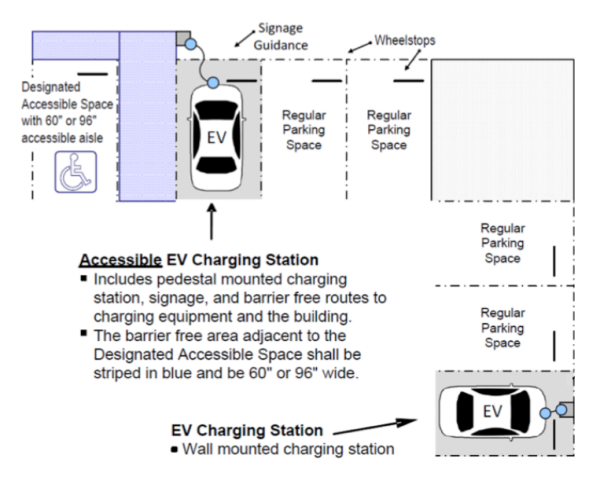
(1) Source is from the Alternative Fuels Data Center, U.S. Department of Energy.
- Space Distribution
- Retail/Office Flex Space
Retail/Office Flex Space shall have a minimum 50% and a maximum of 80% retail and/or office space with the balance consisting of warehouse and/or distribution space. - Light Industrial Flex Space
Light Industrial Flex Space shall have a minimum of 50% and a maximum of 90% light industrial use (see definition of Light Industrial Flex Space in DIVISION 1600) with the balance consisting of office and/or retail space.
- Retail/Office Flex Space
- Architectural Requirements
- Overhead Doors
Overhead doors are permitted; however, all overhead doors shall be located in the rear or side of the building. Refer to Section 1060.010 (Loading and Unloading Areas),D,4 for loading area door locations and screening requirements. - Parking Locations
Public parking for a flex space building shall follow Chapter 1020 Off-Street Parking Requirements. Fleet vehicle parking greater than three (3) company vehicles per any unit, shall be located in the rear of the flex space building.
- Overhead Doors
Chapter 820 Performance Guarantee
Chapter 830 Tree Preservation And Protection
Chapter 840 Canopy Trees, Parking Lot Plantings, And Street Trees
Chapter 850 Incentives For Exceeding Minimum Requirements
Chapter 860 Maintenance, Tree Protection And Planting Standards
Chapter 870 Tree Planting Standards
Chapter 880 Administration And Procedures
Chapter 890 Required Submittals For Tree Preservation Plan
Chapter 8100 Required Submittals For Tree Planting Plan
Chapter 8110 Modifications, Denials, Inspections And Emergencies
Chapter 8120 Penalties, Variances And Appeals
810.020 Relationship To Tree Ordinance Requirements
810.030 Applicability
810.040 Landscape Buffer Yards
810.050 Land Use Groups
810.060 Unlisted Uses
810.070 Buffer Yard Screening Required
810.080 Size And Design Of Required Buffers
810.090 Alternative Buffers And Screening
810.100 Screening Of Accessory Open Storage
810.110 Screening Of Mechanical And Utility Equipment
810.120 Parking Lot Landscaping
810.130 Perimeter Landscaping Of Parking Lots
810.140 Landscaping Adjacent To Buildings
810.150 Landscaped Entryways
810.160 Interior Parking Area Landscaping Requirements - New Parking Areas
810.170 Modification Of Interior Landscaping Requirements
810.180 Perimeter Lot Line Landscaping Requirements
810.190 Street Tree Planting In Downtown Districts
810.200 Coordination Of Landscaping And Pedestrian Improvements
810.210 Maintenance And Irrigation Of Landscaping
These regulations establish minimum requirements for buffer yards, perimeter landscaping, and parking lot landscaping. The intent and purposes of these provisions include:
- To minimize the adverse aesthetic impacts of certain land uses (e.g. outdoor storage yards, junkyards, recycling facilities) by requiring buffer yards between different land uses.
- To encourage tree planting and landscaping as a means of improving and protecting the Town’s environment and ecological balance. Trees, shrubs, and plants will be used to mitigate the ill effects associated with some land uses by filtering noise, dust, and fumes, modifying the rate of stormwater runoff and soil erosion; reducing glare from vehicle headlights and parking lot area lighting; and providing shade and reducing the heat-island effect of large asphalt parking lots.
- To enhance the environment and visual character of the Town of Indian Trail and to safeguard property values of adjacent properties, to protect public and private investments, and to promote high-quality development within the Town. Landscaping is intended to add beauty and value to property in the Town of Indian Trail by enhancing parking lots, home sites, and new commercial and industrial developments through the installation of trees and vegetation.
- To reduce the incompatibility between zoning districts of different land use intensities and type. To lessen the adverse impacts of more intense land uses upon adjacent residential areas and other less intense land uses, thereby reducing the ill effects of large expanses of paved areas, outside storage yards, and parking lots.
- To coordinate policies regarding the removal of existing trees and to require the planting and replacement of trees removed from private property within the Town of Indian Trail. In so doing, this will safeguard the ecological and aesthetic environment of the community.
- Trees that are required to be preserved or planted under the tree save area or canopy planting requirements (see Section 830.040, "Tree Preservation and Protection Requirements", and Section 840.010, "Canopy Tree Planting Requirements") of the Tree Ordinance will be credited toward the applicant’s landscaping obligations established by the requirements of this Chapter. The Planning Director will determine whether saved trees or trees required to be planted to establish a minimum amount of tree canopy are credited toward the buffer yard, perimeter, or parking lot landscaping requirements of this Chapter. Where the Tree Ordinance establishes bonuses (see Chapter 850, "Incentives for Exceeding Minimum Requirements", of the Tree Ordinance) for saving existing stands of trees or heritage trees, the Planning Director will credit those bonuses to the requirements of this Chapter.
The requirements of this Chapter apply to the construction of any principal structure or building and to the construction of any new parking area with more than five (5) parking spaces. Where any provisions of this Chapter overlap or conflict with the requirements of the Tree Ordinance requirements, the most restrictive requirements will apply. The following apply to all new development, unless specifically exempted:
- All ground surfaces, not otherwise built on or required to be paved, must be maintained with appropriate ground cover. Appropriate ground cover must include ground cover plants, turf, grass, mulch, or natural vegetation.
- As illustrated in Figure 800-1, landscaped buffer yards are required to be placed along the boundaries of a zoning lot that abuts properties in a different, less intensive zoning district, as determined by 810.040.D. Where buffer yards are required, these requirements will be considered the most restrictive requirements and will apply in lieu of any other perimeter planting requirements.
Figure 800-1: Illustration of Bufferyard Concept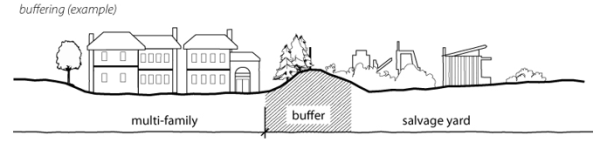
- If a buffer yard is not required, then a landscaped setback consistent with Section 810.130.A (Perimeter Landscaping of Parking Lots) will be required for any parking lot or vehicular use area with more than five (5) parking spaces or 2,000 square feet of area, whichever is less. In addition, building landscaping and interior landscaping will be installed consistent with the requirements of Section 810.140 "Landscaping Adjacent to Buildings" and Section 810.160 "Interior Parking Area Landscaping Requirements - New Parking Areas", respectively.
- If a buffer yard is not required and the development does not trigger the parking lot landscaping requirements of Section 810.120 "Parking Lot Landscaping", then perimeter landscaping consistent with Section 810.180 "Perimeter Lot Line Landscaping Requirements" or street tree plantings consistent with Section 810.190 "Street Tree Planting in Downtown Districts" will be required.
- The requirements of this Chapter apply to existing properties that do not currently conform to the requirements of this Chapter when such existing properties are changed or altered as described below. However, the Planning Director is authorized to permit exceptions and to authorize alternative means of compliance for existing properties when such changes are consistent with the Town’s overall landscaping goals and where such exceptions or alternatives are appropriate given the size and scale of the proposed property improvements.
- A new building or new parking lot (more than five (5) spaces) is proposed;
- An addition to an existing building or parking lot is proposed where such addition represents an expansion of 1,000 square feet or a 50% increase in the existing floor area, whichever is less. In addition, where an outdoor storage yard that is expanded by more than 2,000 square feet of land area;
- When a zoning application for a conditional zoning, variance or other discretionary permit is filed for the property, approval of the zoning application may be granted with the condition that requires the entire property to be brought into compliance with the minimum landscaping requirements of this ordinance. In addition, landscaping over and above the minimums may also be required.
- When an existing parking lot is dug up, removed or reconstructed where such reconstruction involves the removal of existing paving, asphalt, or concrete devoted to parking, loading, or driving aisles. This provision does not apply to simple resurfacing or restriping of asphalt or concrete.
Most parking lots are resurfaced every few years; occasionally when properties are rebuilt or altered existing parking lots are reconstructed. Landscaping is not required when parking is resurfaced but is required when the parking lot is dug up, removed, or reconstructed.
A buffer yard is required at the edge or boundary of a parcel or development site that is adjacent to a less intensive land use.
- Buffers must be improved with trees, shrubs, ground covers, and screening but the Planning Director may also permit bufferyards to be occupied by stormwater retention areas provided such stormwater retention facilities are setback at least 10 feet from any property line and provided such retention areas incorporate state of the art improvements (e.g. wet pond fountains with circulations systems or rain gardens) that make the facilities a significant amenity to the development.
- The required size of buffers required between a proposed land uses and an existing land use on adjoining zoning lots is set forth in the Buffer Matrix, Table 800-1, below. If the land next to the proposed development is vacant, the buffering required shall be determined on the basis of the most intensive use permitted by the existing zoning on the adjacent vacant parcel. If the adjacent parcel is vacant, but is zoned for a more intensive zoning district, no buffer area shall be required of the less intensive use.
- In mixed-use development projects, bufferyards will not be required between different land uses within a development project. Bufferyards will only be required along the perimeter property lines forming the boundaries of the development. The Planning Director will determine the appropriate buffer yard requirement based on an analysis of the character and intensity of land uses nearest to the project boundaries.
- The relative degree of intensity between different land uses shall be determined as follows:
- Single-family shall be the least intensive.
- Attached single-family homes and two-family homes will be the next least intensive.
- Multiple-family development will be the next least intensive.
- Group 1 shall be the next least intensive.
- Group 2 shall be the next least intensive.
- Group 3 shall be the most intensive.
- Notwithstanding the foregoing, if a shared driveway subdivides two lots, not grassed/vegetative strip shall be required where such shared driveway is located, but the area of the grassed strip that would have been required without the shared driveway shall be relocated, as a whole or in parts, to either side or the front lot line of the lot served by the shared driveway. This provision would apply to non-residential driveways exclusively.
Table 800-1: Buffer Matrix
| Buffer Matrix (Required Buffer Width [feet]) | ||||||
| Proposed Use | Abutting Use or Zoning and Required Buffer Width | |||||
| Single-Family/Two Family | Attached Single-Family | Multiple-Family | Group 1 | Group 2 | Group 3 | |
| Single-Family/Two-Family | 0 | 0 | 0 | 0 | 0 | 0 |
| Attached Single-Family | 50 | 25 | 0 | 0 | 0 | 0 |
| Multi-Family | 50 | 50 | 0 | 0 | 0 | 0 |
| Group 1 Use | 25 | 25 | 15 | 0 | 0 | 0 |
| Group 2 Use | 25 | 25 | 15 | 15 | 0 | 0 |
| Group 3 Use | 50 | 50 | 50 | 15 | 15 | 0 |
Land uses shall be assigned to land use intensity groups in accordance with the following table:
Table 800-2: Land Use Intensity Groupings
| Land Use Intensity Group Designation | |
| Group 1 | |
| Cultural Facilities | Residential Support Uses |
| Art Galleries | Child Care Center |
| Libraries | Church/Synagogue/Religious Assembly |
| Museums | College/University |
| Schools | |
| Group 2 | |
| Communication Facilities | Public Facilities |
| Motion Picture Studio | Public Service Facilities |
| Radio And Television Studio | Public Use Facilities |
| Radio And Television Transmitting/Receiving Facility | |
| Telecommunications Tower | |
| Retail | Services |
| Bicycle Sales | Animal Hospital/Veterinary Clinic |
| Commercial Vehicle Sales | General |
| Convenience Goods | Small Animal |
| Domestic Vehicle Sales | Large Animal |
| Gas Station | Automatic Teller |
| General Merchandise | Bank |
| Liquor Stores | Business Services |
| Lumber And Other Building Materials | Financial Services |
| Mail Order Delivery/Pickup Facility | Health Services |
| Manufactured Home Sales | Health Practitioner's Office |
| Motor Vehicle Sales | Medical And Dental Laboratories |
| Service Station | |
| Used Merchandise Sales | |
| Services – Miscellaneous | |
| Bicycle Repair Rehabilitation Centers | Off Premise Signs |
| Business Schools | Parking, Off Street |
| Dry Cleaners Hotels/Motels | Personal Services |
| Electrical/Electronic Repair – Small | Professional Services |
| Flea Markets, Enclosed | Repair Services |
| Food Catering Recreation and Amusement Services | Research Activities |
| Funeral Parlor | Sanitarium/Mental Institution |
| Furniture Refinishing And Repair | Small Motor Repair |
| Gunsmith | Small Motor Repair |
| Locksmith Photography Studio | Technical Schools |
| Mail Order Office Rental Of Light Equipment | Trade Schools |
| Membership Organizations | Vocational Schools Miscellaneous |
| Nursing, Convalescent, and Extended Care Facilities | Watch, Clock And Jewelry Repair |
| Office-Miscellaneous | |
| Group 3 | |
| Junkyards | Transportation Facilities |
| Manufacturing, Processing, Assembly | Truck Terminal |
| Open Storage | Warehousing |
| Open Uses Of Land –Salvage and Recycling | Warehouse |
| Places Of Assembly (Entertainment) | Warehouse, Mini |
| Railroad Switching And Classification Yard | |
| Group 3 Miscellaneous | |
| Adult Uses | Motor Vehicle Repair – Minor |
| Car Wash (Primary Use) | Publishing And Printing |
| Crematorium | Rental Of Vehicles Or Heavy Equipment |
| Electrical/Electronic Repair – Large | Reupholster |
| Exterminator | Sign Painting Services |
| Flea Markets, Open | Slaughterhouse |
| Lawn Care/Landscaping | Stadium |
| Lumberyard | Wholesale Distribution |
In the case of uses not listed above, the Planning Director will make a determination of the group appropriate for such uses. In reaching the determination, the Director must determine the most similar use that has comparable impacts.
Screening shall be required along the property boundaries of the zoning lot with the exception that screening such as hedges, fences or walls, as described in this section, shall not be over four (4) feet tall within front yards unless otherwise expressly authorized in this ordinance. Trees required to be saved or planted as provided in the Tree Ordinance will be counted toward the buffer yard requirements of this Section when such trees are located within the required buffer yard area.
- 15-Foot Buffers
Within buffers that are required to be 15 feet in width, partial screening is required and shall consist of a mix of large deciduous trees planted at an average rate of one (1) tree for every 50 linear feet of buffer with maximum spacing of 70 feet and small deciduous trees planted at an average rate of one (1) tree for every 25 linear feet with maximum spacing of 50 feet of buffer plus one of the following options:- A masonry wall (e.g. brick, stone, or stucco) with a minimum height of five (5) feet (above finished grade); or
- A privacy fence made of wood, vinyl or similar high-quality material that is six (6) feet in height; or
- An evergreen screen; or
- A solid evergreen hedge of densely planted shrubs not less than 24 inches tall at the time of installation and planted not more than three (3) feet apart to achieve a minimum height of six (6) feet and 75% opacity within two (2) years.
Figure 800-2: Berm Detail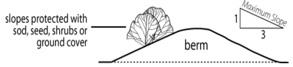
- 25-Foot Buffers
Within buffers that are required to be 25 feet in width, trees and screening are required and will consist of the following:
- Large or medium deciduous trees planted at an average rate of one (1) tree for every 25 linear feet of buffer, small deciduous and ornamental trees planted at an average rate of one (1) tree for every 20 linear feet of buffer with the maximum distance between two (2) trees of 40 feet; and
- A solid evergreen hedge to be placed between the taller elements required below and the adjacent property line.
- And one of the following:
- A solid wall or fence.
- A berm having a minimum height of three (3) feet and integrated with the plantings noted in number 1 above. The maximum slope of any berm will be 3:1 and side slopes will be designed to ensure the prevention of soil erosion.
- An evergreen screen.
Figure 800-3: Illustration of tall evergreens as screen.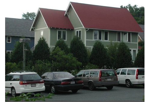
Source: Metropolitan Design Center Image Bank; University of Minnesota
- 50-Foot and Greater Buffers
Within buffers that are required to be 50 or more feet in width, screening is required and shall consist of either an undisturbed tree preservation area of sufficient screening or the following:
- The standards applicable to 25-foot buffers; and
- A double evergreen tree screen.
- In lieu of compliance with the 15-foot, 25 foot or 50-foot buffer standards of this section, an applicant may submit an alternative landscape and buffer plan to the Tree Advisory Committee for review. Upon review of the alternate plan, the Committee may recommend that the Planning Director approve the alternative buffering and screening upon finding that the proposal will afford a degree of buffering and screening, in terms of height, separation, and opacity that is equivalent to or exceeding that provided by the applicable 15, 25, or 50-foot and greater buffer standards of this section.
- The Planning Director may not take final action approving an alternative plan until a recommendation from the committee is received or until forty-five (45) days have passed since the proposal was heard by the committee, whichever is first.
- For any required buffer yard measuring 25 foot or greater, the Planning Director shall be authorized to require the construction of a berm wall meeting the standards of this Chapter. This requirement shall be based on thoughtful consideration of the potential impacts of the proposed land use as it relates to surrounding, established. land uses.
- Where a reduction in buffer width is required due to site constraints in a 25- or 50-foot buffer (not in the case for 15-foot buffer requirements), a berm over three (3) feet in height with a wall installed on the top of the berms can be utilized to reduce the buffer width by up to 50%. The wall shall be six (6) feet in height for a total of nine (9) feet with the berm height. If homes over one (1) story are adjacent somewhere on a side of this berm/wall buffer, then a nine (9)-foot wall is required for a total height of eleven (11) feet with the berm height.
Accessory open storage areas shall be screened from view of any street and from any residential use through the use of the same screening standards provided for 25-foot buffers. See Section 810.080.B, "25-Foot Buffers".
Figure 800-4: Screening of Outdoor Storage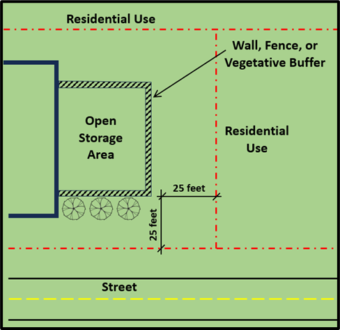
- General
All ground (air conditioners, heat pumps, etc.) and wall (antennas, meters, pipes, vents, etc.) mounted mechanical or other utility equipment must be screened from the adjacent street using of features such as berms, fences, false facades or dense landscaping. Consider site topography in design for rooftop equipment screening and adjust accordingly. For example, if a portion of the perimeter road is elevated so more of the rooftop equipment is visible even though the parapet or screen on the roof is adequate from the ground view adjacent to the building, the height of the parapet or screen on the roof should be increased. - Standards
When landscaping is used it should have a minimum height of four (4) feet at the time of installation and should achieve a minimum 75% opacity within two (2) years. Landscaping screening must follow any minimum clearance requirements recommended by the manufacturer and/or utility entity. - Post Site Plan Review Approval Additions or Relocations
If there are any additions or relocations of mechanical and utility equipment after the site construction plans are approved by Indian Trail, a proposed drawing with revisions to the approved plan (RTAP) shall be submitted to the Planning Department for review.
All parking areas must comply with the following minimum screening and landscaping standards except for parking associated with single-family or two-family dwellings, parking facilities with five (5) or fewer parking spaces, and parking areas entirely enclosed or constructed underground. Trees required to be saved or planted as provided in Chapter 830, "Tree Preservation and Protection", of the Tree Ordinance will be counted toward the parking lot landscaping requirements of this Section when such trees are located within the areas of a parking lot required to be landscaped. The Planning Director will make a determination as to whether trees required by Chapter 840, "Canopy Trees, Parking Lot Plantings, and Street Trees", of the Tree Ordinance are credited toward the landscaping requirements for parking lot perimeters, interiors, or the landscaping required adjacent to buildings.
- Surface parking lots shall be screened from adjacent streets and rights of way by means of an effective screening device consisting of at least the following:
- A setback the width of which will vary according to the street type. This setback must be at least 20 feet in width adjacent to a freeway, thoroughfare, boulevards, or expressways as designated by the Indian Trail Comprehensive Plan. These setbacks apply both in street yards and rear yards of properties along these road typologies unless a denser arrangement of landscaping is required to meet buffering and screening requirements of this ordinance. A setback of at least 10 feet in width is required if adjacent to a private street or any other public street. (See Figure 5.) These setbacks may be reduced to 15 feet and 7.5 feet respectively if the applicant installs a masonry wall no taller than 3.5 feet in height that screens parked cars from the street.
- Trees must be medium/large deciduous trees planted an average of 30 feet on center between the parking lot and street and no further than 15 feet from the edge of the parking lot. The Planning Director will authorize exceptions where there are overhead utility lines present. In such cases, small deciduous or ornamental trees may be used; however, the minimum spacing requirements shall be increased to an average of one (1) tree for every 20 linear feet.
Figure 800-5: Parking Lot Perimeter Plantings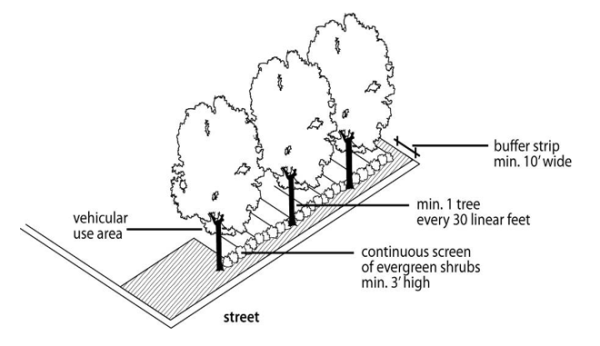 Trees are required at an interval of 1 tree every 30 feet.
- A solid evergreen hedge installed no further than 10 feet from the edge of the parking lot. Where such a hedge would be required in any sight distance triangle, the hedge shall be maintained at a height not to exceed three (3) feet tall.
Exterior building walls adjacent to parking lots, driving aisles, or public sidewalks that are visible from a public or private right-of-way must be improved with a landscaped buffer strip at least three (3) feet in width. Where the exterior building façade provides public access to the building and is adjacent to a surface parking lot and/or a driving aisle there shall be a combined landscape strip and walkway with a width of at least eight (8) feet.
Figure 800-6: Landscaping Adjacent to Building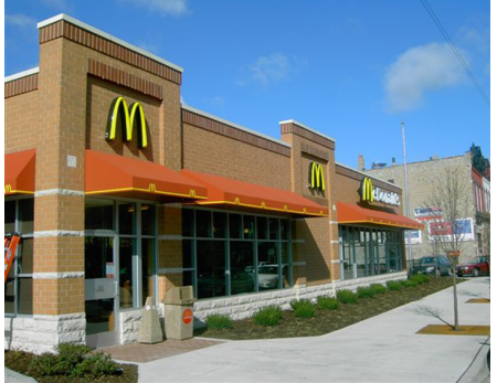 Landscaping is required at the edge of the building in addition to the walkway.
- The principal entryway (i.e. driveway) into parking facilities with more than 200 parking spaces must be bordered by a buffer strip that is landscaped with one (1) tree for every 200 square feet of landscaped area and densely planted hedges at least 24 inches in height at the time of installation. This landscaping strip must extend an appropriate distance into the property in order to frame the property’s entryway as determined by the Planning Director.
Figure 800-7: Landscaped entryway to large parking lot.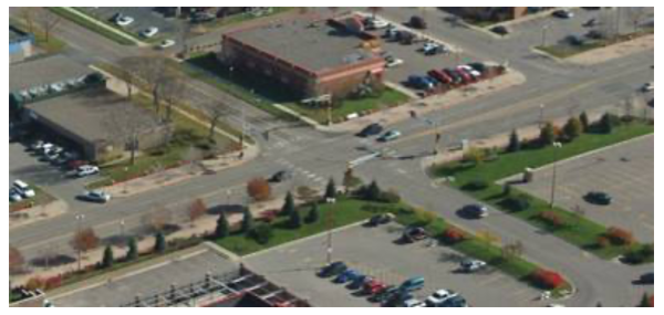 Source: Metropolitan Design Center Image Bank; University of Minnesota
- Canopy Coverage in Parking Lots
- All parking lots over 12 parking spaces must provide a minimum of 35% canopy cover or one tree per every 15 parking spaces whichever results in more trees. For example, a parking area of 12,000 square feet x 0.35 = 4,200 square feet. To achieve this 4,200 square feet, the applicant will be given tree canopy credits in the following manner: a planted large maturing tree shall be counted as equivalent to 1,600 square feet of canopy; a medium maturing tree shall be counted as the equivalent of 900 square feet of canopy; and a small maturing tree shall be counted as the equivalent of 400 square feet of canopy.
- Parking lots containing over 250 parking spaces shall provide at least half of the required 35% canopy cover with large trees.
- In the review of parking lot landscaping plans, the Planning Director will be responsible for ensuring that trees are appropriately dispersed so that significant portions of parking lots are shaded. In general, trees will be considered adequately dispersed if all vehicular parking spaces have at least one (1) tree trunk within 60 feet of each parking space. Where the Planning Director determines that trees saved or planted within the perimeter setback area are located so that they provide significant shading of parking areas then these trees may be counted toward meeting both the perimeter planting requirements of Section 810.180 and the interior planting requirements of this Section.
- A mix of tree species shall be provided for rows of parking spaces over 10 and provide a minimum of three (3) types of tree species.
- A minimum size planting island shall be provided for different size trees:
- Small trees shall have a minimum planting island of 162 square feet with a minimum width of nine (9) feet.
- Medium maturing trees shall have a minimum planting island of 225 square feet with a minimum width of nine (9) feet.
- Large maturing trees shall have a minimum planting island of 288 square feet with a minimum width of nine (9) feet.
- Planting islands that serve to break up every 15 parking spaces shall be a minimum of 162 square feet with a minimum width of nine (9) feet.
- Developers shall have the option of small, medium or large canopy trees so as long as 25% of the trees provided are large trees.
- Existing, healthy, well-formed trees may be preserved and used for credit in satisfying the requirements of this section consistent with the tree save area requirements of Section 830.040.B (Tree Save Area Requirements) of the Tree Ordinance. Trees may be credited toward the parking lot landscaping requirements if they provide some shade to the parking area. Saving existing trees will be credited at the rate of one (1) saved tree for every one (1) new tree required except in the case of the saving of tree stands or heritage trees in which case the Planning Director may authorize greater credits consistent with the Tree Ordinance.
- If any vegetation dies, replacement is required not later than the next planting season.
- Any fraction of these requirements must be rounded up to the next whole number.
- Landscaping must not obstruct the view of motorists using any street, private driveway, parking aisles or the approach to any street intersection so as to constitute a traffic hazard.
- All trees required by this section shall be at least eight (8) feet in height above ground level and at least 2.5 inches in caliper at the time of installation, and shall have an expected mature height of at least 30 feet, unless otherwise expressly stated herein. All shrubs required by this section shall be at least 24 inches in height when planted and shall attain a minimum size of 30 inches in height within three (3) years of plantings. The standards for all trees and shrubs required, including the minimum height, root ball size, number of branches and width shall conform to the American Standard for Nursery Stock published by the American Association of Nurserymen for that type of tree or shrub at the time of installation. The selection and planting of trees and shrubs shall conform to the suggested plant list in Appendix 1.
When a zoning permit is requested for the redevelopment of an existing property, then interior parking landscaping is required per Section 810.160 above, subject to the following allowances for modification:
- The Planning Director may allow landscaping to be placed in alternative locations than those described in this Section if such alternative locations are necessary to maintain the existing parking arrangement.
- Existing street trees and shrubs located within the future public right-of-way may count toward meeting these interior-landscaping requirements. New trees and shrubs installed to meet these requirements may be placed in the future right-of-way only if approval is obtained from the Town of Indian Trail and North Carolina Department of Transportation. The applicant is responsible for replacing these trees if they are damaged or lost when a right-of-way is widened.
- Under circumstances where the application of these requirements is ineffective or inappropriate because application would significantly reduce the available parking due to the site design, topography, unique relationships to other properties, natural vegetation or other special circumstances relative to the proposed development, the developer may submit an alternative plan for planting to the Planning Director. The Planning Director must review the plan and may approve an alternate, interior parking landscaping plan upon making a finding that the alternate plan achieves the purpose of this section to the greatest degree that is reasonable and practical. Plans designed to simply avoid landscaping are not an option.
The following perimeter landscaping requirements apply to all new developments unless the stricter requirements for bufferyards (see Section 810.040) or parking lot landscaping (see Section 810.120) are applicable.
- Front Lot Line Landscaping
- Front lot line landscaping will consist of a landscape strip of at least 20 feet in width adjacent to a thoroughfare or boulevard as designated by the Indian Trail Comprehensive Plan of 2005 (Plate 21) and at least 10 feet in width adjacent to a private street or any other public street. This landscape strip must be located on private property immediately adjacent to a public or private street except within the Downtown Master Plan Districts. Within the Downtown Master Plan Districts, street trees must be planted in the sidewalk or parkway consistent with the permit requirements of the North Carolina Department of Transportation if applicable.
- Any major subdivision, any multiple-family residential development, or any business, commercial or industrial development that has frontage on a public or private street must install landscaping as specified in this section. See Figure 800-8. Where this ordinance requires a landscape buffer yard or perimeter parking lot landscaping, the requirements of this section will not apply. The street frontage landscaping must be installed between the use to be screened and the property line adjacent to any street except within the Downtown Master Plan Districts.
Figure 800-8: Front Lot Line Landscaping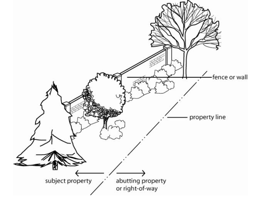 Street frontage landscaping is required when there are no buffer yard or parking lot landscaping requirements.
 - Trees required to be saved or planted as provided in the Tree Ordinance will be counted toward the street frontage landscaping requirements of this Section when such trees are located within the required setback from the right-of-way.
- Design Choices
The required front lot line landscape strip must be comprised of a combination of various plants and structures. The required landscape strip must include both of the following:- Tree Plantings
A row of medium or small deciduous or ornamental trees planted an average of 30 feet on center in the portion of the front lot line landscaping strip near the front property line; and - Shrubs, Wall/Fence or Berm
In addition to the required “Tree plantings”, choose one of the following three options to be installed between the “Tree plantings” and the remaining portion of the landscaping strip closer to the center of the property:- A row of evergreen shrubs not less than 24 inches tall at the time of installation planted not more than three (3) feet apart to form a continuous hedge; or
- A solid brick, stone, or stucco wall; or a wooden, vinyl, wrought iron, aluminum wrought iron design, or similar high-quality material fence, a maximum of four (4) feet high; or
- A berm and planting combination behind the row of evergreen shrubs in "(1)" above, with all of the following:
- The berm having an average height of three (3) feet;
- Dense evergreen shrubs on top of the berm which, when combined with the berm, achieves a height of six (6) feet of continuous screening within two (2) years of installation; and
- The maximum slope of any berm will be 3:1 and side slopes will be designed to ensure the prevention of soil erosion.
- Tree Plantings
- Properties abutting the right-of-way of US-74 in Indian Trail will meet a higher standard for landscaping and screening because of the visibility of this corridor and because of the size and character of businesses located adjacent to this highway. All commercial and other nonresidential developments are required to provide a landscape strip with a minimum width of 20 feet. This strip must be planted with a minimum of one (1) tree for each 30 linear feet of required landscape strip and at least one (1) shrub for each three (3) linear feet of required landscape strip.
- Side and Rear Lot Line Landscaping
- Where no bufferyard is required, a 10 foot wide landscaped setback must be installed alongside or rear lot lines for any non-residential development. This 10-foot landscaped setback must be planted with ground cover and a mix of shrubs and trees acceptable to the Planning Director.
- Where two properties share a driveway then no landscaped setback will be required along the abutting property lines but the amount of landscaped area that would have otherwise been required must be relocated and installed on other portions of the lot. The Planning Director will be responsible for determining that the otherwise required landscaped setback area is appropriately relocated.
Amended by Ord. O210209-347 on 2/8/2021
Adopted by Ord. 393 on 11/14/2023
Amended by Ord. 397 on 3/26/2024
Street trees will be planted consistent with the requirements of Section 840.030 "Street Tree Planting Requirements" of the Tree Ordinance except as provided herein for the Downtown Master Plan Districts.
- New construction within the Downtown Master Plan Districts must install one (1) street or parkway tree for every 30 feet of lot frontage on a public or private street. Street or parkway tree means a tree planted along a street, road, or thoroughfare either in the sidewalk or in a landscaped area between the sidewalk and the curb. Figure 800-9 shows trees planted in the parkway.
Figure 800-9: Trees will be planted in the sidewalk within the Downtown Districts.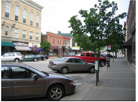 Source: Metropolitan Design Center Image Bank; University of Minnesota
 - Street/parkway trees planted in the Downtown Master Plan Districts must have a minimum caliper size of 2.5 inches at the time of planting.
- No medium/large deciduous tree is required in any existing sidewalk or parkway that is less than six (6) feet in width measured from the edge of the sidewalk to the curb, however, on these smaller sidewalks small deciduous trees must be planted consistent with the recommendation of the Parks, Greenway, and Tree Committee.
- All street/parkway trees must be installed in accordance with standard practices of horticultural professionals and in a good and workmanlike manner and must be maintained by the property owner in good condition for a period of not less than five (5) years. After the five (5) year period, tree maintenance will be the responsibility of the Town of Indian Trail.
Development projects containing multiple buildings and activities are required to provide safe and direct pedestrian connections between the different buildings and land uses. Such sidewalk and walkway improvements must be coordinated with the layout and design of required landscape improvements. The Planning Director is authorized to allow modifications in the design of bufferyards, perimeter landscaping, and parking lot landscaping when such modifications are necessary to accommodate the required pedestrian improvements between buildings and uses. See figure below:
Figure 800-10: Green pathways highlight pedestrian connections between buildings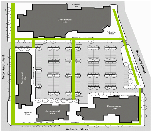
All landscaping and screening that provides required buffering and screening shall be maintained. Landscape plans must indicate the proximity and source of water to irrigate trees and landscaping. Business or commercial centers located within Neighborhood Business, Downtown, General or Regional Business Districts that exceed 10 or more acres in size must have an automated sprinkler system for landscaped areas. All such systems shall be equipped with a rain sensor. The Town may require a performance guarantee if there is any delay in the installation of the irrigation system.
All required landscape materials must be installed prior to the issuance of a zoning compliance permit. The Planning Director may grant a deferral to the next planting season based on consideration of seasonal extremes in weather and unique problems with soil conditions that may be incompatible to landscaping. Where the Planning Director allows a deferral of the required landscaping, the applicant will be required to post a bond or other form of financial guarantee and no zoning compliance permit will be issued until:
- The required landscaping is completed in accordance with the approved plan; or
- A bond or certified check, payable to the Town of Indian Trail, in the amount of 125% of the estimated cost to assure installation of the required landscaping.
- An irrevocable letter of credit issued by a bank in the form approved by the Town Attorney may be accepted in lieu of bond under the terms and conditions applicable to bonds in Subsection 820.010.B above.
- No surety or portion thereof, as provided for in this section shall be released by the Town until all landscaping has been installed, inspected and approved.
- When parking is provided underground or within buildings, the performance guarantees shall not apply.
830.020 Applicability
830.030 Exemptions
830.040 Tree Preservation And Protection Requirements
The regulations of this section are intended to reduce tree canopy loss and implement urban forest improvements through requirements for tree protection, tree preservation, and the planting or replanting of trees and the maintenance of existing trees within the Town of Indian Trail. The tree preservation requirements are intended to enhance the quality of life through sustainable urban forest practices and increase benefits that trees provide, including, but not limited to the following:
- Absorption of carbon dioxide and returning oxygen.
- Reduction of soil erosion and the increase of rainwater infiltration.
- Provision of shade for cooling.
- Screening of noise, dust and glare.
- Improvement of stormwater runoff.
- Maintenance and improvement of Town appearance and aesthetics.
- Provision of habitat for wildlife.
- Preservation, protection, and enhancement of the natural environment.
The provisions of this ordinance shall apply to the following:
- All major subdivisions, non-residential developments, and multi-family developments.
- Changes in use, expansions, and new buildings for already existing non-residential or mixed use land uses as per the following:
- Changes in use from residential to non-residential, such as a change from commercial to residential, or residential to industrial;
- Vehicle Accommodation Areas – Only expanded portions of existing parking lots shall be held to the shading requirements that appear in section 840.010, "Canopy Tree Planting Requirements", of this ordinance.
- Non-Residential Expansions – Any expansion of any existing land use (buildings, parking lots, etc) shall comply with the Tree Preservation and Protection Requirements in Section 830.040 of this ordinance with the following exception:
- All non-residential expansions of less than 25% of existing impervious surfaces (i.e. buildings, parking lots, etc.) shall be exempt from all provisions of this ordinance except those that deal specifically with heritage Trees and vehicle accommodation areas subject to item "2" above.
The requirements of this Chapter do not apply to any of the following:
- Existing or proposed single family detached dwellings or two family dwellings on individually owned lots.
- Forestry activity on forestland that is taxed on the basis of its present-use value as forestland under Article 12 of Chapter 105 of the North Carolina General Statutes.
- Activity that is conducted in accordance with a forest management plan that is prepared or approved by a forester registered in accordance with Chapter 89B of the North Carolina General Statutes.
- General Rules/Objectives
A tree protection plan and a tree inventory are required. The tree inventory must be done and submitted by a certified arborist or a licensed surveyor before it is submitted to the Town for review. The inventory is intended to serve as the basis for formulating a tree protection plan. In delineating areas to protect, the following general objectives apply:
- The protection of tree stands, rather than individual trees, is strongly encouraged. Where a project saves a stand of trees and is subject to the tree save area tree requirements of this Chapter, 110% of the canopy area shall count toward the required tree save area requirements.
Figure 800-11: Preserving Stand of Trees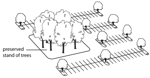
- The protection of large, heritage trees is a priority.
- Quality natural areas, free of exotic invasive species, should be the focus of tree preservation and tree save areas whenever possible.
- If an area proposed for tree preservation or as a tree save area contains exotic invasive species at the time of such proposal, such species must be removed prior to development in order to promote the growth of larger, healthier trees. The removal of invasive species will be required prior to the issuance of certificate of compliance for major subdivisions or non-residential developments.
- The decision of which trees to preserve as shown on the tree inventory shall be made jointly by the Planning Director, developer and design team during project approval process.
- The protection of tree stands, rather than individual trees, is strongly encouraged. Where a project saves a stand of trees and is subject to the tree save area tree requirements of this Chapter, 110% of the canopy area shall count toward the required tree save area requirements.
- Tree Save Area Requirements
All development subject to the requirements of this Chapter must designate tree save areas on site plans in an amount consistent with this Section. Generally, tree save areas should preserve and protect existing trees but such areas may also designate tree planting areas consistent with this Section. The requirements for protecting existing tree canopy or protecting existing canopy and establishing new canopy will be consistent with Table 800-2 below.
Table 800-2: Requirements for Protecting Existing Tree Canopy and Creating New Tree CanopyLand Use Classification Standard for Saving Existing Tree Canopy Standard for Sites Lacking Existing Tree Canopy Low to Medium Density Districts: RSF, SF-1, SF-2, SF-3 Where the existing tree canopy is at least 20% of the property area, a tree save area equal to at least 20% of the property must be protected. Where the existing tree canopy is less than 20% of the property area, a tree save area equal to 20% of the property must be achieved by saving all existing tree canopy and planting new trees consistent with Chapter 870, "Tree Planting Standards". Medium to High Intensity Residential: SF-4, SF-5, and MFR Where the existing tree canopy is at least 15% of the property area, a tree save area equal to at least 15% of the property must be protected. Where the existing tree canopy is less than 15% of the property area, a tree save area equal to 15% of the property must be achieved by saving all existing tree canopy and planting new trees consistent with Chapter 870. All Non-Residential Districts Where the existing tree canopy is at least 10% of the property area, a tree save area equal to at least 10% of the property must be protected. Where the existing tree canopy is less than 10% of the property area, a tree save area equal to 10% of the property must be achieved by saving all existing tree canopy and planting new trees consistent with Chapter 870. Downtown Core District: DCD A tree save area requirement is not applicable to properties in the DCD. A tree save area requirement is not applicable to properties in the DCD. Downtown Transitional District: DTD Where the existing tree canopy is at least 5% of the property area, a tree save area equal to at least 5% of the property must be protected. Where the existing tree canopy is less than 5% of the property area, a tree save area equal to 5% of the property must be achieved by saving all existing tree canopy and planting new trees consistent with Chapter 870. Downtown Transitional, Residential District: DTD-R Where the existing tree canopy is at least 10% of the property area, a tree save area equal to at least 10% of the property must be protected. Where the existing tree canopy is less than 10% of the property area, a tree save area equal to 10% of the property must be achieved by saving all existing tree canopy and planting new trees consistent with Chapter 870. - Method of Calculation The total property area will be calculated by taking the square footage for the entire site and subtracting the square footage for existing or dedicated road right-of-ways, utility easements, and any area covered by existing ponds and lakes. The property designated as a tree save area must be equal to 20%, 15%, 10%, or 5% of the property after rights-of-way, easements, and ponds and lakes are subtracted consistent with the requirements of this Section.
- Method for Designating Tree Save Areas
A tree save area shall be considered the combined areas of the tree protection zone and the critical root protection zone. The critical root and tree protection zone will be measured as a radial distance from the tree truck and will be equivalent to the greater area of: the drip line; a minimum of six (6) feet from the trunk; or a distance of 1.5 feet for every inch of trunk diameter as measured at breast height. If root disturbance or construction activities occur within the drip line of any tree designated as protected, only the area actually being protected will be included in the tree save area.
Figure 800-12: Critical Root/Tree Protection Zone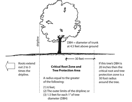
- Limitations on the Removal of Existing Tree Canopy
Any existing tree canopy must be saved to meet the requirements of this Section and may only be removed if:
- The existing trees are located in a project’s future right-of-way, within the outline of the building envelope, or within the project’s required parking area. Preservation of existing trees is not intended to prevent development of property or otherwise unreasonably restrict the use of the property, or
- The existing trees pose a threat to property or public safety because the trees are diseased, in danger of falling, or otherwise present a hazard to other vegetation or surrounding properties; and
- The existing trees that are removed under this Section are replaced with new trees consistent with the requirements of Table in Section 840.010.A, "Canopy Tree Planting Requirements".
Figure 800-13: Tree save areas should include tree stands outside of the building envelope and outside driveway/parking areas.
- Credit for newly planted trees The area devoted to newly planted areas may be counted as part of the tree save area. The land devoted to tree save areas that is represented by newly planted trees will be calculated on the basis of the following credits for new trees. A planted large maturing tree shall be counted as equivalent to 1,600 square feet of canopy; a medium maturing tree shall be counted as the equivalent of 900 square feet of canopy; and a small maturing tree shall be counted as the equivalent of 400 square feet of canopy.
- Heritage Tree Protection
- Applicability To the maximum extent feasible, heritage trees located on any site subject to tree preservation requirements of this Chapter must be preserved. Where a project saves heritage trees and is subject to the canopy tree requirements of this Chapter, 150% of the heritage tree canopy area shall count toward the required canopy tree requirements. Anyone who removes a heritage tree without plan approval, except as noted below in the emergency subsection of Section 2, Exemptions, is subject to one or more of the civil penalties in Section Chapter 8120. Standard for plans representing the removal of heritage trees shall meet the requirements listed in Section (3), Heritage Tree Removal, below.
- Exemptions
This Chapter shall not apply to the removal of heritage trees under the following circumstances.
- Diseased, Dying or Dead Trees and Dangerous Trees
Diseased, dying or dead trees causing a probable safety hazard to buildings, utilities, and/or pedestrian or vehicular travel paths may be removed with written approval from the Planning Director, unless deemed an emergency, as described in subsection (2) below. The removal request shall include the number, location, species and diameter of the trees to be removed along with the condition of the tree and reason for the proposed removal. The Planning Director shall review all heritage tree removal proposals and consider the following:
- The condition of the tree or trees with respect to their health, danger of falling, proximity to existing structures or utilities, and their location near pedestrian or vehicular travel paths and the probability of implementing tree maintenance techniques as an alternative to heritage tree(s) removal.
- The emergency removal of trees that pose an immediate public health and safety hazard, as determined by a Town, County, and/or State emergency services professional, may be removed without first obtaining written approval from the Planning Director. Written documentation of the removed tree(s) shall be provided to the Planning Director and include the tree species, diameter, location and a description of photographic evidence of the emergency condition.
- Trees Within ROW and Utility Easements All reasonable efforts shall be made to minimize the removal of heritage trees located within Right-of-Way (ROW) and within public utility easements. Heritage trees located within the existing public ROW or within public utility easements or heritage trees located in future public ROW or utility easements being dictated as part of an active land development permit are exempt from this chapter once it has been demonstrated to the Town that all reasonable efforts to minimize removal have been implemented. For purposes of this exemption, public ROW shall consist of ROW associated with public roads, sidewalks, and trails/greenways. Public utility easements shall consist of easements associated with water, sewer, electric, natural gas and other infrastructure.
- Diseased, Dying or Dead Trees and Dangerous Trees
Diseased, dying or dead trees causing a probable safety hazard to buildings, utilities, and/or pedestrian or vehicular travel paths may be removed with written approval from the Planning Director, unless deemed an emergency, as described in subsection (2) below. The removal request shall include the number, location, species and diameter of the trees to be removed along with the condition of the tree and reason for the proposed removal. The Planning Director shall review all heritage tree removal proposals and consider the following:
- Heritage Tree Removal
Plans associated with an active land development application that represent the removal of heritage trees will be granted only where:
- The tree(s) is located within the portion of the site where buildings or related improvements are permitted. The applicant should demonstrate that there is no other reasonable location for the building or improvement and that preservation would unreasonably restrict use of the property.
- Removal is necessary to allow construction of a road or drive that is essential for access to site.
- Where removal of healthy heritage trees is approved as part of an approved site plan, subdivision plat or tree removal, new trees will be planted according to the Mitigation Planting standards in Section (4), Mitigation Planting, below (also refer to Chapter 880, Tree Planting Standards).
- Mitigation Planting
The Mitigation Planting standards below are cumulative caliper inches approach to tree mitigation and replanting. For example, for every caliper inch of heritage trees(s) removed, a percentage of those caliper inches must be replaced with a tree or trees equal to that total percentage of those caliper inches. Each replacement tree shall be at least 2.5 inches caliper at the time of replanting. See below for the respective percentages to be replaced based on the type of development.
Where removal of healthy Heritage trees is approved as part of an approved site plan or subdivision plat, new trees shall be planted according to the following in addition to Chapter 870, Tree Replanting Standards:
- Single-Family Residential Use Replanting Ratio – replacement for residential development, excluding single-family lots not developed as part of a subdivision, shall be at a 50% ratio (e.g., 18-inch caliper tree X 50% = 9-inch caliper replacement tree or trees equivalent to that cumulative caliper)
- Non-Single Family Residential Use Replanting Ratio – replacement for all non-single family development shall be at a 25% ratio (18”-inch caliper tree X 25% = 4.5-inch caliper replacement tree or trees equivalent to that cumulative caliper)
- Canopy Retention Option: In instances where site or other constraints prohibit planting the required number of Heritage mitigation trees described in sections (4)(a) and (b) above, any acreage exceeding the tree canopy retention acreage requirements specified in UDO Section 830.040.B may be utilized to satisfy a portion of the Heritage tree mitigation requirements.
Any additional tree canopy acreage used to meet the Heritage tree mitigation requirements shall be comprised of retained existing tree canopy versus newly planted trees/canopy. Qualifying trees within the additional tree canopy area used to meet the Heritage tree mitigation requirement must be a minimum of 15 feet in height. Each Heritage mitigation tree shall equate to 900 square feet (sf) of additional canopy retention area. See below for a sample calculation:
Table 800-3: Sample Calculation for Canopy Retention OptionSite Area Canopy Required Canopy Provided Surplus Canopy (trees over 15’ in height) Canopy Credit Formula Heritage Tree Mitigation Equivalent 45,000 sf 4,500 sf 9,000 sf 4,500 sf 4,500 sf/900 sf 5 Note: In the example above, a total of five trees may be credited toward the Heritage Tree replanting rate. A combination of the two methods described above may also be applied.
- Alternative Mitigation Option
In the event the project site does not have sufficient area or is otherwise unsuitable to accommodate the required heritage tree mitigation planting described in subsection (4), Mitigation Planting, above, one or more of the alternative mitigation measures listed in this section may be proposed.
Alternative Mitigation Plans shall include the number, location, species, and diameter of the trees to be remove, and the number, species, and diameter of trees with which they are being replaced. The review shall evaluate the appropriateness of the Alternative Mitigation Plan by considering the individual development site, the development intensity along with the surrounding uses and other relevant site features. The plans shall be reviewed by Tree Board and recommendation made to the Planning Director, who makes the final decision. Approved Alternative Mitigation Plans shall be integrated into the associated site plan application unless otherwise approved as part of a Conditional Zoning Permit and may include one or more of the following:
- In-Lieu-Fees – Where the Planning Director in consultation with the Tree Board determines that on-site replanting is not feasible and/or appropriate, the Director may require that a payment not to exceed the cost of replanting replacement trees be made to a tree planting fund. Funds will be used for tree planting and maintenance of planted trees on public sites within the Town of Indian Trail such as parks, schools, municipal facilities, and similar locations. Replacement value shall be determined utilizing a professional source and by the Town. Fee Recovery as stated in Section (6), Fee Recovery, below may also apply.
- Alternative Planting Plan – The developer shall submit a heritage tree alternative mitigation plan.
- Such a plan must include a scope of work to be reviewed by the Planning Department.
- The scope of work shall include, at a minimum, the number, location and specifications of the trees to be removed as well as alternative mitigation or conservation measures through which trees or tree area will be saved or replace.
- Fee recovery stated in Section (6), Fee Recovery, below may also apply.
- Off-site Planting – An alternative site(s) may be identified for additional tree planting. Off-site plantings may include parks, schools or other public facilities located in the Town of Indian Trail to the satisfaction of the Planning Director.
- Other method(s) may be considered as deemed appropriate by Planning Director.
- Fee Recovery The Town may retain the services of a consultant to evaluate technical submittals by the applicant and seek an independent judgment on the appropriateness of the heritage tree alternative mitigation plan. The Planning Director shall be responsible for selecting the technical expert hired for the review of the proposed mitigation plan. The Town may seek financial reimbursement for the actual cost of any technical review undertaken. The technical expert must make investigations consistent with all the terms and conditions of this ordinance. The fees charged for the technical expert’s review will be customary fees for plan review and for the evaluation/preparation of a technical report. Charges for such consulting services will be fixed in advance of the processing of applications and will be incorporated into the overall site plan/subdivision/conditional zoning application fee.
840.020 Parking Lot Tree Planting Requirements
840.030 Street Tree Planting Requirements
- All developments subject to the tree save area requirements of Section 830.040.B that cannot save the required amount of canopy through the preservation of existing trees will be required to meet the canopy requirement through the planting of new canopy trees consistent with this Section. The area of newly planted canopy trees will be calculated on the basis of the estimated canopy at maturity as described in Section 830.040.D. (i.e. 1,600 square feet for large maturing trees; 900 square feet for medium maturing trees; and 400 square feet for small maturing trees) The minimum canopy tree cover shall be provided as follows:
Table 800-4: Minimum Canopy Tree CoverLand Use Classification Zoning District Minimum Tree Canopy COMMERCIAL NBD, Neighborhood Business District 10% GBD, General Business District 10% RBD, Regional Business District 10% Mixed Use Activity Center Overlay 10% Sub-Regional Activity Center Overlay 10% DOWNTOWN DCD, Downtown Core District NA DTD, Downtown Transitional District 5% DTD-R, Downtown Transitional, Residential District 10% INDUSTRIAL L-I Light Industrial 10% H-I Heavy Industrial 10% CONDITIONAL ZONING DISTRICTS MXD 10% TND Traditional Neighborhood Development 10% Cluster and Open Space Subdivision 10% RESIDENTIAL MFR 15% SF-5 15% SF-4 15% SF-3 15% SF-2 20% SF-1 20% RSF 20% - All tree canopy cover requirements may be met through the preservation of existing trees and/or the planting of trees. Existing trees that are suitable for use in compliance with the provisions of this ordinance must be used to meet the tree shade requirements. Refer to Section 860.020, Tree Protection Standards for a description of the fencing and other protections necessary in order to receive credit for saving existing tree canopy.
Amended by Ord. O210209-347 on 2/8/2021
Adopted by Ord. 393 on 11/14/2023
Amended by Ord. 397 on 3/26/2024
All new or expanded parking areas must comply with the following tree planting requirements. In order to meet the parking lot planting requirements, required canopy tree areas shall be located within the parking lots and adjacent to parking spaces, inside medians at the end of parking bays, or tree islands and shall adhere to the following:
- All trees shall be a minimum of 2.5 inches in caliper and at least eight (8) feet in height above ground level at time of installation, and shall have an expected mature height of at least 30 feet.
- All parking lots over 12 parking spaces must provide a minimum of 35% canopy cover or one tree per every 15 parking spaces whichever results in more trees. For example, a parking area of 12,000 square feet x .35 = 4,200 square feet. To achieve this 4,200 square feet, the applicant will be given tree canopy credits in the following manner: a planted large maturing tree shall be counted as equivalent to 1,600 square feet of canopy; a medium maturing tree shall be counted as the equivalent of 900 square feet of canopy; and a small maturing tree shall be counted as the equivalent of 400 square feet of canopy.
- Parking lots containing over 250 parking spaces shall provide at least half of the required 35% canopy cover with large trees.
- All vehicular parking spaces must have at least one tree trunk within 60 feet of each parking space.
- A mix of tree species shall be provided for rows of parking spaces over 10 and provide a minimum of three (3) types of tree species.
- A minimum size planting island shall be provided for different size trees:
- Small trees shall have a minimum planting island of 162 square feet with a minimum width of nine (9) feet.
- Medium maturing trees shall have a minimum planting island of 225 square feet with a minimum width of nine (9) feet.
- Large maturing trees shall have a minimum planting island of 288 square feet with a minimum width of nine (9) feet.
- Planting islands that serve to break up every 15 parking spaces shall be a minimum of 162 feet with a minimum width of nine (9) feet.
- Developers shall have the option of small, medium or large canopy trees so as long as 25% of the trees provided are large trees.
- All major subdivision and non-residential developments that have frontage on a public or private street must install tree plantings.
- Where the landscape Section of the UDO or this tree planting and protection Chapter requires a landscape buffer or plantings within parking lots within similar locations as this Section then the requirements of this section will not apply.
- The required perimeter planting strip must be comprised of a row of canopy or ornamental trees including a mix of tree species, planted an average of 30 feet on center and located between the street and sidewalk with a planting strip of no less than nine (9) feet in width.
- The applicant will be required to secure all necessary permits from the North Carolina Department of Transportation.
850.020 Credits For Preserving Existing Trees
A 20% or greater increase in the land area within tree save areas or a 20% or greater increase the percentage of land area devoted to canopy tree cover will result in the following allowances and credits:
- Reduction in setbacks The Planning Department may permit a maximum up to 15% reduction in the front and rear yard setbacks.
- Reduction in parking The Planning Department may permit a maximum up to 15% reduction in required parking.
- Where an applicant saves a stand of trees and that applicant is subject to the tree canopy requirements of Section 830.020 then 110% of the existing tree canopy area will be counted toward meeting the requirements of Chapter 840.
- Where an applicant saves heritage trees and is subject to the canopy tree requirements of Section 840.010, Canopy Tree Requirements, then the percentage in Section 830.040.E.1, Tree Preservation and Protection Requirements, may be applied to the heritage tree canopy to count toward meeting the requirements of Chapter 840.
860.020 Tree Protection Standards
- All property owners shall be responsible for the maintenance of all existing trees to be preserved and new plantings.
- All tree plantings required by or installed pursuant to the tree planting plan approved under this Section or other requirements shall be maintained in good condition so as to present a healthy, neat and orderly appearance.
- All required tree plantings shall be kept free from refuse, debris, and dead, diseased or severely damaged plants or vegetation.
- All dead or unhealthy trees shall be removed and replaced within one growing season.
- All existing and proposed trees used to comply with this Section shall not be sheared, topped or disfigured by improper pruning. Trees shall be allowed to grow to their natural height and form (See Appendix 2: ANSI Pruning Standards).
Figure 800-11: Proper Pruning Techniques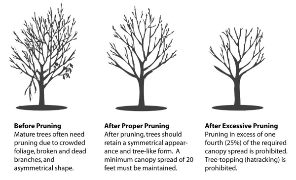
- Existing trees must be protected during construction. To receive credit for the protection of existing trees, trees must be protected from direct or indirect root damage and trunk and crown disturbance. The following standards shall apply:
- The tree protection zones and tree save areas shall remain open and unpaved.
- Construction site activities such as parking, material storage, dirt stockpiling, concrete washout and other similar activities shall be prohibited within the tree save area or tree protection zone.
- Changes that significantly raise the grade of soil adjacent to tree save area or a tree protection zone are prohibited.
- If an underground utility must cross the drip line area, the contractor must tunnel or auger underneath major roots of the tree without cutting them. Permission may be granted for auguring of 1/3 distance of the drip line to the trunk of the tree only if there no other feasible way. Depth of auguring shall be a minimum of two (2) feet. The illustration below highlights both inappropriate and appropriate practice for auguring near saved trees.
Figure 800-12: Proper and Improper Auguring Techniques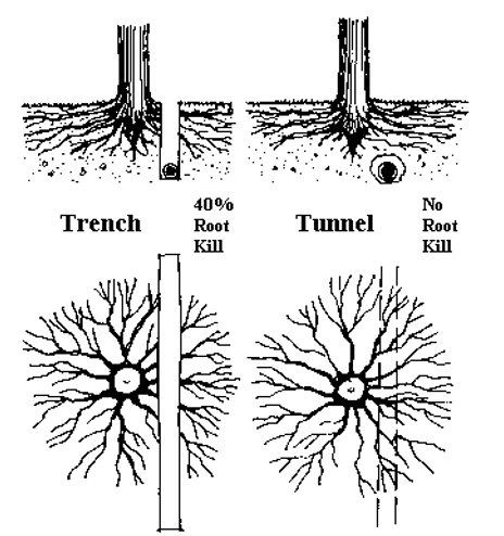
- Protective fencing shall be installed around the tree save area or tree protected zone of preserved trees prior to any land disturbing activities. Fencing shall remain in place until construction is complete and other planting requirements have been installed, and the Planning Director or Enforcement Officer has given approval for removal. The illustration below highlights appropriate fencing.
Figure 800-13: Fencing should be placed to prevent trucks and equipment from damaging tree roots.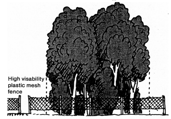 Figure 800-14: Protective fencing should be placed at the outer limits of the tree protection/critical root zone.
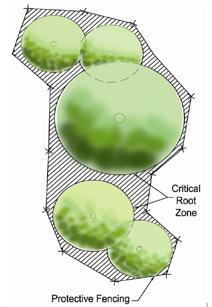
- All tree save areas shall be designated as such with “Tree Save Area” signs posted visibly on the outside of the fenced-in area. Signs may not be posted on the trees, within public right-of-ways or site triangles.
870.020 Planting Hole
870.030 Planting Strip Or Island
870.040 New Plant Material
870.050 Species Mix
870.060 Soil And Proper Planting Method
870.070 Tree And Soil Stabilization
870.080 Tree Size Substitution Due To Overhead Utility Lines
870.090 No Trees In Sight Triangle
All trees planted to meet the requirements of this ordinance shall be selected from the Approved Tree List (See Appendix 1: Tree List) and must adhere standards of Appendix 3 (Caliper to Height Ratios for Deciduous and Coniferous Trees) and the following requirements:
All trees planted to meet the provisions of this ordinance shall be at least eight (8) feet in height above ground level and at least 2.5 inches in caliper at the time of installation.
All prepared planting holes shall be a minimum of 18 inches in depth.
All planting strips or planting islands shall be a minimum of nine (9) feet in width measured from face of curb.
All new plant material shall be of good quality, installed in a manner to meet the standards set forth in the American Standard for Nursery Stock by the American Association of Nurserymen.
All tree plantings shall be required to provide a mix of species.
Installation and construction practices shall be utilized which preserve existing topsoil or amend the soil to reduce compaction (See Figure below for an illustration of proper planting techniques).
Figure 800-15: Proper Planting Method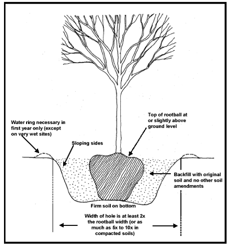
All trees shall be properly guyed or staked (where required due to grade changes, steep slopes, creek embankments, or man-made hazards), fertilized and mulched (3 to 4-inch layer) (See illustration below and the ANSI standards for fertilization and mulching).
Figure 800-16: Proper Tree Mulching Technique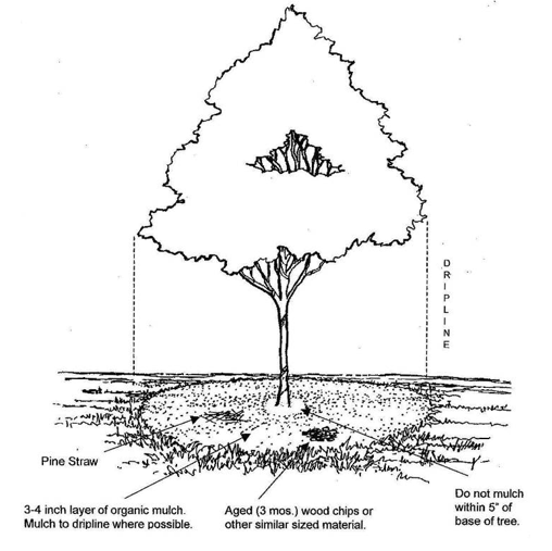
Where large canopy trees are required and overhead utility lines exist, two (2) small canopy trees may be substituted and planted no closer than 25 feet of the overhead distribution lines.
No tree shall be planted directly within the sight triangle.
- The Planning Director or designee shall have the power and authority to administer and enforce this ordinance. The Planning Director or designee may serve notice to any person in violation of this ordinance and/or institute legal proceedings as may be required, and the Town Attorney is hereby authorized to institute appropriate proceedings to that end.
- Tree Advisory Committee will have the power and authority to the following:
- Review and propose revisions to the tree preservation standards.
- Review alternative methods of compliance with the tree planting and tree protection requirements and make recommendations to the Planning Department.
- Provide community outreach and public education.
- Participate in the Town’s Arbor Day Event.
890.020 Tree Preservation/Protection Plan Required
- Tree Inventory A tree inventory shall serve as the foundation for all decisions concerning site planning and layout of new development. The inventory will provide the Town and applicant with a resource for planning landscaping and aesthetic improvements of the proposed development and a basis for encouraging preservation of existing forests, tree canopies and specimen trees. The tree inventory and tree preservation plan required by this Section must be reviewed and approved by the Planning Department.
- Tree Inventory Review
A tree inventory shall accompany all preliminary plat and construction plan submissions for major subdivisions and all non-residential development prior to any land disturbing activities. Such tree inventory will accurately depict the current condition of the site and existing trees to the satisfaction of the Planning Director. The tree inventory shall identify the following:
- Description and location of all trees that are 12 inches in diameter at breast height (DBH) or greater. Include the condition, species and height of each tree.
- General description of stands of trees 12 inches or less DBH with the size, species and density of trees per acre.
A tree preservation/protection plan shall accompany all preliminary plat and construction plan submissions for major subdivisions and all non-residential developments. Such plans must be reviewed and approved by the Planning Department prior to any land disturbing activities. All site development must adhere to the tree preservation/protection plan and all tree preservation/protection plans must include a description of the following:
- Boundaries of the required tree save areas.
- Protected trees and/or stands of trees within the tree save area, including type and size as well as a general assessment of the health of existing trees with special notice of the presence of any harmful insects or any indicators of health problems with the trees (e.g. canopy color or density).
- A tree protection zone established and maintained on site for all trees that are to be preserved (See Figure 800-12 for illustration of Tree Protection Zone and Critical Root Zone).
- Designated future open space areas.
- Future tree save areas and buffers.
- Identification of where and how existing trees are to be protected during the clearing and construction of sites.
- If the applicant is removing existing stands of trees and such removal means the project falls below the tree save requirement of Section 830.040.B then the applicant must indicate within the tree preservation plan an explanation why it is impractical to save the existing trees.
- If the applicant is removing an existing heritage tree(s) and such removal means the project falls below the tree save requirement of Section 830.040.B then the applicant must provide within the tree preservation plan an explanation why it is impractical to save the existing heritage trees. See Section 830.040.E for a description of the limited conditions in which heritage trees may be removed.
8100.020 Combining Plans
A tree planting plan shall accompany all preliminary plat and construction plan submissions. Such plans must receive approval from the Planning Department. The tree planting plan shall adhere to the following:
- The tree planting plan shall be drawn to scale, including dimensions and distances, and it will identify the location of building sites, utilities and clearly delineate all existing and proposed parking spaces or other vehicle areas, access aisles, and driveways.
- The proposed location, size and species of mitigation or replacement trees shall be indicated on the tree planting plan.
- Location of existing and proposed utilities.
Applicants may combine the Tree Preservation/Protection Plan with the Tree Planting Plan when it would more clearly convey their vision for the site, aiding the Planning Department in the review process.
8110.020 Denial Of Zoning And Subdivision Approval
8110.030 Inspections
8110.040 Emergencies
Alternate tree protection/planting plans, plant materials, planting standards or reforestation may be used where it would be unreasonable or impractical to strictly apply the tree protection/planting requirements. Such situations may be the result of streams, natural rock formations, topography, or other physical conditions; utility easements, a unified development design, or unusual site conditions. An alternate plan may be approved as part of a Conditional Zoning or when:
- The Tree Advisory Committee makes a recommendation to planning staff regarding all alternate tree protection/planting plans, plant materials, planting standards or reforestations.
- The Planning Director approves an alternate plan that proposes different plant materials or methods provided that the quality, effectiveness, durability, and performance are equivalent to that required by this ordinance. This determination shall take into account the land use classification of adjacent property, number of plantings, species, arrangement, coverage, location of plantings on the lot, and the level of screening, height, spread and canopy of the plantings at maturity. The Planning Director may not take final action approving an alternative plan until a recommendation from the committee is received or until forty-five (45) days have passed since the proposal was heard by the committee, whichever is first.
- In order to allow planting to occur at the optimal time, the Planning Director may allow for a delay in the installation of the required plantings after the approval of a tree protection or planting plan provided the applicant provides an acceptable form of performance bond, letter of credit, or other type of surety that will ensure future installation of the required trees.
- The Planning Director may grant relief on the tree canopy cover requirements (Chapter 840) if enforcing the minimums would require planting new trees to a degree that would cause undue burden to the property owner counter to the purposes of this UDO. This applies to already existing land uses seeking to change or expand.
- Any decision of the Planning Director regarding alternate methods of compliance may be appealed to the Planning and Zoning Board in a quasi-judicial proceeding.
The Town may deny site plan or subdivision plan approval for a period of up to three (3) years after completion of a land clearance, if the clearance results in the removal of all or substantially all of the trees that would be protected under this ordinance. The denial period may be extended to a period of up to five (5) years if the Town has evidence that the timber harvest was a willful violation of this ordinance.
Planning department staff and authorized representatives of the Town may periodically inspect sites subject to the provisions of this ordinance to determine compliance. The Town shall have the power to conduct such investigations as it may be necessary to carry out its duties as prescribed in this ordinance and for this purpose may enter at reasonable times upon the property, public or private, for the purpose of inspecting the site(s) subject to the provisions of this UDO.
During emergencies, such as windstorms, ice storms, fire, or other disasters, the requirements of this ordinance may be waived by the Planning Director for purpose of restoring order in the town. Requirements shall be waived during the emergency period only. This section shall not be used to circumvent the tree preservation protection requirements.
8120.020 Variances And Appeals
Any person who violates any of the provisions of this ordinance, or rules of orders adopted or issued pursuant of this ordinance shall be subject to any one or all of the combination of penalties authorized by this UDO. If a party continues to fail to comply with a particular provision, the party shall continue to remain subject to the penalties prescribed by this Section for the period of the continued violation of the particular provision. Penalties assessed under this Section are in addition to, and not in lieu of, compliance requirements of the UDO. The town may employ any of the remedies authorized for a municipality pursuant to G.S. 160A-175. Civil penalties for violation of this ordinance will be one or more of the following:
- Destruction or removal of trees greater than 12 inches DBH without approval of the Town of Indian Trail will incur a civil penalty equal to the amount of the value of trees as listed in the “The Guide for Plant Appraisal 9th Edition” published by The Council of Trees and Landscape Appraisers. Appraisals shall be done at the violator’s cost and the appraiser shall be selected by the Town of Indian Trail.
- For purposes of this Chapter, a separate offense shall be deemed to have occurred for each tree greater than 12 inches in DBH that have been destroyed or removed without the approval of the Town of Indian Trail.
- If the Planning Director or designee has determined that a violation of the requirements of this Chapter has occurred, no certificate of compliance shall be issued until compliance has been achieved.
- Variances A request for a variance from the Planning and Zoning Board in a quasi-judicial proceeding shall be made by filing a copy of the completed application with the Planning Department. A variance may be granted by the Planning and Zoning Board after a public hearing has been held in a quasi-judicial manner and advertised in accordance with the UDO and only if it concludes that the strict enforcement of the ordinance would result in practical difficulties or unnecessary hardships for the applicant and that, by granting the variance, the spirit of the ordinance will be observed, public safety, and welfare secured, and substantial justice done.
- Appeals
An appeal from any final order or decision by the Planning Director may be taken to the Planning and Zoning Board in a quasi-judicial proceeding by any person aggrieved. An appeal is taken by filing with the Planning Director a written notice of appeal specifying the grounds therefore. An appeal must be taken within 30 days after the date of the decision or order appealed from. See Chapter 380, "Appeals and Variances", for appeal requirements.
Chapter 920 Sign Area And Height
Chapter 930 Exempt Signs
Chapter 940 Signs Not Requiring A Permit
Chapter 950 RESERVED
Chapter 960 Prohibited Signs
Chapter 970 Temporary Sign Regulations
Chapter 980 Reserved
Chapter 990 Reserved
Chapter 9100 Wall Signs
Chapter 9110 Freestanding And Ground Mounted Signs
Chapter 9120 Sign Illumination
Chapter 9130 Master Signage Plan
Chapter 9140 Nonconforming Signs
Chapter 9150 Maintenance And Upkeep Of Signs
Chapter 9160 Administration, Enforcement, Appeals And Penalties
910.020 Permit Required
910.030 Content
910.040 Substitution Of Message
Pursuant to the authority and provision conferred in Chapter 160A-174 of the North Carolina General Statutes, the Town Council hereby ordains and enacts into law these sections. The purpose of regulating signs within the Town of Indian Trail, North Carolina, is to accomplish the following goals:
- Establish standards for the erection, alteration and maintenance of signs that are appropriate to various zoning districts;
- Allow for adequate and effective signs for communicating identification and other messages while preventing signs from dominating the visual appearance of the area in which they are located;
- Protect and enhance the view of properties from public rights-of-way;
- Ensure the safety of the local and visiting motorists on the roads in the Town by reducing the distracting influence of uncontrolled signs throughout the Town;
- Safety of utility workers on poles;
- Ensure that permitted signs do not become a hazard or nuisance;
- Ensure and advance the positive visual impact and image of the Town. These regulations are designed to provide flexibility for individual needs of business identification and for general communication opportunities.
- Except as otherwise provided in this Ordinance, it shall be unlawful for any person to erect, construct, enlarge, move, or replace any permanent or temporary sign or cause the same to be done, without first having obtained a sign permit for such sign from the Planning Director as required by this ordinance. A fee, in accordance with a fee schedule adopted by the Town Council, shall be charged for each sign permit issued.
- Notwithstanding the above, changing or replacing the copy on an existing lawful sign shall not require a permit, provided the copy change does not change the nature of the sign such as to render the sign in violation of this ordinance.
Any sign allowed under this section may contain: any noncommercial message; a commercial message pertaining to goods, services or other commercial transactions available on the premises or that will be available on the premises when construction is complete; and/or a commercial message related to the sale, lease or rental of the premises on which the sign is located. Signs seeking employees for a business shall be considered to pertain to commercial transactions available on the premises and shall be allowed under this section.
Any sign allowed under this section or a predecessor ordinance, by sign permit, by conditional zoning, by a former special use permit (special use permits no longer a process in this ordinance), by a former conditional use permit (conditional use permits no longer an allowed process), or by variance, may contain, in lieu of any other message or copy, any lawful noncommercial message that does not direct attention to a business operated for profit, or to a product, commodity, or service for sale or lease, or to any other commercial interest or activity, so long as said sign complies with the size, height, area, and other requirements of this ordinance.
920.020 Sign Surface Area
920.030 Sign Frame Area
920.040 Sign Height
All area provisions in this Ordinance are calculated from the sign surface area dimensions defined below.
All area provisions in this DIVISION are calculated from the sign surface area dimensions defined in this Chapter.
- Double-Faced Signs
In case of signs mounted back-to-back, only one side of the sign is to be used for computation of the area. Back-to-back signs shall be defined as double-faced signs. Otherwise, the surface area of each sign is to be separately computed. - Three-Dimensional Signs
In the case of cylindrical signs, signs in the shape of cubes, or other signs which are substantially three-dimensional with respect to their display surfaces, the entire display or surface is included in computations of area. - Entrance Wall or Fence Sign
If a sign is attached to an entrance wall or fence, only that portion of that wall or fence onto which the sign face or letters are placed shall be calculated in the sign area.
The sign area will be measured by the following methods:
- A geometric shape enclosing any message, logo, symbol, name, photograph, or display face for all sign types excluding Channel Letter Signs; and
- The area of individually mounted or painted sign letters applied directly to the building face which are not further emphasized by an architectural or painted element of the building shall be calculated as the sum of the area within a series of rectangles which encompasses each individual letter.
Figure 900-1: Sign Surface Area Calculation
The frame area will be measured from the dimensions of a geometric shape formed by all supports, frames, braces, bordering, and embellishments, which extend beyond the sign surface area, and that enclose the sign surface area.
The height of a sign shall be measured from the highest point of a sign to the point of ground surface beneath it. Ornamentation such as caps and spires are not included in this measurement. The use of berms or raised landscape areas is only permitted to raise the base of the sign to the mean elevation of the fronting street.
930.020 Traffic And Regulatory Signs
930.030 Building Interior Signs Not Visible From Exterior
930.040 Outdoor Space Signage Not Visible
930.050 Art With No Commercial Message
930.060 Town-Recognized Event Temporary Signage
930.070 Off-Premises Town Identification And Wayfinding Signs
The following types of signs are exempt from the regulations herein:
Any official public notice or warning required by a valid and applicable federal, state, or local law, regulation of chapter, by a public utility company or by order of a court of competent jurisdiction.
Traffic and regulatory signs on both public and private property, such as Stop, Yield and similar signs which meet the Department of Transportation standards.
Any sign inside a building not attached to a window or door that is not visible from off the site on which is located.
Any sign inside an athletic field or other enclosed outdoor space where the sign is not legible from more than three (3) feet beyond the lot line of the site on which it is located.
Works of art with no commercial message such as a mural.
Temporary signage erected as part of a Town-recognized event erected at Town approved locations provided that:
- No such sign shall exceed thirty-two (32) square feet in area.
- In no case shall the sign impede the view or travel of any motorist or pedestrian.
- Banner shall be attached to building façade or secured to freestanding post. In no case may the banners be attached to utility poles, traffic control signs, tree or other surface located within the public right-of-way.
- All banner signs and components thereof, including supports, shall be kept in a good state of repair.
Permanent off-premises Town identification and wayfinding signs as authorized by the Indian Trail Town Council.
940.020 Memorial Signs, Plaques And Grave Markers
940.030 Government/Non-Profit Flags, Insignia Or Religious Symbols
940.040 Decorative Or Architectural Features
940.050 On-Premises Directional And Instructional Signs
940.060 Incidental Signs
940.070 Campaign And Election Signs
940.080 Grand Opening Banners
The following types of signs are exempt from permit requirements of this Ordinance and may be placed in any zoning district subject to the provisions of this Ordinance. All such signs (except government signs) shall be located outside a street right-of-way.
Government signs and government logo signs.
Memorial signs, plaques or grave markers that are noncommercial in nature.
Flags, insignia, or religious symbols of any government, non-profit organization when not displayed in connection with a commercial promotion or as an advertising device.
Integral decorative or architectural features of buildings; works of art; so long as such features or works do not contain letters, trademarks, moving parts or lights.
On-premises directional and instructional signs not exceeding six (6) square feet in area and will be limited to two (2) only per premises.
- General Requirements
- Bulletin boards and signs which contain information of a non-commercial nature. Such bulletin boards and signs may have a maximum area of 32 square feet.
- Incidental signs, however, in no case shall a drive-in service window menu board be oriented to a public right-of-way or greater than 32 square feet in area.
- Bulletin boards and signs which contain information of a non-commercial nature. Such bulletin boards and signs may have a maximum area of 32 square feet.
- Incidental signs include the following:
- Directory Signs provided that:
- No sign is located in a road right-of-way.
- The maximum sign area shall be 32 square feet or one-half the area of the largest ground-mounted sign permitted for said use, whichever is less.
- Letters do not exceed six (6) inches in height.
- Height of sign does not exceed six (6) feet.
- No sign is located in a road right-of-way.
- Window Signs
- "Warning", "No Trespassing" and Similar Informational Signs
- Signs Within Stadium or Arena
Signs located within a stadium or arena intended to be read only by persons seated within the stadium. - Municipal, School, Recreational, and Civic Club Sponsored Signs
- Permanent municipal, schools, recreational and civic club sponsored signs, schedule of events, rules and regulations signs.
- Such signs shall not include identification signs.
- Permanent municipal, schools, recreational and civic club sponsored signs, schedule of events, rules and regulations signs.
- Newspaper Box Signs
Signs placed on newspaper boxes designed for placement of delivered newspaper to a particular location. - Historical Plaques
Historical plaques mounted in accordance with the United States Secretary of Interior’s Standards for Rehabilitation. - NC Vehicle Inspection Sign
North Carolina vehicle inspection sign so long as such sign is not located in any right-of-way. - Gas Station Price or Service Signs
Signs advertising price of gasoline or designating self-service or full-service pumps, so long as such signs are attached to the pump island. - Decorative Flags
Flags for decorative purposes only, which are attached to a dwelling and contain no message, identification or advertisement. - Temporary Holiday Displays, Lighting and Signs
- Temporary displays, including lighting, erected in connection with the observance of holidays.
- Any signs associated with the display shall be removed within three (3) days following the holidays.
- Directory Signs provided that:
Campaign and election signs provided that:
- Each sign shall not exceed 20 square feet in area.
- All such signs may be erected no sooner than 45 days in advance of the election for which they were made.
- All such signs shall be removed within seven (7) days after the election for which they were made.
- No sign shall be placed on any curb, sidewalk, post, pole, hydrant, bridge, tree, or other surface located on, over, or across any public street or right-of-way.
Grand opening banners for businesses located in non-single-family residential zoning districts provided that:
- One (1) banner per-business
- Banner size shall not exceed 32 square feet in area
- Banner shall be attached to the building façade for standalone businesses, above the business suite for multitenant commercial centers, or mounted within a Town approved banner display structure.
- Banner shall be removed within 45 days of issuance of the Town zoning verification or building upfit permit associated with the opened business within existing buildings or issuance of a zoning compliance certificate for businesses opened in new buildings through a site plan permit.
- Businesses that did not display a banner within the time period specified within UDO 940.080(D) may display a grand opening banner within the first three (3)-months of the business being open to public subject to obtaining a temporary sign permit and compliance with UDO Chapter 940.080(A) through (C).
960.020 Highly Reflective Or Unshielded Illuminated Signs And Spotlights
960.030 Signs Resembling Government Or Emergency Warning Signs
960.040 Abandoned Or Invalid Signs
960.050 Sign Interference With Health Or Safety
960.060 Non-Government Signs, Banners, Or Displays In Right-Of-Ways And Banners Staked On A Property
960.070 Flashing Signs
960.080 Portable Signs
960.090 Vehicular Signs
960.100 Off-Premises Advertising Signs
960.110 Rotating Signs
960.120 Roof Signs
960.130 Unauthorized Sign Placement
960.140 Airborne Signs
960.150 Signs Designed To Be Transported On Wheels
960.160 Signs In Public Right-Of-Ways, On Utility Poles Or Other Objects
960.170 Other Signs Not Permitted In UDO
960.180 Flashing, Fluttering, Swinging Or Rotating Signs
A sign which the Planning Director determines obstructs the view of bicyclists or motorists using any street, approach to any street intersection, or which interferes with the effectiveness of or obscures any traffic sign, device, or signal shall be prohibited.
Illuminated highly reflective or unshielded signs or spotlights, which hamper or obstruct the vision of motorists or bicyclists.
Signs other than government signs which contain lights, rotating disks, words and other devices not erected by a public authority which may be erroneously construed as government signs or emergency warning signs such as traffic control signs. An example of this is a sign which contains a picture of a traffic sign plus the word “Stop”, “Yield”, etc. The signs shall not be similar in color, design, and appearance to traffic control signs.
Any sign which has been abandoned or advertises any product, business or activity which product is no longer sold, or such business or activity is no longer in existence, for at least 60 days, shall be removed with 30 days after notice from the Town.
Any sign located outdoors which interferes with free passage from or obstructs fire escape, downspout, window, door, stairway, ladder, or opening intended as a means of ingress or egress or providing light or air.
Any sign (other than government sign), banner or display placed on any curb, sidewalk, post, pole, hydrant, traffic control sign, bridge, tree, or other surface located on, over, or across any public street or right-of-way, or any banner, placed on stakes on a property, unless otherwise permitted.
Flashing signs, signs with flashing or reflective disks, signs with flashing lights or lights of changing degree of intensity or color (except government signs or signs used in connection with emergency or public announcements as exempted in Chapter 930 or 9160.040). If any LED sign alternates between messages, it shall continuously show one message a minimum of ten (10) minutes in time before switching to the other message.
Portable signs, except as permitted in Chapter 970.
Vehicular signs.
Off-premises advertising signs (i.e. Billboards) unless otherwise stated in this Ordinance except those sponsored by any government.
Rotating signs, other than on-premises rotating identification names which contain logo and/or business name on it.
Roof signs which extend above the highest point of a pitched roof, mansard roof, or parapet.
Signs placed on a piece of property without permission of its owners or agent.
Airborne signs including inflated balloons having a diameter of greater than two (2) feet.
Any sign whose sign face was initially constructed and designed to be placed and /or transported on wheels, regardless if said sign face is removed from its base and placed on or in the ground so as to otherwise classify said as a “free-standing” sign as herein defined.
All signs, including the supports, frames, and embellishments thereto, located within any public right-of-way, or attached, affixed, or painted on any utility pole, light standard, telephone or telegraph pole, any tree, rock or other natural object.
Other signs not expressly permitted in this UDO.
Flashing, fluttering (such as "feather flags"), swinging, or rotating signs with the exception of time and/or temperature signs.
970.020 Number And Size Allowed
970.030 Temporary Real-Estate Signs
970.040 Temporary Construction Signs
970.050 Temporary Farm Product Advertising Signs
970.060 Non-Profit Or Not-For-Profit Organization Temporary Signs And Banners
970.070 Temporary Yard Sale Signs
970.080 Size And Location Standards For Temporary Signs
A temporary sign permit, issued by the Planning Department shall be approved before the placement of a portable sign, special event sign, promotional temporary sign, or grand opening sign within any non-residential zoning districts as indicated in Section 990.040.
Temporary signs are allowed in addition to permanent signs allocations. The maximum number of Town approved portable or banner signs shall not exceed one (1) per business. However, multi-tenant commercial centers shall be limited to a maximum of one (1) promotional and one (1) grand opening banner display at any given time.
Temporary real estate signs advertising a specific property for sale, lease, rent or development shall be located as follows:
- One (1) sign per street frontage advertising real estate (“For Sale”, “For Rent”, “For Lease”, or “For Development”) not greater than 10 square feet in area in a Residential District and 32 square feet in areas in nonresidential districts may be located on the property being advertised so long as said sign is located behind the street right-of-way line. If the property so advertised lies on a corner lot or double frontage lot, then a second (2nd) sign may be oriented along the second street so long as the two signs are at least 100 feet apart as measured by the shortest straight line.
- In addition to the on-site real estate sign(s), a maximum of two (2) directional signs, each not exceeding four (4) square feet in area, shall be permitted off the subject premises. Such sign must be placed outside of existing right-of-ways. Such signs shall remain for a period not to exceed one (1) year. The message of said signs shall be limited to the name of the property or development being advertised, an address, a telephone number, a directional arrow, mileage to the subject property, and the terms “Lot/Home For Sale”, “For Rent”, “For Lease”, “For Development”, etc.
- No more than three (3) temporary directional signs advertising a specific planned commercial or mixed-use development, subdivision, multi-family development, etc. may also be permitted off-site. Each sign may have a maximum area of four (4) square feet and shall be placed outside all existing right-of-ways.
- All such temporary signs shall be removed within seven (7) days after the property has been sold, rented, leased, etc.
- No sign allowed under this section shall be lighted.
Temporary construction signs are allowed provided that:
- Signs in conjunction with any residential use shall not exceed 15 square feet each.
- Signs in conjunction with all other uses shall have a maximum area of 32 square feet each.
- Only one (1) such sign oriented per street front, per premises shall be erected.
- Such signs shall not be illuminated.
- Such signs shall only appear at the construction site.
- No sign shall be located in the road right-of-way.
- Such signs shall be removed within seven (7) days after completion of the project.
Temporary farm product signs advertising seasonal products produced on the site are allowed provided that:
- One (1) on-premises sign may be used. Said sign shall be located off the street right-of-way and at least ten (10) feet away from any side lot line. Such a sign shall have a maximum area of nine (9) square feet and may not be illuminated.
- Portable signs shall not be used except as permitted in Section Chapter 970.
Temporary special event or Temporary Use signs and banners for government, religious, charitable, civic, fraternal, or similar non-profit or not-for-profit organizations provided that:
- Signs shall be erected no sooner than fourteen (14) days prior to the last day of the first. No sign shall be erected for a period that exceeds sixty (60) days per calendar year from the day of the event and removed no later than three (3) days after the event.
- No such signs shall exceed thirty-two (32) square feet in area or be internally illuminated.
- In no such case may any such sign impede the view or travel of any motorist or pedestrians.
- Said banner may be attached to building façade or secured to freestanding post. In no case may the banners be attached to utility poles, traffic control sign, tree or other surface located within a public right-of-way.
- Signs for civic organizations may be located on property other than the location of the event with written permission from the property owner.
- One (1) on-premises and two (2) off-premises yard sale signs per yard sale.
- All such signs shall be removed within twenty-four hours after the yard sale has been terminated. No such sign shall exceed four (4) square feet. All such signs shall be located off the street right-of-way.
- Standards for Temporary Signs
Table below provides standards under which temporary signs may be displayed. The sign areas allowed are in addition to the sign area allowed for permanent signs. - Permitted Types of Storefront Portable Signs
Table 900-1: Permitted Types of Storefront Portable Signs
*Applications for permits must be submitted within 45 calendar days from the date of application. Applications for events more than 45 calendar days in advance will not be accepted. New applications by the same applicant shall not be accepted until the expiration of any currently valid permit and removal of the expired sign.Type Illustration Maximum Size/Height Maximum Number Location Duration A-Frame or Sandwich Board 
2 feet by 3 feet 1 per business 1. Parallel and adjacent to front of storefront or suite where pedestrian sidewalk is less than 7-feet in width. 2. Not within landscaped areas. 3. On sidewalks located directly in front of the business or suite. Unlimited Swinger 
2 feet by 3 feet 1 per business Same as above. Unlimited Statue/Sidewalk Sign 

5 feet in height or width 1 per business Same as above. Unlimited Temporary Banner “Grand Opening”; “Going Out of Business*” *See UDO Chapter 940.080 for Grand Opening Banners 
32 square feet 1 per business 1. Attached to the building façade for standalone businesses. 2. Mounted within a Town approved banner display structure or on front façade directly above the business suite for multi-tenant commercial centers. 45 days Grand Opening 30 days Going out of Business Promotional Banners “Sales”; “Special Events” 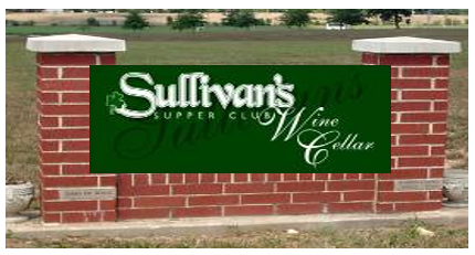
32 square feet for building façade or multi-tenant centers without structure; 18 square feet for placement in banner display monument sign. 1 per business but no more than one in a multi-tenant commercial center. 1. Attached to the building façade for standalone businesses. 2. Mounted on an existing monument sign within multi-tenant commercial centers. 14 days per event with no more than 6 events per year. *
9100.020 Sign Projection From Wall
9100.030 Canopy And Awning Signs
The allowed wall sign area for a development shall comply with the provisions of Section 920.010 of this Ordinance.
No wall sign shall project more than 18 inches from the building wall.
Canopy and awning signs may be substituted for part or all of the allowable wall signage per development. Signs may be painted or printed onto a canopy or awning. In no case shall a canopy or awning extend into the street right-of-way.
9110.020 Ground Mounted Sign Requirement
9110.030 Message/Reader Boards - Highway 74/Independence Boulevard And Old Monroe Road
9110.040 Freestanding, Monument Or Ground Mounted Sign Standards
9110.050 Hwy 74/Independence Blvd And Old Monroe Rd - Single Tenant Parcels
9110.060 Hwy 74/Independence Blvd And Old Monroe Rd - Multi-Tenant Parcels
9110.070 Additional Signage For Corner Lots
9110.080 Multi-Tenant Additional Monument Display Structure
9110.090 Banner Display With Existing Monument Sign
9110.110 Special Event Or Meeting Off-Premises Signage
9110.120 Monument Signs Along Indian Trail Road Downtown Corridor
Except as authorized by this Chapter, there may be no more than one freestanding sign on a single lot. Freestanding signs must be located a minimum of 50 linear feet from any other freestanding sign.
All permitted signs on properties located within the Town of Indian Trail shall be ground mounted with the exception of properties located along Highway 74/Independence Boulevard and Old Monroe Road unless otherwise specified in Chapter 790, Off-Premises Signs (RBD District). No ground mounted sign may be higher than six (6) feet above finished grade for a single tenant sign, and ten (10) feet in height for a multi-tenant sign.
Changeable Reader or Message Boards are authorized for properties located along Highway 74/Independence Boulevard and Old Monroe Road. The message or reader boards shall be attached to the Freestanding Sign and calculated into the Freestanding Sign area subject to the following:
Table 900-2: Changeable Reader or Message Board Calculation of Maximum Board Area
| Type | Maximum Board Area |
| Manual Changing Board | 50% of the total allowable freestanding area as provided above |
| LED Static Message Board | 50% of the total allowable freestanding sign area as provided above |
| Manual or LED Message Board Signs for Movie Theaters | 100% of Sign Area Wall or Freestanding Sign Area |
- No portion of a freestanding, monument, or ground mounted sign shall extend into the street right-of-way or sight triangle.
- All freestanding, monument, or ground mounted signs shall observe and be located outside of all future right-of-way lines as identified in the Indian Trail Comprehensive Plan.
- No freestanding sign shall be located on an artificially created berm.
- Freestanding signs shall be placed in raised landscaped planters whenever possible. See Figure 900-2 for an example.
Figure 900-2: Freestanding sign in raised planter.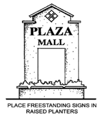
Freestanding signs for single tenant parcels located adjacent to Highway 74/Independence Boulevard or Old Monroe Road shall be calculated based on the following table:
Table 900-3: Permitted Sign Area and Height Along Highway 74/Independence Boulevard or Old Monroe Road
| Permitted Sign Area and Height-- Highway 74/Independence Boulevard or Old Monroe Road | ||
| Size of Property (acres) | Allowable Sign Area (sq feet) | Maximum Height of Sign (feet) |
| Less than 1 | 65 | 20 |
| 1.00 to 1.99 | 75 | 20 |
| 2.00 to 2.99 | 75 | 20 |
| 3.00 to 3.99 | 80 | 20 |
| 4.00 to 4.99 | 90 | 25 |
| 5.00 to 5.99 | 100 | 25 |
| 6.00 to 6.99 | 100 | 25 |
| More than 7 | 128 | 25 |
| All signs defined by this table shall be located a minimum of 10 feet from the edge of Highway 74 or Old Monroe Road right of way. | ||
Freestanding signs for multi-tenant parcels located adjacent to Highway 74/Independence Boulevard or Old Monroe Road shall be calculated based on one of the following tables. If a property meets criteria from both tables, it shall be allowed to apply the most permissive set of sign regulations as described in these tables.
- Multi-Tenant Properties with a Single-User Greater than 40,000 Square Feet
Table 900-4: Allowable Sign Area and Height for Multi-Tenant Properties with Single-User Greater than 40,000 Square FeetGross Floor Area of Single Largest Tenant Allowable Sign Area
(sq. ft.)Maximum Height of Sign (feet) 40,000 to 74,999 150 25 75,000 to 99,999 200 25 100,000 and over 240 25 All signs defined by this table must be located a minimum of 20 feet from the boundary of the Highway 74 or Old Monroe Road right-of-way. - Multi-Tenant Properties
Table 900-5: Allowable Sign Area and Height for Multi-Tenant Properties (by Property Size)Size of Property in Acres Allowable Sign Area
(sq. ft.)Maximum Height of Sign (feet) Less than 1 75 20 1.00 to 2.99 100 20 3.00 to 4.99 125 25 5 to 7.49 150 25 7.5 to 14.99 200 25 15 or over 240 25 All signs defined by this table shall be located a minimum of 20 feet from the boundary of the Highway 74 or Old Monroe Road right-of-way.
All permitted signs on properties located within the Town of Indian Trail shall be ground mounted with the exception of properties located along Highway 74/Independence Boulevard and Old Monroe Road unless otherwise specified in Chapter 790, Off-Premises Signs (RBD District).
- The additional signage allowed for a single tenant development on a corner lot shall not exceed twenty (20) square feet in area and five (5) feet in height and shall not be closer than 200 feet from the primary sign.
- The additional signage allowed for a multi-tenant development on a corner lot shall not exceed fifty (50) square feet in area and six (6) feet in height and shall not be closer than 200 feet from the primary sign.
- The additional signage allowed for a single tenant development located on a corner or through lot and on Hwy 74 or Old Monroe Road shall not exceed:
- Fifty (50) square feet in area and six (6) feet in height of secondary street is classified as a Thoroughfare or Boulevard; or
- Thirty-two (32) square feet in area and six (6) feet in height for all other roadway classifications.
An additional monument display structure may be permitted for multi-tenant commercial centers and shall be constructed of brick, stone, stucco or other high quality building material.
- Range of Use
The use of such monument signs must be limited to temporary signs announcing new stores, special events, and seasonal sales. - Placement
Placement of said monument display shall be restricted to a landscape area located parallel and adjacent to the public right-of-way. - Size
Monument display structures shall be limited to a maximum of four (4) feet in height and eight (8) feet in length. - Monument Banner Displays
Monument banner displays shall obtain a zoning permit from the town planning department. All banners shall be secured to the display monument in such a manner to prevent flapping or other movement which may be distracting to motorist.
The Planning Director may grant an exception to the criteria in Section 9110.110 for the use of a banner display structure with an existing monument sign subject to the following:
- The maximum banner sign area is limited to 18 square feet and shall be positioned no higher than four (4) feet above finished grade.
- Banners are secured to the monument sign in such a manner to prevent flapping or other movement which may be distracting to motorist.
- Existing sign is constructed of brick, stone, stucco, or other high quality building material.
- Existing sign is not located within the existing or future sight triangle.
- The decision of the Planning Director may be appealed to the Planning and Zoning Board in a quasi-judicial proceeding.
Off-Premises Signage for entertainment venue, sports venue, motion picture theater, theatrical playhouse, or meeting and gathering hall such as a conference center shall be authorized by zoning permit when in compliance with the following:
- The venue can accommodate a minimum of 2,000 people or has documented annual attendance of 150,000 people through hosting regional and local completive sporting events; and
- A maximum of two (2) freestanding signs per parcel is authorized when an off-premises sign is proposed; and
- No off-premises sign may be located within a 1,000 radius of any other pre-existing off-premises sign.
- Maximum height of off-premises sign shall be consistent with primary sign authorized on subject property as stated within this chapter; and
- Maximum sign area for off-premises sign shall be 120 square feet in area; and
- Off-premises sign is not located within the existing or future sight triangle, is a minimum of 10 feet from property line adjacent to right-of-way, and shall be a minimum of 50 feet from primary freestanding sign on the same property.
The following requirements are only for monument signs along the Indian Trail Road from Hwy 74 to Old Monroe Road and in the Downtown Overlay. Sample images are provided in Figure 900-1 below and an image summarizing the sign details are in Figure 900-2. The following requirements shall apply:
- Allowed for businesses, townhouses and residential apartments where the main entrance is setback at least 20 feet from the property line along Indian Trail Road.
- No separate standards are provided for multitenant businesses in this downtown corridor. Also, no pole signs are permitted in this corridor.
- Monument Sign Component 1 of 2: Sign Board
Signs with the following specifications shall be mounted in a base and column masonry foundation structure as depicted in the examples below in Figure 900-1.
- Sign Width. The sign board shall have a four (4) -foot minimum and a six (6) -foot maximum width.
- Sign Height. The sign board shall have a height of three (3) feet.
- Number of Signs. One sign per street frontage with a maximum of 2 per lot. Residential subdivision entrances may have 2 per entrance.
- Signs shall have a border or molding and it shall not exceed three (3) inches in width.
- Sign Width. The sign board shall have a four (4) -foot minimum and a six (6) -foot maximum width.
- Monument Sign Component 2 of 2: Structure Base and Side Border
Cradling each monument sign will be a brick or flat stone base and side border meeting the following standards:
- The sign will have one side border (narrow column) that will be situated on the side closer to the building.
- The base and side border materials will be constructed of brick or flat stone. A side border cap, base shelf and/or banding no thicker than four (4) inches may be constructed of a second, contrasting masonry or stone color.
- The sign will be touching the side border and lower base structure with no gaps.
- The sides of the square side border will be matching dimensions on all sides with a maximum of two (2) feet wide.
- The sign will have one side border (narrow column) that will be situated on the side closer to the building.
- Building main facades built up to the street sidewalk that is contiguous to the street curb, shall use a wall or projecting sign instead of a monument sign on the sidewalk.
- In addition to the requirements listed above, the other sections of DIVISION 900 shall apply. For example, if the site does not have the required 20 feet of frontage, the sections on wall signs or projecting signs will apply.
Figure 900-1: Representative Images of Downtown Indian Trail Rd Corridor Monument Signs
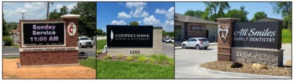
Figure 900-2: Detail of Indian Trail Rd Corridor Monument Sign Standards
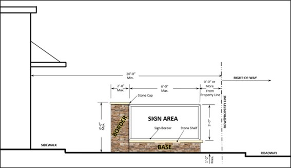
All lighted signs shall have their lighting directed in such a manner as to illuminate only the face of the sign. All lighted signs shall meet all applicable Electrical Codes.
No sign (other than a ground mounted sign) within 100 linear feet of a preexisting residential structure may be illuminated between the hours of 12:00 midnight and 6:00 a.m. A residence shall be deemed “pre-existing” for purposes of this subsection if it had received a certificate of occupancy prior to the installation of such signage or on the effective date of this Ordinance had a valid building permit in place for its construction. Any residential structure constructed prior to the effective date of this Ordinance shall also be considered “pre-existing”.
9130.020 Process
9130.030 Amendments
9130.040 Nature Of Approval
A master signage plan shall be submitted to the Town for developments containing more than one (1) lot, tenant or principal structure. Within a development the coordination of styles and colors shall be utilized to ensure continuity.
A master signage plan shall include the following in booklet form:
- Detailed designs of all proposed signs including the size, height, copy, materials, and colors of such signs.
- Proposed number and location of signs.
- Sign illumination plans.
- Provisions for shared usage of freestanding sign(s).
A master signage plan shall be part of any development plan; site plan or other plan required for development and shall be processed simultaneously with such plan(s). A master signage plan shall be approved prior to the issuance of sign permit(s).
A master signage plan may be amended by filing a new plan, which complies with all the requirements of this Ordinance.
After approval of a master signage plan, no sign shall be erected, affixed, placed, painted or otherwise established except in conformance with such plan and such plan may be enforced in the same way as any other provisions of this Ordinance. In case of any conflict between the provisions of such a plan and any other provisions of this Ordinance, the Ordinance shall control.
9140.020 Increase In Nonconformity Not Permitted
9140.030 Relocation Or Replacement Not Permitted If Not Seeking Conformity
9140.040 Destroyed By Natural Causes
9140.050 Amendment Of Sign Message
9140.060 Renovations And Repairs
9140.070 Signs Advertising Activities Or Items No Longer Applicable
9140.080 Off-Premises Signs (i.e Billboards)
Nonconforming signs shall be governed by the provisions of this Chapter.
Subject to the remaining restrictions of this section, nonconforming signs, other than off-premises advertising signs, that were otherwise lawful on the effective date of this ordinance, may be continued.
No person may engage in any activity that causes an increase in the extent of nonconformity of a nonconforming sign. Without limiting the generality of the foregoing, no nonconforming sign may be enlarged or altered in such a manner as to increase the degree of nonconformity. Nor may illumination be added to any nonconforming sign.
A nonconforming sign may not be moved or replaced except to bring the sign into complete conformity with this ordinance.
If a nonconforming sign is destroyed by natural causes, it may not thereafter be repaired, reconstructed, or replaced except in conformity with all the provisions of this ordinance, and the remnants of the former sign structure shall be cleared from the land. For purposes of this section, a nonconforming sign is "destroyed" if damaged to an extent that the cost of repairing the sign to its former stature or replacing it will an equivalent sign equals or exceeds the value listed for tax purposes of the sign so damaged.
The message of a nonconforming sign may be changed so long as this does not create any new nonconformity (for example, by creating an off-premises sign under circumstances where such a sign would not be allowed).
Subject to the other provisions of this section, nonconforming signs other than off-premises advertising signs may be repaired and renovated so long as the cost of such work does not exceed, within any twelve-month period, 50% of the value listed for tax purposes of such sign.
If a nonconforming sign advertises a business, service, commodity, accommodation, attraction or other enterprise or activity that is no longer operating or being offered or conducted, that sign shall be considered abandoned and shall be removed within 30 days after such abandonment by the sign owner, owner of the property where the sign is located, or other party having control over such sign.
- Removal of Off-Premises Advertising Signs
All off-premises advertising signs (i.e. Billboards) erected and located in the Town’s jurisdiction shall be removed within five (5) years of the effective date of this Chapter. - Nonconformity Created by Extension of Territorial Jurisdiction
All off-premises advertising signs (i.e. Billboards) that are made nonconforming by extension of the Town’s territorial or extraterritorial jurisdiction, shall be removed within five (5) years of the effective date of the extension. - Blank Off-Premises Signs
Notwithstanding paragraphs 9140.090 and 9140.100 above, if an off-premises advertising sign (i.e. Billboard) remains blank for a continuous period of twelve months, that billboard shall be deemed abandoned and shall, within 30 days after such abandonment, be removed by the sign owner, owner of the property where the sign is located, or other person having control over such sign. For purposes of this section, a sign is “blank” if”:- It advertises a business, service, commodity, accommodation, attraction, or other enterprise or activity that is no longer operating or being offered or conducted; or
- The advertising message it displays becomes illegible in whole or substantial part; or
- The advertising copy paid for by a party other than the sign owner or promoting an interest other than the rental of the sign has been removed.
9150.020 Insecure Or Unsafe Signs
9150.030 Only Sign "Shell" Remains
All signs and all components thereof, including supports, braces, anchors, etc., shall be kept in a good state of repair, in compliance with all building and electrical codes and in conformance with the requirements of this Ordinance.
A sign which is determined by the Planning Director as being insecure, in danger of falling or otherwise endangering the public safety shall be immediately removed by its owner unless it is repaired and made to otherwise comply with the requirements of this ordinance.
If the message portion of a sign is removed, leaving only the supporting “shell” of a sign or the supporting braces, anchors, or similar components, the owner of the sign or the owner of the property where the sign is located or other person having control over such sign shall, within 30 days of the removal of the message portion of the sign, either replace the entire message portion of the sign or remove the remaining components of the sign.
9160.020 Appeals
9160.030 Violations And Penalties
9160.040 Table Of Sign Requirements
The Town Manager shall appoint an enforcement officer. The enforcement officer or his appointee shall administer and enforce all provisions of this Chapter. The sign enforcement officer shall also have the following authority:
- To issue a violation notice. A violation notice shall be delivered by certified mail, return receipt requested, or by such other method as allowed by law, to the owner of the sign in violation of the Chapter. Whenever the owner of the sign cannot be located and notified, such notice shall be delivered to the owner of record of the real property upon which the sign is located. The time period provided herein shall commence upon receipt of such violation notice. The violation notice shall contain the following:
- Identify the sign;
- Shall describe the nature of the violation;
- Refer to the section of the UDO violated;
- Specify in detail what action must be taken to correct the violation; and
- Specify a reasonable time limit of up to 15 calendar days within which the violation must be corrected.
- To issue a compliance order for any sign or sign structure not corrected within the time allotted under the violation notice or for a prohibited sign or any temporary portable sign not permitted as established by this Chapter. A compliance order shall be delivered to the sign owner and to the owner of record of the real property upon which the sign is located in the same manner as set out for a violation notice and shall not be effective until received. The compliance order recipient shall be allowed 30 calendar days to remove the subject sign at the owner’s expense. The compliance order shall identify the sign and refer to the section of the UDO violated. Any recurring temporary portable sign violation(s) that occur within a six- (6-) month time period shall be deemed, for purposes of assessing a penalty, a continued violation.
- To issue an unsafe sign notice. Should any sign or sign structure become imminently unstable or in danger of falling or otherwise unsafe, an unsafe sign notice shall be delivered to the sign owner or to the owner of record of the real property upon which the sign is located in the same manner as set out for a violation notice, except that the recipient of the notice shall immediately, in the case of imminent danger, secure or remove the sign in a manner to be approved by the sign enforcement officer in conformity with the provisions of this Chapter. If the condition prompting the notice is not corrected within 24 hours after receipt of the notice, the sign enforcement officer shall have the authority to remove the sign at the recipient’s expense.
Violation notices and compliance orders issued by the sign enforcement officer may be appealed to the Planning and Zoning Board in a quasi-judicial proceeding within 30 working days of receipt of notice. Pending appeal, the time limits set out in the notice or order shall be suspended. If the Planning and Zoning Board finds that the action of the sign enforcement officer has been taken for good cause and in accordance with this Chapter, it shall so declare and the time period for compliance shall run from the issuance of that board’s finding. If the Planning and Zoning Board sustains the appeal of the petitioner, no further action will be taken by the sign enforcement officer.
After due notice and order as provided above for any violation of the terms of this Chapter, the sign enforcement officer or the town attorney may issue a citation imposing a penalty of not more than $100.00 on the owner of the sign in question or on the owner of the record of the real property upon which the sign is located whenever the owner of the sign cannot be located and notified of such citation. In the case of continuing violation, each 24 hour period in which the violation exists shall constitute a separate violation. In addition to the above-described penalty, the Town may enforce this Section by any one or more of the remedies authorized by Chapter 160A-1753 of the General Statutes, with the exception of 160A-175(b).
- The signs in the table are permitted with a permit as an accessory use to a principal permitted use in the respective districts.
- Uses not indicated shall be placed in the category having similar uses by action of the Planning and Zoning Board in a quasi-judicial proceeding. At such time, sign requirements for such uses shall be established.
- Permitted Sign Table—Residential Districts
Business or identification signs in Residential Districts are subject to the following limitations:
Table 900-6: Residential Business/Identification Sign RequirementsUse Classification Maximum Number Maximum Sign Face Area (Sq. Ft.) Allowed Sign Type Maximum Height of Free-Standing Sign (Feet) Single-Family Home, Two-Unit Dwelling 1 1.5 sq. ft. Wall NA Multi-Family 2 per frontage 18 Wall NA Residential Subdivision 2 per frontage 20 Ground 7 Manufactured Home Park 1 per frontage 18 Ground 6 Daycare Center* (Adult or Child Care) 1 per frontage 24 square feet Wall or ground 6 Public Schools* Union County Public Schools see Chapter 7250 64 sq. ft. including bulletin board Ground 6 Churches, Synagogues or other places of Worship 1 per frontage 32 sq. ft. including bulletin board Ground 6 *Institutional Uses may utilize manual changeable copy sign or LED Static Message Board. - Permitted Sign Table—Institutional Uses/Districts
The following identification signs are permitted for Institutional Uses/Districts:
Table 900-7: Institutional Sign Requirements (for Institutional Use or in Institutional District)Use Classification Maximum Number Maximum Sign Area (Sign Face) Allowed Sign Type Maximum Height of Free-Standing Sign (Feet) - Cemetery or Mausoleum - College or University* - Community Service Use or Center* - Convalescent and Nursing Home 3 total which includes any freestanding sign Wall -10% of the front building façade square footage area not to exceed 250 square feet Freestanding – 32 square feet Wall, Free-standing 6 - Convention Facilities* 3 total which includes any freestanding sign Wall -10% of the front building façade square footage area Freestanding – 64 square feet Wall, Free-standing 15 - Day Care Facility* (Adult or Child Care Centers) 3 total which includes any freestanding sign Wall -10% of the front building façade square footage area not to exceed 250 square feet Freestanding – 32 square feet Wall, Free-standing 6 - Hospital* 3 total which includes any freestanding sign Wall -10% of the front building façade square footage area not to exceed 250 square feet Freestanding – 64 square feet Wall, Free-standing 10 - Laboratory - Library* - Medical Facilities - Museums* - Non-profit Agency/Office - Offices - Public Parks/Open Spaces* - Public Utility, Major or Minor 1 per frontage 0.5 sq. ft. per linear foot of frontage not to exceed 100 sq. ft. Wall, Ground, Free-standing 6 - Recreation Facilities* (private golf courses and country clubs) 3 total which includes any freestanding sign Wall -10% of the front building façade square footage area not to exceed 250 square feet Freestanding – 32 square feet Wall, Free-standing 10 - Religious Assembly* - Schools, Public or Private*
(Union Co. Public Schools see Chapter 7250) - Social Service Agency3 total which includes any freestanding sign Wall -10% of the front building façade square footage area not to exceed 250 square feet Freestanding 64 sq. ft. Wall, Free-standing 6 - Government Buildings* 3 total which includes any freestanding sign Wall -10% of the front building façade square footage area not to exceed 250 square feet Freestanding 64 sq. ft. Wall, Free-standing 10 - Emergency Response Facilities (Fire Department, Law Enforcement, etc.) 3 total which includes any freestanding sign Wall -10% of the front building façade square footage area not to exceed 250 square feet Freestanding - 64 sq. ft Wall and Freestanding 6 10 – in RBD *These Institutional Uses may utilize manual changeable copy sign or LED Static Message Board. - Permitted Signs for Business, Commercial, Industrial, Downtown Districts, and Certain Overlays
The following signs are permitted in Business, Commercial, Industrial, and Downtown zoning districts; and certain overlays:
Table 900-8: Sign Requirements for Business, Commercial, Industrial, and Downtown Districts; and Certain OverlaysStandard NBD, GBD Districts Downtown Districts1, Mixed Use Activity Center Overlays, and Sub-Regional Activity Center Overlay RBD District L-I, H-I District Type of Signs Freestanding, wall, or projecting signs Maximum Sign Area per business Wall signs- 10% of front building or suite façade with primary building entrance for each business not to exceed 250 square feet in area for wall signs. Freestanding Signs- 32 square feet for freestanding signs or otherwise authorized in Chapter 9110. Institutional Uses Refer to 9160.040D, Permitted Sign Table - Institutional Uses/Districts Maximum number of signs per business Wall Signs- unlimited (not to exceed 10% of wall area for any given wall) Freestanding Signs- One per lot unless otherwise authorized in Chapter 9110. Maximum Freestanding Sign Height 10 multi-tenant centers 6 single tenant parcels 6 single tenant 10 multi-tenant center 6 ft., 20ft., or 25 ft. pursuant to Chapter 9110 6; 10 multi-tenant Internal Illumination Yes, Allowed Sign Type Illumination Y Y Monument/Freestanding Internally- Back lit channel letters, open face channel letters, routed and backed panel. Monument/Freestanding Externally- Lighting fixtures shall be directed towards the sign. Wall Signs and Projecting Signs No- for signs approved after June 9, 2009. Commercial or Industrial Center Standards Centers located outside of the RBD district are entitled to one multi-tenant center sign with a maximum of 100 sq. ft. One additional ground sign is permissible in accordance with Section 9110.080B. Each business within a center is authorized unlimited wall signs not to exceed 10% of any given wall area as indicated in the table above and a place on a multi-tenant sign consistent therewith the approved Sign Program for said Center. Centers located along Hwy 74/Independence Boulevard shall comply with Chapter 9110. Planned Industrial Parks or Office Parks Two (2) freestanding Park Identification signs per entrance located behind right-of-way. Maximum height 7 feet. Maximum area of sign per monument 18 sq. ft.
1 See "9110.020" for Downtown monument sign requirements.
Adopted by Ord. 393 on 11/14/2023
Amended by Ord. 397 on 3/26/2024
Amended by Ord. 410 on 12/10/2024
Chapter 1020 Off-Street Parking Requirements
Chapter 1030 Bicycle Parking
Chapter 1040 Stacking Spaces For Drive-Through Businesses
Chapter 1050 Accessible Parking
Chapter 1060 Off-Street Loading Requirements
Chapter 1070 Parking And Loading Area Design And Construction
Chapter 1080 Flexibility In Administration Authorized
Chapter 1090 Shared And Remote Parking
1010.020 Exemptions, Reductions, And Special Area Standards
- All developments shall provide a sufficient number of parking spaces to accommodate the number of vehicles likely to be attracted to the development. However, in an effort to minimize impervious surfaces that can cause stormwater quantity and quality problems, the number of parking spaces needed should not be based upon rare seasonal peak demands.
- Each land use or activity within the Town shall provide and maintain off-street parking in compliance with these regulations for residents, employees, customers, visitors or others who use or occupy the homes, businesses, offices, or other types of establishments.
- Off-street parking will be constructed and available to serve the use or business at the time the business or use is established. Parking must be available at the following times:
- At the time a certificate of occupancy is issued for a building or structure to be occupied.
- At the time any principal or ancillary use or building is enlarged or increased in capacity such as adding dwelling units, guest rooms, seats, floor area, employees or other features that increase parking requirements.
- Before the conversion of a building or structure from one use to another where such conversion would trigger an additional parking requirement.
- The Table of Parking Standards represents both the typical minimum number of parking spaces required and the maximum number of parking spaces allowed. For those developments desiring additional parking beyond that required by the parking standards, the total number of parking spaces provided may be increased by up to 25% above that recommended by the parking standards. If additional parking, above the 25% increase, is still desired, the additional parking shall be constructed of permeable pavement or shall be drained directly to a bioretention area or other approved water quality BMP as approved by the Town of Indian Trail.
- The number of parking spaces in lots of 20 or more spaces may be reduced by two (2) if the developer provides a bicycle rack offering a secure parking area for at least 10 bicycles.
- When the use of a nonresidential property changes additional off-street parking and loading facilities must be provided to serve the new use or occupancy only when the number of parking and loading facilities required for the new nonresidential use exceeds the number of spaces required for the use that most recently occupied the building, based on the minimum parking standards of this Unified Development Ordinance. However, the Planning Director may permit a 25% reduction in the number of parking spaces required for the new use if the Director determines that such a reduction would not adversely affect traffic congestion in the area, would not lead to parking “spillover” to adjoining residential neighborhoods, and that the grant of a parking reduction would encourage the reuse and redevelopment of vacant storefronts and other properties.
- The minimum parking ratios of Section 1020.010 are reduced by 25% within the Downtown Master Plan Districts, and the Mixed Use and Sub-Regional Activity Center Overlays. Within the Downtown districts, and the Mixed Use and Sub-Regional Activity Center Overlays, the parking ratios of Section 1020.010 may be further reduced through a planned development application that demonstrates a plan or strategy for centralized, shared parking accessible to all patrons and employees of a mixed use development. All downtown parking reductions allowed by this section are subject to the approval of the Planning Director.
Amended by Ord. O210209-347 on 2/8/2021
Adopted by Ord. 393 on 11/14/2023
Amended by Ord. 397 on 3/26/2024
1020.020 Parking Determinations Based On Need
1020.030 Parking, Loading, And Vehicle/Equipment Storage For Residential Use
Except as otherwise expressly stated, off-street parking for motor vehicles must be provided in accordance with the following minimum ratios. The Town Council recognizes that the Table of Parking Requirements cannot cover every possible situation that may arise. Therefore, in cases not specifically covered, the permit-issuing authority is authorized to determine the parking requirements on the basis of the most similar use within this table.
Table 1000-1: Minimum Parking Requirements (1)
| Use Category | Specific Use | Parking Requirement | Bike Rack Requirement |
| Household Living (2) | Single-Family Detached | 2 spaces per unit plus 1 space per room after the first 3 bedrooms Garages do not count as parking spaces | NA |
| Two-Family Dwelling | 2 spaces for each unit, except that one-bedroom units require only 1 space Garages do not count as parking spaces | NA | |
| Townhouse/ Condominium | 2 spaces for each unit plus 1 guest space for every eight (8) units Garages do not count as parking spaces Townhouse units with corresponding dwelling parking spaces in the front or off an alley must have a minimum of three (3) feet between neighboring concrete dwelling parking spaces - a minimum of 1.5 feet divided between each townhouse unit owner. | NA | |
| Multifamily Dwelling including independent senior housing | 1 1/2 spaces per one-bedroom unit; 2 spaces per two-bedroom unit; 2 1/2 spaces per unit with three or more bedrooms. Plus 1 visitor parking for every 4 parking spaces Garages do not count as parking spaces | 1 space per 15 vehicle spaces | |
| Independent Senior Housing | 1 space per unit, plus 1 space per staff at maximum shift Garages do not count as parking spaces | NA | |
| Manufactured, Modular, Mobile Home | 2 spaces per unit Garages do not count as parking spaces | NA | |
| Clustered Mail Box Unit | 1 parking space (space must have sign for mail box use only) | NA | |
| Mail Kiosk | 2 parking spaces (spaces must have sign for mail box use only) | NA | |
| Group Living/ Care Facilities | Family Homes for Persons with Disabilities (small and large) | 1 space per 3 residents Garages do not count as parking spaces | NA |
| Homes for the Handicapped, Aged, or Infirm including Nursing Homes | 2 spaces for every 5 beds, except for uses exclusively serving children under 16, in which case 1 space for every 3 beds Garages do not count as parking spaces | NA | |
| Child Care Homes | 1 space for every two employees on maximum shift Garages do not count as parking spaces | NA | |
| Day Care Center | 1 space per employee plus 4 spaces per 1000 square feet of floor area. Required parking may be reduced for day care centers with designated pick-up and drop-off area in an amount determined by the Planning Director. Garages do not count as parking spaces | NA | |
| Halfway Houses | 1 space per 3 bedrooms and 1 space per employee Garages do not count as parking spaces | NA | |
| Animal Services | Horse Stables | 1 space per horse at maximum capacity | NA |
| Veterinarian/ Kennel - Indoor | 1 space per 400 square feet of floor area | 1 space per 25 vehicle spaces | |
| Veterinarian/ Kennel - Outdoor | 1 space per 400 square feet of floor area of building plus 1 space per 10 cages for outdoor facilities | 1 space per 25 vehicle spaces | |
| Other | 1 space per 400 square feet of floor area | 1 space per 25 vehicle spaces | |
| Commercial/ Retail/ Office | Adult Use/ Sexually Oriented Business | 10 spaces per 1,000 square feet of gross floor area plus 1 space for every 4 seats in any assembly area | 1 space per 20 vehicle spaces |
| Bar, Nightclub, Taverns | 10 spaces per 1,000 square feet of gross floor area plus 1 space per four seats located outdoors, or 1 space per 4 seats, whichever is greater | 1 space per 25 vehicle spaces | |
| Bed and Breakfast | 1 space per rented room plus parking for any permanent residents consistent with the other requirements of this table | 1 space per 25 vehicle spaces | |
| Car Wash | 1 space for every 3 employees on the maximum shift for a manual or conveyor type car wash and in the case of a self-serve car wash, 2 parking spaces per bay | NA | |
| Convenience Store | 5 spaces per 1,000 square feet of gross floor area | 1 space per 25 vehicle spaces | |
| Extended Stay Facility/ Hotel | 1 space per room plus 1 space for every 2 employees on the maximum shift | 1 space per 25 vehicle spaces | |
| Flex Space - Retail | 1 space per 500 square feet of retail/office space plus 1 space per 2,000 square feet of warehouse/light industrial space | 1 space per 25 vehicle spaces | |
| Fuel Sales | 5 spaces per 1,000 square feet of gross floor area of building devoted primarily to gas sales operation, plus 1 parking space per pumping station | 1 space per 25 vehicle spaces | |
| Hotel/ Motel | 1 space per room plus 1 space for every 2 employees on the maximum shift | 1 space per 25 vehicle spaces | |
| Indoor Entertainment Facility including Bowling Alleys, Skating Rinks, Squash Courts, Billiards and Pool Halls | 5 spaces per 1,000 square feet within an enclosed building plus 1 space for every 3 persons for facilities with seating for visitors to watch participant sports | 1 space per 20 vehicle spaces | |
| Office Uses | 3.5 spaces for every 1,000 square feet of gross floor area | 1 space per 25 vehicle spaces | |
| Restaurant - Drive-Thru | 1 space per 150 square feet of floor area or 1 space per 5 seats, whichever is greater | 1 space per 25 vehicle spaces | |
| Restaurant - Sit-Down | 1 space per 150 square feet of floor area or 1 space per 5 seats, whichever is greater | 1 space per 25 vehicle spaces | |
| Retail Store, General | 4 spaces per 1,000 square feet of floor area | 1 space per 25 vehicle spaces | |
| Retail Super Store | 4 spaces per 1,000 square feet of floor area; 4.5 per 1,000 square feet of floor area for stores over 100,000 square feet | 1 space per 25 vehicle spaces | |
| Shopping Center | 4 spaces per 1,000 square feet of floor area; 4.5 per 1,000 square feet of floor area for shopping centers over 100,000 square feet | 1 space per 25 vehicle spaces | |
| Theater | 1 space for every 4 seats | 1 space per 20 vehicle spaces | |
| Theater - Drive-In | 1 space per speaker outlet | 1 space per 20 vehicle spaces | |
| Vehicle Repair | 1 space per employee during the busiest shift plus 2 spaces per service bay | NA | |
| Vehicle Sales or Rental | 5 spaces per 1,000 square feet of floor area plus 1 space per employee during the busiest shift plus 1 space for each 5,000 square feet of outdoor storage area | 1 space per 25 vehicle spaces | |
| Water Slide, Miniature Golf, Skateboard Parks | 1 space for every 300 square feet of gross floor area | 1 space per 20 vehicle spaces | |
| Other | 1 space for every 300 square feet of gross floor area | 1 space per 20 vehicle spaces | |
| Community/ Civic/ Education/ Religious | Ambulance Service, Rescue Squad, Police Station | 5 spaces per 1,000 square feet of floor area | 1 space per 15 vehicle spaces |
| Business Schools | 1 space per 5 seats within classrooms or assembly spaces | 1 space per 15 vehicle spaces | |
| College/ University | 1 space per 5 seats within classrooms or assembly spaces | 1 space per 15 vehicle spaces | |
| Community Center | 3.3 spaces per 1,000 square feet of floor area | 1 space per 15 vehicle spaces | |
| Detention Center | 1 space per employee during the busiest shift plus 1 visitor space per 10 inmates | 1 space per 15 vehicle spaces | |
| Library, Museum, Art Gallery, Art Center | 3.3 spaces per 1,000 square feet of floor area per 15 vehicle spaces | 1 space per 15 vehicle spaces | |
| Religious Institution | 1 space for every 4 seats plus 4 spaces per 1,000 square feet of non-assembly space | 1 space per 15 vehicle spaces | |
| Schools - Public or Private | - 2 spaces per classroom or office in elementary schools - 5 spaces per classroom or office in high schools | 1 space per 15 vehicle spaces | |
| Trade/ Vocational | 1 space per 5 seats within classrooms or assembly spaces | 1 space per 15 vehicle spaces | |
| Other | 3.5 spaces per 1,000 feet of floor area | 1 space per 15 vehicle spaces | |
| Healthcare/ Medical | Child Care Institutions | 1 space per 3 beds | 1 space per 25 vehicle spaces |
| Continuing Care Facility | 3 spaces per 5 beds except government sponsored facilities for low income households or public/ private facilities for elderly populations which require 1 space per 5 beds | 1 space per 25 vehicle spaces | |
| Hospital | 2 spaces per bed | 1 space per 25 vehicle spaces | |
| Medical Clinic | 6.6 spaces per 1,000 feet of floor area | 1 space per 25 vehicle spaces | |
| Medical Office | 4 spaces for every 1,000 square feet of floor area | 1 space per 25 vehicle spaces | |
| Mental Health Facility | 1 space for every 2 employees on maximum shift | 1 space per 25 vehicle spaces | |
| Nursing Care Institutions and Intermediate Care Institutions | 3 spaces for every 5 beds | 1 space per 25 vehicle spaces | |
| Other | 4 spaces per 1,000 square feet of floor area | 1 space per 25 vehicle spaces | |
| Parks/ Recreation & Open Space | Cemetery | 1 space per 50 internment plots | NA |
| Golf Course or Country Club - Private | 5 spaces per 1,000 square feet within an enclosed building plus 2 spaces per tee box | 1 space per 20 vehicle spaces | |
| Golf Course - Public | 5 spaces per 1,000 square feet within an enclosed building plus 2 spaces per tee box | 1 space per 20 vehicle spaces | |
| Gym, Spa, Indoor Tennis Court or Pool - Private | 5 spaces per 1,000 square feet within an enclosed building plus 1 space for every 3 persons for facilities where visitors watch participant sports | 1 space per 20 vehicle spaces | |
| Outdoor Athletic Facility - Private | 5 spaces per 1,000 square feet within an enclosed building plus 1 space for every 3 persons for facilities with seating for visitors to watch participant sports | 1 space per 20 vehicle spaces | |
| Public Park | 5 spaces per 1,000 square feet within an enclosed building plus 1 space for every 3 persons for facilities where visitors watch participant sports | 1 space per 20 vehicle spaces | |
| Public Swimming Pool, Tennis Courts, Golf Course | 5 spaces per 1,000 square feet within an enclosed building plus 1 space per 3 persons for facilities like swimming pools where a maximum capacity has been established | 1 space per 20 vehicle spaces | |
| Other | 1 space per 5 seats in any facility with viewing stands or seating areas (permanent or temporary) | 1 space per 20 vehicle spaces | |
| Transportation Uses | Bus Passenger Terminal | 5 spaces per 1,000 square feet of floor area | 1 space per 20 vehicle spaces |
| Taxicab or Limousine Operations or Facility | 1 space per employee | NA | |
| Industrial | Aviation Service | 1 space per employee plus 1 visitor space per 200 square feet of office space | 1 space per 25 vehicle spaces |
| Flex Space - Light Industrial | 1 space per 2,000 square feet of warehouse/light industrial space plus 1 space per 500 square feet of retail/office support space | 1 space per 25 vehicle spaces | |
| Other | 1 space per 2,000 square feet of warehouse space plus 2 spaces per 1,000 square feet of office floor area plus 1 space per 1,000 square feet of outdoor work areas. When a proposed building would accommodate multiple tenants, the parking requirements will be calculated on the basis of the floor area for each tenant. | 1 space per 25 vehicle spaces | |
| Light Industrial Service | 2 spaces per 1,000 square feet of floor area | 1 space per 25 vehicle spaces | |
| Manufacturing and Production | 1 space per employee during the busiest shift | 1 space per 25 vehicle spaces | |
| Reclamation Landfill | 1 space per employee on the busiest shift plus 1 space per vehicle used in facility operations | NA | |
| Recyclable Materials Collection | 1 space per 2 employees on maximum shift plus 1 space per vehicle used in facility operations | NA | |
| Resource Extraction | 1 space per employee on the busiest shift | NA | |
| Salvage Yard | 1 space per 2 employees on the maximum shift but not less than 1 space per 5,000 square feet of area devoted to salvage yard use | NA | |
| Sanitary Landfill | 1 space per 2 employees on maximum shift plus 1 space per vehicle used in facility operations | NA | |
| Self-Service Storage | 1 space per employee during the busiest shift plus 2 spaces per 100 storage units | 1 space per 25 vehicle spaces | |
| Truck Terminal | 1 space per employee on maximum shift | NA | |
| Warehouse and Freight Movement | 1 space per employee on the busiest shift but not less than 1 parking space per 5,000 square feet of area devoted to warehousing or storage use (whether inside or outside) | 1 space per 25 vehicle spaces | |
| Wholesale Sales | 1 space for every 2 employees on maximum shift | 1 space per 25 vehicle spaces | |
| Other | 1 space per 2 employees on maximum shift plus 1 space per vehicle used in the operation of the business | 1 space per 25 vehicle spaces | |
| Agribusinesses | Farmers Markets | 1 space per 1,000 square feet of lot area used for product display or sales | 1 space per 25 vehicle spaces |
| Greenhouses | 1 space per 2 employees on maximum shift | 1 space per 25 vehicle spaces | |
| Utilities | Major Utility | 1 space per employee plus 1 space per each fleet vehicle kept at the site | NA |
| Minor Utility | None | NA | |
| Telecommunication Facility | 1 space for each service vehicle | NA |
(1) Electric vehicle charging stations shall be clearly marked "EV CHARGING ONLY".
(2) Refer to any applicable lot coverage limits in DIVISION 500 BASE ZONING DISTRICTS and "E." in Section 1020 for the residential front yard parking surface maximum.
- In recognition that inflexible application of the minimum parking requirements in Section 1020.010, may result inadequate or excessive parking requirements, the Planning Director may permit deviations from the presumptive requirements of this Chapter and may require more parking or allow less parking whenever they find that such deviations are more likely to satisfy the basic purposes of these parking requirements.
- Any allowed or required deviation from the presumptive parking requirements set forth in this Chapter shall be entered on the permit along with the reasons for allowing or requiring the deviation.
- If the applicant does not wish to accept the Planning Director's decision and requirements, the applicant may appeal the determination of the Director to the Planning and Zoning Board in a quasi-judicial proceeding as outlined in Chapter 380.
- Driveway and Dwelling Parking Space Design
- Parking and driveway areas must be constructed of permanent non-erodible surface treatment such as pavers, poured concrete or asphalt. Construction of these parking and driveway areas must follow the requirements in the Indian Trail Land Development Standards Manual. Any proposed deviations from these surface treatments must be considered by the Engineering Director.
- As confusion can occur with residential parking areas being called “driveways”, this ordinance shall refer to parking spaces in the front or side of detached or attached residential homes as “dwelling parking spaces”. Single-Family detached and attached residential developments shall meet the following size standards:
Table 1000-2: Single-Family Detached and Attached Dwelling Parking Spaces*
* All driveways shall be surfaced with permanent, non-erodible material such as concrete, asphalt, or pavers.Lanes Width Length Single Lane Dwelling Parking Spaces (min.) 10 feet 44 feet Double Lane Dwelling Parking Spaces (min.) 20 feet 22 feet
- Parking and driveway areas must be constructed of permanent non-erodible surface treatment such as pavers, poured concrete or asphalt. Construction of these parking and driveway areas must follow the requirements in the Indian Trail Land Development Standards Manual. Any proposed deviations from these surface treatments must be considered by the Engineering Director.
- General Residential Vehicles and Utility Trailers
For the purposes of administering and enforcing the provisions in this Section 1020.030, general residential vehicles and utility trailers are defined as follows:- General Residential Vehicles
General residential vehicles include but is not limited to passenger cars, passenger vans, pickup trucks, motorcycles, and small recreational vehicles 15 feet or less in length. These vehicles shall meet the following:- Licensed for use on public streets,
- Designed primarily for the transportation of people as opposed to equipment, freight or other vehicles, and
- Sold primarily to individuals for personal use.
- Licensed for use on public streets,
- Recreational Vehicles and Equipment
Recreational vehicles and equipment include but is not limited to camping structures with or without their own propulsion, boats, jet skis, and trailers used for hauling recreation vehicles or equipment. Recreational vehicles with and without propulsion are defined in Section 1620.180 Definitions - "R" under "Recreation Vehicles (RV) - Motorized and Non-Motorized. - General Residential Utility Trailers
General residential utility trailers include but is not limited to enclosed trailers, open-air or flatbed trailers, and various watercraft trailers.
- General Residential Vehicles
- Household Parking Locations
No person may park or store a general residential vehicle or utility trailer other than in an unenclosed area on any lot in a residential zoning district, except when necessary for loading and unloading or within the performance of a service to or upon property in the block the vehicle is parked, or as specifically authorized by a Home Occupation Permit. Recreational vehicles longer than 15 feet and equipment are subject to the additional requirements:- Operable Vehicles
All operable vehicles not stored in an enclosed area such as a garage shall be stored either in the driveway dwelling parking space or on-street in compliance with on-street parking standards. - Inoperable Vehicles
Inoperable vehicles of any type shall not be located on site unless in an enclosed garage or covered outbuilding.
- Operable Vehicles
- Large and Select Medium Commercial Vehicles
No person may park or store large commercial vehicles and select medium commercial vehicles, as defined in Division 1600 of this ordinance, in any off-street parking area in a residential zoning district, except when necessary for loading and unloading or within the performance of a service to or upon property in the block the vehicle is parked. - Recreational Vehicles and Utility Trailers
No person may park or store a recreation vehicle or utility trailer of any size in any off-street parking area in a residential zoning district. A recreation vehicle or utility trailer of any length shall not be stored in the driveway or dwelling parking spaces in the house front yard or side yard adjacent to a street. If lot access allows, recreation vehicles and utility trailers may be parked in the rear yard, or an interior side yard if it is placed behind the front building line. - Parking on Impervious Surface Locations
Parking on lawn and landscaped areas or on exposed soil areas is prohibited. - Dwelling Parking Expansion - Homes Not in a Subdivision
For single family detached, two-family, modular and manufactured (mobile) homes not in a subdivision, a maximum of 35% of the front yard may be used for parking. Driveway and dwelling parking space areas in the right-of-way, connecting to the roadway, shall not be expanded. Dwelling parking space and sidewalk expansions will require a review for a permit. Refer to the Indian Trail Land Development Standards (ITLDS) for requirements and details for road and sidewalk construction. - Dwelling Parking Expansion – Homes in a Major Residential Subdivision
Within a residential major subdivision, the maximum driveway and dwelling parking space coverage is per the parking area in the approved site construction plans. The following shall apply to dwelling parking space expansion requests:- Expansions will be allowed in such subdivisions up to a driveway and dwelling parking surface maximum of 35% of the front yard.
- Side-access dwelling parking spaces with or without garages shall have a maximum width of 40% of the distance from the front property line to the rear corner of the house, but the actual parking must be located behind the primary house front façade.
- For multifamily, refer to D. Parking Location/Orientation under Section 1310.070 Multiplex and Apartment/Condo Buildings: Attached and Multifamily.
- Expansions will be allowed in such subdivisions up to a driveway and dwelling parking surface maximum of 35% of the front yard.
- The Planning Director may approve driveways and required parking areas to be surfaced with four (4) inches of gravel or crush and run subject to the following criteria:
- A concrete apron meeting Indian Trail's Land Development Standards manual will need to be provided with any gravel driveways.
- Properties located outside an established subdivision that are over three (3) acres in size and where the residential properties near the property feature unpaved driveways.
- Properties where the public or private roadway providing direct access to the property is surfaced with an unpaved material.
- Existing properties constructed prior to the adoption of this section, 1020.030, on February 2, 2021 with parking area improvements in violation of this section shall be considered legally nonconforming.
- See Section 13120.020 for driveway, street and sidewalk requirements.
Adopted by Ord. O210209-347 on 2/8/2021
Amended by Ord. 397 on 3/26/2024
Amended by Ord. 423 on 1/13/2026
1030.020 Bike Parking Design And Location
- No bicycle parking is required for residential uses except in the case of planned developments or cluster subdivisions with common recreation areas. Businesses and institutions providing the bicycle parking required by this section are eligible for a reduction in parking space requirements authorized by Section 1010.020.A. The following table establishes the minimum bicycle parking requirements for use groups and specific uses that typically generate significant amounts of traffic including bicycle traffic:
Table 1000-3: Bike Parking Space RequirementsUse Group Specific Use Types Minimum Bike Parking Public/Institutional Uses Libraries, Museums, Public Parks, Hospitals, Post Office 1 bike parking space per 15 parking spaces Planned Developments/Cluster Subdivisions (Residential) Club houses, recreational buildings or facilities, and other amenity areas or facilities 1 bike parking space per 15 parking spaces Assembly Uses Churches, Public and Private Schools, Auditoriums, Stadiums 1 bike parking space per 15 parking spaces Entertainment Uses Skating Rinks, Golf Courses, Theaters, Health Clubs 1 bike parking space per 20 parking spaces Retail and Business Services Convenience stores, Shopping centers, Restaurants 1 bike parking space per 25 parking spaces Employment Uses Offices, Industrial Services, Manufacturing 1 bike parking space per 25 parking spaces - No use is required to provide more than 25 bicycle parking spaces.
- The Planning Director is authorized to waive or modify the number of bicycle parking spaces required for a specific use when the applicant demonstrates to the satisfaction of the Director that the number of spaces required by this Section is not necessary because of the building’s occupancy or the characteristics of the building’s patrons or customers.
- Required short-term bicycle parking spaces must be provided in bicycle parking racks and each bike space must have minimum dimensions of two (2) feet in width by six (6) feet in length and a minimum overhead clearance of seven (7) feet. Racks must be affixed securely to the ground or building.
- Bicycle racks must be high-quality, inverted “U”-type construction. Alternative high-quality designs may be required by the Planning Director within the Downtown Master Plan Districts so that there is a consistent design and appearance of bicycle racks within the downtown.
- A use that is required to provide more than 10 bicycle parking spaces may use up to two (2) required vehicle parking spaces for bicycle parking spaces.
In addition to meeting the off-street parking requirements of this section, drive-through facilities (as-defined) shall comply with the minimum stacking space standards established by the table below. The design and layout of required queuing lanes and stacking spaces must not interfere with circulation and traffic flow on the site and may not interfere with access to parking spaces.
Table 1000-4: Drive-Through Vehicle Stacking Space Requirements
| Type of Use | Minimum Stacking Spaces | Measured From |
| Bank, teller lane | 4 | Teller window |
| Bank, ATM | 3 | Teller machine |
| Restaurant, with drive through | 6 plus 4 to pick-up window | Order box |
| Car Wash, automatic | 6 | Bay entrance |
| Car Wash, self-service | 3 | Bay entrance |
| Car Wash, full service | 4 | Bay entrance |
| Auto Service Station, gas pump island | 30 feet from the end of each island | |
| Unlisted | ** |
** Requirement for uses not specifically listed may be determined by the Planning Director based upon the requirement for comparable uses and upon the particular characteristics of the use. As an alternative the applicant may submit a study on the need for queuing spaces from a qualified traffic engineer.
Figure 1000-1: Drive-through businesses must have adequate stacking spaces.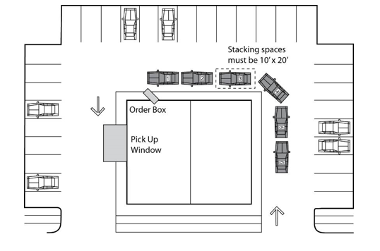
- Accessible parking spaces shall be provided in compliance with the following table and shall be identified with above-ground signs as specified in the U.S. Department of Transportation’s Manual on Uniform Traffic Control Devices and the specifications of the North Carolina Department of Transportation.
Table 1000-5: Accessible Parking Space RequirementTotal Parking Spaces Provided Minimum Number of Accessible Spaces Required Minimum Number Required By Type Regular (8’ + 5’) Van (8’ + 8’) Side Loaded Van 1 to 25 1 0 1 0 26 to 50 2 1 1 0 51 to 75 3 2 1 0 76 to 100 4 3 1 0 101 to 150 5 3 2 0 151 to 200 6 4 2 0 201 to 300 7 5 2 0 301 to 400 8 6 2 0 401 to 500 9 6 2 1 501 to 1,000 2% of total Required total less van spaces 1 in 4 total accessible spaces 1 for every 3 van spaces 1,001 and Over 20 plus 1 for each 100 over 1,000 Required total less van spaces 1 in 4 total accessible spaces 1 for every 3 van spaces Refer to 4.1.2 (5) of the Americans With Disabilities Act (ADA) and 4.1.2 (5) (d) for medical care facilities. - All accessible signs must conform to the Manual of Uniform Traffic Control Devises (MUTCD).
- All 12 inches x 18 inches accessible signs must be mounted at seven (7) feet from grade to the bottom edge of the sign face. The mounting height may be reduced to five (5) feet above grade if placed in an area between the sidewalk and the building face in which pedestrian are not expected to use.
- Accessible parking spaces serving a particular building shall be located on the shortest route of travel which shall be accessible from adjacent parking to an accessible entrance.
- In buildings with multiple accessible entrances with adjacent parking, the accessible parking spaces must be dispersed and located closest to the accessible entrances. In parking facilities that do not serve a particular building, accessible parking must be located on the shortest route of travel to an accessible pedestrian entrance of the parking facility.
- Parking access aisles must be part of an accessible route to the building or facility entrance. Two (2) accessible parking spaces may share a common access aisle.
- Persons using the accessible spaces must not be required to cross a travel way or maneuver behind a backing vehicle to reach the access aisle or accessible route to the building entrance.
- Accessible parking spaces may not be located adjacent to storm drains or stormwater retention facilities.
Figure 1000-2: Accessible Parking Spaces (13 feet by 18 feet) and Van Accessible Spaces (16 feet by 18 feet).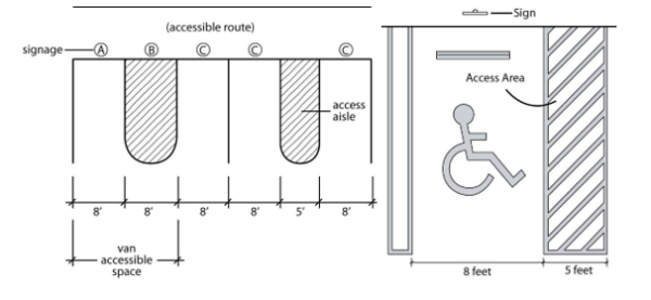
- Off-street loading and unloading area must be provided in accordance with this Section in order to accommodate the delivery or shipment operations of businesses and institutions in a safe and convenient manner.
- The Planning Director may reduce or eliminate the requirements for off-street loading facilities within the Downtown Master Plan Districts.
- The loading and unloading area must be of sufficient size to accommodate the numbers and types of vehicles that are likely to use this area. The following table indicates the number and size of spaces that, presumptively, satisfy the standard set forth in this subsection. In recognition that inflexible application of the requirements in this Section may result in inadequate or excessive loading requirements, the Planning Director may require more or less loading or unloading space based on a determination of what is necessary to ensure safe and convenient shipping and deliveries to the property.
Table 1000-6: Loading and Unloading Area Size RequirementSpecific Land Use Type Size: (Square feet of gross floor area) Required Number and Size of Loading and Unloading Spaces 10 feet x 25 feet 10 feet x 50 feet Office, Restaurant, Hotel or Motel 10,000—99,999 1 0 100,000—149,999 0 1 150,000 and over 0 2 Retail establishments, shopping centers, and industrial uses 0—4,999 1 0 5,000-19,999 0 1 20,000—49,999 0 2 50,000-79,999 0 3 80,000-99,999 0 4 100,000-149,999 0 5 150,000 and over 0 6 - Required loading and unloading areas shall be so located and designed that the vehicles intended to use them:
- Can maneuver safely and conveniently to and from a public right-of-way; and
- Complete the loading and unloading operations without obstructing or interfering with any public right-of-way or any parking lot driving aisle.
- Complete the loading and unloading operations without the use or obstruction of any off-street parking required by this Unified Development Ordinance.
- Loading areas within the lots of industrial subdivisions shall be self-contained and each business must be capable of handling its own truck maneuvering and docking requirements. The use of public streets for commercial vehicle staging and/or maneuvering is prohibited. Loading areas shall be located either to the rear or the side of the industrial structures(s) to alleviate unsightly appearances often created by loading facilities. Where such locations are not feasible, loading docks and doors must be landscaped consistent with the requirements of this ordinance and, in addition, must be screened from the public right-of-way by walls, opaque fencing, and opaque entry gates.
1070.020 Required Widths Of Parking Spaces And Driving Aisles
1070.030 Location Of Parking And Access Design
1070.040 Parking And Loading Area Improvement Standards
Parking and loading areas must be designed so that:
- Vehicles may exit such area without backing onto a public street. This requirement does not apply to driveways serving one or two dwelling units.
- Vehicles cannot overhang property lines, public rights-of-way, or public sidewalks, or tend to bump against or damage any wall, vegetation or other obstruction.
- Vehicles can move without posing a danger to pedestrians or other vehicles and without interfering with parking areas.
- Each parking space and driving aisle will have the dimensions provided in Section 1070.020 and all accessible parking spaces will meet the requirements of Chapter 1050.
- Angled parking spaces shall conform to the dimensions illustrated below. Alternative designs may be allowed by the Planning Director provided it is consistent with the recommended dimensions contained in the latest edition of the Traffic Engineering Handbook published by the Institute of Traffic Engineers.
- The design of large parking areas (more than 250 parking spaces) at retail stores and shopping centers will be subject to site plan review and approval by the Planning Director. The site plans for large retail parking lots will be approved by the Director if the site plan:
- Segments the off-street parking area, visually and functionally, into smaller parking “pods” that reduce the visual and environmental impacts of the parking. Pods will be created by separating the field of parking into areas of no more than 50 parking spaces separated from each other by physical breaks consisting of:
- Landscape strips between parallel rows that are a minimum of seven (7) feet in width; or
- Pedestrian walkways a minimum of five (5) feet in width that incorporate landscaping, lighting, and other pedestrian amenities; or
- Buildings including outbuildings designed and located in a manner that physically separates one field of parking from another.
- Where the Planning Director determines that a site plan and landscape plan effectively reduces the visual impacts of a large field of parking then the size of any parking pod may be increased provided the parking lot design meets the overall objective of this Section.
- Incorporates safe access for pedestrians and bicyclists through the development site through the use of paths designated by special paving materials, separated pedestrian walkways, directional lighting for pedestrians.
- Incorporates traffic calming techniques designed to enhance pedestrian safety.
- Segments the off-street parking area, visually and functionally, into smaller parking “pods” that reduce the visual and environmental impacts of the parking. Pods will be created by separating the field of parking into areas of no more than 50 parking spaces separated from each other by physical breaks consisting of:
- Roll Up/Overhead Doors
Roll up/overhead doors shall not be visible from a street or thoroughfare. Facilities must be oriented on a site to eliminate visibility from the street or thoroughfare or provide adequate screening (i.e. landscaping, walls, fences, and berms) to be approved by the Planning Director.
Parking spaces and aisle widths shall conform to the following table, which relates aisle widths to parking angles.
Table 1000-7: Geometric Design Standards Parking
| Parking Angle (degrees) | Stall Width (ft) | Stall to Curb (ft) | Aisle Width (ft) | Curb to Curb Width (ft) |
| 0 | 8’-0” | 22’-0” | Parallel Space | |
| 45 | 9’-0” | 18’-8” | 12’ (One-way) | 50’-0” |
| 60 | 9’-0” | 20’-1” | 14’-5” (One-way) | 54’-7” |
| 90 | 9’-0” | 18’-0” | 24’ | 60’ |
- Except as otherwise expressly authorized in this ordinance, required parking spaces must be located on the same lot as the use to be served by the parking.
- No parking lot serving a multi-family use may be located within any required front yard.
- Driveways shall be not less than 10 feet in width for one-way traffic and 18 feet in width for two-way traffic, except that 10-foot wide driveways are permissible for two-way traffic when:
- It provides access to not more than six (6) spaces;
- Sufficient turning space is provided so that vehicles need not back into a public street;
- The use is a low traffic volume use and the public right-of-way has a low traffic volume.
Figure 1000-3: Illustration of Parking Layout and Access Standards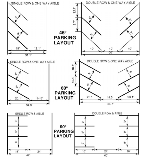
- All parking lots and vehicular use areas (i.e. parking, maneuvering, circulation, and loading areas) must be graded and surfaced with asphalt or concrete that will protect against potholes, erosion, and dust. The Planning Director may authorize an exception to this requirement for temporary parking associated with a special event or short-term, seasonal activity.
- The perimeter of parking areas with five (5) or more parking spaces shall be defined by curbs and gutter or similar improvements.
- Except in the case of temporary parking lots or parking lots with fewer than five (5) parking spaces, all parking spaces shall be clearly demarcated with painted lines or other markings.
- Where parking facilities are paved with concrete or asphalt such facilities must provide a drainage system along the periphery of the parking lot except where it is determined by the Planning Director that such system is not practical for storm drainage purposes. This provision is not intended to prevent the use of low-impact design (LID) techniques such as breached curb drainage inlets or curb cuts that allow runoff to flow into bioretention cells or biofiltration swales.
- All parking spaces on the interior of parking lots must be provided with wheel guards or curbs if they abut a sidewalk less than seven (7) feet in width or abut any landscape area less than (7) feet in width. Where wheel guards and curbs are required, such improvements must be located so that no part of a parked vehicle may encroach into a pedestrian walkway such that the width of the walkway is less than five (5) feet.
- Parking lots and vehicular use areas must be properly maintained. In particular, parking lot and vehicular use area surfaces shall be kept in good condition and parking space demarcations shall be kept clearly visible and distinct.
- In recognition that inflexible application of the parking standards in Section 1020.010 above, may result inadequate or excessive parking requirements, the Planning Director may permit deviations from the presumptive requirements of Section 1020.010, and may require more parking or allow less parking whenever they find that such deviations are more likely to satisfy the basic purposes of these parking requirements.
- Any allowed or required deviation from the presumptive parking requirements set forth in Chapter 1020 above shall be entered on the permit along with the reasons for allowing or requiring the deviation.
- If the applicant does not wish to accept the Planning Director’s decision and requirements, the applicant may appeal the determination of the Director to the Planning and Zoning Board in a quasi-judicial proceeding.
1090.020 Remote Parking
- Shared parking represents an arrangement where two or more non-residential uses with different peak parking demands (hours of operation) can use the same off-street parking spaces to meet their off-street parking requirements.
- The Planning Director is authorized to approve a shared parking arrangement for non-residential uses that operate at different hours or that operate at different days. The Planning Director may authorize shared parking after making a finding that there is no substantial conflict in the principal operating hours of the uses for which the shared parking is proposed.
- For the purposes of this section, the following uses are considered daytime uses: office uses, industrial uses; retail uses.
- For the purposes of this section, the following are considered nighttime or Sunday uses: school auditoriums; religious assembly facilities; theaters and similar entertainment uses; sit-down restaurants.
- Any use applying for shared parking must be located within 500 feet walking distance of the parking lot as measured from the entrance of the use to the nearest parking space in the shared use lot.
- An agreement providing for shared use of parking must be executed by the parties involved and be filed with the Planning Director and in a form approved by the Town Attorney. Shared parking facilities will continue in effect only as long as the agreement remains in force. If the agreement is no longer in force then the parking must be provided as otherwise required by this section.
- If some or all of the required number of off-street parking spaces cannot reasonably be provided on the same lot as the use they are serving then spaces may be provided on nearby lots in accordance with the provisions of this Section. These off-site spaces are referred to as satellite parking spaces.
- Satellite parking spaces (except spaces intended for employee use) must be located within 400 feet of the use to be served by such parking. Employee parking may be within 500 feet of the use to be served. These distances will be measured from the main entrance of the use to the nearest parking lot space following a reasonable and safe walking route.
- Such land used for off-site parking must be located in a zoning district within which the use served would be a permitted use or in a Conditional Zoning approval.
- There must be a pedestrian walkway or sidewalk connecting the parking area to the use it is intended to serve.
- There must be satisfactory written evidence of permission by the owner(s) of the area to be used for satellite parking spaces that it will be available to the users of the intended property. The developer must provide a contract or agreement acceptable to the Town’s legal counsel and the developer must also sign an acknowledgment that the continuing validity of the zoning permit depends upon the developers continuing ability to provide the requisite number of parking spaces.
- Satellite parking areas are required to satisfy the general design requirements of Chapter 1070.
Chapter 1120 Water, Sewer, Utilities And Easements
Chapter 1130 Fire Protection
Chapter 1140 Flood Damage Reduction And Stormwater Management
Chapter 1150 Sedimentation Pollution Control
Chapter 1160 Park, Recreation, And Open Space Dedication Or Fees In Lieu
Chapter 1170 Improvements Guarantees
1110.020 Purpose And Objectives
1110.030 Applicability
1110.040 Exemptions
1110.050 Development Names
1110.060 Applicable Policies
1110.070 Installation Of Permanent Reference Points
1110.080 Lots
1110.090 Street And Sidewalk Improvements
This Chapter is hereby adopted under the authority and provisions of the General Statutes of North Carolina (Chapter 160D, Article 8, Subdivision Regulation). The purpose of this Chapter is to establish procedures and standards for the development and subdivision of real property within the corporate limits of the Town of Indian Trail in an effort to ensure proper legal description, identification, monumentation, and recordation of real property boundaries.
This Chapter is intended to promote the orderly layout and appropriate use of the land and to:
- Provide safe, convenient, and economic circulation of vehicular traffic;
- Provide suitable building sites which are readily accessible to emergency vehicles;
- Assure the proper installation of streets and utilities;
- Promote the eventual elimination of unsafe or unsanitary conditions arising from undue concentration of population;
- Conserve and protect the physical and economic resources of the Town of Indian Trail.
- These regulations shall govern all subdivisions of land within the corporate limits of the Town of Indian Trail as now or hereafter established. Subdivision means all divisions of a tract or parcel of land into two or more lots, building sites, or other divisions for the purpose of sale or any type of development whether development is immediate or in the future. The definition of subdivision includes residential and non-residential developments with multiple building sites and multi-site projects even if there is no division of the underlying land into separate parcels and also includes all division of land involving the dedication of a new street or a change in existing streets. All subdivisions, as defined, must be recorded with the Union County Register of Deeds.
- After December 31, 2008, each individual subdivision of land within the Town of Indian Trail's corporate limits shall comply with the requirements specified in this ordinance before any plat can be recorded or lots sold.
- All plats for the subdivision of land must conform to the requirements of this section and must be submitted in accordance with the procedures and specifications established in Chapter 360, Subdivisions. Land or parcels described by metes and bounds in an instrument of transfer or other document used for selling or transferring land are not exempt from compliance with this chapter. No utility shall be extended nor any permit be issued by an administrative agent of the Town of Indian Trail or Union County for the construction of any building or other improvement upon any land for which a plat is required until the requirements of this chapter have been met and the final plat approved.
The following will not be subject to the regulations of this Chapter:
- The combination or recombination of portions of previously subdivided and recorded lots where the total number of lots is not increased and the resultant lots are equal to or exceed the standards of the Town of Indian Trail as shown in its subdivision regulations;
- The division of land into parcels greater than 10 acres where no street right-of-way dedication is involved;
- The public acquisition by purchase of strips of land for the widening or opening of streets; and
- The division of a tract in single ownership whose entire area is not greater than two (2) acres into not more than three (3) lots, where no street right-of-way dedication is involved and where the resultant lots are equal to or exceed the standards of the Town of Indian Trail as shown in this ordinance.
The subdivision name shall not duplicate or closely approximate the name of an existing subdivision within or within the general vicinity of Indian Trail. The following shall also apply:
- Proposed subdivisions or developments may have the same or similar name if they are an extension of an existing subdivision or development with the same or similar name.
- Development names must be reviewed by the Town and submitted to Union County Emergency Services for official approval. Additional fees may be assessed for any change in development names.
- Residential subdivisions shall have a monument sign with the development’s name at each vehicle access point. Refer to Section 9160.040 for the Table of Sign Requirements.
Subdivisions must be designed and laid out in accordance with:
- Zoning and Other Laws All subdivisions and lots created under this Ordinance must comply with all relevant sections of the Indian Trail Unified Development Ordinance and all other local, State and Federal laws.
- Town of Indian Trail Comprehensive Plan When a proposed subdivision embraces any part of a proposed thoroughfare, school, park, or recreation site, or other public facility that has been designated in the officially adopted plan of the Town, that planned facility will be platted and designated by the applicant in the location shown on the plan. All reservations or dedications of land consistent with the Comprehensive Plan must be recorded with the Union County Register of Deeds.
- Land Development Standards All site improvements shall be done in accordance with standards established by the Town of Indian Trail. All subdivisions will comply with the Town of Indian Trail Land Development Standards (ITLDS). Plans for all infrastructure improvements shall be approved prior to the commencement of any site work.
- Traffic Movement and Pedestrian Circulation
- Subdivisions should be designed to create an integrated system of lots, streets, trails, and infrastructure that provides for efficient movement of people, bicycles and automobiles within the subdivision and to and from adjacent development.
- Subdivisions should provide for the efficient movement of through traffic by providing a completely interconnected hierarchy of streets and roads in order to avoid isolation of residential areas and over-reliance on federal, state and county roads.
- All subdivisions should be designed to provide safe and attractive pedestrian routes to nearby commercial centers, as well as nearby public/civic, employment and recreation uses. Pedestrian improvements to publicly accessible buildings will comply with the requirements of the Americans with Disabilities Act (ADA).
- Street layouts should be uncomplicated, so that emergency services, public services, and visitors can find their way to their intended destinations.
- Appearance
- Lot and street designs should be designed to avoid extended distances of back yard frontage on major roads. When that cannot be avoided, back yards abutting major streets should be buffered with uniform landscaping, fences and/or walls consistent with the perimeter landscaping requirements of Section 810.180.
- Subdivision perimeter areas should include adequate landscaping and buffering to protect future residents of the subdivision and adjacent developments from adverse impacts caused by significant differences in use, development intensity, or building height consistent with the perimeter landscaping requirements of Section 810.180.
- Open Space
- Open spaces should be integrated into and throughout subdivisions, should be connected with one another and with open spaces in adjacent developments, and should include trails that connect to pedestrian routes in the subdivision and to regional trail systems.
- Open spaces anticipated for use as active or developed parks should be accessible with at least minimum of 50 feet of frontage on a street and all active parks should be located on relatively flat, well-drained terrain.
- Open spaces not anticipated for use as active or developed parks should be located on prominent high points with significant views, or along significant and interesting geological features or wooded areas or along significant drainages.
- Open spaces that are anticipated to serve as trail corridors should be continuous with anticipated trail corridors on adjacent properties.
- Open spaces that are intended for use as a trail or public park shall be consistent will all adopted Town Plans.
- Natural Hazards Lands subject to flooding, excessive erosion, and subsidence because of soil types or groups, water courses and other drainageways, steep slopes, or other natural hazards may not be platted for residential or other uses in such a way as to present a danger to life or property, or to the public health, safety, or general welfare.
- Natural and Cultural Resources
- Subdivisions should be designed in a manner that creates the least damage to the natural environment, avoids to the maximum extent feasible, significant natural resources such as woodlands, wetlands, water bodies, steep slopes, and rock outcroppings. Subdivisions should be designed to preserve trees and native vegetation, ponds, streams, rivers, lakes, hillsides and other natural resources that exist on a site.
- Subdivisions should be designed to preserve cultural and historic resources.
- Property Owners Associations
- Property owner associations are required for all subdivisions that include land or improvements owned in common.
- If a property owners association is assigned responsibility for the maintenance and control of streets, open space, recreational facilities, or other common areas and facilities within a subdivision, that association must have legal authority to maintain and exercise control over the common areas and facilities, including the power to compel contributions from residents or property owners to cover their proportionate share of the costs associated with the maintenance of the common areas and facilities.
Monuments must be installed in accordance with Standards of Practice for Land Surveying in North Carolina, as adopted by the North Carolina State Board of Registration for Professional Engineers and Land Surveyors and such monuments must be placed in all subdivisions.
The size, shape, and orientation of lots must be appropriate for the location of the proposed subdivision and for the type of development contemplated. All lots must comply with the standards of this section, except as expressly provided in this ordinance.
- Compliance with Other Regulations Every lot must have sufficient area, dimensions, and street access to permit the construction of a principal building in compliance with all applicable requirements of this ordinance.
- Minimum Building Area Every lot must have a contiguous buildable area of a shape sufficient to hold a principal building that is at least 40% of the lot’s total area or 3,000 square feet, whichever is less. This contiguous buildable area must lie at an elevation at least two (2) feet above the 100-year flood elevation.
- Lot Depth-to-Width Ratio Lots may not have a depth greater than four (4) times their width (at the required front setback).
- Side Lot Line Configuration Side lines of lots should be at or near right angles or radial to street lines.
- Lot Lines and Drainage Lot boundaries must coincide with existing (natural and constructed) drainageways to the extent practicable. This provision is intended to avoid the creation of lots that can be built upon only by altering drainageways.
- Lots on Thoroughfares Major subdivisions may not be approved that permit individual residential lots to access major thoroughfares or boulevards.
- Access Requirements All lots must have public street access and frontage meeting the requirements of the subject zoning district, except as expressly stated in this section. Lots and dwelling units located in cluster developments and planned developments with property owners’ associations may have in which permanent access and frontage on approved private streets, private driveways and/or private drives. The development as a whole must have public street access and frontage in accordance with the standards of the subject zoning district.
- Flag Lots
- Flag lots are prohibited, provided that the Technical Review Committee may recommend the creation of flag lots when they determine that a flag lot is necessary to allow reasonable use and benefit of the subject parcel or to alleviate situations that would otherwise cause undue hardship. Flag lots may be allowed only in the following instances:
- When necessary to eliminate access onto thoroughfares;
- When necessary to make reasonable use of irregularly shaped parcels;
- When necessary to make reasonable use of parcels with severe topography or other physical constraints;
- When necessary to provide greater protection of natural resources areas (e.g., streams);
- When necessary to provide suitable land area and soil for location and operation of utilities.
- Flag lots are prohibited, provided that the Technical Review Committee may recommend the creation of flag lots when they determine that a flag lot is necessary to allow reasonable use and benefit of the subject parcel or to alleviate situations that would otherwise cause undue hardship. Flag lots may be allowed only in the following instances:
- Basic Requirements All internal streets within a subdivision and any street upon which any lot within a proposed subdivision abuts or has its required frontage (other than a street maintained by the Town or State) shall be graded and paved by the developer in accordance with NCDOT, Division of Highways’ standards, or the Town of Indian Trail Land Development Standard (ITLDS), for paved streets. Curb, gutter, and sidewalk are required on all existing and new road segments abutting the subdivision except as provided in Section 1110.090Q.3. All associated storm drainage is to be contained within the street right-of-way or easement and shall be in accordance with NCDOT standards or the Town of Indian Trail Storm Water Manual, whichever is most restrictive. Sidewalks shall be required on both sides of all streets and shall be in accordance with ITLDS, the Indian Trail Pedestrian Plan, and NCDOT standards.
- Coordination and Continuation of Streets
The proposed street system shall be designed to provide a network of interconnected streets so as to facilitate the most advantageous development of the entire neighboring area. Access to adjacent properties may be gained by extending proposed streets to the property line, dedication to the boundary of such property and a temporary turnaround must be provided until streets on adjacent properties are built. The proposed street system must extend existing streets on their proper projections. Cul-de-sacs may not be used to avoid connection with an existing street or to avoid future extension. Cul-de-sacs and other permanently dead-end streets are permitted where one or more of the following conditions offer no practical alternative for connectivity:
- Significant topographical changes.
- Limiting environmental conditions.
- Restrictions or limitations on property accessibility.
- Conflicts due to land use relationships.
- Access to Subdivision Lots Every major subdivision with more than 50 lots and/or building units must have at least two (2) entrances, 200 lots or more shall have at least three (3), to the subdivision that afford reasonable means of ingress and egress for emergency vehicles as well as for all residents/visitors who need or desire access to the subdivision. These two entrances shall be on different roads wherever feasible. Regardless of the number of lots, entrances shall not be gated or otherwise restricted to public access.
- Private Streets
- Private streets may be platted subject to conditional zoning approval and only associated with the following development types in the following below:
- Business and/or industrial parks
- Private streets allowed pursuant to Section 1190.090 (D1) above may be platted in a subdivision with guarantees and/or surety as required by this section and only after the issuance of a Zoning Permit for the subdivision. A construction bond in the amount of the cost of construction plus 25% must be posted, and can be reduced to 10% once construction is complete and the road has passed the inspections from the Town. The reduced surety will be held in the form of a maintenance surety for a period of three (3) years to allow the infrastructure to go through several freeze-thaw cycles. In order to release the surety, the Town will conduct another inspection and request any repairs needed. The surety will be released once all repairs are made.
- Private streets may be platted subject to conditional zoning approval and only associated with the following development types in the following below:
- Marginal Access Streets Where a tract of land to be subdivided adjoins a major thoroughfare, the applicant may be required to provide a marginal access street parallel to the major thoroughfare or reverse frontage on a local street for the lots to be developed adjacent to the major thoroughfare. Where reverse frontage is established, private driveways may not be designed to have direct access to the major or minor thoroughfare.
- Street Names Proposed streets that are in alignment (as determined by the Planning Director) with existing streets shall be given the same name. In assigning new names, duplication of existing names must be avoided and in no case can the proposed name be phonetically similar to existing names irrespective of the use of a suffix such as street, road, drive, place, court, etc. Street names shall be subject to the approval of the Town and Union County Emergency Services.
- Right-of-Way Widths and Dedication Minimum street right-of-way widths are based on roadway classification and the design and improvement of all streets must comply with the Town of Indian Trail Comprehensive Plan and ITLDS. Roadway dedication may be required to comply with said documents and shall be measured for dedication purposes based on distance from the official centerline of the existing right-of-way. Said dedication shall be clearly noted on preliminary and final plats.
- Pavement Design Pavement widths and thicknesses shall be in accordance with the standards of the North Carolina Department of Transportation and the Town ITLDS, whichever is more restrictive, for the type of street. Alternatively, a licensed geotechnical engineer may submit a recommended design to the Planning Director for consideration in the review of a particular project.
- Grades
- Street grades shall be not more than 8% or less than 0.5%.
- Grades approaching intersections shall not exceed 5% for a distance of not less than 100 feet from the centerline of the intersection.
- The mainline street cross-slope shall be carried out a distance of at least 10 feet into the side street. Low points with catch basins shall be at least 10 feet from the end of the radius. A vertical curve may be necessary to transition to side street grade.
- Horizontal Alignment The roadway alignment shall preserve the natural features such as woodlands, creeks, and floodplains to the maximum extent practicable. All horizontal curves shall have such length as necessary to provide safe sight distance as outlined in the AASHTO Policy on Geometric Design of Highways and Streets, current edition.
- Vertical Curves All vertical curves shall have such length as necessary to provide safe sight distance as outlined in the AASHTO Policy on Geometric Design of Highways and Streets, current edition.
- Intersections
- Streets must be laid out so as to intersect as nearly as possible at right angles, and under extreme circumstances at a minimum of 75 degrees. No proposed street may intersect any other street at an angle less than 75 degrees.
- Property lines at street intersections shall be round with a minimum radius of 20 feet. Where a street intersects a highway, the design standards of the North Carolina Department of Transportation, Division of Highways will apply.
- Offset intersections are to be avoided unless an exception is granted. Intersections that cannot be aligned should be separated by a minimum length of 200 feet between street center lines.
- Intersections with collectors must be 500 feet from another intersection on the same side.
- Intersections with major or minor thoroughfares should be at least 1,000 feet apart measured from centerline to centerline.
- Intersections that are to be signalized shall be no closer than 2,500 feet or the location must comply with the standards of the North Carolina Department of Transportation, Division of Highways, whichever is more restrictive.
- Dead-End Streets
- Streets shall be designed to provide interconnectivity. Permanent dead-end streets must end in a cul-de-sac turnaround, and are allowed if the following conditions occur in a manner that prohibits connecting to an adjacent street:
- Significant topography limitations.
- Limiting environmental conditions.
- Odd parcel sizes or shapes.
- Limited accessibility to the property.
- Conflicting land use relationships.
- Street designs such as loop streets or closes are preferred to the use of traditional cul-de-sac designs. These alternatives help support the turning movements of emergency and service vehicles.
Figure 1100-1: Alternative to Cul-de-sac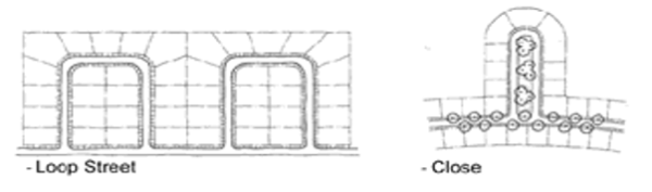
- Streets shall be designed to provide interconnectivity. Permanent dead-end streets must end in a cul-de-sac turnaround, and are allowed if the following conditions occur in a manner that prohibits connecting to an adjacent street:
- Temporary Turnarounds
- The Technical Review Committee may recommend a temporary turnaround (either a standard bulb cul-de-sac or T-turnaround) to be provided at the end of any stub street over 150 feet length or serving more than four (4) lots. Temporary turnarounds must comply with the following:
- The turnaround must be constructed in a temporary easement, located either on-site or off-site;
- The developer of the adjacent property making a road connection to the existing stub road is responsible for the removal of the turnaround and for the restoration of the area at the time that the road connection is made; and
- The turnaround must comply with all applicable cul-de-sac standards, including the Town ITLDS.
- Any plat containing a stub street must include the following note: “The street system shown on this plat includes one or more stub streets that are intended to be connected to the adjacent property at such time that the property is developed. The interconnection of neighborhoods with a street network ensures the efficient flow and dispersal of traffic and provides for additional points of ingress and egress for emergency vehicles.”
- In addition, a sign must be posted on the stub street right-of-way indicating that it is intended as a “Future Street Extension.”
- The Technical Review Committee may recommend a temporary turnaround (either a standard bulb cul-de-sac or T-turnaround) to be provided at the end of any stub street over 150 feet length or serving more than four (4) lots. Temporary turnarounds must comply with the following:
- Alleys
Alleys shall be allowed where approved as part of a subdivision or planned development. The following requirements shall apply to any single-family attached or detached development as indicated:
- Single-family attached or detached residential units with rear-loaded vehicular alley access may face onto a designated maintained open space with a minimum width of fifteen (15) feet in addition to the front setback.
- Primary pedestrian access into the building shall be from a public street frontage line, sidewalk, or parking area.
- If one home fronts onto a common open space and an adjacent home of the same type (attached or detached) is on the opposite side, the adjacent home shall also front onto the open space and have rear-loaded vehicular alley access.
- Lots front-loaded with vehicle access shall not face across a street onto the rear of lots, unless an intervening landscape buffer of 25 feet, per Chapter 810 Buffer Yards, Parking Lots and Street Frontages, is planted along the street block.
- Alleys shall be required for single-family attached townhouse developments with lots having 30-foot wide or less frontage width.
- Dwelling parking spaces in the alleys shall have a minimum of 3 feet between neighboring concrete dwelling parking spaces – a minimum of 1.5 feet divided between each townhome unit owner.
- Attached single-family uses abutting detached single-family uses shall provide a 25-foot landscaped buffer, per Chapter 810 Buffer Yards, Parking Lots and Street Frontages, along the length of the shared frontage, unless the attached units orient their front facades toward the detached homes with rear-loaded vehicle access from an alley.
- The standards of construction of alleys will be per the ITLDS and NCDOT requirements.
- Single-family attached or detached residential units with rear-loaded vehicular alley access may face onto a designated maintained open space with a minimum width of fifteen (15) feet in addition to the front setback.
- Street Design to Prevent Congestion and Promote Traffic Calming
- The street design shall have multiple connections, (existing and future), to disperse traffic impacts and reduce speeding.
- Modifications of street geometry, intersection design, and other traffic calming measures are acceptable when necessary to discourage high volume, high speed through traffic.
- Where feasible, all new development shall provide more than one access for ingress and egress at the time of development.
- Limitations or restrictions on cut-through traffic will not apply when a street is designated as a thoroughfare on the Town’s Comprehensive Plan or is designated as the collector street on the adopted major collector street map.
- Curb, Gutter and Sidewalk
- Street rights-of-way are designed and developed to carry motor vehicle traffic and allow some on-street parking; to provide a safe and convenient passageway for pedestrian and bicycle traffic; and to serve as an important link in the Town’s drainage systems.
- All streets within a new subdivision (residential or commercial) shall be constructed with curb and gutter in accordance with the ITLDS and NC DOT.
- Concrete sidewalks shall be installed along both sides of the street within a new residential or commercial subdivision. Refer to the Indian Trail Pedestrian Plan for recommended pedestrian connections. A sidewalk may be allowed on only one (1) side of the street if:
- The street services fewer than five (5) dwellings units, or
- The street serves single-family detached residences where the lots (at least 90%) are four (4) acres or more in size, or
- The Town Council determines that, given the likely use of the sidewalk, its cost is utterly disproportionate to its value to the public as may be the case in low density developments or in environmentally sensitive areas such as the Goose Creek Village area.
- The sidewalks required by this section shall be constructed according to the specifications set forth in the ITLDS and Comprehensive Plan. The Town Council may consider the installation of walkways constructed with other suitable materials when it concludes that such walkways would serve the residents of the development as adequately as concrete sidewalks; and where such walkways would be more environmentally desirable or more in keeping with the overall design of the development.
- The Planning Director, Planning and Zoning Board, or Town Council may require pedestrian crosswalk improvements when blocks exceed 600 feet in width or whenever deemed necessary to provide safe and adequate pedestrian circulation or access to schools, playgrounds, shopping areas, or community facilities.
- Any development located along public or private streets must provide curb, gutter and sidewalks along its street frontage in accordance with the Town of Indian Trail Comprehensive Plan, ITLDS, and this section.
- Development along the Highway 74 Corridor must provide sidewalk ten (10) feet in width and curb and gutter as required by the Indian Trail Comprehensive Plan and all other applicable ordinance.
- Responsibility for maintenance of sidewalk must be documented and recorded prior to final plat approval, as per Section 1170.050A. In most cases responsibility would be that of the homeowners association (HOA) or developer.
- Street Name Signs Street name signs must be installed by the developer at each street intersection as appropriate to identify all street names and located as shown in the ITLDS. Street name signs, poles and brackets shall be of a type approved by NCDOT for installations on state maintained streets. All street name signs, poles, and brackets must be installed prior to the issuance of a certificate of occupancy permit for any home adjacent to the street.
- Traffic Control Devices Traffic control devices such as stop, yield and speed limit signs (but not including electric or electronic traffic signals) shall be installed on public streets by the developer at the appropriate locations as determined by NCDOT and the Manual of Uniform Traffic Control Devices (MUTCD). Installation standards and materials shall be in conformance with NCDOT standards for such devices.
- Storm Drainage Not Contained in Street Rights-of-Way All storm drainage facilities that are not situated in a street right-of-way shall be constructed for and maintained by the homeowners association (HOA) or developer in a manner consistent with the Town of Indian Trail stormwater management manual.
- Street Lights
- Street lights shall be provided in all new subdivisions. Lighting fixtures shall be of a common theme, decorative cutoff type, and shall comply with the lighting standards for public and private roadways as established in Lighting Standards (see Chapter 1330) of this Unified Development Ordinance. Fixtures shall be mounted on a free-standing non-wood pole, approved by the Town. The poles and fixtures shall be painted black unless otherwise approved by the Planning and Zoning Board.
- Lighting layout for the entire subdivision must be submitted to the Town for approval, even if the subdivision is being built in phases. The lighting layout shall be consistent with the Lighting Standards Section of this UDO and the standards provided in the “Roadway Lighting Handbook,” U.S. Department of Transportation, Federal Highway Administration 1978, as revised.
- A layout plan shall be submitted to the Town for approval and must include a foot-candle grid with the average, minimum/maximum, and uniformity calculations and all planned light improvement must comply with the Lighting Standards of this Unified Development Ordinance.
Amended by Ord. O210209-347 on 2/8/2021
Amended by Ord. 397 on 3/26/2024
Amended by Ord. 410 on 12/10/2024
1120.020
1120.030
1120.040
1120.050
Any subdivision which has either public water or public sewer system or both legally available or to be made available within 300 feet of its boundary shall have such available systems extended by the developer to provide service to each lot in the subdivision. Water and sewer installations shall be in accordance with the standards of the Union County Public Works Department.
Where water and/or sewer is not made available to each lot a certificate shall appear on the final plat from the Union County Health Department indicating the appropriateness of the lots to support whatever alternate systems are to be permitted.
Electrical, television, and telephone utility lines installed within subdivisions must be underground unless the Technical Review Committee determines that underground installation is unreasonable of infeasible. The Town must not require a developer or builder to bury existing above ground power lines located outside the boundaries of the parcel of land considered for subdivision pursuant to G.S. 160D-804; S.L. 2019-174.
Utility easements with a width acceptable to public and private utility providers must be provided to accommodate electric, telephone, gas, and community antenna television services; conduits; and sewer or water lines. The location of such easements must be reviewed and approved by the Town, with advice from utility providers, before final plat approval.
Utility easements must be kept free and clear of any buildings or other improvements that would interfere with the proper maintenance or replacement of utilities. The city is not liable for damages to any improvement located within the utility easement area.
1130.020
1130.030
1130.040
1130.050
Fire hydrants shall be installed according to the fire code adopted by the Union County Fire Service and fire hydrant improvements and locations shall be installed consistent with the following:
Every development (subdivided or unsubdivided) that is served by a public water system shall include a system of fire hydrants sufficient to provide adequate fire protection for the buildings located or intended to be located within such development.
Fire hydrants must be located in accordance with the rules and regulations identified in North Carolina Fire Prevention Code. Appeals of these codes shall be filed with the North Carolina Building Code Council and the North Carolina Department of Insurance.
The Planning Staff and Union County Fire Service shall review all fire hydrant locations and fire hydrant specifications. A letter shall be provided from the Union County Fire Marshal’s Office to the Town stating the proposed development is in compliance with said Code. Final approval of locations and specifications shall be by the permit issuing authority.
Water lines that serve hydrants shall be at least six (6) inch lines, and, unless no other practicable alternative is available, no such lines shall be dead-end lines.
The permit issuing authority may modify any previously issued permit to bring that project into compliance based on the Fire Marshal’s certification that said project is in compliance with the North Carolina Fire Prevention Code.
All subdivision shall comply with Chapter 1360 and Chapter 1370 of the Unified Development Ordinance.
In order to prevent soil erosion and sedimentation pollution of waterways, the applicant shall comply with all requirements of the North Carolina Pollution Control Act. A plan shall be submitted and approved by North Carolina Department of Environmental and Natural Resources and a copy of the plan and DENR permit shall be provided to the Town prior to Zoning Certificate permit issuance.
1160.020 Payments Of Fees In Lieu Of Land Dedication
1160.030 Procedures
1160.040 Authority To Sell
1160.050 Provisions Of Equivalent Facilities Under Neighborhood Or Community Home Owners Association
1160.060 Greenways
- Every applicant who proposes a subdivision of land for residential purposes shall dedicate a portion of land or pay a fee in lieu thereof, in accordance with this Chapter, for public park, greenway, recreation, and open space sites to serve the recreational needs of the residents of the subdivision or development. In the case of active recreation facilities (ball parks, soccer fields, bike paths) and passive facilities such as greenways and trails, the Planning Director will require that an easement be recorded assuring public access to these facilities in perpetuity.
- At least 1/35 of an acre shall be dedicated for each dwelling unit planned or proposed in the subdivision plat or development. To the extent feasible, areas with environmentally limitations (e.g. designated flood plain areas, wetlands, and areas with a slope in excess of 15%) should be dedicated as open space and the Town may require these areas to be dedicated in excess of the minimum standard provided in this Section provided that reasonable economic use of the property is permitted. Designated wetland areas must be identified and reserved on the plat of subdivision and such areas must be posted with warning signs designed to prevent any future alteration or damage to these natural areas.
- Except as otherwise required by the Town Council or Planning Director at the time of preliminary plat approval, all dedications of land shall meet the following criteria:
- Unity The dedicated land shall form a single parcel of land, except where the permit authorizing authority determines that two (2) or more parcels would be in the best interest of the public, for example, two (2) or more parcels may be acceptable where a subdivision covers a large area or where a site includes two (2) or more environmentally sensitive areas. In such cases, the Town may require that such parcels be connected by a dedicated strip of land at least 30 feet in width for the purpose of connecting the parcels via trails, bikeways, and greenways.
- Usability Two-thirds of the dedicated land shall be useable for active recreation. Furthermore, only 50% of lakes and streams may be included in computing any of the dedicated land area excluding stormwater detention facilities. Land dedicated only for greenways need not follow the requirements of this subsection for improved recreation space. In the case of a Planned Development, dedicated open space may be used for other public projects such as schools, libraries, and civic centers that serve the needs of the community.
- Shape The shape of the portion of the dedicated land which is deemed suitable for active recreation shall be sufficiently square or round to be usable for any or all recreational facilities and activities such as athletic fields and tennis courts, when a sufficient amount of land is required to be dedicated. Land dedicated only for greenways need not follow the requirements of this subsection.
- Location The dedicated land shall be centrally located so as to reasonably serve the recreation and open space needs of residents of the subdivision.
- Access Public access to the dedicated land will be provided either by adjoining public street frontage or by a dedicated public easement, at least 30 feet wide, which connects the dedicated land to a public street or right-of-way. Side-slope grades adjacent to existing and proposed streets will allow for reasonable access to the dedicated land. Where the dedicated land is located adjacent to a street, the developer or applicant will remain responsible for the installation of utilities, sidewalks, and other improvements required along that street segment. Public access or dedicated walkways to greenway dedications must be at least 20 feet wide. After the property is dedicated and improved consistent with the requirements of this Section, the Town of Indian Trail or a homeowners association (HOA) will assume responsibility for maintaining any sidewalks and other improvements adjacent to the street used for access to the open space.
- Topography The average slope of the portion of dedicated land deemed usable for active recreation will not exceed the average slope of the entire subdivision to be developed. In no case shall a slope on the usable portion of dedicated land exceed 15%.
- Landscaping Dedicated parks, recreation, and open space areas will have a sufficient natural or manmade buffer or screen to minimize any negative impacts on adjacent residents.
- The payment of fees, in lieu of the dedication of land under Section 1160.010 above, may occur at the request of the applicant or developer. However, the decision to require the dedication of land for recreational purposes, or a payment of a fee in lieu, will be made by the Town Council (for Conditional Zoning Districts) after having received a recommendation from the Planning and Zoning Board and the Town’s Parks, Arts, Recreating and Culture Advisory Committee and having evaluated the proposed dedication and the relationship such dedication would have with the Town’s overall recreational needs.
- The Planning and Zoning Board may recommend approval, denial or approval with conditions of a preliminary plat based on the required open space dedication of this Section. Preference will be given to projects that provide open space on-site in the form of a land dedication. The final decision to either accept land for recreational purposes or to accept a fee in lieu of land will be the jurisdiction of the Town Council.
- The fees in lieu of dedication shall be paid prior to final plat approval.
- The amount of the payment shall be the product of:
- The number of acres to be dedicated, as required by Section 1160.010B above;
- The assessed value for property tax purposes of the land being subdivided, adjusted to reflect its current fair market value at the time such payment is due to be paid.
- Procedures for determining the amount is as follows:
- An appraisal of the land in the development shall be performed by a professional land appraiser selected by the developer from an approved list maintained by the Town. The appraisal shall not be done prior to submission of the preliminary plat but must be completed prior to the final plat approval. The cost of the appraisal shall be borne by the developer.
- Professional land appraiser refers to a land appraiser who, in the opinion of the Town, has the expertise and/or certification to perform an adequate appraisal.
- Procedures for determining the amount is as follows:
- At the time of filing a preliminary plat, the applicant shall designate thereon the area or areas to be dedicated pursuant to Section 1160.010A. If the applicant desires to make a payment in lieu of the dedication of land, a letter to that effect shall be submitted with the preliminary plat. All payments in lieu of dedication will be deposited in the Town’s “Parkland Capital Improvements Account” to be used for park, greenway, trail, or other open space or recreational improvements in the vicinity of the development paying the fees. The Town Council reserves the right to refuse to accept dedication of parcels for a public park, recreation area, or open space but the Town Council must specify the basis for such refusal. In the case of a refusal, the applicant will have the opportunity to modify the proposed dedication or fee-in-lieu or seek review of the decision in a court of competent jurisdiction.
- Where a dedication of land is required, such dedication shall be shown on the final plat when submitted, and such plat shall be accompanied by an executed general warranty deed conveying the dedicated land to the Town. Where a payment in lieu of dedication is approved by the Town, such payment will be made before the final plat is signed and recorded.
The Town Council shall have the authority to sell land dedicated pursuant to Section 1160.010. The proceeds of such sale shall be used for the acquisition and/or development of other recreation, park or open space sites, greenways, or for sidewalk development serving the subdivision or more than one subdivision in the immediate area.
The Town encourages neighborhood or homeowner associations or management to construct, operate, and maintain private parks and recreation. The construction, operation, or maintenance of such private facilities shall not, however, diminish or eliminate the responsibility and obligations of the applicant under Section 1170.050A, et seq.
Greenways may be credited toward the requirements of Section 1160.010 provided that such greenways are part of the Town’s Comprehensive Pedestrian Plan and dedicated to public use. An easement will be recorded for any greenway and such easement will provide for public access for pedestrians, bicyclists, and others expected to make use of this open space.
1170.020 Performance Guarantees (Surety Bonds)
1170.030 Cash Or Equivalent Security
1170.040 Default
1170.050 Reduction And Release Of Guarantee Security
1170.060 Legal Provisions
- In lieu of requiring the completion, installation and dedication of all improvements within the subdivision prior to plat approval, the Town of Indian Trail may enter into an agreement with the applicant whereby the applicant shall agree to complete all required improvements in the subdivision. Alternatively, such agreement can call for the completion of improvements for only a portion (i.e. phase) of the subdivision.
- Once said agreement is signed by both parties and the security required herein is provided, the final plat, or portion thereof, may be approved, if all other requirements of this Ordinance are met. To secure this agreement, the applicant shall provide to the Town Council, either one, or a combination of the forms of guarantees described in Sections 1170.010C and 1170.030.
- The following items shall be required to be included within the performance bond or surety calculation for both developed and undeveloped lots: curb, gutter, sidewalk, pavements, seeding, and stabilization, landscaping within the right-of-way, stormwater features for residential subdivisions, and community storm water features for commercial subdivisions, in accordance with other sections of this ordinance and the Post Construction Ordinance. Additionally, other required improvements within the subdivision will be required to be guaranteed in accordance with the Town ordinances. The applicant must provide an itemized cost estimate for the cost of the construction to the Town. The Town of Indian Trail’s engineering staff and any consultants must validate the estimated costs. The owner shall provide information sufficient for the Town of Indian Trail’s engineering staff and consultants to make a determination as to the appropriateness of the security amount. If less than 50% of the work is complete, a surety of 125% of the remaining construction improvements will be held by the Town in the form of a performance surety. If more than 50% of the work is complete, the Town will hold two (2) sureties: (1) A performance surety of 125% of the cost of the improvements which have not been completed at the time. (2) A maintenance surety for 1/3 of the cost of all of the improvements for the final plat. Sidewalk and right-of-way seeding may be placed in a separate surety in the amount of 125% of the construction cost estimate. This surety cannot be held for longer than two (2) years. If the surety/bond described herein is not provided, the Town of Indian Trail may not issue Zoning Permits to any affected properties within the subdivision.
- The applicant shall obtain one or more performance guarantee(s) for the proposed improvements, including any associated stormwater infrastructure, for the project. The amount shall not exceed one hundred twenty-five percent (125%) of the reasonably estimated cost of completion at the time the performance guarantee is issued, and/or at the time of any extension of the performance guarantee is granted. A performance guarantee shall be in any of the following forms:
- Surety bond issued by any company authorized to do business in the state of North Carolina.
- Letter of credit issued by any financial institution licensed to do business in the state of North Carolina; or
- Cash surety in the form of a certified check in the exact approved amount.
- Performance guarantees shall only be used for the completion of any improvements and not for repairs or maintenance after completion.
- The duration of any performance guarantee(s) shall be until such time as the improvements are accepted by the Town. Any performance guarantee shall be returned or released, as appropriate, in accordance with section 1170.050, "Reduction and Release of Guarantee Security of this ordinance, and G.S. 160D-804, (g).
- If improvements are not complete and the current performance bond is expiring, the performance guarantee shall be extended, or a new performance guarantee issued, for an additional period until such required improvements are complete. A developer shall demonstrate reasonable, good faith progress toward completion of the required improvements that are the subject of the performance guarantee or any extension. The form of any extension shall remain at the election of the developer.
- If improvements are not complete and the current performance bond is expiring, the performance guarantee shall be extended, or a new performance guarantee issued, for an additional period until such required improvements are complete. A developer shall demonstrate reasonable, good faith progress toward completion of the required improvements that are the subject of the performance guarantee or any extension. The form of any extension shall remain at the election of the developer.
The applicant shall deposit cash, an irrevocable letter of credit, or other instrument readily convertible into cash at face value, either with the Town or in escrow with a financial institution designated as an official depository of the Town of Indian Trail. Checks provided for security will only be accepted in the form of a certified check. If cash or other instrument is deposited in escrow with a financial institution as herein provided, the applicant shall then file with the Town an agreement between and the financial institution and himself guaranteeing the following:
- That said escrow account shall be held in trust until released by the Town and may not be used or pledged by the applicant in any other matter during the term of the escrow; and
- That in case of a failure on the part of the applicant to complete said improvements, the financial institution shall, upon notification by the Town submission of the Engineer's estimate of the amount needed to complete the improvements by the Town to the financial institution immediately either pay to the Town the funds estimated to complete the improvements, up to the full balance of the escrow account, or deliver to the Town any other instruments fully endorsed to pay for the full amount of the improvements.
Upon default, meaning failure on the part of the applicant to complete the required improvements in a timely manner as spelled out in the performance bond or escrow agreement, then the surety, or the financial institution, holding the escrow account, shall, if requested by the Town, pay all or any portion of the bond or escrow fund to the Town of Indian Trail up to the amount needed to complete the improvements based on the Engineer's estimate. Upon payment, the Townin its discretion, may expend such portion of said funds as it deems necessary to complete all or any portion of the required improvements. The Town shall return to the bonding firm any funds not spent in completing the improvements. Should the amount of funds needed to complete the installation of all required improvements exceed the amount in the bond or escrow account, the applicant shall nonetheless be responsible for providing the funds to cover such costs. The applicant shall at all times bear the financial burden for the installation of all required improvements.
The Permit issuing authority is authorized to release or reduce any security posted as the improvements are completed and approved consistent with this Section. The release of any security will be consistent with the following procedures:
- A surety reduction on an existing or future Town-maintained roadway can be granted as long as the applicant can show proof that over 75% of the required improvements have been completed in a satisfactory manner. If the improvements are along a NCDOT-maintained roadway, then the applicant would have to follow NCDOT Division 10's bond process.
- If there are other required improvement bonds (landscaping, trails, etc.) that the applicant would like to be reduced by the Town, he or she can submit a request and approval will be determined by the Engineering Director.
- The surety release process on an existing Town-maintained roadway will begin once the applicant submits for a Town inspection. Once the inspection is completed and a report is issued, the applicant will receive a list of repairs that need to be corrected. After repairs are completed to the Town's satisfaction then a release will be issued. For future Town-maintained streets, the applicant must follow the process as outlined in the adopted Street Acceptance Policy for the Town of Indian Trail. For NCDOT-maintained roadways, the applicant must follow NCDOT Division 10's bond process.
- For Private Roads, please see the following. For a one-time reduction, the applicant shall show proof that over 75% of the required improvements have been completed in a satisfactory manner.
- For the release of a surety for a private road: (1) The Town will hold an inspection and provide a repair list as needed; and (2) Once roads pass inspection, the sureties will be released.
- Other Improvements: In order for the Town to release the bond for improvements other than streets, the applicant must verify the construction is complete. In the case of a stormwater feature, the applicant must submit as-built calculations and an as-built survey. This must be completed in accordance with all other applicable Town regulations.
- Procedure for Plat Approval
- After the effective date of this Ordinance, no subdivision plat of land within the Town's jurisdiction shall be filed or recorded until it has been submitted to and approved by the Town and appropriate agencies, and until this approval is entered in writing on the face of the plat by the Chairman or head of that agency.
- A plat shall not be filed or recorded by the Union County Register of Deeds of any subdivision located within the Town's jurisdiction that has not been approved in accordance with this Ordinance, nor shall the Clerk of Superior Court order or direct the recording of a plat if the recording would be in conflict with the requirements of this Ordinance.
- Effect of Plat Approval on Dedications Pursuant to General Statute 160D-806, the approval of a plat shall not be deemed to constitute or affect the acceptance by the Town of the dedication of any street or other ground, public utility line, or other public facility shown on the plat. However, the Indian Trail Town Council may, by resolution, accept any dedication made to the public of lands or facilities for streets, parks, public utility lines, or other public purposes, when the lands or facilities are located within its corporate limits.
- Penalties for Violation After the effective date of this Ordinance, any person who, being the owner or agent of the owner of any land located within the territorial jurisdiction of this Ordinance, thereafter subdivides his land in violation of this Ordinance or transfers or sells land by reference to, exhibition of, or any other use of a plat showing a subdivision of the land before the plat has been properly approved under the terms of this Ordinance and recorded in the Office of the Register of Deeds of Union County, shall be subject to the penalties set forth in Chapter 1520, Section 1520.060 "Penalties". The descriptions by metes and bounds in the instrument of transfer or other document used in the process of selling or transferring land shall not exempt the transaction from this penalty. The Town of Indian Trail, through its attorney or other official designated by the Town may enjoin illegal subdivision, transfer, or sale of land by action for injunction.
- Variances Where, because of severe topographical or other conditions peculiar to the site, strict adherence to the provisions of this Ordinance would cause an unnecessary hardship, the Planning and Zoning Board through a quasi-judicial proceeding may authorize minor adjustments to the terms of this Ordinance only to the extent that is absolutely necessary and not to an extent which would violate the intent of the Ordinance. See Chapter 380 Appeals and Variances for appeal requirements.
- Abrogation It is not intended that this Ordinance repeal, abrogate, annul, impair, or interfere with any existing easements, covenants, deed restrictions, agreements, rules, regulations, or permits previously adopted or issued pursuant to law. However, where this Ordinance imposes greater restrictions, the provisions of this Ordinance shall govern.
Amended by Ord. O210209-347 on 2/8/2021
Amended by Ord. 02-22-2022-371 on 2/22/2022
Amended by Ord. 410 on 12/10/2024
Chapter 1220 Equestrian Oriented Subdivisions
1210.020 General Description
1210.030 Minimum Subdivision Site Size
1210.040 Minimum Open Space
1210.050 Density, Lot Size And Setback Requirements
1210.060 Additional Lot And Building Standards
1210.070 General Requirements
1210.080 Open Space Dedication Or Reservation
1210.090 Maintenance
The regulations of this section are intended to encourage subdivision design that is more efficient and provides greater protection of open space and natural resources than conventional subdivision designs. Cluster and Open Space Subdivisions shall be processed in accordance with Chapter 330 of this UDO. Cluster and open space subdivision designs allow more compact and less costly networks of roads and utilities. They also help reduce stormwater run-off and non-point source pollutant loading rates and may help to preserve an area’s rural character. Cluster and open space subdivisions are intended to encourage the provision of needed open space and recreational amenities for residents, while also helping to retain an area’s character and preserve natural, environmentally sensitive and historic resources. Any open space to be set aside pursuant to this section shall be above and beyond what is minimally required of a standard subdivision pursuant to Chapter 1160.
The cluster and open space subdivision standards of this section require that a specified portion of each subdivision be set aside and permanently preserved as open space. The primary difference between cluster subdivisions and open space subdivisions is the amount of open space that must be preserved. Cluster subdivisions are required to set aside a modest amount of open space, while open space subdivisions are required to set aside a far greater amount. The required open space area within cluster or open space subdivisions can be used to provide recreational opportunities for the subdivision's residents, to conserve and protect significant natural resources, or to conserve productive farming and forestry uses.
- Cluster Subdivision
The minimum required land area for a cluster subdivision is 10 acres and that meets the density, lots size, and yard requirements of Sections 1210.050A and 1210.060.
Figure 1200-1: Flexibility with lot sizes and yards can allow for conservation of woodlands and protection of creeks and streams. Detention area not counted towards required open space.
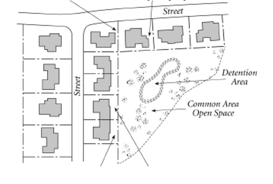
- Open Space Subdivision
The minimum required land area for an open space subdivision is 25 acres density and that meets the density, lots size, and yard requirements of Section 520.040.B.
Figure 1200-2: Open Space Subdivision Allow for Significant Preservation of Green Space
Standard Subdivision Open Space Subdivision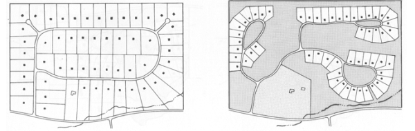
- Cluster Subdivision
- At least 15% of the net land area within a cluster subdivision must be set aside and permanently preserved as open space if the development is located within an area served by public water and sewer systems.
- Cluster subdivisions located in an area that is not served by public water and sewer systems must set aside and permanently preserve at least 20% of the subdivision’s net land area as open space.
- Open Space Subdivisions
- At least 25% of the net land area within an open space subdivisions must be set aside and permanently preserved as open space if the development is located within an area served by public water and sewer systems.
- Open space subdivisions located in an area that is not served by public water and sewer systems must set aside and permanently preserve at least 30% of the subdivision’s net land area as open space.
The density, lot size, and setback requirements for conventional, cluster, and open space developments must be consistent with the requirements of this Section.
- Cluster Subdivisions
The following density and lot size standards apply to all cluster subdivisions.
Table 1200-1: Flexible Lot Size; No Density IncreaseZoning District Cluster Subdivision Maximum Density (Units Per Acre) Minimum Lot Size Minimum Frontage RSF 1 30,000 100 SF-1 2 15,000 80 SF-2 2.9 12,000 70 SF-3 3.6 10,000 60 - Open Space Subdivisions
The following density and lot size standards apply to all open space subdivisions Table 1200-2: Ten Percent Density Increase for Preserving Open SpaceZoning District Open Space Subdivision Maximum Density (Units Per Acre) Minimum Lot Size Minimum Frontage RSF 1.1 20,000 100 SF-1 2.2 15,000 75 SF-2 3.2 12,000 60 SF-3 4.0 10,000 60
The following additional lot and building standards apply to cluster and open space subdivisions.
Table 1200-3: Front, Side and Rear Yard Flexibility: Cluster and Open Space Subdivisions.
| Minimum Setbacks | RSF | SF-1 | SF-2 | SF-3 |
| Cluster Subdivisions | ||||
| Front | 20 | 20 | 20 | 20 |
| Corner | 18 | 18 | 15 | 15 |
| Side | 12 | 12 | 12 | 12 |
| Rear | 20 | 20 | 20 | 20 |
| Open Space Subdivisions | ||||
| Front | 20 | 20 | 20 | 20 |
| Corner | 15 | 15 | 15 | 15 |
| Side | 12 | 12 | 6 | 6 |
| Rear | 20 | 20 | 20 | 20 |
- Maximum Density
- The maximum number of dwelling units allowed within a cluster or open space subdivision will be consistent with the density provisions of Section 1210.050.
- If the cluster or open space development site (subdivision) is located in more than one zoning district, the maximum number of dwelling units allowed must be determined separately for each portion of the site lying within a different zoning district. Density may be transferred from one portion of the site to another, provided that such transfers do not result in an increase in the number of dwelling units allowed on the overall site.
- Lot Design Each lot must be regularly shaped and meet or exceed the minimum lot area and lot width standards in this section. Side lot lines extending from a road must be approximately perpendicular or radial to the road’s right-of-way boundary.
- Open Space
- The amount of open space within a cluster or open space subdivision must be in addition to required open space of conventional subdivision as referenced in Section 1160.010 of this UDO. Open space provided to meet minimum open space requirements must be in one or more parcels dedicated or otherwise protected as permanent, active or passive open space. Open space must be at least 75 feet wide for all cluster and open space subdivisions, with houses facing towards the open space where possible and the open space being accessible to all residents of the subdivision.
- Use, Location, and Design: Open space must be dedicated or reserved for one or more of the following uses:
- conservation of, and avoidance of development in, any readily identifiable natural hazard areas, i.e., areas that potentially pose a significant hazard to people or property (e.g., designated floodways, other perennially wetlands, and lands whose slope and/or soils make them particularly susceptible to erosion when disturbed by development activities);
- conservation and protection of any identified significant natural areas (e.g., rare plant communities, important wildlife habitat) or other environmentally sensitive areas where development might threaten water quality or ecosystems (e.g., watershed buffers, groundwater recharge areas);
- conservation and protection of any identified important historic resources (e.g., homesteads, mills, barns, archeological sites);
- provision of active and/or passive outdoor recreation opportunities (e.g., ball fields, playgrounds, tennis courts, swimming pools, basketball courts, golf courses, bikeways, walking trails, nature trails, and picnic areas), either for the general public or for the subdivision’s residents or employees and their guests; or
- retention of productive farmland or forestland for continued agricultural and/or forestry use.
- Highest priority for the location, design, and use of open space must be given to conserving, and avoiding development in, any open space that is set aside.
- Open space may contain only such buildings, structures, accessways, and parking facilities as are necessary and accessory to its principal uses (e.g., pedestrian path, utility lines, driveway, barns and other farm storage and processing facilities).
- Open space may contain individual water supply wells or subsurface sewage disposal fields serving dwelling units on adjacent lots, or community wells, provided they do not conflict with the principal uses of the open space.
- The location, size, character, and shape of required open space must be appropriate to its intended use(s). (e.g., open space proposed to be used for recreation, particularly active recreation, should be located and designed so that it can be accessed conveniently and safely by intended users, and open space to be used for ball fields, playing fields, or other active recreational facilities should be located on land that is relatively flat and dry.)
- Cluster and/or open space subdivision occupants must be ensured direct access to and use of the entirety of the subdivision’s open space on the development site, by conveying that open space to a property owners association or similar legal entity meeting the provisions of Section 1110.060I for this UDO, or to a public agency or nonprofit organization that is organized for, capable of, and willing to accept responsibility for managing the open space for its intended purpose, and that will ensure subdivision occupants direct access to and use of the open space. Any other open space provided may be conveyed to such organizations as listed above or to any agency, organization, person, or other legal entity that is organized for, capable of, and willing to accept responsibility for managing the open space for its intended purpose, provided such conveyance is restricted to ensure continued maintenance and preservation of the open space and provided that the subdivision residents enjoy direct access and use of the open space.
- Each dedicated or reserved open space parcel must be shown on all subdivision plans and on a record plat recorded with the Union County Register of Deeds, with a notation of its area and its intended open space use. The owner of an open space parcel may re-dedicate or re-reserve the parcel for another open space use allowed under this subsection by recording a record plat showing the parcel and its new intended open space use.
- The owner of the open space is responsible for maintaining the open space so that it continues to effectively function for its intended use, and any dedication or conveyance of an open space parcel must provide for such responsibility.
- Where the cluster or open space subdivision is located within a RSF or the Goose Creek Village area, retention of undeveloped open space in a vegetated or natural state must be ensured by maintenance provisions filed with the Union County Register of Deeds, either as part of recorded documentation providing for establishment of an appropriate legal entity (e.g. homeowners association, property owners association or land conservation organization) that is to be responsible for maintenance and control of open space or in a maintenance agreement recorded with the property deeds.
1220.020 General Provisions
1220.030 Required Plans
1220.040 Conditional Zoning Approval And Public Notice For Conversion
- Equestrian Oriented Subdivisions are developments of a residential character that are designed with particular emphasis on equestrian activities and incorporate such facilities as community stables, riding rings, pastures, game fields, and riding trails.
- Private stables may be located on individual residential lots subject to the provisions of Section 1220.020E and Section 1220.020F below.
- Pastures, riding trails, community stables must be established, and these facilities must be accessible by a drive to allow easy ingress and egress. The access drive may be gravel in lieu of asphalt or concrete. Single stables may also be established on individual lots with equestrian oriented subdivisions.
- Equestrian oriented subdivisions are permitted in the RSF, SF-1, and SF-1 Cluster Districts and require Conditional Zoning district approval based on the applicant compliance with the requirements of this Chapter. However, where an existing approved subdivision is proposed to be converted to an equestrian subdivision then the applicant shall apply for conditional zoning approval from the Town Council.
- All buildings and structures related to the care of horses and to the operation of the riding facilities shall be located no nearer than 100 feet to any property line outside the development.
- Corral or yard areas used for keeping horses shall be located no closer than 35 feet from any property line outside of the development.
- All areas used for keeping horses shall be fenced. Chain link and electric fences as well as sharp fence materials such as barbed wire and razor wire are prohibited.
- Generally, riding trails shall be located within the interior of the development and should not extend along adjoining property lines. Where a proposed trail is to be located along the exterior property line of the project, such trail shall be a minimum of 20 feet wide with adequate fencing provided to maintain all equestrian traffic within the project. Where buffer yards and landscape setbacks are provided along the exterior property lines these buffer yards and setbacks may be counted as part of the required 20 feet. However, any area improved and designated as a riding trail must have a minimum clear dimension of at least 20 feet in width.
- Private stables for horses on residential lots shall be accessory to the residential structure and located on lots no smaller than 20,000 square feet. Only two (2) horses on any one (1) lot shall be allowed.
- Private stables for horses on residential lots shall be located at the rear of the property behind the principal residential structure but no closer than 10 feet to any rear lot line; 20 feet from any side property line; and no closer than 35 feet from any corner yard property line.
- Individual barns and community barns must be located so there is easy access to 3/4 acre of fenced pasture land per horse.
- No minimum shall be placed on the number of horses boarded by the community stable. However, the site shall be of adequate size to handle the horses housed on-site and properly maintained to protect adjacent uses from adverse impacts.
- Private stables, community stables, corrals, and other related facilities must be maintained in sanitary condition through the proper use of lime and pesticides.
- All grain on the lot shall be stored in rodent-proof containers.
A development for an Equestrian Oriented Subdivision shall delineate the following in addition to other subdivision requirements:
- Lots to have private stables shall be designated and the general location for such stables shall be indicated.
- All proposed community riding facilities, including community stables, riding rings, pastures, game fields, and riding trails. A written statement describing the proposed means of ownership and proposed program for the maintenance of these facilities shall be included. The approved statement shall be recorded as a covenant at the Union County Register of Deeds.
- The location and design of any walls, fencing, or screen planting proposed.
- Plans shall include calculation table detailing the maximum amount of horses allowed as per the horse to pasture ratio found in Section 1220.020.
- A subdivision of record shall file for a conditional zoning request when considering converting to equestrian oriented status. The application shall be accompanied by a notarized petition signed by each property owner within the existing subdivision. The Town Council may approve the Conditional Zoning upon finding that the applicant complies with the requirements of this Chapter.
- Notice and proceeding for the public hearing shall be in compliance with Chapter 310.
- If the Conditional Zoning is granted, standard site plan review pursuant to Chapter 370 of the Unified Development Ordinance is required.
Chapter 1320 Nonresidential/Commercial Design Standards
Chapter 1330 Lighting Standards
Chapter 1340 Transportation Infrastructure And Traffic Impacts
Chapter 1350 Intersection Visibility
Chapter 1360 Flood Damage Reduction Ordinance
Chapter 1370 Storm Water Management Permits
Chapter 1380 Post Construction
Chapter 1390 Sedimentation Pollution Control
Chapter 13100 Water, Sewer, Utilities And Easements
Chapter 13110 Fire Protection For Developments
Chapter 13120 Driveway, Street And Sidewalks
Chapter 13130 Trash Enclosures And Grease Trap Facilities
Chapter 13140 School Impact Study
1310.020 Compliance
1310.030 Articulation Standards For Residential Buildings
1310.040 Desired Building Material Standards For Site-Built And Modular Housing In Conditional Zoning Developments
1310.050 Manufactured Housing Units On Individual Lots
1310.060 Two-Family Dwellings, Town Homes And Rooming Houses
1310.070 Multi-Unit Apartment/Condo Buildings: Attached And Multi-Family
The regulations of this Chapter are intended to promote quality, aesthetically pleasing development throughout Indian Trail and to provide a wide range of nonresidential and residential structure types to accommodate the life-styles and economic levels of the projected population. The regulations are further intended to promote quality development that complies with all Town and state regulations and minimizes land use conflicts.
Plans demonstrating compliance with the design standards of this Chapter will be reviewed by the authorizing permit authority at the time of development’s initial review and consideration for approval. The authorizing permit authority may approve plans that deviate from these standards if the plan is consistent with the statement of purpose and utilize equal or better design strategies and materials.
- Any proposed changes to an approved Integrity and Design Permit such as a change in building design or building materials, shall require approval by the Planning Director.
- Any proposed changes to an approved Integrity and Design Permit associated with a Conditional Zoning shall be bound by the conditions of approval, this Chapter, and the following:
- Building materials and colors shall be similar to the materials already being used in the neighborhood, and/or if dissimilar materials are being proposed, other characteristics such as scale, proportion, form, architectural detailing, color, and texture shall be used to ensure that enough similarity exists for the buildings to relate to the rest of the neighborhood.
- Any proposed deviation from conditions of approval of a Conditional Zoning approved by the Town Council shall require an amendment of the Conditional Zoning approval.
- In the event of conflict with the Downtown Master Plan design guidelines, the master plan shall apply.
- Standards for accessory structures and apartments are provided in “G. Accessory Structure Materials” of Section 710.040 Lot and Building Standards.
- Required Articulation Standards for All Residential Buildings
All residential buildings on individual lots in residential districts must include the following design feature:- Front loading garages shall not extend further than four (4) feet past the predominant front façade of the house unless a front porch is used and then the garage shall not extend further than four (4) feet past the porch excluding side loading garages. A maximum of ¼ of the front façade is allowed to be front facing garage door(s).
- Front loading garages shall not extend further than four (4) feet past the predominant front façade of the house unless a front porch is used and then the garage shall not extend further than four (4) feet past the porch excluding side loading garages. A maximum of ¼ of the front façade is allowed to be front facing garage door(s).
- Desired Articulation Standards for Residential Buildings in Conditional Zoning Developments
- The following are desired design features for residential structures in Conditional Zoning districts. Residential structures are encouraged to include at least five (5) of the following desired design features:
- Bay or bow windows on the front façade (Note: the provision of one such window is sufficient);
- Dormers (Note: the provision of one such roof feature is sufficient);
- A roof pitch greater than or equal to a 6 to 12 (6:12) for primary roof;
- Eaves with a minimum 10-inch projection on all sides of the building;
- Rear decks or patios with a minimum size of 64 square feet;
- Front porch and entry facing the front lot line (Note: entryway can be located on the long or short axis of the dwelling;
- Off-sets on building face with a minimum depth of 12 inches;
- Decorative pillars or posts. Square post or columns may not be less than six (6) nominal inches on any side and round columns may not be smaller than eight (8) nominal inches in diameter from the bottom of the column unless consistent with a distinct architectural style. (Note: suggested at least one pair, decorative or plain, but finished in manner that is consistent with the dwelling exterior);
- Distinct Architectural Style (2 point value). The use of a distinct architectural style may be determined by a qualified professional contracted by the Town at the cost of the applicant unless the Planning Director is confident in the determination of the style.
- Each of the following design features are desired on residential structures in a Conditional Zoning development:
- Openings including doors and/or windows on street facing building facades. Windows are suggested to have appropriate window trim per style of architecture. Blank walls are not desired.
- Masonry (preferably brick) perimeter enclosure at base but also including poured concrete so that each home has the appearance of a raised foundation (Note: wood products covered with a treatment to appear as masonry do not qualify). Poured concrete shall be treated with brick, stone, or color and textured material appropriate foundation style per style of architecture.
- Changes in the use of wall facing materials should occur at wall setbacks or projections, or to articulate the transition between the building base middle and top. Material changes should return to inside corners of front façade. Those materials however, are not required to wrap the outermost front corner of the home.
- Front loading garages shall not extend further than four (4) feet past the predominant front façade of the house unless a front porch is used and then the garage shall not extend further than four (4) feet past the porch excluding side loading garages. A maximum of ¼ of the front façade is allowed to be front facing garage door(s).
- The following are desired design features for residential structures in Conditional Zoning districts. Residential structures are encouraged to include at least five (5) of the following desired design features:
- Build-To Line
Infill development in existing residential subdivisions or new home construction on a lot along a street corridor with developed home lots within 300 feet on each side of such lot shall be constructed at a distance from the front property line consistent with the developed homes or to be known as the “build-to line”. The build-to line distance is the average of the developed home lots within 300 feet on each side of the new home lot from the front property line to the front primary elevation façades. The new residential structure shall front on the same street as the developed homes. Setbacks must still be met with the following exception in “D”. - Reduced Front Yard Setback in Developed Areas
The minimum front yard setback may be reduced for any lot where the build-to line (the average established front setback on developed lots located within 300 feet on each side of such lot) is less than the minimum required setback. In such cases, the front setback on such a lot may be less than the required front setback but not less than the average of the existing front setbacks on the developed lots within 300 feet of each side.
Residential buildings in a Conditional Zoning constructed on-site may be improved with quality materials that are durable, safe, and require limited maintenance. It is recommended that materials be selected for suitability to the type of building and design for which they are used. All facades visible from public or private streets are desired to be constructed of the following materials:
- Brick, natural stone, wood, architectural cast stone, hardcoat stucco, cementitious siding, glass or EIFS – Exterior Insulation Finishing System (when applied according to manufacturer specifications and the North Carolina Building Code).
- Vinyl siding (minimum of .44mm), galvanized, aluminum coated, or zinc-aluminum coated metal finishes provided such materials do not exceed 20% of those façades visible from public or private streets.
- Roof material standards are not provided for site-built and modular housing that is not under a Conditional Zoning, but the roof material shall be consistent in appearance to the existing neighborhood materials on primary homes for new infill development. For Conditional Zonings, the following is suggested if the consistency of the neighborhood does not imply otherwise:
- Only roof asphalt shingles, slate and terracotta tile materials are used on site-built and modular housing structures.
- Metal and synthetic rubber are not allowed roof materials.
- Metal roof materials may be used in the RSF zoning district.
- When replacing an existing roof on a housing structure, the new materials shall follow the standard listed in “C” above. In an established residential subdivision, the roofing material shall be consistent in appearance to the primary homes in the subdivision.
- See "G. Accessory Structure Materials" in Section 710.040 Lot and Building Standards for accessory structure material requirements.
This section and Section 1630.060 Household Living Category provides standards for manufactured homes. Permitted Class A or B manufactured housing units may be placed on individual lots in residential districts that permit or conditionally permit detached manufactured houses only if they meet all the following standards:
- Shall be used for residential purposes only;
- Shall be served with a public water supply and sanitary sewer or approved septic system;
- Are constructed in accordance with the National Manufactured Housing Construction Safety Standards Act of 1974 as amended on August 22, 1981;
- Minimum Size
- General
Enclose a floor area of not less than 1,000 square feet in any residential zoning districts (Note: single-wide manufactured dwellings that include expandable units, pop-outs and tilt-outs are not permitted.). - Class A Manufactured HomeHas a minimum width of sixteen (16) feet.
- Class B Manufactured HomeHas no minimum width.
- General
- Foundation and Crawl SpaceThe manufactured home shall be placed on an excavated and/or backfilled foundation and the open portion under the home enclosed with pressure treated wood, masonry, or concrete walls, so that the top of the perimeter wall is not more than eight (8) inches above the finished ground level, except on a sloping lot where the top of the perimeter wall may be no more than eight (8) inches above the finished ground level at its highest point along the perimeter wall (Note: when pressure treated wood is used for the perimeter wall, a covering similar in appearance to the manufactured housing unit siding, or a finished concrete wall will be used to cover the wall). Metal or materials resembling metal (i.e. vinyl panels) shall not be used to enclose the crawl space.
- Exterior Wall Materials
- Class A Manufactured Home
Has exterior siding, comparable in composition, appearance, and durability to the exterior siding commonly used in standard residential construction, consisting of one or more of the following:- Vinyl or aluminum lap siding whose reflectivity does not exceed that of flat white paint;
- Cedar or other wood siding;
- Wood grain, weather resistant press board siding;
- Stucco siding;
- Brick or stone siding.
- Vinyl or aluminum lap siding whose reflectivity does not exceed that of flat white paint;
- Class B Manufactured HomeNo specific wall material standards except for no bare metal siding.
- Class A Manufactured Home
- Roof Shape and Materials
- Class A Manufactured Home
The Class A home shall have the following:- Has a roof finished with roofing material with a fire rating of Class C or better and that is commonly used in standard residential construction.
- Has a gable roof having a pitch with a minimum vertical rise of three and one-half (3.5) feet for each twelve (12) feet of horizontal run.
- Has a roof structure that provides an eave projection of no less than six (6) inches, which may include a gutter.
- Has a roof finished with roofing material with a fire rating of Class C or better and that is commonly used in standard residential construction.
- Class B Manufactured HomeThe home shall have a gable roof with a pitch having a minimum vertical rise of three and one-half (3.5) feet for each twelve (12) feet of horizontal run.
- Class A Manufactured Home
- General Two-unit houses, town homes and rooming houses are subject to the standards of Section 520.040, "Lot and Building Standards," (density, frontage and yard requirements) except as expressly modified or supplemented by the following standards.
- Maximum Units
Town homes are limited to no more than five (5) dwelling units per building. - Varied Building Placement
Town home neighborhoods shall position buildings in a manner to avoid long, uninterrupted runs along a street block. Where possible, buildings should be clustered into shorter blocks and/or around common open space. - Entrances
- The street-facing façade of a rooming house may have only one (1) visible entrance to the building. If the building is located on a corner lot, one (1) building entrance may be visible from each street.
- Patio-style doors, such as sliding glass doors, may not be used for main entrance doors.
- Pedestrian Circulation A pedestrian circulation system must be provided that connects residential entrances to adjacent public rights-of-way and to parking areas and other on-site facilities.
- Parking Location/Orientation Surface parking and parking within accessory structures must be located behind principal building or otherwise concealed from view of abutting streets. Parking areas may not be located directly between the principal building and the street or within any required interior side setback area. Any portion of a parking area that is not completely concealed from view of an abutting street must be screened in accordance with the parking lot landscaping requirements of DIVISION 800.
- Outdoor Living Space
Each individual lot or building shall provide an adequate quantity of outdoor living space for the use of recreation, eating, and storage of customary outdoor items such as garbage receptacles.
- General Multi-unit apartment/condominium buildings are subject to the standards of Section 520.040 (density, frontage, and yard requirements) except as modified or supplemented by the standards of this Chapter.
- Varied Building Placement
Buildings shall be positioned in a manner to avoid long, uninterrupted runs within interior drives and parking areas. Where possible, buildings should be clustered into smaller groups and/or around common open space. - Façade Materials
All buildings and other structures must be constructed with brick, natural stone, EIFS (Exterior Insulation Finishing System), glass, cementitious (i.e. Hardie) plank, panel or shingle siding or other comparable, durable materials that are consistent with the purpose and intent of this chapter and approved during the plan review process. A minimum of 30% of the building façade shall consist of brick and/or stone materials.
Use of architecturally finished/treated cast stone, precast panels or concrete masonry units as a primary building material may allowed in visible areas that are suitable for use on multifamily buildings and are consistent with the purpose and intent of this chapter and approved by the Planning Director during the plan review process.
Unfinished/treated concrete masonry units, unfinished/treated precast panels, and similar utility/economical grade materials (with exception of metal siding) may be allowed in service areas and in exterior corridors or stairwells that are not generally visible to the public. - Façade Colors
Façade colors must be low-reflectance, subtle, neutral or earth tone colors. Building trim and accent areas may feature brighter colors, as approved during the plan review process. - Building Design
The following standards apply to all building facades and exterior walls that are visible from adjoining streets, properties or parking areas.- Façade design and materials shall be consistent on all building elevations.
- All building designs must express a distinct “base”, “middle”, and “top” through the building’s architecture details and the use of building materials.
- Roofs must have multiple planes and elements such as hips, gables, dormers, raised parapets, or other offsets and features with at least one additional plane or feature every 60-ft of façade frontage.
- Buildings must have architectural features that conceal rooftop equipment, such as HVAC units, from public view. All flat roof buildings must include parapet screening (maximum five (6) feet in height), and cornice or decorative coping elements along rooflines.
- Vehicular parking shall not be placed between residential buildings and public streets. On-street parking is permitted and encouraged.
- For proposed buildings located within the Downtown Overlay, exposed stairwells, corridors, or breezeways shall not be permitted. In the event of conflict with the design guidelines of the Downtown Master Plan the master plan shall apply.
- Façade design and materials shall be consistent on all building elevations.
- Articulation
Buildings visible from public streets, adjacent properties, and parking areas must include at least three (3) of the following features:- Clearly pronounced recesses and projections (articulation) at multiple locations for any building with a front façade exceeding 50 feet in width.
- Wall plane off-sets (minimum two (2) foot depth and spacing every 30’) at multiple locations, reveals, projections, and changes in texture and color for wall surfaces for any building with a front façade exceeding 50 feet in width.
- Multiple windows grouped together to establish a design feature that can be either recessed or projecting with a minimum 4’’ wide trim.
- Multiple ornamental pilasters, columns or other similar architectural features integrated into the overall architectural design.
- A projecting or recessed balcony on at least 50% of the units of an individual façade and a covered porch for each unit at the ground-level.
- Other features that reduce the apparent mass of a building subject to approval by the Planning Director.
- Clearly pronounced recesses and projections (articulation) at multiple locations for any building with a front façade exceeding 50 feet in width.
- Entrances
- Entrance doors to dwelling units located above the ground floor must be provided from an enclosed lobby or corridor and stairwell. Unenclosed or partially enclosed stairs may not be used as the primary means of access to upper-floor dwellings units.
- Patio-style doors, such as sliding glass doors, may not be used for main entrance doors.
- Each building must have a clearly defined, highly visible entrance featuring at least 3 of the following elements:
- Canopies or porticos;
- Overhangs;
- Recesses/projections;
- Raised corniced parapets over the door;
- Peaked roof forms;
- Arches;
- Architectural details such as tile work and moldings that are integrated into the building structure and design; or
- Integral planters or wing walls that incorporate landscaped areas and/or places for siting.
- Canopies or porticos;
- Pedestrian Circulation A pedestrian circulation system must be provided that connects residential entrances to adjacent public rights-of-way and to parking areas and other on-site facilities.
- Parking Location/Orientation Surface parking and parking within accessory structures must be located behind principal building or otherwise concealed from view of abutting streets. Parking areas may not be located directly between the principal building and the street or within any required interior side setback area. Any portion of a parking area that is not completely concealed from view of an abutting street must be screened in accordance with the parking lot landscaping requirements of DIVISION 800.
- Open Space
- General
- Every applicant who proposes a multi-family apartment or condominium building shall set-aside a portion of land, in accordance with this Chapter, for a private or public park, greenway, recreation, and open space sites to serve the recreational needs of the residents of the development.
- At least 15% of the gross acreage of the site (outside of Downtown Overlay) shall be set-aside for park, recreation, greenway, or open space sites to serve the recreational needs of the residents of the subdivision or development A minimum of 10% of the gross acreage shall be set aside for sites within the Downtown Overlay District.
- To the extent feasible, areas with environmental limitations (e.g. designated flood plain areas, wetlands, and areas with a slope in excess of 15%) should be dedicated as open space and the Town may require these areas to be dedicated in excess of the minimum standard provided in this Section provided that reasonable economic use of the property is permitted.
- At the time of filing a site plan or conditional rezoning application, the applicant shall designate thereon the area or areas to be set-aside.
- Every applicant who proposes a multi-family apartment or condominium building shall set-aside a portion of land, in accordance with this Chapter, for a private or public park, greenway, recreation, and open space sites to serve the recreational needs of the residents of the development.
- Design and Active Amenities
- Open space shall be designed to provide maximum accessibility and visibility to residents within the development. Opportunities for both passive and active recreation should be provided. Indoor amenity areas such as indoor pools, etc. may be used towards compliance with the open space acreage requirements.
- Multi-family and condominium uses must provide fully developed, targeted amenities (indoor or outdoor) of an appropriate size and scale with the number of units as follows.
- Fewer than 75 units = 1 amenity
- 75 to 150 units = 2 amenities
- 151 to 300 units = 3 amenities
- More than 300 units = as determined by Planning Director
- Fewer than 75 units = 1 amenity
- Examples of indoor amenities include, but are not limited to: Fitness center with fitness equipment, recreation or game room including features such as billiards tables, game tables, or movie viewing area, solarium, sauna, steam room, or other type of relaxation room, common cooking and/or dining facility, and swimming pools.
- Examples of outdoor amenities include, but are not limited to fenced dog park with dog wash station, bike workshop and storage area, community vegetable and flower garden, outdoor lounge area such as with a fire pit and grills or outdoor kitchen, playground with commercial-grade equipment basketball court (full or half court); tennis court; pickleball court; volleyball court; or soccer field that is graded properly to an amateur or practice-level facility, is grassed, and has goals, putting green, bocce courts, horseshoe courts, or shuffleboard courts, and swimming pools.
- Open space shall be designed to provide maximum accessibility and visibility to residents within the development. Opportunities for both passive and active recreation should be provided. Indoor amenity areas such as indoor pools, etc. may be used towards compliance with the open space acreage requirements.
- General
- Site Plan Review Site plan review, pursuant to Chapter 370, is required for all multi-unit apartment/condo buildings containing more than three (3) dwelling units.
1320.020 Pedestrian Circulation
1320.030 Facade Materials
1320.040 Building Design
1320.050 Large-Stores And Shopping Centers
1320.060 Industrial Centers/Business Parks
Unless otherwise expressly stated, the material and color standards of this section apply to all facades visible from a public or private street or public areas of adjacent sites for non-residential/commercial development in all zoning districts that are subject to site plan review. This section excludes industrial land uses.
- A pedestrian circulation system must be provided that interconnects building entrances to adjacent public rights-of-way and other on-site facilities. Buildings with parking abutting them shall have a concrete pedestrian walkway with a minimum five (5)-foot width. Such walkways must be located three (3) feet from the facade of the building to provide planting beds for foundation landscaping, except where features such as arcades, display windows, planters, or entryways are part of the facade.
- All internal pedestrian walkways that cross parking aisles or driveways must be distinguished from driving surfaces through the use of durable, low-maintenance surface materials such as pavers, bricks, scored concrete or scored and painted asphalt designed to enhance pedestrian safety and comfort. Raised walkways may be installed if elevated six (6) inches with tapered side slopes and meet ADA standards.
- All buildings and other structures must be constructed with brick, cementitious panels or siding, natural stone, architecturally finished and integrally colored concrete masonry units, EIFS (Exterior Insulation Finishing System), glass or other comparable, durable materials that are consistent with the purpose and intent of this chapter and approved during the site plan review process.
Use of architecturally finished/treated cast stone or precast panels as a primary building material may be allowed in visible areas that are suitable for use in commercial locations and are consistent with the purpose and intent of this chapter and approved by the Planning Director during the site plan review process. - For buildings 40,000 square feet and larger, a minimum of 30% of the building facade that is visible from streets or other public areas, excluding doors and windows, shall consist of brick and/or stone.
- Unfinished/treated concrete masonry units, unfinished/treated precast panels, and similar utility-/economical-grade materials may be allowed in service areas and on exterior walls that are not generally visible to the public unless otherwise stated in this ordinance.
- Facade Colors Facade colors must be low-reflectance, subtle, neutral or earth tone colors. Building trim and accent areas may feature brighter colors, as approved during the site plan review process. Traditional or standard franchise colors shall also comply with this section.
- The following standards apply to all building facades and exterior walls that are visible from adjoining streets or properties.
- All building designs must express a distinct “base”, “middle”, and “top” through the building’s architecture details and the use of building materials.
- Buildings visible from public streets must include at least three (3) of the following features:
- Variations in roof form and parapet heights;
- Clearly pronounced recesses and projections at multiple locations for any building with a front façade exceeding 50 feet in width;
- Wall plane off-sets (dimension established by building module) at multiple locations for any building with a front façade exceeding 50 feet in width;
- Reveals and projections and changes in texture and color of wall surfaces;
- Deep set windows with mullions;
- Ground level arcades and second floor galleries/balconies; or
- Other features that reduce the apparent mass of a building.
- Buildings must have architectural features that conceal rooftop equipment, such as HVAC units, from public view. All flat roof buildings must include parapets and cornice or decorative coping elements along rooflines.
- Each building must have a clearly defined, highly visible customer entrance featuring at least four (4) of the following elements:
- Canopies or porticos;
- Overhangs;
- Recesses/projections;
- Arcades;
- Raised corniced parapets over the door;
- Peaked roof forms;
- Arches;
- Outdoor patios;
- Display windows;
- Architectural details such as tile work and moldings that are integrated into the building structure and design; or
- Integral planters or wing walls that incorporate landscaped areas and/or places for sitting.
- Building height may not exceed 35 feet for a one-story building or as otherwise authorized within the UDO.
- Applicability In addition to the requirements listed in Division 1300, "General Development and Design Standards," the standards of this section apply to all retail uses and food and beverage retail sales uses on sites that include, in aggregate, more than 70,000 square feet of gross floor area.
- Pedestrian Circulation
At least one continuous internal pedestrian connecting walkway must be provided from the public sidewalk or right-of-way and the principal customer entrance of all principal buildings on the site. Such pedestrian connections must be at least six (6) feet in width. Refer to the Indian Trail Land Development Standards for the required sidewalk construction standards. At a minimum, walkways must connect focal points of pedestrian activity such as, but not limited to, transit stops, street crossings, building and store entry points, and feature items such as adjoining landscaped areas that includes trees, shrubs, benches, flower beds, planters, groundcover, or other such materials for no less than 30% of its length.
- Walkways must be provided along the full length of the building along any facade featuring a customer entrance, and along any facade abutting public parking areas. Such walkways must be located a minimum of three (3) feet from the facade of the building to provide planting beds for foundation landscaping, except where features such as arcades, display windows, planters or entryways are part of the facade.
- Customer entrances must have weather protection features, such as awnings, arcades, or vestibules.
- All internal pedestrian walkways that cross parking aisles or driveways must be distinguished from driving surfaces through the use of durable, low-maintenance surface materials such as pavers, bricks, scored concrete or scored and painted asphalt or applied surface materials (e.g. bubbled runner mats) designed to enhance pedestrian safety and comfort. Raised walkways may be installed if elevated six (6) inches with tapered side slopes and meet ADA standards.
- Industrial Buildings (for individual properties and parks)
Unless otherwise expressly stated, the material and color standards of this section apply to all facades visible from a public or private streets or public areas of adjacent sites for allowable uses in Chapter 570, "Permitted Uses".
Figure 1300-1: Preferred Industrial Design
- Facade Materials
- All buildings and other structures must be constructed with brick, cementitious (i.e. Hardie) panels, natural stone, architectural cast stone, EIFS (Exterior Insulation Finishing System), glass, architecturally finished and integrally colored concrete masonry units, precast wall panels that incorporate architectural treatment such as integral coloring and texture, or other comparable, durable materials that are consistent with the purpose and intent of this chapter and approved during site plan review process. The use of various materials to produce effects of texture and relief is encouraged to produce diversity and visual interest while reducing building scale.
- Unfinished/treated concrete masonry units, unfinished/treated precast panels, metal siding, and similar utility/economical grade materials may be allowed in service areas and on exterior walls that are not generally visible from public or private streets or public areas of adjacent sites unless otherwise stated. The use of metal siding as a primary material visible from the street or public areas of adjacent sites must be approved through the conditional rezoning process.
- Facade Colors
Facade colors must be low-reflectance, subtle, neutral or earth tone colors. Building trim and accent areas may feature brighter colors, as approved during the site plan review process. - Building Articulation
The following standards seek to promote high-quality and creative development and shall apply to all building facades and exterior walls that are visible from adjoining streets or properties. Each business park should have a distinct architectural concept that is consistent in theme, architecture details and the use of building materials. Buildings must include the following features:- Facade offsets, modulation, indentations and architectural details occurring every 80 feet to create clearly pronounced buildings and to avoid large, blank surfaces. Offsets or offsetting details shall be a minimum of two (2) feet in width;
- Screening of equipment and storage areas (if allowed) that is consistent with the primary structure(s);
- Reveals, projections, and changes in texture and color of wall surfaces;
- Landscaping to soften building exteriors;
- Varying building heights/massing and setbacks to define different functions such as offices and warehouses;
- Loading facilities shall not be located in front of the building or side facing a public street or entryway and shall be located at the rear or side of the site; and
- Architectural features that conceal rooftop equipment such as HVAC units, from public view. All flat roof buildings must include parapet screening that includes variations to avoid long, continuous planes. Roof line areas that are not visible from public or private streets or public areas of adjacent sites, are not required to have parapets.
- Entrances
Entrances to individual buildings shall create visual interest and be readily identifiable to visitors, architecturally integrated within the overall building compositions, and shall incorporate at least two (2) of the following design standards:- Overhangs and canopies;
- Recesses/projections with raised parapets, gabled roof forms or arches;
- Outdoor patios;
- Architectural details such as tile work and moldings that are integrated into the building structure and design; and
- Integral planters or wing walls that incorporate landscaped areas and/or places for sitting.
1330.020 Applicability
1330.030 General Exemptions
1330.040 Light Measurement Technique
1330.050 General Lighting Standards
1330.060 Prohibited Uses Of Lighting
1330.070 Standards For Specific Uses
1330.080 Compliance
1330.090 Violations
- It is the purpose and intent of this Chapter to encourage the use of lighting design practices and systems that will: 1) minimize glare, light trespass and light pollution; 2) conserve energy and resources while maintaining nighttime safety, security and productivity; and 3) to curtail the degradation of the nighttime visual environment.
- It is the purpose and intent of this Chapter to establish clear and comprehensive outdoor lighting standards with an emphasis on reducing glare and light trespass by requiring, in most circumstances, the installation of both semi-cutoff (minimum required) and full cut-off (preferred) lighting fixtures.
- It is the purpose and intent of this Chapter to allow for outdoor lighting that is appropriate for the task and to establish light fixture height limits that will help prevent light trespass to adjacent properties.
- It is the purpose and intent of this Chapter to establish specific standards for certain land uses that typically have unique lighting requirements, such as (but not limited to) automotive dealerships, service stations, and outdoor sporting facilities.
- New Construction
This outdoor lighting standard applies to the development of all new multi-family housing, new major residential and non-residential subdivisions, non-residential construction, and the construction of parking lots where such developments include the installation of new outdoor lighting fixtures or the replacement of existing lighting fixtures. All new construction projects shall have enough exterior lighting to meet the minimum safety and security requirements of the Southern Building Code (SBC), National Electrical Code (NEC) and North Carolina Building Code (NCBC). The replacement of an existing lighting fixture is defined as a change of the type of fixture; a change in the mounting height of a fixture on a pole, building, or other structure; or a change in the location of a lighting fixture. All of these applications require compliance with this section. Routine lighting fixture maintenance such as replacement of lamps, ballast, starter, photo control, or similar components will not constitute the need to comply with this ordinance, and is permitted provided such changes do not result in a higher wattage or higher lumen output. - Expansions or Improvements
This outdoor lighting standards shall apply to any redevelopment, expansion, or improvement exceeding 50% of a site's existing floor area as established by the Tax Department and will require compliance with this section.
The following lighting is exempt from the requirements of this Section:
- Emergency lighting: Lighting required for public safety in the reasonable determination of public safety officials with authority.
- Decorative lighting: Low-wattage fixtures (comprised of incandescent bulbs of less than eight (8) watts each or other lamps of output less than one hundred (100) lumens each) used for holiday decoration.
- DOT lighting: Department of Transportation highway signage luminaires, which must comply with national D.O.T. standards.
Measurements shall be made at finished grade (ground level), with the light registering portion of the meter held parallel to the ground, pointing up. The meter shall have an accuracy tolerance of no greater than plus or minus 5%. Measurements shall be taken with a light meter that has been calibrated within one (1) year. Light levels are specified, calculated and measured in footcandles (FC), and should be taken after a one hundred (100) hour burn-in time, which will more accurately read “maintained” lighting levels.
All outdoor lighting (other than lighting for automotive dealerships and outdoor sporting facilities) shall comply with the following standards: All exterior lighting should be provided as to minimize the amount of light that is distributed towards an adjacent property, thereby limiting light trespass.
- Lighting Levels
- All new lighting installations adjacent to a residential property (and renovations to existing lighting fixtures), shall show the intent to limit FC levels at property lines to a maximum amount of one (1) footcandle maintained. All new lighting installations adjacent to a commercial property (and renovations to existing lighting fixtures), shall show the intent to limit FC levels at property lines to a maximum amount of two (2) footcandles maintained.
- The maximum light level allowed at any point on a given parcel or property (with the exception of automobile dealerships, gas and service station canopies, and sporting facilities) shall not exceed twenty (20) footcandles maintained. The maximum light level allowed at any point on an automobile dealership (display or parking area) shall not exceed fifty (50) footcandles maintained.
- The minimum light level allowed at frequently used building entrances and public areas of sites (i.e. parking lots, refuse or delivery areas, etc.) is one (1) footcandle maintained.
- Fixture Shielding
- All lighting fixtures, (regular lamps and flood lamps) rated 100 watts or less (see Table 1300-1 for LED equivalent) may be used without restriction to light distribution (non-cutoff classification) except when the luminaire creates direct glare perceptible to persons on a public right of way, or into the window openings of a residential dwelling unit. Care should be taken to minimize light trespass across property lines. Internal louvers or “glare or house side shields” should be provided where the emitted light becomes a hindrance.
Table 1300-1: Metal Halide / High Pressure Sodium to LED Wattages Conversion
.Original Lamp (Watts) LED Lamp (Watts) METAL HALIDE TO LED 70 30 100 40-50 150 60-70 175 80-90 HIGH PRESSURE TO LED 70 40 100 50-60 150 80-90 250 90-125 - All lighting fixtures rated greater than 100 watts (regular lamps and flood lamps) shall be listed as a “full cutoff” distribution only (see Figure 1300-2) and shall not emit any light above the horizontal plane of the fixture. With exception of sporting facilities, the light source should not be visible (within reason) from adjacent properties or the public street right-of-way.
Figure 1300-2: Full Cutoff Style Light (left) and Non-Cutoff Style (right)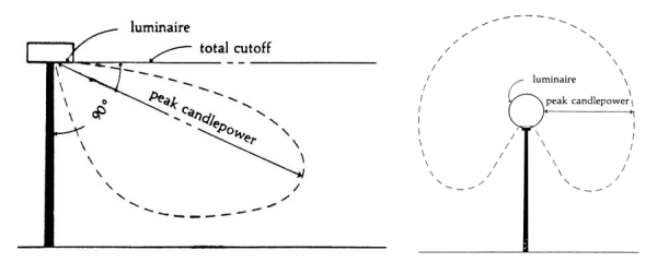
- All parking lot lighting fixtures shall use a "house side shield" when within 100 feet of a residential use or when abutting a public road.
- All building wall mounted lighting fixtures, or “wallpacks”, shall be of the full cutoff type.
- The Planning Director is authorized to approve modifications to shielding requirements for decorative and security lighting.
- All lighting fixtures, (regular lamps and flood lamps) rated 100 watts or less (see Table 1300-1 for LED equivalent) may be used without restriction to light distribution (non-cutoff classification) except when the luminaire creates direct glare perceptible to persons on a public right of way, or into the window openings of a residential dwelling unit. Care should be taken to minimize light trespass across property lines. Internal louvers or “glare or house side shields” should be provided where the emitted light becomes a hindrance.
- Pole Structures
- The maximum fixture height (grade to top of fixture) for all ground mounted lighting fixtures, except those used for sports facilities, shall be as follows:
- Commercial - 32 feet or 22 feet when within 100 feet of residentially zoned property
- Residential - 22 feet
- Pedestrian Pathways - 15 feet
- All new lighting fixtures shall be mounted on metal or concrete poles with underground utilities for all new developments, redevelopments, and subdivisions except when:
- New lights are proposed within existing subdivisions or non-residential sites where utility poles and overhead utilities exists.
- New security lights are proposed on commercial property where utility poles and overhead utilities exist.
- New wood poles may be permitted for temporary lighting and for lighting services areas of industrial and institutional uses that are not visible from the street or public areas of adjacent sites.
- All new lighting poles shall be a minimum of ten (10) feet from an existing or proposed tree planting, measured from center of fixture to center of tree.
- The maximum fixture height (grade to top of fixture) for all ground mounted lighting fixtures, except those used for sports facilities, shall be as follows:
- Unshielded flood lights, except for residential flood lights rated 100 watts or less, that are permitted but must be aimed towards the ground and not towards adjacent properties.
- Unshielded lamps or fixtures, except for those used for swimming pools, hot tubs, semi-enclosed decks or porches and similar accessory structures.
- Searchlights used for advertising purposes.
- Laser sourced lighting fixtures used for advertising purposes.
- Other than architecturally aesthetic neon signs or other signs permitted elsewhere in this ordinance, all exposed light “striping” on or around commercial buildings or associated structures shall be prohibited.
- Gas and Service Station Canopies
- Any linear light striping around the edge or exterior of the canopy shall be prohibited if not shielded to illuminate back onto the canopy edge.
- All lighting fixtures mounted on the underside of canopies must be “full-cutoff” classified, being either completely recessed/flush in the canopy, or having solid sides on a surface mounted fixture (canopy edges do not qualify as shielding).
Figure 1300-3: Recessed (full cutoff) service station lighting on the top; surface mounted (non-cutoff) on the bottom.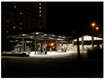
- The light source shall be metal halide, ceramic metal halide or LED.
- Lighting levels under the canopy shall be no greater than thirty (30) footcandles. Areas outside the pump island canopy shall be illuminated as to provide proper safety to customers, but shall be limited and not exceed ten (10) footcandles maintained. General Outdoor Sporting Facility/Performance Area Lighting Standards
- Any linear light striping around the edge or exterior of the canopy shall be prohibited if not shielded to illuminate back onto the canopy edge.
- General Outdoor Sporting Facility/Performance Area Lighting Standards
- The mounting height of outdoor sports field and outdoor performance area lighting fixtures shall not exceed eighty (80) feet from finished grade unless approved prior to construction by the Planning and Zoning Board in a quasi-judicial proceeding or Town Council.
- All outdoor sports field and outdoor performance area lighting fixtures shall be equipped with a glare control package (louvers, shields, visors or similar devices). The fixtures must be aimed so that their beams are directed and fall within the primary playing field or performance area.
- The hours of operation for the FIELD lighting system for any game or event shall not exceed one (1) hour after the end of the event. The security and egress illumination lighting systems may remain turned on for any amount of time deemed necessary to remove people safely.
- Light levels for sports field illumination shall comply with, but not exceed IESNA standards. Where new sporting facility lighting is installed adjacent to an existing residential property, the INTENT shall be made for all installations to limit property line light levels to a maximum of two (2) footcandles at grade level. When not installed adjacent to a residential property, light levels at the property line shall not exceed four (4) footcandles at grade level. ALL possible means of shielding must be applied if this level has not been met. Owner must prove to the appropriate permitting authority that these means have been exhausted, and the intent has been made to meet these goals.
- Security and Display Lighting
- Outdoor security lighting should be designed to provide safety to a building occupant, while effectively allowing proper surveillance, though not to exceed lighting levels described in Section 1330.050, subsection A.
- The use of motion sensors, timers, photocells or other means to activate lighting during nighttime hours is required to conserve energy, provide safety, and promote compatibility between different land uses.
- In order to direct light downward and minimize the amount of spill light, all security lighting fixtures shall be shielded and aimed so that the main beam is directed toward the ground or designated area where security lighting is needed.
- Security Lighting for ATM’s shall be consistent the Illuminating Engineering Society North America (IESNA) standards for that industry.
- Architectural Accent Lighting
- Lighting fixtures used to accent architectural features, materials, colors, style of buildings, landscaping, signs, and/or art shall be located, aimed and shielded so that light is directed only on those features. Such fixtures shall be aimed or shielded to minimize light spill from the source in conformance with the luminaire standards.
- Fixtures shall not exceed 175 watts or LED equivalent, with the exception of Department of Transportation highway signage luminaires, which must comply with National Department of Transportation standards. Lighting fixtures shall be selected, located, aimed and shielded so that direct illumination is focused exclusively on the item being illuminated, and away from adjacent properties and the public street right-of-way.
- Accent lighting shall not generate excessive light levels, cause glare, or direct light beyond the façade onto neighboring properties, streets or night sky.
- National flags may be illuminated from below provided such lighting is focused primarily on the individual flag or flags, and to limit light spill into the night sky. These fixtures must conform with Section 1330.050, subsection B of this document.
- Temporary Outdoor Lighting Any temporary outdoor lighting that conforms to the requirements of this Chapter shall be allowed. Any temporary lighting that does not conform to these outdoor lighting standards may be permitted after considering: (a) the public and/or private benefits that will arise from the temporary lighting; (b) any annoyance or safety problems that may result from the use of the temporary lighting, and (c) the duration of the temporary nonconforming lighting. The applicant shall provide a detailed description of the proposed temporary outdoor lighting to the Engineering Director for review and approval.
- Public and Private Roadways
All streets and sidewalks shall be sufficiently illuminated to ensure the security of the street right-of-way and safety of pedestrians present in the area.
- Street lighting must be included on all new residential and commercial streets. In addition, street lighting must be installed on the perimeter of the development along a thoroughfare, boulevard, and/or collector road that lack such lighting, unless deemed unsafe or unsuitable by the Director of Engineering and/or NCDOT.
- For a new subdivision, a lighting layout and overall design is required in the subdivision design submittal documents. Lighting submittals shall include the fixture, lamp, pole height and the method of shielding being used.
- Subdivision developers are required to have the lighting design approved by the Planning Department, and shall then submit the approved design to the power company prior to installing the assemblies. An accurate scale reference must be included on all layout drawings.
- In general, the layout of roadway lighting should conform to the RP-8-00 Roadway Lighting Manual and the following standards:
- All light poles shall be placed approximately 200 feet apart. Due to geometric limitations, this distance between poles can be adjusted up to forty (40) feet. Light fixture assemblies shall be placed on the side of the street where the sidewalk is located. If both sides have a sidewalk, lights shall be alternated.
- All corners shall have at least one (1) light fixture assembly for a three-way intersection, and two (2) light fixture assemblies for a four-way intersection.
- All cul-de-sacs shall have a minimum of one (1) light fixture assembly, located such that the entire cul-de-sac right-of-way has an ample amount of illumination.
- Lights should be placed on the outside of the curve and the spacing should be lessened.
- Photometric calculations shall be required by the Town of Indian Trail for outdoor lighting applications. Average footcandle values shall be taken from the table below:
Figure 1300-2: Recommendations for Roadway Average Maintained Horizontal Illumination
Source: “Roadway Lighting Handbook”, U.S. Department of Transportation, Federal Highway Administration 1978, as revised.Vehicular Roadway Classification Commercial Urban Intermediate Residential Foot-candle Lux Foot-candle Lux Foot-candle Lux Freeway* 0.6 6 0.6 6 0.6 6 Expressway* 1.4 15 1.2 13 1.0 11 Major 2.0 22 1.4 15 1.0 11 Collector 1.2 13 0.9 10 0.6 6 Local 0.9 10 0.6 6 0.4 4 Alleys 0.6 6 0.4 4 0.4 4
* Both the mainline of freeways and expressways and the ramps.
Note: The recommended illumination levels shown are only meaningful when designed in conjunction with other elements. The most critical elements as described in this practice are as follows:- Illumination depreciation;
- Quality;
- Uniformity;
- Luminaire mounting heights;
- Spacing;
- Traverse location of luminaire;
- Luminaire selection;
- Traffic conflict areas;
- Border areas;
- Transition lighting;
- Alleys;
- Roadway lighting layouts.
- All new lighting fixtures must be installed on new metal poles. Wood poles shall not be permitted except when installing light fixtures within an existing residential subdivision where wood utility poles exist.
- New residential subdivision street lights or street lights within the Downtown Districts shall be semi or full cutoff fixtures in compliance with Section 1330.050. Poles shall be free standing painted black. Refer to Section 1330.050 C for allowable pole heights. No overhead service wires shall be allowed.
Figure 1300-4: Decorative street lighting fixture (example) with semi-cutoff classification. Internal glare shielding preferred for residential applications.
- Collector and thoroughfare lighting shall be AEL 125 full cutoff style cobrahead, 400 watt high pressure sodium or metal halide, and shall conform to NC DOT standards. Sag lens shall not be allowed. Poles shall be free standing with an aluminum finish. No overhead service wires shall be allowed.
Figure 1300-5: Collector or thoroughfare cobrahead lighting fixture (example) with full cutoff style.
- New residential subdivision street lights or street lights within the Downtown Districts shall be semi or full cutoff fixtures in compliance with Section 1330.050. Poles shall be free standing painted black. Refer to Section 1330.050 C for allowable pole heights. No overhead service wires shall be allowed.
Amended by Ord. O210209-347 on 2/8/2021
Adopted by Ord. 393 on 11/14/2023
Amended by Ord. 397 on 3/26/2024
Amended by Ord. 410 on 12/10/2024
- A photometric site plan and lighting fixture cut sheets for all proposed exterior fixtures shall be included with the required application for a subdivision of land or a site plan. Depending on the size and type of the project, the Planning Director shall require that the photometric site plan include the following:
- The location of pole and building mounted lighting relative to the principal land uses and relative to the abutting streets.
- The zoning district classifications of all properties abutting the site.
- The location and site coverage of service station canopies and outdoor sales and display areas.
- The location and height of all lighting poles, building mounted lights, and ground mounted lighting fixtures.
- A photometric diagram showing the predicted levels of illumination from the proposed lighting fixtures.
- The manufacturer’s product descriptions showing that the proposed lighting fixtures meet the requirements of this ordinance.
- Minimum, maximum, and average lighting levels of the proposed lighting fixtures.
- The Planning Director shall require the installation of full-cutoff shielding or directional shielding when a zoning applicant proposes repairing or replacement of any component of any luminaire where the Town has found that the existing lighting fixture has created a public hazard due to excessive glare or light trespass.
- The Town shall have the authority to require an “As-Built Lighting Photometric Plan” in the event that actual field conditions appear to not be in accordance with an approved permit. The cost for the study and to make any corrective action shall be borne by the property owner. Issuance of a Zoning Compliance Certificate may be withheld until completion of the plan and demonstration of compliance with the UDO.
- Any person, firm or company, whether principal, agent, employee or otherwise, who violates any of the provisions of this Section shall be fined an amount not to exceed the lighting standards violation amount listed on the Town Fee Schedule for each such violation, such fine shall be paid to the Town of Indian Trail. Each day of the documented existence after written notification of any situation held to be in violation shall be deemed an equal and separate offense.
The Town may withhold certificates of occupancy for any use that installs luminaries that do not comply with this Section.
1340.020 Town To Require Traffic Impact Study
1340.030 Town To Require Traffic Impact Mitigation
Consistent with the terms and conditions of the Town of Indian Trail’s Traffic Impact Study Policy, new developments must demonstrate that they are served by roads with adequate traffic capacity and that any proposed development will not lead to conditions of excessive traffic congestion or dangerous driving conditions.
Consistent with the terms and conditions of the Town of Indian Trail’s Traffic Impact Study Policy, the Town may require a traffic impact study as part of development approvals consistent with the terms and conditions of this Unified Development Ordinance. Said traffic impact study is subject to review and approval by the Engineering Director.
Consistent with the terms and conditions of the Town of Indian Trail’s Traffic Impact Analysis Policy, the Town may require a traffic impact mitigation and roadway improvements as part of development approvals consistent with the required Traffic Impact Study as approved by the Engineering Director and terms and conditions of this Unified Development Ordinance.
1350.020 Applicability
1350.030 Intersection Visibility Triangles
1350.040 Prohibited Obstructions
1350.050 Exemptions
The intersection visibility standards of this article establish triangular areas on corner lots, referred to as “intersection visibility triangles,” within which the placement of buildings, fences, hedges, walls, and other structures is restricted in order to maintain clear lines of sight at street intersections for the purposes of traffic and pedestrian safety.
Lots located at the corner of any street intersection must comply with the requirements of this article.
- At the intersection of 2 local streets, a local street and a collector street, or 2 collector streets, the legs of the intersection visibility triangle must be at least 35 feet in length, as measured along the curbline from the point where the curbs of the 2 streets intersect. In the absence of a curb, the legs of the triangle must be at least 35 feet in length, as measured along the edge of the street pavement from the point where the pavement of the 2 streets intersect.
Figure 1300-5: Sight or Visibility Triangle
The following obstructions are prohibited within intersection visibility triangles:
- Hedges and walls higher than two (2) feet above curb level.
- Fences higher than two (2) feet above curb level. However, fences that are less than 20% solid, such as split rail, open weave, or wrought-iron are permitted within the intersection visibility triangle if they are kept free from plantings and other materials that are more than two (2) feet in height. The “20% solid” threshold must be determined based on the proportion of the fence over a random area that is made up of solid, opaque material that does not allow light or air to pass through.
- Signs, except as expressly exempted.
- Structures of any type, including principal and accessory buildings, except as expressly exempted.
- Items of outdoor display or storage, including ornamental features, such as fountains, statues, garden structures and similar features.
- Parking and vehicular display areas.
The following structures are exempt from the provisions of the intersection visibility standards of this section subject to review and approval by the Engineering Director.
- Structures including signs within the Downtown Districts.
- After review by the Town, buildings on lots at intersections where both streets are signalized. The Town may approve or deny a request to construct a building within the intersection visibility triangle based on such factors as street right-of-way width, speed and volume of traffic through the intersection, and the number of turning movements.
- Utility and street light poles.
- Traffic control equipment, including control boxes, traffic signs, and structures that support traffic signals.
- Signs attached to buildings that are exempt from the intersection visibility triangle requirements as specified in paragraphs “A” and “B,” above.
- A sign established in accordance with all applicable requirements of DIVISION 900 provided the bottom edge of the sign and any supporting structure is at least nine (9) feet above the adjacent curb level, so that visual clearance is maintained within the intersection visibility triangle. Poles and supporting structures for signs are prohibited within the intersection visibility triangle.
See the Flood Damage Reduction Ordinance on the Town's website under the Engineering Department.
1370.020 Downstream Impact Analysis
1370.030 100 Plus 1 Flood Analysis
1370.040 Ponds
1370.050 Embankments
1370.060 General Requirements
1370.070
1370.080
1370.090
1370.100
1370.110
1370.120
All developments will be constructed and maintained so that adjacent properties are not unreasonably burdened with surface waters as a result of such developments. More specifically:
The purpose of flood control detention requirements is to protect downstream properties from increased flooding due to upstream development. Development or redevelopment creating a total of 20,000 square feet or more of impervious area shall be designed to control the peak discharges from the 2-, 10-, and 25-year, 24-hour storm events to pre-development levels. The emergency overflow and outlet works for any stormwater BMP shall be capable of safely passing a discharge with a minimum recurrence frequency as specified in the Town of Indian Trail Stormwater Design Manual.
Development or redevelopment that proposes to use existing detention facilities shall comply with the requirements of this Section 1370.
Detention facilities shall not be located within FEMA Special Flood Hazard Areas, drainage areas where the 100-year storm event is greater than 50 cfs, or within 10 feet of any property lines. Design of detention facilities shall be consistent with the Town of Indian Trail Stormwater Design Manual except as stated herein.
Stormwater detention design must be performed by a North Carolina Registered Professional Engineer.
- Hydrologic Analysis The Owner shall cause a downstream hydrologic analysis to be performed to determine if there are any additional impacts in terms of peak discharge increase or downstream flooding due to the difference in the pre and post-development 50- and 100-year storm events. The analysis shall be performed at the outlet(s) of the site and downstream at each tributary junction to the point in the conveyance system where the area of the portion of the site draining into the system is 10% of the total drainage area above that point. Key detention structures in the study area must be modeled.
- Hydraulic Analysis
If during the site plan review process the Engineering Director determines that as a result of an increase in peak discharge between the pre and post-development 50-year storm event, detrimental impacts at thoroughfare culvert crossings are probable, the Owner shall cause a hydraulic analysis to be performed to determine flood elevations for the areas impacted by increased flows. No existing or proposed thoroughfare culvert crossing shall be designed to have stormwater encroach upon the roadway pavement.
If during the site plan review process the Engineering Director determines that as a result of an increase in peak discharge between the pre and post-development 100-year storm event, detrimental impacts on building footprints are probable, the Owner shall cause a hydraulic analysis shall to be performed to determine flood elevations for the areas impacted by increased flows. No existing or proposed building or habitable structure shall be designed to be flooded or have water impounded against it.
Downstream Impact Analysis must be performed by a North Carolina Registered Professional Engineer and shall comply with the requirements in Appendix 7, “Downstream Impact Analysis”.
All streams in Indian Trail which drain more than one square mile (640 acres) are regulated by Section 1360, “Flood Damage Reduction Ordinance”. Streams that drain less than one square mile will also experience flooding and require regulation as well. This regulation is known as the “100 + 1 Flood Analysis”. For drainage systems which are expected to carry 50cfs of more in the 100-year storm event, both the 100-year + 1 Storm Water Elevation Line (SWEL) and the Storm Water Protection Elevation (SWPE) shall be shown on the site, grading plan, and recorded map.
Flood Analysis must be performed by a North Carolina Registered Professional Engineer.
- All plans that include a proposed natural pond, and all plans that include stormwater runoff to any existing natural ponds, shall be subject to the review of the State Dam Safety Engineer. An Evaluation of the pond dam shall be made by the designer, in accordance with the Dam Safety Law of 1967, and submitted to the Dam Safety Engineer for review.
- All existing natural ponds proposed to comply with Section Error! Reference source not found. shall be evaluated to verify the ponds will safely withstand the post-development 50-year storm event with a minimum of 0.50 feet of freeboard at the dam. Design calculations shall include the assumption of future build out of the drainage basin.
- Where ponds are proposed to be constructed, the owners, heirs, assigns or successors of the land will agree to perpetual maintenance of the pond and will release and hold harmless the Town of Indian Trail from any liability, claims, demands, attorney’s fees, and costs or judgments arising from said pond. At a minimum, ponds will be inspected by a North Carolina Registered Professional Engineer on a yearly basis. The annual inspection report will be submitted to the Engineering Director for purposes of compliance.
All stormwater detention and water quality facilities with embankments that are designed to hold water shall comply with the requirements in Appendix 6, “Embankment Requirements”.
No certificate of occupancy or release of sureties will be issued for any development until:
- As-built drawings of all storm drainage, detention, and water quality features have been submitted by a professional land surveyor.
- Any required revised calculations have been submitted and approved by the Town. Said revised calculations must be sealed by a North Carolina Registered Professional Engineer.
- The facility has been stabilized consistent with the North Carolina Department of Environment and Natural Resources standards and specifications.
- The as-built survey, final calculations, and facility will be inspected and approved by the Town.
When a detention facility serves more than one property, a permanent detention easement that encompasses the detention facility will be shown on a recorded plat. This easement will be described by metes and bounds.
There will be a note placed on the recorded plat that clearly describes who is responsible for maintenance of the detention facilities, pipes and/or channels located within the permanent detention facility.
Deviations from the Stormwater Manual may be necessary to accommodate soil types found in Union County and site constraints subject to approval by the Engineering Director.
Additions to existing non-residential structures over 50% of the existing floor area (square footage) or demolition of existing structures for purposes of redevelopment will be subject to the requirements of this section.
Minor residential subdivisions and individual single-family residences are exempt from said requirements.
All non-conforming developments (existing impervious area > 20,000 sq. ft.) adding impervious area (structural or non-structural) shall provide detention for the newly added impervious area only in compliance with this section.
All developments shall comply with the Indian Trail Post Construction Ordinance dated September 11, 2007. See DIVISION 1700 APPENDICES, Chapter 1740 Appendix 4: Post-Construction Storm Water Ordinance for a link to the document.
In order to prevent soil erosion and sedimentation pollution of waterways, the applicant shall comply with all requirements of the North Carolina Pollution Control Act. A plan shall be submitted and approved by North Carolina Department of Environmental and Natural Resources and a copy of the plan and DENR permit shall be provided to the Town prior to Zoning Certificate permit issuance.
13100.020
13100.030
13100.040
13100.050
Any developments which has either public water or public sewer system or both legally available or to be made available within 300 feet of its boundary shall have such available systems extended by the developer to provide service to each lot in the subdivision. Water and sewer installations shall be in accordance with the standards of the Union County Public Works Department.
Proof of public water/or sewer availability is required prior to issuance of a zoning permit to start construction. If public water/or sewer is not available proof of service by private system (well and/or septic, etc) authorized by the Union County Environmental Health Department or other authorizing agency shall be provided.
Electrical, television, and telephone utility lines installed within subdivisions must be underground unless the Technical Review Committee determines that underground installation is unreasonable of infeasible.
Utility easements with a width acceptable to public and private utility providers must be provided to accommodate electric, telephone, gas, and community antenna television services; conduits; and sewer or water lines. The location of such easements must be reviewed and approved by the Town, with advice from utility providers, before site plan approval.
Utility easements must be kept free and clear of any buildings or other improvements that would interfere with the proper maintenance or replacement of utilities. The Town is not liable for damages to any improvement located within the utility easement area.
13110.020
13110.030
13110.040
13110.050
Fire hydrants shall be installed according to the fire code adopted by the Union County Fire Service and fire hydrant improvements and locations shall be installed consistent with the following:
Every development (subdivided or unsubdivided) that is served by a public water system shall include a system of fire hydrants sufficient to provide adequate fire protection for the buildings located or intended to be located within such development.
Fire hydrants must be located in accordance with the rules and regulations identified in North Carolina Fire Prevention Code. Appeals of these codes shall be filed with the North Carolina Building Code Council and the North Carolina Department of Insurance.
The Planning Staff and Union County Fire Service shall review all fire hydrant locations and fire hydrant specifications. A letter shall be provided from the Union County Fire Marshal’s Office to the Town stating the proposed development is in compliance with said Code. Final approval of locations and specifications shall be by the permit issuing authority.
Water lines that serve hydrants shall be at least six (6)-inch lines, and, unless no other practicable alternative is available, no such lines shall be dead-end lines.
The permit issuing authority may modify any previously issued permit to bring that project into compliance based on the Fire Marshal’s certification that said project is in compliance with the North Carolina Fire Prevention Code.
13120.020 Requirements
All new developments shall comply with the requirements of Section 1110.090 Street and Sidewalk Improvements.
Driveways, streets and sidewalks shall comply with the following:
- Follow the Indian Trail Land Development Standards (ITLDS) for any design and construction standards for driveways, streets, sidewalks, parking, and loading storage for requirements such as the following:
- Top and base material composition,
- Depth of each layer of materials, and
- Driveway and parking dimensions.
- Top and base material composition,
- Any person desiring to construct a driveway or other connection within the right-of-way of a public street must secure a permit prior to construction. Connections from single family and duplex dwellings are excluded unless access is requested to a thoroughfare as identified on the Thoroughfare Plan. Failure to secure a permit prior to construction may result in the removal of the driveway(s) at the expense of the property owner and/or denial of access at that location. All driveways must conform to the design and construction standards established by the Town ITLDS.
- Any development located adjacent to public or private streets must provide curb, gutter, and sidewalks, along its street frontage in accordance with the Town of Indian Trail Comprehensive Plan, ITLDS, and this ordinance.
- All lots or parcels are entitled to at least one (1) driveway connection per street frontage on any street except those which access is otherwise limited or controlled. Requests for two (2) driveways will only be accepted for lots with a street frontage of 350 feet or more. Request for three (3) driveways will be considered for tracts with 600 feet or more street frontage. Artificial division of a single parcel or development to increase the number of access points is not permitted.
- No driveway may be located within 50 feet of the corner of two intersecting thoroughfare streets. No driveway may be located within 10 feet of any non-residential property line or within 20 feet from an existing driveway.
- Nothing in this section exempts any person from complying with any regulations or requirements of the North Carolina Department of Transportation regarding driveway connections to NCDOT maintained roads, nor does compliance with any or all NCDOT requirements exempt any person from the requirements of this ordinance. In the case where these regulations may overlap or conflict, the more restrictive provision will control. The granting of a driveway permit by the Town of Indian Trail does not ensure the granting of the permit by NCDOT. The requirements in this section apply to all zoning districts.
- Alteration/Maintenance of Existing Driveways: Existing driveways shall not be altered within the right-of-way without a permit and the maintenance of all driveways located on or within the public right-of-way shall be the responsibility of the property owner.
- Changes in Land use: When the use of the property is to be changed or altered, a new driveway permit must be obtained prior to a land use change.
- Any driveway or other connection for residential development with minimum of 20 residential lots, 20 residential units or 100 trips per peak hour requires a turn lane.
- The driveways or other connection of any subdivision directly or indirectly intersecting with any state maintained road in the town limits that have more than 4000 ADT (Average Daily Traffic) require a turn lane.
- Any commercial and industrial site with minimum of 1000 ADT (Average Daily Traffic) or 100 trips per peak hour having a driveway or other connection directly or indirectly intersecting with any state maintained road in the Town that has more than 4000 (Average Daily Trips) requires a turn lane.
- The Town shall require a traffic study for applicants in accordance with the adopted Traffic Study Policy or from applicants seeking a variance on any proposed driveway or other connection to be designed to accommodate both current conditions and traffic projections for 10 years into the future. In any case, the location of the proposed driveway or other connection can not interfere with the daily function of the roads or intersections.
- Intersection corner- A minimum 35’x35’ sight triangle (measured along right-of-way lines) shall be provided at each intersection corner. An additional 10’x70’ sight triangle shall be provided at each intersection corner. An additional 10’x70’ sight triangle shall be provided at intersections connecting to NCDOT maintained roadways. Additional sight distance requirements may be required by the NCDOT or the Engineering Director. When designing a TND (Traditional Neighborhood Development) the sight distance standards may be approved by the Engineering Director on a case by case basis depending on the speed limit.
- Applicants may apply for a variance to the Planning and Zoning Board in a quasi-judicial proceeding.
Amended by Ord. O210209-347 on 2/8/2021
Amended by Ord. 397 on 3/26/2024
Amended by Ord. 410 on 12/10/2024
13130.020
Every development with the exception of individual single-family residential dwellings will be required to provide one (1) or more trash enclosures for solid waste collection. Said trash enclosure and/or grease trap facility shall be located so as to:
- Facilitate collection and minimize any negative impact on persons occupying the development site, neighboring properties, or public rights-of-way; and
- Constructed according to specifications established by the Town of Indian Trail Land Development Standards and/or the Planning Director to allow for collection without damage to the development site or the collection vehicle. When not in use, the trash enclosure and/or grease trap facility must remain closed as to not unduly cause any vehicular traffic interference.
When required, all trash enclosure and/or grease trap facility shall be screened pursuant to the following:
- Trash enclosures and/or grease trap facilities constructed to serve new buildings or expansions greater than 50% of the existing building’s gross floor area shall be fully enclosed with a wall to a minimum height of eight (8) feet to block 100% of the view into the enclosed area. The trash enclosure and/or grease trap facility shall match the primary color and material of the building when viewed from the public or private right-of-way. Said trash enclosure and/or grease trap facility shall also include an opaque gate(s) constructed of either synthetic wood or painted metal affixed to a metal frame.
- Trash enclosures and/or grease trap facilities constructed to serve existing buildings or building expansions constituting less than 50% of the existing building’s gross floor area shall be fully enclosed with a wall to a minimum height of eight (8) feet to block 100% of the view into the enclosed area. The trash enclosure and/or grease trap facility shall match the primary color and be constructed of a material consisting of brick, natural or synthetic masonry stone, architecturally finished block material, fiber cement (i.e. Hardie products) panels or siding, or EIFS, or painted metal panels when viewed from the public or private right-of-way. Said trash enclosure and/or grease trap facility shall also include an opaque gate(s) constructed of either synthetic wood or painted metal affixed to a metal frame.
- The trash enclosure panels and gate may be constructed of vinyl on metal posts/supports if they are not visible from the right-of-way and are located within one of the business/industrial parks identified below. The minimum 8-foot tall gate shall include a self-latching mechanism.
- Indian Trail Business Park
- Indian Trail Industrial Park
- Industrial Ventures I &II
- Old Hickory Business Park
- 74 Industrial Park
- Sun Valley Industrial Park
- Town industrial Park
Plant material shall supplement the trash enclosure. Planting material shall screen 25% of the trash enclosure wall area. Planting material shall consist of a minimum of six (6) low branching evergreen shrubs a minimum of three (3) feet in height at time of planting.
Requests for single-family and multifamily residential developments consisting of 50-lots/units or more shall include a school impact study estimating the number of students generated by the proposed development.
- Minimum Study Requirements: School impact studies shall provide an estimate of the student generation by the proposed residential development over a minimum ten (10) year horizon between preschool and twelfth (12) grades. School impact studies shall be prepared by a professional demographer possessing at a minimum a master’s degree in the subjects of demography, sociology, economics, urban planning, geography, and/or similar field. The demographer shall also have previous professional work experience in preparing population projections and other demography work products. A qualifications summary demonstrating the demographer’s compliance with these requirements shall be included with each study. School impact studies shall be based on local, Union County specific population and student data and identify all data sources and assumptions used in the analysis.
- Submittal: School impact studies shall be submitted with the conditional rezoning or planned development application corresponding to the proposed residential development. If the residential development is not associated with the conditional rezoning or planned development application, the study shall be submitted with the site plan or major subdivision application corresponding to the proposed residential development.
- Exceptions: Nursing care or skilled care facility uses are exempt from the requirements of UDO Chapter 13140.
Chapter 1420 Nonconforming Uses
Chapter 1430 Nonconforming Structures
Chapter 1440 Nonconforming Lots
Chapter 1450 Damage Or Destruction
Chapter 1460 Nonconforming Signs
Chapter 1470 Nonconforming Site Aspects
1410.020 Authority To Continue
1410.030 Determination Of Nonconforming Status
1410.040 Repairs And Maintenance
1410.050 Change In Tenancy Or Ownership
The regulations of this Division govern nonconformities, which are lots, uses, developments or signs that were lawfully established but—because of the adoption of new or amended regulations—no longer comply with one or more requirements of this ordinance.
Sometimes uses, buildings, structures and other development features that were lawfully established (i.e., in compliance with all regulations in effect at the time of their establishment) have been made nonconforming by zoning map changes (rezonings) or amendments to the text of this ordinance. The regulations of this Chapter are intended to clarify the effect of such nonconforming status and avoid confusion with illegal buildings and uses (those established in violation of zoning and development regulations). The regulations of this Chapter are also intended to:
- Recognize the interests of landowners in continuing to use their property for uses and activities that were lawfully established;
- Promote maintenance, reuse and rehabilitation of existing buildings; and
- Place reasonable limits on nonconformities that have the potential to adversely affect surrounding properties or the community as a whole.
Any nonconformity that existed on the effective date of this ordinance or any situation that becomes nonconforming upon adoption of any amendment to this ordinance may be continued in accordance with the regulations of this Chapter.
- The burden of proving that nonconformity exists (as opposed to a violation of this ordinance) rests with the subject landowner. The owner may satisfy this burden by submitting documentary evidence establishing the initial date of the nonconforming situation and its continued use thereafter to the present.
- Documentary evidence may include property tax records, income tax records, insurance records or other records that normally may be kept in the operation of such a nonconforming situation.
- Once such documentary evidence has been provided, the burden shifts to the Town to demonstrate that the nonconforming situation is not lawful.
- Nonconformities must be maintained to be safe and in good repair.
- Incidental repairs and normal maintenance necessary to keep nonconformity in sound condition are permitted unless otherwise expressly prohibited by this ordinance.
Nonconforming status runs with the land and is not affected by changes of tenancy, ownership, or management.
1420.020 Expansion Of Use
1420.030 Loss Of Nonconforming Status
1420.040 Screening Of Certain Nonconforming Uses
1420.050 Nonconforming Use Certification
- A nonconforming use of land or of a structure shall not be changed to any use other than a use permitted in the zoning district in which the land or structure is located. When a nonconforming use has been changed to a permitted use, it shall only be used thereafter for a use permitted in the zoning district in which it is located. For the purposes of this section, a use shall be deemed to have been changed when an existing nonconforming use has been terminated and the permitted use has commenced and continued for a period of seven (7) days. The property owner is required to contact the Planning Department before any change in use to obtain any necessary permits and confirm compliance with this ordinance.
- A nonconforming use of open land (e.g. junk yard, storage or salvage yard, sales lot etc.) may not be changed to any other nonconforming use of open land.
- A nonconforming use may not be enlarged or expanded unless such expansion eliminates or reduces the nonconforming aspects of the situation, or the expansion is into a part of a building or other structure that was lawfully and manifestly designed or arranged for such use.
- Expansion for the sole purpose of providing off-street parking will not be considered expansion of a nonconforming use. Any such parking lot expansion must meet all current Town standards for construction, landscaping, setbacks, parking for persons with disabilities, stormwater management and other applicable regulations.
- Discontinuance
Once a nonconforming use is discontinued, its nonconforming status is lost and any subsequent use of the property must comply with the regulations of the zoning district in which it is located. When a nonconforming use of open land (e.g. junk yard, salvage yard, contractor’s yard, material storage, sales lot) ceases for a period of 90 consecutive days or more, it will be considered discontinued. Other nonconforming uses will be considered discontinued when any of the following occurs:
- The property is not maintained and appears abandoned and the use discontinued for a period of 180 days or more;
- No use has been maintained in the structure for a period of 180 days or more;
- All equipment and furnishings have been removed from the premises and have not been replaced by similar or other equipment and furnishings within 180 days.
- Change to a Conforming Use If a nonconforming use is changed to a conforming use, no matter how short the period of time, all nonconforming use rights are lost and re-establishment of the nonconforming use is prohibited.
- Accessory Uses and Structures No use or structure that is accessory to a principal nonconforming use or structure may remain after the principal use has been discontinued, unless the accessory use or structure it complies with all applicable regulations of this ordinance.
- Rehabilitation of Structure Containing Nonconforming Residential Use Any structure that is occupied by a nonconforming residential use may be remodeled or renovated, subject to compliance with all other provisions of this section. After such remodeling or renovation, such structure may not be used to accommodate a greater number of dwelling or lodging units than such structure accommodated before such work.
All nonconforming open storage yards, junk or salvage yards or other outdoor display or storage of merchandise in connection with an auction establishment, or a business specializing in secondhand merchandise, or any other open use of land that was lawfully operating in any residential district as of December 31, 2008 may be continued. However, by December 31, 2009, such uses must comply with the following regulations:
- All such uses are required to provide screening in the form of a uniform solid, opaque fence, wall, or landscape screening or combination thereof meeting the following requirements:
- Be at least one foot taller than the highest elevation of the material stored up to a maximum of 10 feet;
- Be maintained in good condition at all times.
- No storage areas are permitted in the required front or side yards. No merchandise may be stored or stacked higher than the screening fence or wall.
- The Planning Director is authorized to grant a Nonconforming Use Certificate when it has been determined, upon review of all competent evidence, that a use was lawfully established.
- The subject property owner may seek a Nonconforming Use Certificate in a manner consistent with this section. In granting such a Nonconforming Use Certificate, the Planning Director is authorized to impose such conditions as deemed necessary to protect the health, safety and welfare of the surrounding area.
- Every right or privilege authorized by a Nonconforming Use Certificate may continue so long as the conditions set forth in the permit and this ordinance is met, provided that the certificate was not obtained by fraud or misrepresentation.
- The Planning Director has continuing jurisdiction over all Nonconforming Use Certificates and may revoke, modify, or suspend the approved permit after a public hearing and notice given of 90 business days under the following conditions:
- The certificate was obtained by fraud or misrepresentation; or
- The certificate has been exercised contrary to this section, or to other conditions of its approval.
1430.020 Enlargement Or Expansion
1430.030 Loss Of Nonconforming Status
A nonconforming structure may be used for any use allowed in the underlying zoning district.
A nonconforming structure may be enlarged or expanded if the expansion does not increase the extent of the nonconformity. In case of an enlargement or expansion, the standards of this ordinance apply only to the enlargement or expansion, and not to the entire structure.
- Intentional Acts When a nonconforming structure is intentionally destroyed or damaged by causes within the control of the property owner or tenant, all nonconforming structure rights are lost and re-construction of the nonconforming structure is prohibited.
- Accidental Acts
- When more than 50% of a nonconforming structure is accidentally destroyed or damaged by causes that are not within the control of the owner or tenant, the structure may not be restored except in conformity with the regulations of the zoning district in which it is located.
- When 50% or less of a nonconforming structure is accidentally destroyed or damaged by causes that are not within the control of the property owner or tenant, the structure may be restored or repaired provided that no new nonconformities are created and the existing degree of nonconformity is not increased. A building permit to reconstruct a destroyed or damaged structure must be obtained within six (6) months of the date of occurrence of such damage, and once issued, construction must be diligently pursued or the nonconformity will be considered to be discontinued.
1440.020
This section applies only to undeveloped, vacant nonconforming lots.
When a nonconforming lot can be used in conformity with all of the regulations applicable to the intended use, except that the lot is smaller than the required minimum lot area applicable to that zoning district, then the lot may be used as proposed just as it were conforming.
When a use proposed for a nonconforming lot is one that is conforming in all respects, except the applicable setback standards cannot be met then property owners may seek approval of a zoning variance in accordance with Chapter 380.
If a nonconforming use, a structure containing a nonconforming use, or a nonconforming structure is destroyed by any means, including, but not limited to neglect, to the extent of more than 50% of its market value, as determined by the Union County Assessment Department, immediately prior to damage, the nonconforming use, structure containing a nonconforming use, or nonconforming structure may not be restored unless it is in full compliance with the provisions of this ordinance. If a nonconforming use, structure containing a nonconforming use, or a nonconforming structure is destroyed by any means, including, but not limited to neglect, to the extent of less than 50% of its market value, as determined by the Union County Assessment Department, immediately prior to damage, the nonconforming use, structure containing a nonconforming use, or nonconforming structure may be re-established to the extent that existed before the time of damage, provided that such repairs, restoration or reconstruction is completed within 12 months of the date of such damage. Any litigation period will not be counted as part of the 12-month period allowed for restoration.
1460.020 Alterations
1460.030 Abandoned Nonconforming Signs
Nonconforming signs may remain in use, subject to the applicable regulations of this Chapter. Nonconforming signs must be maintained in good repair, and must comply with all other requirements of this ordinance.
Change of copy or the substitution of panels or faces on nonconforming signs is permitted without affecting the legal status of a sign as a nonconforming sign (subject to requirements for building and electrical permits). No other alterations are allowed, except for routine maintenance and repair.
- Any nonconforming on-premise sign that is located on property that has failed to maintain a valid business license or that becomes vacant and unoccupied for a period of 12 months or more, or any nonconforming on-premise sign that pertains to a time, event or purpose that is no longer imminent or pending will be deemed to have been abandoned.
- Any nonconforming off-premise sign that is not used or for which a valid permit or license does not exist for a continuous period of 12 months or more will be deemed to have been abandoned.
- Abandoned nonconforming signs, including all elements of the sign and supporting structure, are prohibited and must be removed by the owner of the sign or the owner of the property upon which the sign is located.
- No permits or development approvals may be issued for property occupied by nonconforming abandoned signs until such signs are removed.
- No business license may be issued for businesses with nonconforming abandoned signs after the date that such nonconforming signs are required to be removed or altered.
1470.020 Applicability
1470.030 Exemptions
1470.040 Structural Alteration
1470.050 Expansions
1470.060 Establishment Of Allowed Use On Site With Nonconforming Site Aspects
The purpose of this section is to provide a means by which the city may require certain nonconforming site features to come into compliance with the standards of this Ordinance as part of remodeling, expansion of a building or structure, or the establishment of an allowed use into a site which had previously been used for a nonconforming uses. It is not the intent of this section to allow multiple incremental improvements to a nonconforming site without addressing the nonconformities as required in this section.
- For purposes of this section, the term “nonconforming site features” includes the following:
- Nonconforming off-street parking;
- Nonconforming landscaping;
- Nonconforming screening of mechanical equipment; and
- Nonconforming screening and buffering.
- In all cases, sites will be responsible for the full implementation of the requirements of:
- Chapter 1360 Flood Damage Reduction Ordinance, Chapter 1370 Storm Water Management Permits, Chapter 1380 Post Construction and Chapter 1390 Sedimentation Pollution Control of This Ordinance; and
- Americans with Disabilities Act (ADA) regulations of this and any other applicable ordinances.
- For the purposes of record keeping, the tracking of improvements to nonconforming structures or sites, will begin on the date of the adoption of this ordinance, November 9th, 2010.
- If an application is filed for an zoning permit for the remodeling or expansion of a building or site that has one or more nonconforming site features identified in 1470.020 (A), Applicability, and the value of the proposed improvements over a five-year period exceeds at least 25% of the assessed value of the existing site over a five-year period, the applicant shall be required to address the nonconforming site features as provided in this section.
- The Planning Director may develop administrative guidelines to assist in the implementation of this subsection, including guidelines for the resolution of conflicts when it may not be possible for one or more types of nonconforming site features to be brought into conformance with the requirements of this Ordinance because of particular site constraints or impacts upon adjacent properties.
These standards shall not apply to the reconstruction of a nonconformity damaged by an act of God or other natural disaster.
- Determining Applicability Structural alterations only include activities that do not result in the expansion of a building. For the purpose of determining when site features must be brought into partial or full compliance with the standards of this Ordinance, the costs that constitute the assessed value of the structural alteration of a building or structure shall be as shown on the zoning permit application, and shall include the cost of materials and labor.
- General
- 25 Percent or Less of Structure Value Structural alteration of a building or structure during a five (5)-year period whose assessed value is 25% or less of the current assessed value of the building or structure shall not require any correction to nonconforming site features.
- More Than 25 Percent but Less Than 75 Percent of Structure Value Structural alteration of a building or structure whose assessed value exceeds more than 25% but less than 75% of the current assessed value of the structure during a five-year period shall require that a corresponding percentage of the site features identified in, 1470.020 (A), Applicability, be brought into compliance incrementally, until the site achieves 100% compliance. Example: a nonresidential site with nonconforming off-street parking (site feature) with an assessed value of $100,000 is undergoing remodeling equaling $40,000 (40% of the assessed value), the developer must add a corresponding number of additional required parking spaces until the site fully complies. The site at the time of remodel has 10 parking spaces, but the ordinance requires a minimum of 20 for the use that is proposed (10 more spaces are required for the site to be conforming), the applicant would be required to provide 40% of the 20 spaces - or 8 more parking spaces, bringing the total number of spaces on the site to 18 spaces.
- 75 Percent or More of Structure Value Structural alteration of a building or structure during a five (5)-year period whose alteration is estimated to cost 75% or more of the current assessed value of the building or structure shall require 100% compliance with the site features identified in Section 1470.020 (A), Applicability.
- Two or Fewer Additional Parking Spaces When two (2) or fewer additional off-street parking spaces are required under this subsection as a result of a redevelopment, such additional off-street parking is not required to be installed.
- Physically Constrained Properties- Comply to Maximum Extent Practicable Lands that are physically constrained (due to limited size, topography, or other environmental considerations) from complying with these provisions shall comply to the maximum extent practicable, as determined by the Planning Director.
Expansions to buildings or structures or use areas on sites with nonconforming site features identified in 1470.020 (A), Applicability, shall require compliance until the site achieves 100% compliance for site features in accordance with this section.
- General
- Expansions of 15 Percent or Less Additions or expansions that increase a building or structure or use area’s size by 15% or less over a five (5)-year period shall not require any correction to nonconforming site features.
- Expansion between 15 and 50 Percent of Gross Square Footage Over 5 Years
Expansion in any continuous five (5)-year period, which results in an increase in the gross square footage of the existing building or structure or use area (measured at the beginning of the five (5)-year period) greater than 15%, but less than 50%, requires a corresponding percentage of the nonconforming site features identified in 1470.020 (A), Applicability, to be brought into compliance, incrementally until the site achieves 100% compliance.
Example: A 25% increase in square footage will necessitate a 25% increase in the total number of parking spaces provided (up to the minimum requirement). Existing landscaping on the site shall be retained or replaced but shall not count toward the required percentage of new landscaping. - Expansion of Greater Than 50 Percent of Gross Square Footage Over 5 Years Expansions over any continuous five (5)-year period, which results in a greater than 50% increase of the gross square footage of the existing building or structure or use area (measured at the beginning of the five (5)-year period) that has a nonconforming site feature identified in 1470.020 (A), Applicability, shall require the building or site or use area to comply with all standards of this ordinance for the new site features. Examples of these requirements include parking, landscaping, screening, installation of trash enclosures, lighting, etc.
- Physically Constrained Properties- Comply to Maximum Extent Practicable Lands that are physically constrained (due to limited size, topography, or other environmental considerations) from complying with these provisions shall comply to the maximum extent practicable as determined by the Planning Director.
- Addition of Outdoor Storage Area Only When only outdoor storage areas are being added or increased on a site, the percentage increase in outdoor operations area shall require a corresponding percentage increase in perimeter buffers and screening. Perimeter buffer and screening augmentation shall be located so as to achieve the performance objectives in Section 810.100, Screening of Open Storage.
- Applicability The purpose of this section is to establish regulations for when an allowed use obtains a zoning permit to operate on a site with nonconforming site aspects and where the previous use was nonconforming. The amount of improvements required will be related to the amount of investment placed into the property.
- General
- 75 Percent or Less of Structure or Site Value Items listed in 1470.020 (A)(1,3,4), Applicability, will be required to comply with the standards of this ordinance. This will require that parking, and screening and buffering will be installed.
- More than 75 Percent of Structure or Site Value When more than 75% of the structure of a structure or site value is invested into a site, then the site will need to be brought into full compliance with the ordinance, including both on-site and off-site improvements.
- Physically Constrained Properties- Comply to Maximum Extent Practicable Lands that are physically constrained (due to limited size, topography, or other environmental considerations) from complying with these provisions shall comply to the maximum extent practicable as determined by the Planning Director.
Chapter 1520 Remedies And Enforcement Powers
1510.020 Authority To Issue Citations
1510.030 Violations
1510.040 Enforcement Procedure
1510.050 Liability
It is the duty of the Planning Director or other authorized staff, to administer and enforce this ordinance.
- The Planning Director or other authorized staff is authorized to make inspections as necessary to enforce regulations in this ordinance as provided in G.S. 160D-402 (b), and development approvals and investigate any complaints of alleged violations as provided in G.S. 160D-1113; -403 (e).
- Staff are authorized to enter any premises within the jurisdiction of the Town at all reasonable hours for the purposes of inspection or other enforcement action, upon presentation of proper credentials, provided the appropriate consent has been given for inspection of areas not open to the public or that an appropriate inspection warrant has been secured as provided in G.S. 160D-402 (b), and development approvals and investigate any complaints of alleged violations as provided in G.S. 160D-403 (e).
- Union County Building Code Enforcement Division provides inspection for any of their issued building permits.
The Planning Director is authorized to investigate complaints and serve citations on persons charged with a violation of this ordinance.
All buildings and land used, and all buildings and structures erected, converted, enlarged, reconstructed, moved or structurally altered, must comply with all applicable provisions of this ordinance. Failure to comply with applicable provisions constitutes a violation of this ordinance. Express violations include but are not limited to the following:
- Using land or buildings in any way not consistent with the requirements of this ordinance;
- Erecting a building or other structure in any way not consistent with the requirements of this ordinance;
- Engaging in the development of land in any way not consistent with the requirements of this ordinance;
- Developing or subdividing land inconsistent with the standards and procedures of this ordinance;
- Subdividing, transferring or selling land unless the subdivision has been approved and recorded, as provided in this ordinance;
- Installing or using of a sign in any way not consistent with the requirements of this ordinance;
- Failing to maintain any building, structure, landscape feature or natural resource area required to be maintained by this ordinance;
- Engaging in the use of a building or land, the use or installation of a sign, or any other activity requiring one or more permits or approvals under this ordinance without obtaining all such permits or approvals;
- Failing to comply with any permit or approval granted under this ordinance;
- Failing to comply with any condition imposed on a permit or approval, specifically including conditions of approval on a planned unit development, site plan, administrative adjustment or variance;
- Obscuring, obstructing, removing or destroying any notice required to be posted or otherwise given under this ordinance;
- Otherwise undertaking any development or establishing any use in a manner that does not comply with this ordinance.
Upon determination that a violation exists, a written violation notice shall be delivered to the property owner and lessee or holder of the development approval by first class mail, personal delivery, electronic delivery, or posted on the property as provided in G.S. 160D-404 (a). If posted on the property, the person posting the notice shall certify to the Town that the notice was provided. Such notice must include:
- A description of the property involved;
- Applicable sections of the Town ordinance upon which the violation is based;
- A statement of the nature of the violation; and
- The time allowed for correction of the violation shall be within 30 days of the notice of violation or within a longer time period as established by the Planning Director based on an assessment of the nature/scale of the zoning violation.
The property owner, tenant or occupant of any land or structure, or part thereof, or any , builder, contractor, , authorized agent or other person who participates in, assists, directs, creates or maintains any situation that is contrary to the requirements of this ordinance is jointly and severally liable for the violation and subject to all available penalties and remedies.
1520.020 Remedies Cumulative
1520.030 Withhold Permit
1520.040 Forfeiture And Confiscation Of Signs
1520.050 Stop Work Orders
1520.060 Penalties
1520.070 Revocation Of Development Approvals
1520.080 Continuation Of Previous Enforcement Actions
In addition to the following remedies and enforcement powers, the Town may enforce this ordinance by any one or more of the remedies authorized by Chapter 160A-175 of the General Statutes.
The remedies and enforcement powers established in this ordinance are cumulative. All remedies and penalties provided in this ordinance are in addition to all other provisions of this code, and not in lieu or exclusive thereof.
The Town may deny or withhold all permits, certificates or other forms of authorization on any parcel of land or structure or improvements thereon upon which there is an uncorrected violation of a provision of this ordinance.
Any sign installed or placed on public property, except in compliance with the regulations of the Town of Indian Trail UDO, will be subject to forfeiture to the public and confiscation. In addition to other remedies and penalties of this section, the Town has the right to recover from the sign owner, or person who placed the sign, the full costs of sign removal and disposal.
Whenever any work or activity is undertaken in substantial violation of any State or local law. or in a manner that endangers life or property, a stop work order may be issued in accordance with G.S. 160D-404 (b). Individuals may appeal stop work orders with the Planning Director within 15 days of receiving the order.
Any person who violates any provisions of this Ordinance shall be subject to assessment of a civil penalty in the amount prescribed for the first and each successive violation of the same provision. The following penalties are hereby established:
| Notice of Violation | Correct Violation by Specified Deadline |
| First Civil Citation | $50.00 for same offense |
| Second Civil Citation | $100.00 for same offense |
| Third & Subsequent Civil Violations | $300.00 for same offense |
- Each day any single violation continues shall be a separate violation. Unless expressly stated otherwise in a chapter or appendix, a violation of this Ordinance shall not constitute a misdemeanor pursuant to N.C.G.S. 14-4. If the offender fails to correct a violation by the prescribed deadline after being notified of said violation, a civil penalty may be incurred and the penalty may be recovered in a civil action in the nature of a debt.
- Upon failure of the violation to obey the warning citation, a civil citation may be issued by the enforcement official, either served directly on the violator, his duly designated agent, or registered agent if a corporation, either in person or posted in the United States mail service by first class mail addressed to the last known address of the violator as contained in the records of the County or obtained from the violator at the time of issuance of the warning citation. The violator shall be deemed to have been served upon the mailing of said citation. The Notice of Civil Citation shall direct the violator to appear in person at the Town Hall to pay the penalty within fifteen (15) days of the date of the Civil Citation, or alternatively to pay the citation by mail. The violation for which the penalty is issued must have been corrected by the time the penalty is paid, otherwise further penalties shall accrue. Penalties accrue from the date initially in the Notice of Civil Citation and will continue without further notice, for each day the offense continues, until the prohibited activity is corrected, ceased, or abated.
- If the violator fails to respond to a citation within fifteen (15) days of its issuance, and pay the penalty therein, the Town of Indian Trail may institute a civil action in the nature of debt in the appropriate division of the North Carolina General Court of Justice for the collection of the penalty, costs, attorney fees, and such other relief as permitted by law.
- Development approvals shall be revoked for any of the following circumstances:
- Substantial departure from the approved application, plans, or specifications;
- For refusal or failure to comply with the requirements of any applicable Town development regulation or any State law delegated to the Town for enforcement purposes in lieu of the State;
- For false statements or misrepresentations made in securing the approval; or
- For any development approval mistakenly issued in violation of an applicable State of local law.
- The Town shall follow the same development review and approval process required for issuance of the development approval, including any required notice or hearing, in the review and approval of any revocation of that approval.
- The revocation of a development approval by a staff member may be appealed pursuant to G.S. 160D-405.
- If an appeal is filed, the provisions of G.S. 160D-405 (e) regarding stays shall be applicable.
Nothing in this ordinance will be interpreted to prohibit the continuation of previous enforcement actions, undertaken by the Town under previous, valid ordinances and laws.
Chapter 1620 Definitions
Chapter 1630 Use Groups And Categories
Chapter 1640 Measurements And Exceptions
1610.020 Determining Use Type Classification Or Definition
- Unless specifically defined below, words or phrases use in this ordinance shall be interpreted so as to give them the meaning they have in common usage and to give this ordinance it's most reasonable application.
- Typical uses cited in the description are not intended to be exclusive or restrictive.
- When a specific use type cannot be readily classified or appears to fit into two or more definitions, the Planning Director is authorized to determine the most similar, thus most appropriate, use based on the following considerations:
- The actual or projected characteristics of the activity in relationship to the stated characteristics of each use type;
- The relative amount of site area or floor space and equipment devoted to the activity;
- Relative amounts of sales from each activity;
- The customer type for each activity;
- The relative number of employees in each activity;
- Hours of operation;
- Building and site arrangement;
- Vehicles used with the activity;
- The relative number of vehicle trips generated by the use;
- Signs;
- How the use advertises itself; and
- Whether the activity is likely to be found independent of the other activities on the site.
1620.020 Definitions - "B"
1620.030 Definitions - "C"
1620.040 Definitions - "D"
1620.050 Definitions - "E"
1620.060 Definitions - "F"
1620.070 Definitions - "G"
1620.080 Definitions - "H"
1620.090 Definitions - "I"
1620.100 Definitions - "J"
1620.110 Definitions - "K"
1620.120 Definitions - "L"
1620.130 Definitions - "M"
1620.140 Definitions - "N"
1620.150 Definitions - "O"
1620.160 Definitions - "P"
1620.170 Definitions - "Q"
1620.180 Definitions - "R"
1620.190 Definitions - "S"
1620.200 Definitions - "T"
1620.210 Definitions - "U"
1620.220 Definitions - "V"
1620.230 Definitions - "W"
1620.240 Definitions - "X"
1620.250 Definitions - "Y"
1620.260 Definitions - "Z"
Accessory Apartment
A residential addition for living purposes, whether attached or detached, that is incidental and subordinate to a principal residential dwelling unit characterized by the presence of separate sleeping quarters, bathroom facilities, and a full kitchen or food preparation facility.
Accessory Building
A building that is subordinate in area, extent and purpose to the principal use and building on the lot and that is customarily used or occupied in conjunction with a permitted accessory use.
Accessory Structure
A structure that is subordinate in area, extent and purpose to the principal use and building on the lot and that is customary and incidental to a permitted accessory use.
Accessory Use
A use that is subordinate in area, extent and purpose to the principal use on the zoning lot and that is customarily found in conjunction with a permitted principal use.
Airport, Public Use
Any publicly or privately-owned airport licensed as a public airport, which meets minimum safety and service standards and is open for use to the general flying public.
Alley
A public or private right-of-way primarily designed to serve as access to the side or rear of those properties whose principle frontage is on some other street.
Alteration
Any addition, removal, extension, or change in the location of an exterior wall or roof of a principal building or accessory building.
Alteration, Structural
Any change in the supporting members of a building or structure, such as bearing walls, columns, beams, or girders.
Alternative Methods of Compliance
Alternate tree planting plans, plant materials, planting methods, or reforestation may be used where unreasonable or impracticable situations would result from application of the tree planting and preservation requirements.
ANSI
American National Standards Institute (ANSI) is a private, non-profit organization (501©3) that administers and coordinates the U.S. voluntary standardization and conformity assessment system. This includes tree care operations for trees, shrubs and other woody plant maintenance. www.ansi.org.
Appeal
An action requesting reversal or modification of a decision made by the Planning Director based on his/her interpretations of the code. Appeals are made to the Town Planning and Zoning Board in a quasi-judicial proceeding.
Arterial Street
A street, identified as an arterial street on the Indian Trail Comprehensive Plan, intended to move through traffic to and from the major traffic generators and to serve as a route for traffic between communities or large areas.
Augering
A practice of tunneling under to reduce the damage to and loss of individual trees where underground construction involves a tree's CRZ (Critical Root Zone).
Bar
An establishment where the primary business is the sale of alcoholic beverages, which may be in conjunction with the provision of live music, dancing, or other entertainment, such as comedy, theatre, or the viewing of televised sporting events. Food may be served but is not the primary focus of the establishment.
Basement
That portion of a structure between the floor and ceiling which is wholly or partly below grade and having more than one-half of its height below grade.
Berm
A man-made mound of earth designed and intended to shield or buffer properties from adjoining uses, highways, and streets.
Block
A tract of land bounded by streets or by any combination of streets, public parks, cemeteries, railroad rights-of-way, waterways, boundary lines of municipalities, or other natural or man-made features.
Block Face
All lots abutting one side of a street between the two nearest intersecting streets.
Bufferyard
A continuous area of land along the perimeter of a lot including landscaping, trees, walls, fences, berms and any combination thereof that is designed to physically and visually separate one use of the property from another in order to mitigate the impacts of noise, light, or other nuisance.
Building
An enclosed structure anchored to a permanent foundation and having exterior or party walls and a roof, designed for the support or shelter of any use or occupancy such as persons, animals, or property. When divided by other than common or contiguous walls, each portion or section of such building is to be considered a separate building.
Building Coverage
The proportion of the lot area expressed as a percent that is covered by the maximum horizontal cross-section of a building or buildings.
Building Line
An imaginary line that coincides with the location of the exterior building wall of a building.
Building Height
Look under "Height, Building" for definition.
Building, Setback Line
A line establishing the minimum allowable distance between the nearest portion of any building and the street right-of-way line or any other lot line when measured perpendicularly.
Business Park
A defined area of land with multiple employment-generating establishments in fields such as manufacturing, processing and assembly, warehousing, distribution and service enterprises, office, and ancillary service establishments. Business parks are typically defined by common or shared development features that may include, but are not limited to architectural design, landscaping, signage, roadway access, stormwater management, and other features. A single, standalone building located outside a park environment would not be considered a business park.
Caliper
A diameter measurement of the tree trunk taken at 6 inches above ground level for trees up to and including four (4) inches in caliper. For larger trees over four (4) inches in caliper, the measurement shall be taken at 12 inches above ground level.
Canopy
The uppermost spreading branchy layer of a tree.
Canopy Cover
The area that a tree’s canopy shades. This area should coincide with the drip line.
Canopy Trees
A deciduous tree with height at maturity greater than 35 feet which produces significant shade due to the size and shape of its canopy.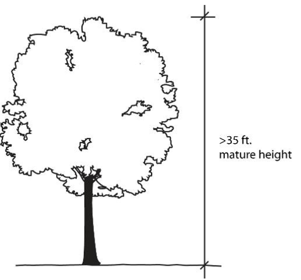
Certified Arborist
A person who is properly licensed through a combination of either a professional certification or ISA certification as a Certified Arborist. See Appendix 4 for a list of local certified Arborists.
Charitable Events
An event where proceeds, if any, will directly benefit a charitable organization that maintains a 501 (c) (3) charitable status.
Civic Organization
Any local service club, veterans' post, fraternal society, or association operated exclusively for educational or charitable purposes and the net earnings of which are devoted exclusively to charitable, educational, recreational, or social welfare purposes.
Clear Cut
Felling and removal of all trees from an area. Typically an indiscriminate removal of trees except in the case of silvicultural harvesting where tree removal is followed up with a forest replanting or regeneration effort to keep the land forested.
Cluster Plantings
A grouping of three (3) or more plants installed in close proximity to one another.
Cluster of Trees
A group of trees gathered together in their natural state.
Cluster Subdivision
A type of subdivision that permits a reduction in lot area and lot frontage provided there is no increase in the overall density of the development and where the remaining land created by the smaller lots is devoted to permanent open space, active recreation space, or the preservation of environmentally sensitive areas.
Collector Street
A street identified as a collector street on the Thoroughfare Plan, intended to move traffic from minor streets to arterial streets. The collector street is similar to a minor thoroughfare but carrying less through traffic.
Commercial Establishment
A business classified in the commercial use group, the ownership, management and physical location of which are separate and distinct from those of any other place of business located on the same lot, as partly evidenced by maintaining separate and distinct doors and access points.
Commercial Message
Any sign, wording, logo, symbol, picture, any combination, or other representation that, directly or indirectly, names, advertises or calls attention to a business, product, commodity, service, entertainment, or other commercial activity sold or offered for sale or a fee.
Comprehensive Plan
A document that links Town development policy, short- and long-range objectives and implementation strategies to a number of interdependent elements. The elements of the Comprehensive Plan are based on the present and future needs of the Town. The core elements of the Comprehensive Plan include Economic Development; Land Use; Transportation; Community Facilities; Utilities; Historic Preservation; Neighborhood Development; Parks and Recreation; and Environmental and Natural Resource Preservation. The elements of the Comprehensive Plan are to be adopted by the Planning Commission and Town Council, and are to be used as a guide for development.
Condominium
A form of property ownership in which the buildings or portions of the buildings, whether residential or non-residential in use, are owned by individuals separate from the lands which surrounds the building, said lands held in common ownership by the owners of the individual buildings.
Contiguous
Lots are contiguous when at least one boundary line of one lot touches a boundary line or lines of another lot.
Corner Lot
A lot which occupies the interior angle at the intersection of two (2) street lines which make an angle of more than forty-five (45) degrees and less than one hundred thirty-five (135) degrees with each other. The street line forming the least frontage shall be deemed the front of the lot except where the two (2) street lines are equal, in which case, the owner shall be required to specify which is the front at the time the owner is requesting a building permit.
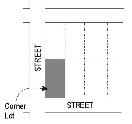
County
Union County.
Cul-De-Sac
A local street with only one outlet and having an appropriate terminus at one end for the safe and convenient reversal of traffic movement.
Cutoff Fixture
A fixture that provides shielding in some form or fashion to limit the amount of light or glare that is produced. Fixture designation would be non-shielded, semi-cutoff and full cutoff.
DBH
See "Diameter at Breast Height".
Deciduous
Plants or trees that lose their leaves annually.
Deciduous Tree
Those trees which drop all of their leaves annually, such as Ash, Sycamore, Willow, Maple, etc.
Dedication
A gift, by the owner, or a right to use of land for a specified purpose or purposes. Because a transfer of property rights is entailed, dedication must be made by written instrument, and is completed with an acceptance.
Department of Environmental Health
The Union County Department of Environmental Health.
Department of Environmental Quality
The North Carolina State Department of Environmental Quality (DEQ). Formally named the Department of Environment and Natural Resources (DENR).
Developer
A person, firm or corporation undertaking development or building on a lot, tract or parcel of land. Includes subdividers, builders and property owners.
Development
The act, process or state of erecting buildings or structures, or making improvements.
Development Permits
A permit issued by the Planning Director that authorizes the recipient to make use of property in accordance with the requirements of this ordinance.
Development Standards
See definition for the "Land Development Standards (ITLDS), Indian Trail" under 1620.120, Definitions - "L".
Diameter at Breast Height (DBH)
A measurement of the size of a tree equal to the diameter of its trunk measured 4-1/2 feet above natural grade.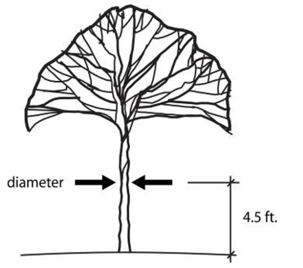
Direct Glare
The effect causing visual discomfort resulting from insufficiently shielded light sources in the field of view.
Disability, Person with
A person who has a condition of physical or mental disability that substantially limits one or more major life activities, as provided in Section 168-21 (2) of the North Carolina General Statutes.
Display Lighting
Lighting for uses such as auto dealerships, outdoor storage areas, retail establishments and outdoor displays.
District
Referring to a zoning district.
Double Frontage Lot
A parcel or property with frontage on 2 or more streets that do not intersect (also known as “through lot”).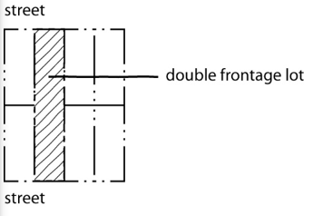
Drip Line
An imaginary vertical line extending from the outermost portion of the tree canopy to the ground.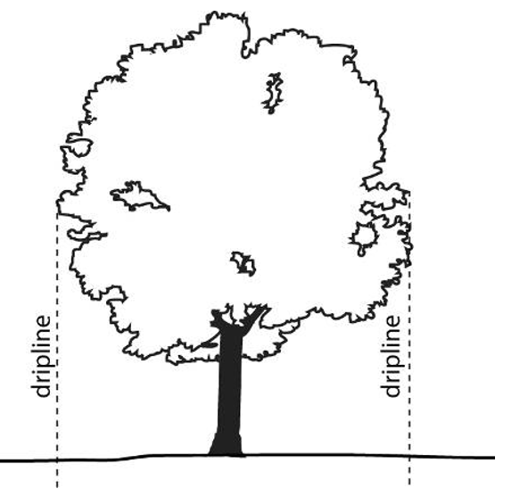
Drive-Through Facility
Any service window, automated device or other facility that provides goods or services to individuals in a motor vehicle. Includes drive-in and drive-thru type uses.
Dwelling
A building that contains one or two dwelling units used, intended or designed to be used, rented, leased, let or hired out to be occupied for living purposes. (2012 NC Building Code)
Dwelling Unit
A single unit providing complete, independent living facilities for one or more persons, including permanent provisions for living, sleeping, eating, cooking, and sanitation. (2012 NC Building Code)
Easement
A grant by the property owner to the public, a corporation, or persons of the use of that land for specific purposes.
Electronic Gaming Device or Machine
A device or machine operated electrically, electronically or mechanically as a computer that is used for internet games. Machines may use software and/or require that payment be in the form of a credit card, prepaid card, debit card, money, token or any other method of payment that will activate a machine. The customer may receive a token, sweepstake ticket, card or another item which will enable them to enter a sweepstake. A customer may also enter a sweepstake by purchasing an item related to the sweepstakes. Also referred to as electronic gaming machine or virtual gaming machine.
Electronic Gaming Operation
A business with electronic gaming device(s) or machine(s) where games of skill or dexterity are played for prizes. Electronic gaming operations may also be referred to as internet sweepstakes, electronic gaming facilities, internet cafés or other similar terms. Lotteries approved by the State of North Carolina are not considered electronic gaming operations.
Electric Vehicle (EV)An automotive-type vehicle for on-road use, such as passenger automobiles, buses, trucks, vans, neighborhood electric vehicles, electric motorcycles, and the like, primarily powered by an electric motor that draws current from a rechargeable storage battery, fuel cell, photovoltaic array, or other source of electric current. Plug-in hybrid electric vehicles (PHEV) are considered electric vehicles. Off-road, self-propelled electric vehicles, such as industrial trucks, hoists, lifts, transports, golf carts, airline ground support equipment, tractors, boats, and the like, are not included.
Electric Vehicle Charger (EV Charger)Off-board charging equipment used to charge an electric vehicle.
Electric Vehicle Charging Space (EV Space)A space intended for future installation of EV charging equipment and charging of electric vehicles.
Electric Vehicle Charging Station (EVCS)One or more electric vehicle charging spaces served by electric vehicle charger(s) or other charging equipment allowing charging of electric vehicles. Electric vehicle charging stations are not considered parking spaces.
Electric Vehicle Supply Equipment (EVSE)The conductors, including the ungrounded, grounded, and equipment grounding conductors and the electric vehicle connectors, attachment plugs, and all other fittings, devices, power outlets, or apparatus installed specifically for the purpose of transferring energy between the premises wiring and the electric vehicle.
Emergency Lighting
Lighting used by or for the purpose of Police Departments, Fire Departments, or other government entities for the purpose of public safety, and the lighting installed for safe occupant egress.
Equestrian Trails
Typically an un-paved path for horse riders that may be routed with and parallel to bike or pedestrian trails. On local streets (i.e. not arterials or thoroughfares) equestrian trails may share a road right-of-way with automobile traffic but in all circumstances such trails will be separated from the road by barriers such as fencing or landscaping. When horse trails are located away from the horse population then amenities such as hitching posts, water supply parking lots, and will be incorporated into the trail design.
Equine
Any horse, pony, donkey, burro, or mule that is 12 months of age or older. Any animal that is under 12 months of age and is the off-spring of or is un-weaned and is being nursed by a female equine lawfully kept on the property will not be subject to any of the limitations of the equestrian subdivision ordinance.
Evergreen
Plants or trees that retain their leaves throughout the year.
Evergreen Trees
Those trees which retain their leaves during dormancy, such as Pine, Juniper, Yews, Fir, etc.
Existing Light Fixture
A lighting fixture installed, or approved by the Town to be installed, pursuant to the effective date of this ordinance.
Existing Tree Canopy
Tree canopy that existed for at least two (2) years prior to development as evidenced by the Town or County aerial photography and/or satellite imagery.
Exotic/Invasive Species
An alien species that becomes established in natural or semi-natural ecosystems or habitats and threatens native plants and when such species spread they threaten biological diversity. Invasive species include English Ivy-Hedera helix, Chinese Wisteria-Wisteria sinensis, Japanese Wisteria-Wisteria floribunda, Japanese Honeysuckle-Lonicera japonica, Kudzu-Pueraria Montana.
Fence
A structure, other than a building, purposely designed for and used as a barrier to provide a boundary, means of confinement or protection, or visual screen for areas of land.
Final Subdivision Plat, Final Plat or Recorded Plat
The map of a subdivision to be recorded after approval by the Town Council or Planning Director.
Flag Lot
A lot having the required width at the building line, but having access to a dedicated street only by means of a corridor of less width. Sometimes referred to as “panhandle lots".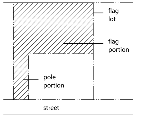
Flood Light (or Spot Light)
Any light fixture or lamp that incorporates a reflector or a refractor to concentrate the light output into a directed beam in a particular direction.
Floodplain
Any land area susceptible to being inundated by water from the base flood. As used in this ordinance, the term refers to that area designated as subject to flooding from the base flood (one hundred year flood) on the "Flood Boundary and Floodway Map" prepared by the U.S. Department of Housing and Urban Development and dated July 18, 1983, a copy of which is on file in the administrator's office.
Floodway
The channel of a river or other watercourse and the adjacent land areas that must be reserved in order to discharge the base flood without cumulatively increasing the water surface elevation more than one foot. As used in this ordinance, the term refers to that area designated as a floodway on the "Flood Boundary and Floodway Map" prepared by the U.S. Department of Housing and Urban Development and dated July 18, 1983, a copy of which is on file in the administrator's office.
Floor Area
The gross floor space within the exterior walls of a building, not including space in cellars or basements.
Food Trucks (or Mobile Food Vending Units)
The following definitions shall apply for Mobile Food Vendor Units and variations thereof:
- Commissary
A location that the Union County Health Department has deemed to be an acceptable location to safely prepare food and utensils, dispose of grease and garbage and other food prep related activities. May also be referred to as a commercial kitchen. Mobile food vending units may be stored there when not in use. - Mobile Food Vendor
Any person selling food from a mobile vehicle. - Mobile Food Vending Unit
Any motorized or nonmotorized vehicle, trailer, food truck, or other device designed to be portable and not permanently attached to the ground from which food is vended, served or offered for sale. This unit, which leaves its point of sale location, returns daily to its base of operations and is used for either the preparation or sale of food products, or for both.
Forest Management Plan
A document that defines a landowner’s forest management objectives and describes specific measures to be taken to achieve those objectives.
Footcandle (FC)
A quantitative unit measuring the amount of light cast onto a given point, measured as one lumen per square foot.
Frontage
That portion of a lot abutting a public or private street. On corner lots front yards requirements will be determined on the basis of the orientation of a building’s main entrance to the street but, for the purposes of the landscaping requirements, street tree plantings and street front landscaping applies to all property lines abutting a street.
Frontage Road
A frontage road is a local street or road that is parallel to a full or partial access controlled facility and functions to provide access to adjacent land.
Full Cutoff Fixture
An outdoor light fixture shielded or constructed in such a manner that it emits no light above the horizontal plane of the fixture.
Grade
The slope of a road, street, or other public way specified in percentage terms.
Grading or Land Disturbing
Any use of land by any person that results in a change of the natural cover or topography and that may cause or contribute to sedimentation or soil compaction.
Ground Cover
Low-growing plants or turf grass, installed to form a mostly continuous cover over the ground surface.
Height, Building
Building height shall be measured from the average elevation of the highest and lowest finished grade points (average grade) of that portion of the lot covered by the building to the highest point of the roof beams adjacent to the front of the wall in the case of a flat roof, or to the average height of the gables in the case of a pitched roof.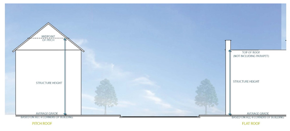
Height, Non-Building Structure
Non-building structure height (signs, fences, cell towers, flag poles, water tanks, and the like) shall be measured from the finished grade at the base of the non-building structure to the highest point of the non-building structure. When the elevation of the driveway or roadway providing access to the site varies by more than four (4) feet, the Planning Director may utilize the elevation of the driveway or roadway providing access to the site when determining height.
Heritage Tree
- A deciduous tree that is 14 inches in diameter or larger measured at 4.5 feet above grade (i.e., diameter at breast height). Deciduous trees include but are not limited to oak, hickory, elm, crepe myrtle, etc.
- An evergreen tree that is 18 inches in diameter or larger measured at 4.5 feet above grade (i.e. diameter at breast height). Evergreen trees include but are not limited to pines, cedars, etc.
- Specific tree species that shall not be considered Heritage Trees, regardless of the diameter size are as follows: Bradford Pear, Magnolia, Mimosa, Mulberry, Silver Maple and Sweet Gum.
Household
One or more persons related by blood, marriage, legal adoption or guardianship, plus not more than four (4) additional persons, all of whom live together as single housekeeping unit.
Illuminating Engineering Society
The Illuminating Engineering Society of North America, a non-profit professional organization of lighting specialists that has established recommended design standards for various lighting applications.
Impervious Surface (or Impervious Cover)
A surface that has been compacted or covered with a layer of material so that it is highly resistant to infiltration by water. It includes surfaces such as compacted sand, lime rock, or clay, as well as most conventionally paved streets, roofs, sidewalks, parking lots, and other similar improvements.
Interior Lot
A lot whose side lines do not abut upon any street.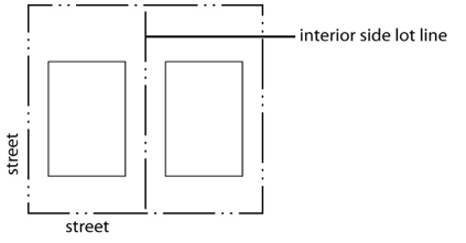
Interior Parking Lot Landscaping
Landscape located within a paved parking area planted with live plant material, such as trees, shrubs, groundcover, or turf grass.
Intermittent Stream
A stream or portion of a stream that flows only in direct response to precipitation. It receives little or no water from springs and only temporary supply from melting snows or other sources.
Intersection
The crossing of two (2) or more streets at the same elevation.
Lake or Watercourse
Any stream, river, brook, swamp, creek, run, branch, waterway, reservoir, lake, or pond, natural or impounded, in which sediment may be moved or carried in suspension and which could be damaged by accumulation of sediment and pollutants.
Land Clearing
The large scale indiscriminate removal of trees, shrubs, and undergrowth with the intention of preparing real property for non-agricultural development.
Land Development Standards (ITLDS), Indian Trail
The manual of construction standards and details prepared by the Engineering Director which regulates and controls the provisions and construction of public and private improvements relating to streets, sidewalks, drainage and other facilities.
Landlocked
A lot that does not abut any street.
Landmark
A property or structure designated as a “Landmark” by ordinance of the Town Council because it meets one or more of the national criteria for landmarks as established by the U.S. Department of Interior contained in 36 CFR 65.5 'Designation of National Historic Landmarks".
Landscape Material
Living material as trees, shrubs, ground cover/vines, turf grasses; nonliving material such as rocks, pebbles, sand, bark, mulch, brick pavers, earthen mounds (excluding pavement); and/or other decorative items such as fountains, pools, walls, fencing, and sculpture.
Landscaped Open Space
All land within the property lines not covered by building or pavement, except that paved outdoor areas used exclusively for pedestrian walkways, plazas, gathering or seating areas, or water features may be considered landscaped open space.
Landscaping
The act of or the result of preservation of natural vegetation; bringing the soil surface to a finished grade; designing the soil surface with berms, installing trees, shrubs, ground cover, grass, and other acceptable materials to soften building lines, provide shade, improve the visual appearance of property, and enhance the environment.
Large Maturing Tree
A tree whose height is greater than 60 feet at maturity and meets the specification of “American Standards for Nursery Stock” published by the American Association of Nurserymen. See also Canopy Tree.
Level of Service (LOS)
Rating conditions or criteria measuring the capacity of public facilities or service providers.
Light Pollution
Any artificial light that is emitted either directly or indirectly by reflection that alters the appearance of the night sky, interferes with astronomical observation, or interferes with the natural functioning of nocturnal native wildlife.
Light Trespass
Effects of light that stray from the intended purpose and becomes an annoyance, a nuisance, or a deterrent to visual performance. As such, light trespass should always be considered negative, unlike spill light, which can have positive or negative attributes. Light trespass is the encroachment of light causing annoyance, loss of privacy, or other nuisance.
Local Street
A local street is any link not a higher-order urban system and serves primarily as a direct access to abutting land and access to higher systems. It offers the lowest level of mobility and through-traffic is usually deliberately discouraged.
Lot
A tract, plot, portion of a subdivision or other unit of land that may be transferred in ownership or used for building development.
Lot Coverage
Impervious surface and partially impervious surface on a lot to the extent that the partially impervious surface does not allow water to infiltrate through the surface and into the subsoil.
- Considered Lot Coverage
Items that shall be added together for a lot coverage total is as follows, but not limited to: asphalt/concrete surfaces; building and shed roofs; tight-slatted patios/decks; gravel; and sidewalks; and the water surface area in an in-ground private swimming pool. - Not Considered Lot Coverage
The following do not contribute to the calculation of lot coverage: a loose slatted deck (a quarter-inch (1/4”) space between decking boards); the water area in an on-ground private swimming pool; or landscaping material that will not be compacted by the weight of a vehicle. The “landscaping material” not to be compacted by a vehicle as previously mentioned is including, but not limited to gravel, mulch, sand, and vegetation.
This lot coverage definition is derived from the definition of “built-upon area” as directed under the NC Administrative Code (NCAC) direction to use § 143-214.7. Stormwater runoff rules and programs, (b2).
Lot Depth
The average horizontal distance from the front lot line to the rear lot line.
Lot Lines
The lines bounding a lot.
Lot Line, Exterior
A lot line abutting a street.
Lot Line, Front
A lot line abutting a street on which the lot fronts. On corner lots it shall be the street side which is the smallest in length.
Lot Line, Interior
A lot line that does not abut a street.
Lot Line, Rear
A lot line that is opposite the front street line, except that in the case of uncertainty the Building Official will determine the rear lot line
Lot Line, Side
Any lot line that is not a front lot line or rear lot line. A side lot line may be an interior lot line or an exterior lot line such as on street side of a corner lot other than a front lot line.
Lot of Record
A lot described by plat or deed and recorded in the Office of the Register of Deeds of Union County, North Carolina.
Luminaire
The complete lighting system, which includes the lamp (or lamps) and the fixture.
Luminaire Pole Height
The total measurement from a paved or landscaped surface at ground level under the fixture to the further most point on top of the luminaire.
Maintained Footcandles
The level of illumination present after a typical one hundred (100) hour burn-in period. Typically less than the original “initial” footcandle level that is present at the time of the installation.
Major Street
A street classified on the Thoroughfare Plan of the Town of Indian Trail, North Carolina, as a Boulevard, Arterial Street or Collector Street.
Major Subdivision
Any subdivision that results in the creation of more than five (5) lots out of a single tract and requires the construction of new streets or street rights-of-way or improvements to existing roads; the extension of rights-of-way or easements for public water or sewer facilities; the installation of drainage improvements through one or more lots; or the installation of a private waste water treatment plant or a private water supply system for more than one lot or building site.
Major Thoroughfares (Boulevards)
Major thoroughfares consist of Interstate, other freeway and expressway links, and major streets that provide for the expeditious movement of volumes of traffic within and through urban areas. These major thoroughfares are identified as Boulevards within the Indian Trail Comprehensive Plan.
Medium Maturing Tree
A tree whose height is 30-60 feet at maturity and meets the specification of “American Standards for Nursery Stock” published by the American Association of Nurserymen.
Minor Street
A street that is not a major street and that is intended to provide access to individual properties.
Minor Thoroughfares
Minor thoroughfares are important streets in the Town system and perform the function of receiving traffic from collector and local access streets and carrying to the Major. Minor thoroughfares may be used to supplement the major thoroughfare system by facilitating a minor through-traffic movement and may also serve abutting property. These minor thoroughfares are referred to as thoroughfares within the Indian Trail Comprehensive Plan.
Mitigation of Impacts
Steps taken to correct adverse effects of proposed development to the levels or requirements established in the policy.
Mobile Home Space
A plot of ground designed for the accommodation of one mobile home within a mobile home park.
Model Home
A dwelling unit used initially for display purposes that is representative of the type of dwelling units that will be constructed in the subject subdivision.
Monoculture
A single, homogeneous culture without diversity or dissension.
Monument Banner Display Structure
A monument sign structure constructed for the purpose of displaying banner signs in conjunction with a special event, grand opening or promotional event.
Motion Sensors
A mechanism for controlling illumination by turning lights on when activated by motion, remaining on during activity for a set amount of time (typically thirty [30] minutes) following the last detection of motion.
Native Grasses
Those species of perennial grass other than those designated as noxious weeds by the State of North Carolina Department of Agriculture.
Native Species
Refers to a tree species whose geographic range during pre-colonial times included the Piedmont of North Carolina.
Net Land Area
The total land area of the development site excluding any land required for street right-of-way, flood ways, stormwater detention ponds or ponds used for on-site, waste water treatment or the recycling or land area for any publicly dedicated improvements.
Nonconforming Lot
A tract of land lawfully established on a duly recorded subdivision plat, or by a duly recorded deed, or by other lawful means that does not comply with the minimum lot area or lot width standards of the zoning district in which it is located. In order to be deemed “nonconforming,” a lot must have complied with all applicable lot area and width standards in effect at the time of the lot’s establishment.
Nonconforming Sign
A sign that was lawfully established, in accordance with zoning and other sign regulations in effect at the time of its establishment but that is no longer allowed by the regulations of this ordinance.
Nonconforming Structure
A building or structure that was lawfully established in accordance with building setback, height, floor area and building coverage regulations in effect at the time of its establishment but that no longer complies with the building setback, height, floor area and coverage regulations of the zoning district in which it is now located.
Nonconforming Use
A use that was lawfully established in accordance with zoning regulations and occupational licensing regulations in effect at the time of its establishment but that is no longer allowed by the use regulations of the zoning district in which it is now located.
Nonconformity
Any nonconforming lot, nonconforming sign, nonconforming structure or nonconforming use.
Nonessential Lighting
Means lighting that is not necessary for an intended purpose after the purpose has been served. For example, lighting for a business sign, architectural accent lighting and parking lot lighting, is considered essential during business or activity hours, but is considered nonessential once the hours of operation have ended.
Non-Profit Events
Are sponsored by an organization that is incorporated or otherwise organized as a non-profit organization and where the proceeds, if any, will directly benefit either a charitable or non-profit organization.
Not-For-Profit Event
A not-for-profit event is any event that is requested by, or held for, a recognized non-profit organization or other charitable organization, with at least 51% of the revenue derived from the event intended for a not-for-profit entity or for its programs.
Open Space
An area of land or water permanently set aside for public or private use which is open and unobstructed including areas maintained in a natural or undisturbed character or areas improved for active or passive recreation. Open space may be used as community open space or preserved as green space.
Open Space, Common
A lot or parcel of open space within a development site (i.e., major/minor subdivisions) designed and intended for the use and enjoyment of residents of the development or for the general public, not including streets or off-street parking area.
Open Space Subdivisions
A type of subdivision that permits a reduction in lot area and lot frontage where such reductions allow up to a 10% increase in the overall density of the development and where the remaining land created by the smaller lots is devoted to permanent open space, active recreation space, or the preservation of environmentally sensitive areas, farmlands or forestlands.
Open Space, Usable
An area contained within common open space that is designed and accessible for outdoor recreation, pedestrian access, and landscaping but excluding any area occupied by any substantial structure; a street right-of-way, or a roadway, parking area, sidewalk, or waste disposal field. At most, one-third of the useable open space can be located in a hundred year flood plain or within the surface area of a lake, pond, or other body of water, and is only one-fourth of the open space that can be located within any utility easements. In addition, usable open space shall count as one-half (50%) of all set aside common open space and shall include sidewalks, bicycle trails and facilities, natural trails parking areas, and crosswalks across roadways that happen to go through the said usable open space (i.e., for ingress and egress).
Open Storage
The storing, accumulation and distribution of materials, goods, equipment, fleet vehicles, etc., for more than 24 hours for any use or sale, within any uncovered area whether enclosed by a fence, etc., or not. For this ordinance, open storage uses shall not include open storage areas defined under RV storage and Towing.
Ornamental Trees
Low-growing trees, including those species of trees that reach a height between 15 to 30 feet. Sometimes referred to as “understory” trees.
Outdoor Lighting
Any outdoor artificial lighting device, fixture, lamp, or other similar device, whether permanently installed or portable, which is intended to provide illumination for either visibility or decorative effect. Such devices shall include, but not be limited to, area, search, spot, and flood lighting used for: buildings and structures, recreational facilities, parking lots, landscape lighting, business and advertising signs, roadways, walkways, etc.
Outdoor Vending Machine
Any self-contained or connected appliance, machine, and/or storage container located outside or in a non-enclosed space that dispenses or provides storage of a product or service. Newspaper racks, phones, and automatic teller machines are not considered or regulated as vending machines.
Pad Site Development
Separate lots or parcels encompassed by, or contained within a shopping center, office park or business park that are physically separated from the main shopping center building or buildings, with their egress points located from within the shopping center, office park or business park, and having no direct access to adjoining public streets.
Parcel
A lot, tract or other division of land.
Parking, DwellingFormally known as the “driveway” in this ordinance, this is where the parking spaces are provided in the front, side or rear of a residential structure or unit. The term is established to help clarify terminology for residential personal parking spaces and standards for actual travel driveways leading to a residential structure from the property line, along an easement, etc.
Parking Lot
An unenclosed area for the use and storage of motor vehicles including parking spaces, parking lot driving aisles, vehicle storage and queuing areas, and off-street loading areas. For the purposes of the parking lot landscaping requirements of this UDO, the queuing areas of drive-through businesses and outdoor service areas of gasoline stations will be counted as part of the parking lot area.
Parking Lot Perimeter
The planted area outside the perimeter of the paved area of a parking lot, measured from the edge of the parking lot outwards.
Parking Lot Plantings
Plantings areas within and adjacent to parking areas designed to shade and improve the attractiveness of large areas of pavement.
Parking, Non-AccessoryParking that is not provided to comply with minimum off-street parking requirements and that is not provided exclusively to serve occupants of or a visitor to a particular use, but rather is available to the public at-large. A facility that provides both accessory parking and non-accessory parking is classified as non-accessory parking.
Parks, Arts, Recreating, and Culture Advisory Committee
A council-appointed committee that consists of nine (9) members assisting in the planning, development and management of all future parks, recreation, greenway systems.
Pasture
An enclosed area, typically fenced, with natural cover or planted with forage for horses or other permitted animals. This area will be distinct from any corral area, riding trail, or required residential yard.
Photocells
Mean a mechanism that is activated by the non-presence of sunlight and has the effect of illuminating a property all night. Photocells are permitted only at primary entrances (unless mounted to a building wall) and where the light source is fully shielded by opaque material.
Plan
Any documented and approved program of recommended action, policy, intentions, etc., which sets forth goals and objectives along with criteria, standards, and implementing procedures necessary for effectively guiding and controlling decisions relative to facilitating development and growth management. The Plan is sometimes referred to as "The Land Development Plan".
Planting Strip
A ground surface located outside of any public right-of-way that is free of impervious cover and/or paved material and is reserved for landscaping purposes.
Planting Yard
A planting yard is a strip of land (of various widths) provided along the perimeter of a site for the installation of plant material in a combination of canopy trees, and/or understory trees and shrubs.
Plat
A map, plan, chart or drawing indicating the subdivision or re-subdivision of land filed or intended to be filed for record, and meeting the requirements of G.S. 47-30 as amended.
PM Peak Hour
The hours between 4:00 p.m. and 6:00 p.m. during the weekdays, Monday through and including Friday, at which the average traffic volume is highest.
Preliminary Consultations
A meeting with either the Planning Staff and/or the Town’s consulting engineer, prior to submittal of a subdivision plat or site plan, to determine preliminary requirements and development criteria required by the Town.
Principal Building
A building or buildings in which the principal use or uses of the premises is contained, housed, or situated.
Private Driveway
A roadway serving two (2) or fewer lots, building sites, or other division of land and not intended to be public ingress or egress.
Property Lines
The lines bounding a lot.
Protective Fencing
A physical and visual barrier installed around the critical root zone of a tree to prevent damage to the tree and its root system. At a minimum this would include four (4) foot tall orange safety fencing.
Pruning
The cutting off or removal of dead or living parts of a tree or shrub. See ANSI standards for recommended pruning practices.
Public Sewer System
The Union County Sewer System.
Public Street
Dedicated and accepted by North Carolina Department of Transportation or the Town of Indian Trail for future maintenance.
Public Water System
The Union County Water System.
**RESERVED**
Recreation Vehicles (RV) - Motorized and Non-Motorized
A motorized or non-motorized vehicle designed or used as temporary living quarters for recreation, camping or travel. The following are examples of motorized and non-motorized vehicles:
- Motorized RV Examples (See Table 1600-1)
- Class A
Built on motorhome chassis with living quarters and driving compartment built as one shell. - Class B
A van converted for RV use including bathroom, kitchen and sleeping area. - Class C
Living quarters built by RV manufacturer on a van or truck chassis with original front cab. - Bus Conversion
New or used commercial or school bus converted for RV living. - Camper Van
A cargo or passenger van converted for RV use by a professional or do-it-yourself project. May or may not have all the amenities as a Class B RV.
- Class A
Table 1600-1: Motorized RVs
| Class A |  |
| Class B |  |
| Class C |  |
| Bus Conversion |  |
| Camper Van |  |
- Non-Motorized RV Examples (See Table 1600-2)
- Fifth Wheel (Fiver)
A trailer that connects to a hitch in a truck's bed. This is typically much larger than the other trailer types. - Travel TrailerRV trailer that connects to a large or small vehicle depending on the range of sizes that are available.
- Hybrid TrailerThis trailer has beds that pop-out similar to the pop-up/tent camper but large spaces like the Fifth Wheel and Travel Trailer above.
- Pop-Up/Tent CamperA camper with a roof that raises up and beds that slide out to provide more interior space. The camper folds down for travel and storage.
- Truck CamperThis camper is designed to slide into the bed of a pickup trick to create a motorized RV. Sizes are from small to large units that can be similar to or larger than a Class C motorized RV.
- Teardrop CamperAn ultralight, teardrop shaped travel trailer typically only holding a bed. The exterior may have a compartment that opens into a small kitchenette.
- Fifth Wheel (Fiver)
Table 1600-2: Non-Motorized RVs
| Fifth Wheel (Fiver) |  |
| Travel Trailer |  |
| Hybrid Trailer |  |
| Pop-Up / Tent Camper |  |
| Truck Camper |  |
| Teardrop Camper |  |
Recreational Vehicle Space
An area of ground within a recreational vehicle park designated for the temporary accommodations of one recreational vehicle.
Reserve Strip
A strip of land (usually only a few feet wide) owned privately, and set aside around a subdivision in order to prevent access to adjacent property by way of subdivision streets.
Right-of-Way
Land opened, reserved or dedicated for a street, walk, drainage way or other public purposes. Street right-of-way shall mean any public right-of-way set aside for public travel which has been accepted for maintenance by the State of North Carolina or the Town of Indian Trail or Union County, if so authorized, or has been dedicated for public travel by the recording of a plat or a subdivision which has been approved or is subsequently approved by the Town of Indian Trail, or has otherwise been established as a public street prior to the adoption of this ordinance.
Screening (Visual)
A method by which a view of one site from another adjacent site is shielded, concealed, or hidden. Screening techniques include fences, walls, hedges, tree rows, berms, or other features.
Security Lighting
Means a light used either commercially or residentially for protection of goods or property and is designed and used to discourage crime and undesirable activity.
Semi Cutoff Fixture
An outdoor light fixture shielded or constructed in such a manner that it emits no more than 5% of its light above the horizontal plane of the fixture, and no more than 20% of its light ten (10) degrees below the horizontal plane of the fixture.
Setback
An open, unobstructed area that is required by this ordinance to be provided from the furthermost projection of a structure to the lot line of the lot on which the building is located. If the area to be set back is affronting or abutting a public and/or private street, then the area to be measured shall be from the ultimate right-of-way, except as may be otherwise indicated for the street in question in a recorded plat map, tract map, or a specific plan that has been adopted by the Town. Such measurement shall conform to the definition of ultimate right-of-way as indicated in this Section of this ordinance.
Setback, Exterior
A setback from a street which shall be measured, except where may be indicated by a specific recorded plat map, tract map, or a specific plan that has been adopted by the Town, from the ultimate right-of-way as indicated in this Section of this ordinance.
Setback, Front
A setback between a building and the front lot line of the lot on which the building is located, extending along the full length of the front lot line between the side lot lines. If the setback abuts or affronts a public and/or private street, then the setback shall be measured from the ultimate right-of-way of the street to the building itself. Such a measurement shall use the Definition of ultimate right-of-way as indicated in this Section of this Ordinance.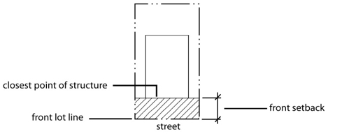
Setback, Interior
A setback from an interior (non-street) lot line. Such setbacks need not utilize the ultimate right-of-way definition provided in this Section of this Ordinance unless the setback abuts a public and/or private street.
Setback, Street Side
A setback from a street lot line on a corner lot. Such setbacks need not utilize the ultimate right-of-way definition in this Section of this Ordinance unless the setback abuts a public and/or private street.
Shielding
A design feature or a device that is applied to a luminaire to prevent its luminous output from being visible from selected locations or horizontal and/or vertical angles.
Shopping Center
A group of two (2) or more commercial or office uses designed as one unified entity under single ownership or control consisting of one or several buildings either attached or detached.
Short-Term Loan Service
Any business that loans money on a short-term basis to members of the general public as an element of its operation, including businesses offering title loans, payday loans, signature loans and small loans under North Carolina General Statutes, and other similar businesses. This does not include banks, savings and loan associations or credit unions licensed by appropriate State and Federal agencies, or a retail credit financing institution that is licensed under North Carolina General Statutes, or pawn brokers governed by North Carolina General Statutes.
Shrubs
Any self-supporting, woody plant of a species which normally grows to an overall height of less than 15 feet in the region.
Sight Triangle
The triangular area formed by a diagonal line connecting two points located on intersecting right-of-way lines, or a right-of-way line and the curb or edge of pavement or a private street or driveway, each point being 35 feet from the intersection, and the two intersecting right-of-way lines (or right-of-way line and curb cut).
Sign
Any object, display, or structure, or part thereof, situated outdoors, which is used to advertise, identify, display, direct, or attract attention to an object, person, institution, organization, business, product, service, event, or location by any means, including words, letters, figures, design, symbols, fixtures, colors, illumination, or projected images. The term “sign” does not include the flag or emblem of any nation, organization of nations, state, political subdivision thereof, or any fraternal, religious or civic organization; works of art which in no way identify a product or business; scoreboards located on athletic fields; or religious symbols.
Sign, Advertising
A sign, other than directional sign, which directs attention to or communicates information about a business, commodity, service, or event that exists or is conducted, sold, offered, maintained, or provided at a location other than the premises where the sign is located. Any advertising sign allowed under this Ordinance may display either a commercial or noncommercial copy.
Sign, Airborne
Any sign, including any moored blimp, gas balloon, or other inflatable element, whether or not intended to move in the wind, which is designed to inform or attract the attention of persons not on the premises on which it is located.
Sign, Animated
A sign with action, motion or color changes, including wind-activated devices, video screens, and including intermittent or sudden changes of light intensity, but not including signs defined as changeable copy signs or electronic message center signs.
Sign, Banner
A sign made of non-rigid material, possessing some characters or ornamentation, intended to be hung either with or without an enclosing framework, but not a flag or pennant.
Sign, Billboard
A permanently constructed sign structure composed of one or more large surfaces for permanent or changeable messages supported by one or more vertical posts and generally used for off-premises advertising.
Sign, Bulletin Board
A sign used to announce meetings or programs to be held on the premises of a church, school, auditorium, library, museum, community recreation center or similar noncommercial place or public assembly.
Sign, Campaign or Election, Political
A sign that advertises a candidate or issue to be voted on a definite Election Day.
Sign, Canopy or Awning
A sign attached to or painted or printed onto a canopy or awning. For the purposes of the Ordinance, the permitted size of a canopy or awning will be calculated on the basis of the size of the building wall to which the canopy is attached. It will, for measuring purposes, be considered a wall sign.
Sign, Changeable Copy
A sign designed so the copy can be changed while the display surface remains unchanged; includes such signs as manually or electronically changed reader boards and fuel price displays. Electronically changed reader boards do not include rapid changes in light intensity or blinking features. Light Emitting Diodes (LED) changeable copy signs may only be a Static Message Board with change in message limited to ten (10) minute intervals.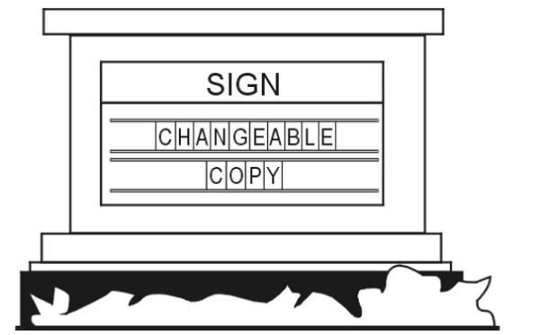
Sign, Construction
A sign placed at a construction site identifying or announcing the project or the name of the architect, engineer, financier, or others involved in the development of the project.
Sign, Directional
Any sign that provides on-site directional assistance for the convenience of the public, an on-site sign indicating the location exits, entrances, or parking.
Sign, Directory
A sign on which the names and locations of occupants or the use of a building or property is identified.
Sign, Electronic Message Center
A sign or component of a sign that uses changing lights of a single color to form a message or series of messages that are electronically programmed or modified by electronic processes.
Sign, Flashing
A sign that uses an intermittent or flashing light source or windblown and/or mechanical moved reflective material to attract attention.
Sign, Free-Standing
Any sign that is not affixed to a building and is securely and permanently mounted in the ground. Such sign may include a ground, pole, or monument sign.
Sign, Government
Any temporary or permanent sign erected and maintained for any government purposes other than signs placed on the premises of a publicly owned building, structure or other land use, designed to identify to the public such land use. Examples of government signs include speed limit signs, town limit signs, street name signs, and traffic signs. Conversely, a sign placed on a public building such as library, school, or public safety building which identifies said building, shall not be considered a government sign.
Sign, Ground Mounted
Any sign not attached to a building which extends from the ground or which has supports which places the bottom of the sign permanently mounted less than three (3) feet from the ground directed beneath the sign.
Sign, Identification
A sign which displays only the name, address, and/or crest, or insignia, trademark, occupation or profession of an occupant or the name of any building on the premises.
Sign, Incidental
A sign used in conjunction with equipment or functional elements for a use or operation. These shall include, but not limited to drive through window menu boards and signs on automatic teller machines, gas pumps, vending machines, or newspaper delivery boxes.
Sign, Instructional
An on-premises sign designed to guide vehicular and/or pedestrian traffic by using such words as “Entrance”, “Exit”, “Parking”, “One-Way”, or similar directional instruction, but not including any advertising message. The name or logo of the business or use to which the sign is giving direction may also be included on the sign.
Sign, Lighted
A sign illuminated only by light cast upon the sign from an external light source.
Sign, Logo
A sign used on limited access highways to direct motorists to nearby businesses and services.
Sign, Luminous
A sign internally lighted through the use of phosphorescent or luminescent paint or materials.
Sign, Monument
A nonmetallic sign in which the bottom of the sign is flush with the ground and the vertical dimension is greater than the horizontal dimension.
Sign, Nonconforming
A sign that, on the effective date of this ordinance, does not conform to one or more or the regulations set forth in this ordinance, particularly those contained in this Chapter.
Sign, Off-Premises
A sign that draws attention to or communicates information about a business, service, commodity, that exists or is conducted, sold, offered, maintained or provided at a location other than the premises where the sign is located.
Sign, On-Premises
A sign that draws attention to or communicates information about a business, service, commodity, accommodation, attraction, or other enterprise or activity that exists or is conducted, sold, offered, maintained or provided on the premises where the sign is located.
Sign, Pennant
Any lightweight material, whether or not containing a message or any kind, suspended from a rope, wire, string, or pole, usually in a series designed to move in the wind.
Sign, Pole
A sign whose face is suspended from a support arm at a right angle from a ground mounted pier, pillar, column, or pole. The face of such sign shall not be more than three (3) feet from the ground.
Sign, Portable
Any sign not permanently attached to the ground or other permanent structure, including those signs which may be transported to the site on wheels or a truck; signs constructed or as converted to an A-frame or sandwich board, T-frame sign; or umbrellas used for advertising purposes. Such sign, whether or not bolted to the ground, shall nonetheless be deemed to be a “portable sign”.
Sign, Projecting
Any sign other than a wall, awning, canopy, or marquee sign, which is affixed to a building and is supported only by the wall on which the sign is mounted.
Sign, Public Interest
A sign on private property that displays information pertinent to the safety or legal responsibilities of the general public such as “Warning” and “No Trespassing” signs.
Sign, Real Estate
Signs that are used to offer for sale, lease, or rent the premises upon which such sign is placed.
Sign, Roof
A sign erected or maintained in whole or in part upon or over the roof or parapet of a building.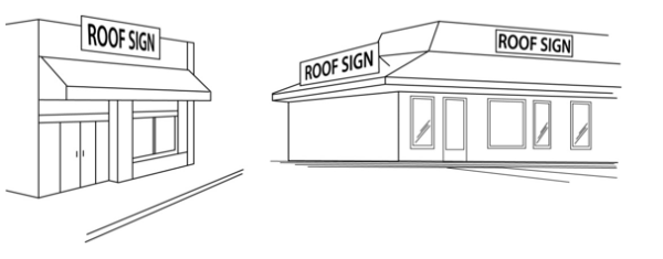
Sign, Sandwich Board
A portable A-frame sign constructed with two faces, which rest at an angle less than 45 degrees to each other.
Sign, Subdivision or Neighborhood Identification
A sign containing only the name of the subdivision or neighborhood in which the sign is located.
Sign, Temporary
A sign that is not permanently installed in the ground or affixed to any structure or building, and that is designed for short-term use or is used in connection with a special event expected to take place or be completed within a period of time as permitted in this chapter.
Sign, V-Shaped
Any sign which has two (2) faces that are not parallel, (not to include sandwich signs and "A" frame signs). A "V" shaped sign shall not have an included angle of not more than 45 degrees. Sign area shall be calculated by measuring a single face.
Sign, Vehicle
A motor vehicle or trailer containing a commercial message and regularly parked on the exterior side of any business and not customarily used in the operation of the business.
Sign, Wall
Any sign directly attached to an exterior wall of a building or dependent upon a building for its support with its exposed face parallel or approximately parallel to the plane of the building or structure on which it is placed. Signs directly painted on walls shall be considered wall signs.
Sign, Wind-Blown
A sign consisting of balloons, pennants or objects designed and fashioned in such a manner as to move when subjected to wind pressure.
Site Plan
A drawing that shows all of the existing conditions of a specific area (the site) and all of the improvements and changes proposed to be made on the site. A site plan is the drawing required by the ordinance for certain new developments and certain additions and must contain all applicable information as specified in this.
Sleeping Unit
A room or space in which people sleep, which can also include permanent provisions for living, eating, and either sanitation or kitchen facilities but not both. Such rooms and spaces that are also part of a dwelling unit are not sleeping units. (2012 NC Building Code)
Small Maturing Tree
A tree whose height is less than 30 feet at maturity and meets the specifications of “American Standards for Nursery Stock” published by the American Association of Nurserymen.
Small Wind Energy System
A wind energy conversion system consisting of a wind turbine, a tower, and associated control or conversion electronics that has a maximum power of no more than 50kW and that is used primarily to reduce on-site consumption of utility power.
Specified Anatomical Areas
Less than completely and opaquely covered human genitals, pubic region, buttock, or female breast below a point immediately above the top of the areola; or human male genitals in a discernibly turgid state, even if completely and opaquely covered.
Specified Sexual Activities
Any of the following:
- human genitals in a state of sexual stimulation, arousal, or tumescence; or
- the fondling or other erotic touching of human genitals, pubic region, buttocks, anus, or female breasts; or
- sex acts, normal or perverted, actual or simulated, including intercourse, oral copulation or sodomy; or
- masturbation, actual or simulated; or
- masochism, erotic or sexually oriented torture, beating or the infliction of pain; or
- erotic or lewd touching, fondling, or other contact with an animal by a human being; or human excretion, urination, menstruation, vaginal or anal irrigation.
Stable, Private
A detached accessory building that has a roof and one or more sides that is used to house and shelter an equine or equines owned by the occupants of the premises or subdivision and not kept for remuneration, hire, or sale.
Stable, Public
A stable other than a private stable.
Stand
A group of trees of sufficiently uniform and/or complimentary species composition, age, and condition that they may be considered homogenous unit for management purposes.
Street
A public right-of-way that affords the principal means of vehicular access to abutting property.
Street Link
The segment of street between intersecting streets that have traffic control devices that interrupt traffic flow.
Street Tree
A tree planted within or adjacent to a public right-of-way as required by the town.
Street Tree Planting
The planted area within the front setback adjacent to a public or private street.
Street Width
The measured width of a street from edge of usable pavement to edge of usable pavement.
Structural Adequacy
A determination by the Town that the pavement cross section (or bridge design) is of sufficient depth and design to carry the increased traffic volume generated by the proposed development, including the heavy construction vehicles which will be present, without causing undue failure of the infrastructure.
Structure
Anything constructed or erected that requires location on the ground or is attached to something having a location on the ground, including but not limited to signs, but not including excepting pavement, utility poles, fences, and retaining walls.
Subdivider
Any person, firm, or corporation who subdivides or develops any land deemed to be a subdivision as herein defined.
Subdivision, Minor
Is a subdivision of land that does not involve any of the following:
- The creation of more than a total of five lots since 1978;
- The creation of any new public streets or street right-of-ways;
- The extension of water and sewer system facilities operated by the Union County Public Works Department;
- The installation of drainage improvements through one or more lots to serve one or more other lots;
- The installation of a private waste water plant or a private water supply system for more than one lot or building site.
Subdivision Plat
The final map or drawing, described in this ordinance, on which the developer’s plan of subdivision is presented for approval and that, if approved, is to be submitted to the County Recorder of Deeds for filing.
Sustainable
Capable of being continued with minimal negative long-term effects on the environment, the economy, and on residents’ quality of life.
Swale
A depression in the ground or a wide shallow ditch, usually grassed.
Swimming Pool, PrivateThis term shall mean any structure containing water used, or intended to be used, for swimming, recreational water games/sports, or recreational bathing/relaxation which is available in single-family detached residential districts only to the family and guests of the householder. Private swimming pools include in-ground swimming pools, and on-ground swimming pools, hot tubs and spas.
Swimming Pool, PublicThis pool is any swimming pool other than a private swimming pool.
Technical Review Committee
A committee of staff established to review technical aspects of subdivision proposals.
Temporary Portable Storage Container
A purpose-built, fully enclosed, box-like container that is designed for temporary storage of household goods and/or equipment. Such containers are uniquely designed for ease of loading to and from a transport vehicle.
Terminus Intersections
The intersection of the final connecting street, being evaluated for adequacy, with the street previously determined or considered adequate.
Threshold DVH (Design Hour Volume)
Maximum allowable design hourly volume (DHV) permitted of a given street link or intersection based on prevailing conditions.
Through Lot (Double Frontage)
A lot which fronts upon two parallel streets, and/or which fronts upon two streets which do not intersect at the boundaries of the lot.
Topping
The inappropriate removal or cutting back of major portions of a tree by any pruning practice resulting in more than 25% of the foliage and limbs being removed. This includes any pruning that leads to disfigurement of the normal shape of the tree. Topping is also referred to as “heading”, “stubbing” or “dehorning”.
Total Land Area
The land area equal to the developable area plus any on-site, open space or area devoted to stormwater detention or waste water treatment, but excludes all floodways from its calculations. Floodways may not be included into the calculations for density or total land area under any circumstances.
Tow Lot
The use of a site for temporary storage of motor vehicles for a period of not more than 30 days, not including temporary storage facilities for vehicles that are to be sold, rented, salvaged, dismantled, or repaired.
Town Recognized Event
A Town-recognized event is one that is in part or wholly sponsored by the Town, recognized by the Town, or proclaimed as a Town-recognized event by the Town Council. Such events shall include only those events listed on the Town recognized Event List as maintained by the Town Clerk. The Town-recognized Event List may be amended as need by the Town Council.
Tree Advisory Committee
A council-appointed committee that consists of seven (7) members from the Town of Indian Trail Planning and Zoning Board assisting in the planning and management of the Indian Trail community forest and the administration of the Tree Preservation and Protection and Landscaping Ordinances.
Tree Protection Zone or Critical Root Protection Zone
The critical root and tree protection zone is defined as the critical area above and below ground with a radius equivalent to the greater of the drip line, six feet, or a distance of 1.5 feet for every inch of trunk diameter as measured at breast height.
Tree Save Area
One or more areas of a site which includes existing trees and their tree protection zone. The purpose of a tree save area is to encourage the preservation of healthy clusters of trees or heritage trees.
Trees
Any self-supporting, woody plant of a species that normally grows to an overall minimum height of 15 feet in the region.
Trip Distribution
The method of assigning trips to street network based on projected travel origins and destinations.
Trip Generation
An analytical process that provides the relationship between land use and vehicle trip production. A one-way movement.
Turf Grass
A species of perennial grass grown as permanent lawns or for landscape purposes as distinguished from those species grown for agricultural or commercial seed purposes.
Typical Uses
See "Uses, Typical" for definition.
Ultimate Right-of-Way
The right-of-way shown as ultimate on an adopted Thoroughfare Plan, Comprehensive Plan, or the street rights-of-way shown within the boundary of a recorded tract map or other recorded parcel map. The latest adopted or recorded document in the above cases shall take precedence. If none of these exist, the ultimate right-of-way shall be considered the right-of-way required by the highway classification as shown on the Indian Trail Comprehensive Plan, Thoroughfare Plan, or by NCDOT standards. In all other instances, the ultimate right-of-way shall be considered to be the existing right-of-way, in the case of a private street, and the existing right-of-way, in the case of a public street, unless otherwise dedicated to NCDOT as existing or future right-of-way. All setbacks are to be measured from this right-of-way, unless otherwise indicated by NCDOT, the Indian Trail Thoroughfare Plan, the Indian Trail Comprehensive Plan, or other adopted or recorded plans or plats.
Up-Lighting
Lighting that is directed and aimed in such a manner as to shine light rays above the horizontal plane, such as the lighting of a building façade, church steeple, foliage, flagpole or sign.
Urban Forest
Trees or plants in the town.
Use
An activity carried on in a building, structure, or tract of land, including accessory uses that are subordinate in area, extent, and purpose to the principal use and that are customary adjuncts to the principal use.
Use Categories
Each use group is further divided into more specific “use categories.” use categories classify land uses and activities based on common functional, product, or physical characteristics. Characteristics include the type and amount of activity, the type of customers or residents, how goods or services are sold or delivered and site conditions.
Use Groups
This ordinance classifies land uses into 5 major groupings: “residential,” “public and civic,” “commercial,” “industrial” and “other.” These are referred to as “use groups.”
Uses, Typical
Typical uses cited in the description of use categories are not intended to be exclusive or restrictive.
Variance, Zoning
Relief from or variation of the zoning-related provisions of this ordinance, other than use regulations. Variances are requested through the Town Planning and Zoning Board in a quasi-judicial proceeding. See Chapter 380 Appeals and Variances for appeal requirements.
Vehicle, Commercial
Commercial vehicles are defined as Light, Medium or Large as follows:
- Light
Any vehicle designed or used for business purposes that has a gross vehicle weight rating (GVWR) of less than ten thousand (10,000) pounds and a cargo area/work platform (including any installed accessories such as ladder racks, cranes, compressors, hose reels, welders, etc.) that does not exceed the height of the cab of the vehicle. Cargo area/work platforms separate from the cab shall not exceed nine (9) feet in length (not to include step bumpers less than eighteen (18) inches in length). A pickup truck, sport utility vehicle, van, or similar vehicle may be considered a passenger vehicle if it is less than ten thousand (10,000) pounds gross vehicle weight rating (GVWR) and has only the original "showroom stock" body/bed. A camper shell, toolbox within the bed, or similar accessory equipment will not disqualify the vehicle as a passenger vehicle. - Medium
Any vehicle designed or used for business purposes that has a GVWR of less than fourteen thousand (14,000) pounds and does not exceed nine and one-half (9.5) feet in height (including any installed accessories such as ladder racks, cranes, compressors, hose reels, welders, etc.). Cargo area/work platform shall not exceed nine (9) feet in length (not to include step bumpers less than eighteen (18) inches in length). Also, any removal of the bed of the truck for commercial enhancements will be considered a large commercial vehicle or any improvement to a vehicle which primary purpose is not for the transportation of people. - Large
Any vehicle designed or used for business purposes that has a GVWR of fourteen thousand (14,000) pounds or more. Large commercial vehicles also include commercial vehicles with a GVWR of less than fourteen thousand (14,000) pounds if the height of the vehicle exceeds nine and one-half (9.5) feet (including any installed accessories such as ladder racks, cranes, compressors, hose reels, welders, etc.), or the length of the cargo area/work platform exceeds nine (9) feet (not to include step bumpers less than eighteen (18) inches in length).
Vertical Sight Distance
The length of street ahead of an object in the street, of specified height, visible to the driver while traversing a vertical curve.
Visibility or Sight Triangle
A triangular-shaped portion of land established at street and driveway intersections in which nothing is erected, placed, planted or allowed to grow in such a manner as to limit or obstruct the sight distance of motorists entering or exiting an intersection of streets or of a street and driveway. See figure below:
Wallpack Fixture
A lighting unit typically surface mounted to a vertical exterior building wall.
**RESERVED**
Yard, Front
The actual yard that exists across the full width of the lot from the front lot line to the building line. See also “setback.”
Yard, Rear
The actual yard that exists across the full width of the lot between the rear lot line and the rear line of the principal building. See also “setback.”
Yard, Side
The actual yard that exists between the principal building and the adjacent side lot line extending entirely from the front lot line to the rear lot line. See also “setback.”
Zero-Lot Line Development
A development that complies with the zero lot line regulations of this ordinance or the zero lot regulations in effect at the time the development was established.
1630.020 Use Categories
1630.030 Typical Uses
1630.040 Determination Of Most Similar Use Category
1630.050 Residential Use Group
1630.060 Household Living Category
1630.070 Public And Civic Use Group
1630.080 Use Groups And Categories
1630.090 Industrial Use Group
1630.100 Other Use Group
This ordinance classifies land uses into 5 major groupings: “residential,” “public and civic,” “commercial,” “industrial” and “other.” These are referred to as “use groups.”
Each use group is further divided into more specific “use categories.” use categories classify land uses and activities based on common functional, product, or physical characteristics. Characteristics include the type and amount of activity, the type of customers or residents, how goods or services are sold or delivered and site conditions.
Typical uses cited in the description of use categories are not intended to be exclusive or restrictive.
When a specific use type cannot be readily classified into a use category or appears to fit into two or more use categories, the Community Development Director is authorized to determine the most similar, thus most appropriate, use category based on the following considerations:
- The actual or projected characteristics of the activity in relationship to the stated characteristics of each use type;
- The relative amount of site area or floor space and equipment devoted to the activity;
- Relative amounts of sales from each activity;
- The customer type for each activity;
- The relative number of employees in each activity;
- Hours of operation;
- Building and site arrangement;
- Vehicles used with the activity;
- The relative number of vehicle trips generated by the use;
- Signs;
- How the use advertises itself; and
- Whether the activity is likely to be found independent of the other activities on the site.
The residential use group includes uses that provide living accommodations to one or more persons. The group includes two use categories: group living and household living.
- Group Living
Residential occupancy of a dwelling by other than a “household,” typically providing communal kitchen/dining facilities. Examples of group living uses include but are not limited to fraternities, sororities, convents, monasteries, nursing homes and the following specific use types:
- Group Home
A single dwelling occupied on a permanent basis by a group of unrelated persons. Group homes may also be occupied by paid staff and caregivers.
- Type 1: Family Home (Small) Means a home with support and supervisory personnel that provide room and board, personal care and habilitation services in a family environment for no more than six resident persons with disabilities.
- Type 2: Family Home (Large) Means a home with support and supervisory personnel that provide room and board, personal care and habilitation services in a family environment for more than six resident persons with disabilities.
- Nursing Home A residence which provides lodging, meals, nursing and other personal services for those who are unable to care for themselves or otherwise requires assistance for certain essential functions.
- Senior Housing A residential complex containing multifamily dwelling designed for and principally occupied by senior citizens. Such facilities may or may not include a common dining area but such facilities do not include institutional care such typically associated with nursing homes or senior life-care centers.
- Boarding House
A building, other than a hotel or motel, where lodging or individual rooms, or both are provided for compensation, whether directly or indirectly, to more than four (4) unrelated persons for periods in excess of 30 days.
- Group Home
A single dwelling occupied on a permanent basis by a group of unrelated persons. Group homes may also be occupied by paid staff and caregivers.
Residential occupancy of a dwelling unit by a household with tenancy arranged on a monthly or longer basis and arranged through short-term rentals. Household living occurs in the following types and uses of residential buildings:
- Detached House A building containing one dwelling unit located on a single lot with private yards on all sides.
- Zero Lot Line House A building containing one dwelling unit located on a single lot. The building is shifted to one side of the lot so that there is a more usable side yard on one side of the house and very little or no private yard on the other side.
- Attached House A building containing multiple dwelling units, each located on its own lot with a common or abutting wall along shared lot lines. Each dwelling unit has its own external entrance.
- Two-Unit House
A building containing 2 dwelling units, both of which are located on a single lot or parcel (also referred to as a “duplex” or “two-flat”). The dwelling units are attached and may be located on separate floors or side-by-side.
- Multi-Unit House A building containing 3 to 8 dwelling units located on a single lot. Multi-unit houses appear as large detached houses and have only one entrance visible from the street.
- Multiplex A building containing 3 to 8 dwelling units, each of which has its own external entrance.
- Apartment/Condo A building containing 3 or more dwelling units that share common walls and/or common floors/ceilings. Apartment/condo buildings are typically served by one or more common building entrances.
- Manufactured Home / Mobile Home
A building unit structure or assembly of closed construction that is fabricated in an off-site facility. The structure is constructed in conformance with the federal construction and safety standards established by the Secretary of Housing and Urban Development pursuant to the “Manufactured Housing Construction and Safety Standards Act of 1974,” 42 U.S.C. §§ 5401, 5403 and that has a permanent label or tag affixed to it, as specified in 42 U.S.C. § 5415, certifying compliance with all applicable federal construction and safety standards. Note that a manufactured home may be referred to as a “mobile home”, but a mobile home must meet this definition to be referred to as a “manufactured home”. The term manufactured home shall not include the terms travel trailers, motor homes, travel and/or motorized coaches, pick-up coaches, camping trailers, recreational vehicles, pop-up campers, prefabricated and modular structures and/or homes. Pursuant to G.S. 143-145, a manufactured home includes the following:
- Transportable in one or more sections where the traveling mode eight (8) body feet or more in width, or 40 body feet or more in length, or, when erected on site, is 320 or more square feet.
- Built on a permanent chassis.
- Designed to be used as a dwelling.
- With or without a permanent foundation when connected to the required utilities, including the plumbing, heating, air conditioning and electrical systems contained therein.
- "Manufactured home" also encompasses double-wide manufactured homes, which is two or more portable manufactured housing units designed for transportation on their own chassis that connect on site for placement on a temporary or semipermanent foundation having a measurement of over 32 feet in length and over eight feet in width.
- Transportable in one or more sections where the traveling mode eight (8) body feet or more in width, or 40 body feet or more in length, or, when erected on site, is 320 or more square feet.
- Manufactured Home / Mobile Home, Class A
A manufactured home meeting or exceeding the United States Department of Housing and Urban Development standards (all manufactured homes built after June 14, 1976), which is of multi-sectional or double-wide design and meets the appearance criteria provided in Section 1310.050 Manufactured Housing Units On Individual Lots. - Manufactured Home / Mobile Home, Class B A manufactured home constructed to meet or exceed United States Department of Housing and Urban Development code requirements for manufactured homes, and which meets any applicable requirements in Section 1310.050 Manufactured Housing Units On Individual Lots.
- Manufactured Home / Mobile Home Park Any plot of ground containing more than one mobile home space, regardless of whether or not a charge is made for the occupation of such spaces.
- Modular Home A dwelling unit constructed in accordance with the standards set forth in the North Carolina State Building Code and is made of components substantially assembled in a manufacturing plant and transported to a lot location site for final assembly on a permanent foundation. This is to be done in addition with also meeting or exceeding federal HUD requirements for these types of homes.
- Temporary Family Health Care Structure
A transportable residential structure providing an environment facilitating a caregiver's provision of care for a mentally or physically impaired person that (i) is primarily assembled at a location other than its site of installation, (ii) is limited to one occupant who shall be the mentally or physically impaired person, (iii) has no more than 300 gross square feet, and (iv) complies with applicable provisions of the State Building Code and G.S. 143-139.1(b). Placing the temporary family health care structure on a permanent foundation shall not be required or permitted. - Short-Term Rental (Whole House)
A house that can be used for overnight lodging accommodations that is provided to renters for no longer than 30 days for compensation.
The public and civic use group includes uses that provide public or quasi-public services. The public and civic use group includes the following use categories:
- College/University Colleges and other institutions of higher learning that offer courses of general or specialized study leading to a degree. They are certified by the state or by a recognized accrediting agency. Colleges tend to be in campus-like settings or on multiple blocks. Examples include universities, liberal arts colleges, community colleges, nursing and medical schools not accessory to a hospital, conservatories and seminaries.
- Day Care
Uses providing care, protection and supervision for children or adults with physical or mental disabilities on a regular basis away from their primary residence for less than 24 hours per day. There are 3 types of day care:
- Family Child Care Home Day care, provided within a dwelling unit, where, at any one time, more than two children, but less than nine children, receive child care. Of the children present at any one time in a family child care home, no more than five children shall be preschool‑aged, including the operator's own preschool‑age children.
- Child Care Center A child care center is an arrangement where, at any one time, there are three or more preschool age children or nine or more school age children receiving child care.
- Adult Day Care Home A facility where an individual, agency or organization provides supervision or care in a home-like environment for a maximum of six (6) adults in need of care because of physical or mental disability in a place other than their usual place of abode.
- Adult Day Care Center A facility where an individual, agency or organization provides supervision or care during the day time for more than six adults in need of care because of physical or mental disability in a place other than their usual place of abode.
- Detention and Correctional Facilities Facilities for the judicially required detention or incarceration of people. Inmates and detainees are under 24-hour supervision by peace officers, except when on an approved leave. Examples include prisons, jails, probation centers and juvenile detention homes.
- Hospital Uses providing medical or surgical care to patients and offering inpatient (overnight) care.
- Library/Cultural Exhibits Museum-like preservation and exhibition of objects in one or more of the arts and sciences, gallery exhibition of works of art, or library collection of books, manuscripts, etc., for study and reading.
- Park/Recreation Recreational, social, or multi-purpose uses associated with public parks, public open spaces, public community centers, public play fields, public or private golf courses, or other public recreation areas or buildings.
- Religious Assembly Religious services involving public assembly such as customarily occur in synagogues, temples, mosques and churches.
- Safety Services Public safety services that provide fire, police or life protection, together with the incidental storage and maintenance of necessary vehicles. Typical uses include fire stations, police stations and ambulance services.
- School Public and private schools at the primary, elementary, junior high, or high school level that provide state-mandated basic education.
- Utilities and Services
- Minor, Basic Infrastructure services that need to be located in area where the service is provided. Minor utilities and services generally do not have regular employees at the site and typically have few if any impacts on surrounding areas. Typical uses include water and sewer pump stations; small/minor water towers and reservoirs; small/minor electrical substations; water conveyance systems; stormwater facilities and conveyance systems; telephone switching equipment and emergency communication broadcast facilities.
- Major Infrastructure services that typically have substantial land-use impacts on surrounding areas and/or serve a larger regional or town-wide area. Typical uses include, but are not limited to, water and waste water treatment facilities, major water storage facilities and/or elevated tanks, and major electrical substations.
Commentary: Major utilities and services do not include “waste-related uses.”
The commercial use group includes uses that provide a business service or involve the selling, leasing or renting of merchandise to the general public. The commercial use group includes the following use categories.
- ABC Stores An establishment that specializes in the sale and distribution of alcoholic beverages as a retail use, provided that such establishments meet all of the requirements and standards of Chapter 18B of the North Carolina General Statutes, the State of North Carolina ABC Commission, any local ABC Board in the jurisdiction where such an establishment will be placed, and any other appropriate local and/or state regulations or ordinances.
- Adult Arcade Any place or establishment operated for commercial gain that invites or permits the public to view adult material through coin-operated devices or electronically or mechanically controlled motion picture machines, projectors, video or disc players that show images to persons within a booth or small theater where the images so displayed are distinguished or characterized by the depiction or description of specified sexual activities or specified anatomical areas.
- Adult Bookstore or Adult Video Store
An establishment that sells, offers for sale, or rents adult material for commercial gain and that meets one of the following two criteria:
- More than 10% of the gross public floor area is devoted to adult material.
- More than 10% of the stock in trade consists of adult material.
- Adult Entertainment An adult club, adult juice bar, adult dancing establishment, adult theater or other commercial establishment where any employee, operator, or owner exposes his/her specified anatomical area for viewing by patrons. This may include massage establishments, salons, modeling studios, or lingerie studios where employees, operators, owners, or patrons expose his/her specified anatomical areas.
- Adult Material
Any one or more of the following, regardless of whether it is new or used:
- books, magazines, periodicals, or other printed matter; photographs, films, motion pictures, video cassettes, slides, or other representations; recordings, other audio matter; and novelties or devices; any of which have, as their dominant theme, subject matter that depicts, exhibits, illustrates, or otherwise graphically describes specified sexual activities or specified anatomical areas; or
- instruments, novelties, devices, or paraphernalia that are designed for use in connection with specified sexual activities.
- Adult Modeling Studio Any place where a person appears in a manner that displays specified anatomical areas in order that that person can be observed, sketched, drawn, painted, sculpted, photographed, or similarly depicted by other persons for any form of consideration. Adult modeling studio shall not include a proprietary school licensed by the State of North Carolina or a college, junior college, or university supported entirely or in part by public taxation; a private college or university which maintains and operates educational programs in which credits are transferable to a college, junior college, or university supported entirely or partly by taxation or university supported entirely or partly by taxation; or a studio or establishment where there is no sign visible from any public street advertising or otherwise indicating the availability of nude or semi-nude persons who expose specified anatomical areas for viewing and where the participation in drawing, painting, sculpting, or photography activities is by students who enroll at least three days in advance of the class.
- Adult Motel A hotel, motel, or similar commercial establishment that offers accommodations to the public, for any form of consideration, and provides patrons with closed-circuit television transmissions, films, motion pictures, video cassettes, slides, or other photographic reproductions that depict or describe specified sexual activities and that has a sign visible from any public street that advertises the availability of this type of material to guest or patrons.
- Adult Motion Picture Theater A commercial establishment where, for any form of consideration, films, motion pictures, video cassettes, slides, or similar photographic reproductions are regularly shown as one of its principal business purposes that depict or describe specified sexual activities and/or specified anatomical areas.
- Adult Theater A theater, concert hall, auditorium, or similar commercial establishment which regularly features, exhibits, or displays, as one of its principal business purposes, persons who expose specified anatomical areas or where live entertainment acts involve performances that expose or depict specified anatomical areas and/or specified sexual activities.
- Sexual Encounter Center A business or commercial enterprise that, as one of its principal business purposes, offers for any form of consideration physical contact in the form of wrestling or tumbling between persons of the opposite sex, or activities between male and female persons and/or persons of the same sex when one or more of the persons exposes specified anatomical areas.
- Amusement Arcade
A building or part of a building containing four (4) or more video, pinball, or similar player-operated amusement devices, in any combination, for commercial use. - Animal Services
The following are animal services use types:
- Animal Sales and Grooming Sales and grooming of dogs, cats and similar small animals. Typical uses include pet stores, dog bathing and clipping salons and pet grooming shops.
- Animal Shelter and Boarding Kennel Animal shelters and kennel services for dogs, cats and small animals. Typical uses include boarding kennels, dog training centers and animal rescue shelters.
- Animal Hospital (Indoor Kennels) A place where animals are given medical or surgical treatment and the boarding of animals is incidental to the hospital use. All facilities associated with an animal hospital shall be located indoors.
- Animal Hospital (Outdoor Kennels)
A place where animals are given medical or surgical treatment, and the boarding of animals is incidental to the hospital use. Facilities may be located outdoors and may include, but not be limited to kennels and training/exercise areas. - Animal Foster Care A residence in which the individual is caring with food, water and shelter for no more than six (6) dogs or cats total until a permanent home can be found for the animals. More than six (6) dogs and/or cats total in an allowed residential use shall constitute an Animal Shelter.
- Apiaries
A place where bee colonies are kept. - Artist Work or Sales Space Floor space devoted to the production, showing, or sale of art. Typical uses include art galleries and artist studios, but not including art museums. Art museums are classified in the “Libraries and Cultural Exhibits” use category.
- Building Maintenance Services Provision of maintenance and custodial services to commercial and industrial establishments. Typical uses include janitorial, landscape maintenance and window cleaning services. Also includes exterminator services for residential, commercial or industrial applications.
- Business Equipment Sales and Services Sales, rental, or repair of office, professional and service equipment and supplies to companies rather than to individuals. Excludes automotive and heavy equipment sales or service. Typical uses include office equipment and supply firms, small business machine repair shops and hotel equipment and supply firms.
- Business Support Services Provision of clerical, employment, protective, or minor processing services to firms rather than individuals. Typical uses include employment agencies, telephone answering services, blueprint services, and business or trade schools. Business or trades schools that involve outdoor storage or manufacturing processes are not considered business support services but rather are to be classified in an Industrial use group category.
- Communication Service Establishments Broadcasting and other information relay services accomplished through use of electronic and telephonic mechanisms. Excludes services classified as “major utilities and services” and “Minor Utilities.” Typical uses include recording studios, television and radio studios, telecommunication service centers and telegraph service offices.
- Eating and Drinking Establishments Provision of prepared food or beverages for on- or off-premises consumption. Typical uses include restaurants, restaurants with alcohol service, or private clubs.
- Entertainment and Spectator Sports
Provision of cultural, entertainment, athletic and other events to spectators. The following are spectator sports and entertainment use types:
- Small Venue Entertainment and spectator sports establishments with a capacity of no more than 149 persons. Typical uses include small theaters and meeting or banquet halls.
- Medium Venue Entertainment and spectator sports establishments with a capacity of more than 149 and fewer than 500 persons. Typical uses include theaters and meeting or banquet halls.
- Large Venue Entertainment and spectator sports establishments with a capacity of 1,000 persons or more. Typical uses include large theaters, cinemas and meeting or banquet halls.
- Financial Services
Financial or securities brokerage services. Typical uses include banks, savings and loans, credit unions, consumer investment businesses, pawn shops and short-term loan services.
- Short-Term Loan Services Businesses that loan money on a short-term basis to the general public as an element of their operation, including businesses offering title loans, payday loans, signature loans and small loans under North Carolina General Statutes, and other similar businesses, but not including banks, savings and loan associations or credit unions that are licensed by appropriate state and federal agencies, or retail credit financing institutions that are licensed North Carolina General Statutes, or pawn shops as governed by Chapter 91A-1 of the North Carolina General Statutes.
- Pawn Shops Businesses that lend money on the security of pledged goods or that is engaged in the business of purchasing tangible personal property on condition that it may be redeemed or repurchased by the seller for a fixed price within a fixed period of time. Pawnshops and pawnbrokers are further governed by Chapter 91A-1 of the North Carolina General Statutes.
- Food and Beverage Retail Sales Retail sale of food and beverages for home consumption. Typical uses include groceries, specialty food stores and wine shops.
- Funeral and Internment Services
Provision of services involving the care, preparation or disposition of human dead. The following are funeral and interment services use types:
- Cemetery/Mausoleum/Columbarium Land or facilities used for burial of the dead.
- Cremating Crematory services involving the purification and reduction of the human body by fire. Typical uses include crematories and crematoriums.
- Undertaking Undertaking services such as preparing the dead for burial and arranging and managing funerals. Typical uses include funeral homes and mortuaries.
- Gasoline and Fuel Sales A building or portion thereof used for offering for sale at retail to the public, fuels, oils and accessories for motor vehicles, where repair service and automobile washing is incidental, where no storage or parking space is offered for rent and where no motor vehicles or boats are offered for sale or rent.
- Lodging
Provision of lodging services on a temporary basis with incidental food, drink and other sales and services intended for the convenience of guests. The following are lodging use types:
- Bed and Breakfast An owner- or manager-occupied detached house that contains 6 or fewer guestrooms for short-term lodging and in which the only meal provided to guests is breakfast. For the purposes of this definition, a guest is a person who rents a room in a bed and breakfast establishment for no more than 30 consecutive days.
- Hotel/Motel An establishment, other than a detached house, in which short-term lodging is offered for compensation and that may or may not include the service of one or more meals to guests. Typical uses include hotels, motels and boarding houses.
- Medical Service Personal health services including prevention, diagnosis and treatment, rehabilitation services provided by physicians, dentists, nurses and other health personnel and medical testing and analysis services. Typical uses include medical and dental offices, medical/dental laboratories, health maintenance organizations and government-operated health centers. Excludes use types more specifically classified, such as hospitals.
- Office Professional, governmental, executive, management or administrative offices of private organizations or government agencies. Typical uses include government offices, administrative offices, legal offices and architectural firms.
- Personal Improvement Service
Informational, instructional, personal improvement and similar services of a nonprofessional nature. Typical uses include hair salons, barber shops, beauty shops, nail salons, tattoo parlors, fortune telling studios, health clubs, yoga or dance studios, driving schools and martial arts studios.
- Body Art Service Provision of any of the following procedures: body piercing, tattooing, cosmetic tattooing, branding and scarification. This definition does not include practices that are considered medical procedures by the North Carolina State Medical Board, which services may not be performed in a body art service establishment.
- Fortune Telling Service An establishment engaged in or that professes to foretell future or past events or that is engaged in the practice of palmistry (the art or practice of reading a person’s character or future from the lines on the palms of hands).
- Repair and Laundry Services, Consumer Provision of repair, dry cleaning or laundry services to individuals and households, but not to firms. Excludes vehicle and equipment repair. Typical uses include laundry/dry cleaning drop-off stations (with no dry cleaning on the premises), hand laundries, appliance repair shops, locksmiths, shoe and apparel repair and musical instrument repair.
- Retail Category
Businesses involved in the sale, lease or rent of new or used products, merchandise to consumers. Typical uses include drug stores, grocery stores, department stores, apparel stores and a host of other stores and shops offering goods and merchandise for sale to the public. The following are specific retails sales use types.
- Second Hand Thrift/Consignment Sales The retail sale of mostly previously used merchandise to the general public such as clothing, furniture, small appliances, household goods, sporting goods, recreation equipment, or other similar merchandise not considered to be antique. Second Hand Thrift/Consignment Sales uses may operate as for-profit businesses or be associated with a nonprofit charitable organization and are commonly referred to as consignment stores, thrift stores, second hand stores, and vintage stores. This definition specifically excludes antique shops, pawnshops, flea markets, firearms shops, and other land uses that are more specifically identified within UDO Chapter 570.
- Antique Shops The retail sale of mostly previously used merchandise to the general public that is deemed to have collectible value and is at least 50 years of age. This definition specifically excludes Second Hand Thrift/Consignment Sales uses.
- Florist (Flower Shop)
Establishments primarily engaged in the arrangement and retail sale of cut flowers, small plants, cards, small gifts, and other similar items. - Retail Sales, Accessory (including vending)
Accessory retail uses include shops or stands within the primary structure or on the property that is secondary to the primary building and the primary use. Examples of such uses may include hospital cafeterias; magazine/newspaper stand; coffee shops; commercial electric vehicle charging stations; and retail package pickup lockers such as an Amazon Hub. Accessory retail uses may be conducted for the general public as well as for the convenience of the employees, patients, patrons, students or visitors. Such retail use shall be reviewed and allowed where applicable in the Table of Permitted Uses in Section 570.010.
- Sports and Recreation, Participant Provision of sports or recreation primarily by and for participants. (Spectators would be incidental and on a nonrecurring basis). Examples include bowling alleys, skating rinks, billiard parlors driving ranges and miniature golf courses.
- Vehicle Sales and Service
Sales of motor vehicles or services related to motor vehicles or the sale of automobile supplies such as vehicle parts. The following are vehicle sales and service use types:
- Car Wash/Cleaning Service A building or site containing facilities for washing automobiles. It may use automatic production line methods—a chain conveyor, blower, steam cleaning device, or other mechanical device—or it may provide space, water and equipment for hand washing, cleaning or detailing of automobiles, whether by the customer or the operator.
- Heavy Equipment Sales/Rentals
- Retail – Involves sales and /or rental directly from the premises of heavy construction equipment, trucks and aircraft, together with incidental maintenance. Typical uses include heavy construction equipment dealers and tractor trailer sales.
- Wholesale – Involves sales and/or rental not conducted directly from the premises of heavy construction equipment, trucks or aircraft, involving no incidental on-site maintenance, outdoor display and/or storage involved with the use. Typical uses include business-to-business distributorships and other similar wholesaling uses.
- Light Equipment Sales and Rentals
- Retail – Involves sales and /or rental directly from the premises of autos, noncommercial trucks, motorcycles, trailers with less than 10,000 lbs. gross cargo weight, recreational vehicles and boat dealers, together with incidental maintenance. Typical uses include automobile and boat dealers, car rental agencies and recreational vehicle sales and rental agencies.
- Wholesale – Involves sales and/or rental not conducted directly from the premises of autos, noncommercial trucks, motorcycles, trailers with less than 10,000 lbs. gross cargo weight, recreational vehicles and boat dealers, with no incidental on-site maintenance, outdoor display and/or storage involved with the use. Typical uses include business-to-business distributorships and other similar wholesaling uses.
- Motor Vehicle Repair
An establishment primarily engaged in maintenance, repair, servicing, or painting of motor vehicles.
- Limited Motor Vehicle Repair
Either of the following:
- A vehicle repair establishment that provides lubrication and/or checking, changing, or additions of those fluids and filters necessary to the maintenance of a vehicle. Customers generally wait in the car or at the establishment while the service is performed. Examples include quick lube services.
- A vehicle repair establishment that provides replacement of any passenger vehicle part or repair of any passenger vehicle part that does not involve body work or painting or require removal of the engine head or pan, engine transmission or differential. Examples include tire, muffler and transmission shops.
- General Motor Vehicle Repair Any vehicle repair activity other than “minor vehicle servicing” or “minor vehicle repair.” Examples include repair or servicing of commercial vehicles or heavy equipment or body work, painting, or major repairs to passenger vehicles.
- Limited Motor Vehicle Repair
Either of the following:
- Vehicle Storage and Towing Storage of operating motor vehicles or vehicle towing services. Typical uses include towing services, private parking lots, tow-aways, impound yards and fleet storage yards. This category will include storage yards for boats of recreational vehicles.
The industrial use group includes uses that produce goods from extracted materials or from recyclable or previously prepared materials, including the design, storage and handling of these products and the materials from which they are produced. It also includes uses that store or distribute materials or goods in large quantities. The industrial use group includes the following use categories:
- Junk/Salvage Yard An open area where waste or scrap materials are bought, sold, exchanged, stored, baled, packed, disassembled, or handled, including but not limited to scrap iron and other metals, paper, rags, rubber tires and bottles. A junk or salvage yard includes an auto wrecking yard, but does not include waste-related uses or recycling facilities.
- Manufacturing, Production, and Industrial Services
- Artisan Production On-site production of goods by hand manufacturing, involving the use of hand tools and small-scale, light mechanical equipment. Typical uses include woodworking and cabinet shops, ceramic studios, jewelry manufacturing and similar types of arts and crafts or very small-scale manufacturing uses that have no negative external impacts on surrounding properties.
- Limited Manufacturing of finished parts or products, primarily from previously prepared materials. Typical uses include: catering establishments, printing and related support activities; machinery manufacturing; food manufacturing; computer and electronic product manufacturing/assembly; electrical equipment, appliance, component manufacturing/assembly; furniture and related product manufacturing/assembly; and other manufacturing and production establishments that typically have very few, if any, negative external impacts on surrounding properties.
- General
- Manufacturing of finished or unfinished products, primarily from extracted or raw materials, or recycled or secondary materials, or bulk storage and handling of such products and materials. Typical uses include: textile mills; textile product mills; apparel manufacturing; leather and allied product manufacturing; wood product manufacturing; paper manufacturing; chemical manufacturing; plastics and rubber products manufacturing; nonmetallic mineral product manufacturing; transportation equipment manufacturing; primary metal manufacturing; and fabricated metal product manufacturing.
- Industrial service firms engaged in the repair or servicing of industrial or commercial machinery, equipment, products or by-products. Typical uses include: welding shops; machine shops; industrial tool repair; fuel oil distributors; solid fuel yards; laundry, dry-cleaning and carpet cleaning plants; and photofinishing laboratories. Excludes uses classified as “repair or laundry services.”
- Intensive Manufacturing of acetylene, cement, lime, gypsum or plaster-of-Paris, chlorine, corrosive acid or fertilizer, insecticides, disinfectants, poisons, explosives, paint, lacquer, varnish, petroleum products, coal products, plastic and synthetic resins and radioactive materials. Also includes smelting, animal slaughtering and oil refining.
- Mining/Excavation Mining or extraction of mineral or aggregate resources from the ground for off-site use. Examples include quarrying or dredging for sand, gravel or other aggregate materials; mining; and oil and gas drilling.
- Open Storage
See definition for "Open Storage" in Section 1620.150, Definitions - "O". - Recycling Service
Any building, portion of building or area in which recyclable material is collected, stored, or processed for the purpose of marketing the material for use as raw material in the manufacturing process of new, reused or reconstituted products.
- Limited, Indoors A recycling facility in which recyclable materials are temporarily stored or collected, or processed by manual separation. (Note: consumer-oriented collection boxes for newspapers, cans and glass items are considered an accessory use and may be allowed in any zoning district.)
- General A recycling facility that, in addition to any activity permitted as part of a limited recycling service, engages in processing of recyclable materials such as cleaning, bundling, compacting or packing of recyclable materials. This category includes facilities that operate principally indoors but may have accessory outdoor operations.
- Residential Storage Warehouses Storage or warehousing service within a building for individuals to store personal effects and for businesses to store materials for operation of an industrial or commercial enterprise elsewhere. Incidental uses in a residential storage warehouse may include the repair and maintenance of stored materials by the tenant; but in no case may storage spaces in a residential storage warehouse facility function as an independent retail, wholesale, business, or service use. Spaces may not be used for workshops, hobby shops, manufacturing, or similar uses. Human occupancy is limited to that required to transport, arrange and maintain stored materials.
- Warehousing, Wholesaling, and Freight Movement Storage, wholesale sales and distribution of materials and equipment. Typical uses include storage warehouses, moving and storage firms, trucking or cartage operations, truck staging or storage areas, wholesale sales of materials and equipment to parties other than the general public.
- Waste-Related Use Uses that receive solid or liquid wastes or recyclable material from others for transfer to another location and uses that collect or compact sanitary wastes or recyclable material. This may include facilities that manufacture or produce goods or energy from waste materials. This category includes resource recovery facilities, waste transfer stations, and compacting and shipping facilities.
- Flex Space - Light Industrial
Individual units in a building or portion thereof that is used and/or easily converted to a mix of primary uses for warehouse, distribution, laboratory, and/or light manufacturing space. The remaining portion of each unit is accessory, supporting retail and/or office space. Fewer customers come to the site than at a retail flex space. - Flex Space - Retail
Individual units in a building or portion thereof that is used and/or easily converted to a mix of primary uses for office, retail sales, showroom, and/or wholesale sales. The remaining portion of of each unit is accessory, supporting warehouse, and/or distribution space. More customers come to the site than at a light industrial flex space.
The “other” use group includes the following:
- Agriculture, Crop The use of land for the production of row crops, field crops, tree crops; timber, bees, apiary products, or fur-bearing animals.
- Agriculture, Animal The feeding, breeding, raising or holding of cattle, swine, poultry or other livestock, whether held in a confinement area or open pasture.
- Breweries, Distilleries, and Wineries (including taproom and taste room)
- Breweries (including micro breweries and cideries) An establishment, whether as a principal or accessory use, which manufactures or produces beer regardless of alcohol content.
- Distillery (including micro-distillery) An establishment, whether as principal or accessory use, which manufactures or produces, distilled spirits.
- Winery (including vineyard) An establishment, whether as a principal or accessory use, which manufactures or produces wine or sparkling wine.
- Outdoor Advertising The use of a site for the placement of off-premise signs.
- Taproom or Taste Room An area maintained predominately for the purpose of tasting, selling and consumption of the alcohol beverages manufactured on the premises or at a production facility of an associated use, including the sale of take home containers such as kegs, bottles and cans as may be allowed under Federal, State and County Law.
- Wireless Communication Antenna and Tower
Facilities related to the use of the radio spectrum for the purposes of transmitting or receiving radio signals, and may include, but are not limited to radio towers, television towers, telephone exchanges, micro-wave relay towers, telephone transmission equipment buildings, and commercial mobile radio service facilities. The wireless communication antenna and tower category includes all associated equipment unless the written context clearly indicates otherwise. The term associated equipment may include, but is not limited to equipment shelter or platform, lighting, monopole tower, mounting hardware, and supporting electrical or mechanical equipment.
- Co-located wireless facility A wireless communication antenna that is attached to an existing tower or to an existing building or structure including, but not limited to a church, water tower, clock tower, sign, telephone pole or similar structure.
- Free-standing facility A new tower, monopole, or other unattached structure erected to support wireless communication antennas and connecting appurtenances.
- Guyed tower
A communication tower or telecommunication tower that is supported in whole or part by guy wires or cables and ground anchors rather than by the superstructure of the tower itself.
Figure 1600-1: Tower with guy wires
- Lattice tower
A three or four sided structure with an open framework made of metal or similar material overlapped or overlaid in a regular, usually crisscross pattern.
Figure 1600-2: Lattice Tower
- Stealth wireless communication facility
A communication tower designed and installed in a manner such that the antenna, tower or pole, and associated equipment are disguised or hidden so as to eliminate the visual impact of the tower to the casual observer. Stealth towers and facilities must be built in an aesthetically and architecturally appropriate manner with regards to an existing structure or immediate environment in which the communication tower is located. Examples include, but are not limited to, church steeples, bell towers, clock towers, flag poles, fake trees, and chimneys.
Figure 1600-3: Samples of Stealth Towers

1640.020 Site
1640.030 Setbacks
The following rules apply when measuring compliance with and interpreting exceptions to applicable lot size standards.
- Lot Area Lot area refers to the total land area contained within the lot lines of a lot.
- Lot Area per Unit
Lot area per unit is a measure of “net” residential density and refers to the amount of lot area required for each dwelling unit on the subject lot. For example, if a minimum lot-area-per-unit standard of 4,000 square feet is applied to 8,000 square foot lot, a maximum of 2 dwelling units would be allowed on the property.
Commentary: Lot area per unit represents a maximum density standard; it is not a guarantee of density. Other factors may affect the total achievable density of an individual property. - Lot Frontage Lot frontage is measured between side lot lines along the front lot line abutting a street. Lot frontage requirements do not apply to lots abutting the bulb end of a cul-de-sac.
- Lot Width Lot width is measured between side lot lines along the front building line.
The following rules apply when measuring compliance with and interpreting exceptions to applicable site-related standards.
- Site Area Site area refers to the total gross land area of a development site.
- Open Space Open space refers to the total gross land area dedicated or otherwise set aside and protected as permanent open space. See Sec. 1110.060F
- Site Area per Unit Site area per unit is a measure of “gross” residential density and refers to the amount of site area required for each dwelling unit on the subject lot. For example, if a minimum site-area-per-unit standard of 10,000 square feet is applied to a site with a gross area of one acre (43,560 square feet), a maximum of 4 dwelling units would be allowed on the property.
Commentary: Site area per unit represents a maximum density standard; it is not a guarantee of density. Other factors may affect the total achievable density or “yield” on an individual site.
- Generally Required setbacks must be unobstructed and unoccupied from the ground to the sky except as expressly allowed for minor encroachments provided in this section.
- Exterior Setbacks
- Measurement
- From Collector and Arterial Streets When a lot abuts a street that is designated as a collector or arterial street on the Thoroughfare Plan, all setbacks abutting the collector or arterial street must be measured from a line one-half the proposed right-of-way width from the center line, or from the right-of-way line, whichever provides the greater setback.
- Local Streets For lots abutting local streets, setbacks abutting the street must be measured as the horizontal distance between (1) the exterior lot line and the furthermost projection of a building or structure located on the subject lot or (2) a line 25 feet from the street center line and the furthermost projection of a building or structure located on the subject lot, whichever method provides the greater setback.
- Measurement
- Interior Rear Setbacks
- Measurement Interior rear setbacks refer to the required horizontal distance between the rear lot line and the furthermost projection of a building or structure located on the subject lot.
- Through Lots On through lots, both (opposing) street lines are considered front lot lines and exterior setback standards apply. Interior rear setback standards do not apply.
- Interior Side Setbacks
- Measurement Interior side setbacks refer to the required horizontal distance between an interior (non-street) side property and the furthermost projection of a building or structure located on the subject lot.
- Features Allowed to Encroach In Setbacks Required setbacks must be unobstructed and unoccupied from the ground to the sky except that certain building features and structures are allowed to encroach into required setbacks to the extent expressly indicated in this section or in other sections of this ordinance. Encroachments may include uncovered walks, chimneys, bay windows, and other minor structures as determined by the Planning Director.
Chapter 1720 Appendix 2: O-PED, Pre-Existing Development Overlay
Chapter 1730 Appendix 3: Flood Damage Reduction Ordinance Contents
Chapter 1740 Appendix 4: Post-Construction Storm Water Ordinance
Chapter 1750 Appendix 5: Policy On Retaining Wall Design And Construction
Chapter 1760 Appendix 6: Embankment Requirements
Chapter 1770 Appendix 7: Downstream Impact Analysis
Chapter 1780 Appendix 8: Unified Development Ordinance Text Amendments
**This is not an inclusive list. Other species that can grow in cold hardiness zone 7b and/or are otherwise not listed on NCDOT’s or the USDA’S invasive species list are permitted upon review and approval of Staff.
Table 1700-1: Recommended Large and Medium Deciduous Trees
| Common Name | Latin Name | Mature Height And Spread (Feet) |
| LARGE MATURING DECIDUOUS TREES | ||
| Ash, Green1 | Fraxinus* pennsylvanica | 50-60; 25-30 |
| Baldcypress | Taxodium distichum | 50-70; 20-30 |
| Birch, River | Betula nigra | 40-70; 40-60 |
| Hackberry, Common | Celtis occidentalis | 40-60; 40-60 |
| Hackberry, Sugar | Celtis laevigata | 60-80; 60-80 |
| Ginkgo | Ginkgo biloba | 50-80; 50-80 |
| Maple, Red | Acer rubrum | 40-60; 25-40 |
| Maple, Sugar | Acer saccaharum | 60-75; 40-50 |
| Oak, Laurel | Quercus hemisphaerica (laurifolia) | 50-75; 40 |
| Oak, Northern Red | Quercus rubra | 60-70; 45-60 |
| Oak, Pin | Quercus palustris | 50-70; 40 |
| Oak, Sawtooth2 | Quercus acutissima | 40-60; 40-60 |
| Oak, Shumard | Quercus shumardii | 50-75; 40 |
| Oak, Southern Red | Quercus falcata | 70-80; 50-60 |
| Oak, Water | Quercus nigra | 50-80; 50-80 |
| Oak, White | Quercus alba | 50-80; 50-80 |
| Oak, Willow | Quercus phellos | 40-80; 40 |
| Pagoda Tree, Japanese | Sophora japonica | 50-60; 40-60 |
| Poplar, Tulip | Liriodendron tulipifera | 70-90; 30-50 |
| Sycamore, American | Platanus occidentalis | 75-100; 75-100 |
| Willow, White | Salix alba | 75-90; 50-70 |
| Zelkova, Japanese2 | Zelkova serrata | 50-80; 50-75 |
| MEDIUM MATURING DECIDUOUS TREES | ||
| Black Gum/Tupelo | Nyssa sylvatica | 30-50; 20-30 |
| Carolina Silverbell | Halesia tetraptera | 30-40; 20-35 |
| Dogwood, Flowering | Cornus florida | 15-35; 20-35 |
| Dogwood, Kousa | Cornus kousa | 20-35; 15-25 |
| Redbud, Eastern | Cercis canadensis | 20-30; 15-30 |
| Hornbeam, European | Carpinus betulus ‘fastigiata’ | 40; 25-35 |
| Katsura Tree | Cercidiphyllum japonicum | 40-60; 25-30 |
| Magnolia, Saucer | Magnolia soulangiana | 20-30; 20-25 |
1 Species with many varieties. 2 Species may become invasive and should be planted with care.
Table 1700-2: Recommended Small Deciduous Trees, Large Deciduous Shrubs and Evergreens
| Common Name | Latin Name | Mature Height And Spread (Feet) |
| SMALL MATURING DECIDUOUS TREES | ||
| Chastetree | Vitex negundo | 15-20; 15 |
| Cherry, Japanese | Prunus serrulata | 15-25; 15-25 |
| Cherry, Yoshino | Prunus x yedoensis | 30-45; 25-40 |
| Cherry-Laurel, Carolina | Prunus caroliniana | 20-40; 15-25 |
| Crabapple, Flowering | Malus spp. | 7-25; 15 |
| Higan Cherry, Japanese Weeping | Prunus subhirtella | 20-30; 15-25 |
| Crape Myrtle | Lagerstoemia indica | 15-25; 15 |
| Hawthorn | Crataegus sp. | 15-30; 25 |
| Magnolia, Sweetbay | Magnolia virginiana | 10-20, some var. larger; 10-20 |
| Magnolia, Star | Magnolia stellata | 15-20; 10-15 |
| Maple, Amur | Acer ginnala | 15-20; 20 |
| Maple, Hedge | Acer campestre | 20-30; 20-30 |
| Maple, Japanese | Acer palmatum | 15-25; 20 |
| Serviceberry | Amelanchier sp. | 10-20; 8-15 |
| Smoketree | Cotinus coggyria | 10-15; 10-15 |
| LARGE MATURING DECIDUOUS SHRUBS | ||
| Althea | Hibiscus syriacus | 8-12; 6-10 |
| Burkwood Viburnum | Viburnum X burkwoodii | 8-10; 6-8 |
| Common Fig Tree | Ficus Carica | 10-20; 10-20 |
| Common/Fragrant Lilac | Syringa vulgaris | 10-12; 6-8 |
| Common Witch-hazel | Hamamellis virginiana | 15-30; 15-20 |
| Doublefile Viburnum | Viburnum plicatum | 8-10; 10 |
| Fringetree | Chinonanthus virginicus | 12-20; 8-12 |
| Possumhaw | Ilex decidua | 10-15; 3-10 |
| Silverberry | Eleagnus commutata | 10-12; 10 |
| EVERGREENS | ||
| Cherry-Laurel, Carolina | Prunus caroliniana | 40; 15-25 |
| Eastern Red Cedar | Juniperus virginiana | 40-50; 8-20 |
| Holly, American | Ilex opaca | 30-50; 15-25 |
| Holly, Chinese (Tree Form) | Ilex cornuta | 15-25; 15-25 |
| Holly, Foster | Ilex X attenuata ‘fosteri’ | 20-30; 8-12 |
| Holly, Hume | Ilex opaca‘Hume #2’ | 30-50; 15-20 |
| Holly, Nellie R. Stevens | Illex X 'Nellie R Stevens' | 15-25; 10-15 |
| Holly, Savannah | Ilex X attenuate ‘Savannah’ | 25-35; 6-10 |
| Holly, Yaupon | Ilex vomitoria | 15-20; 15-20 |
| Loquat | Eriobotrya japonica | 10-30; 15 |
| Magnolia, Southern | Magnolia grandiflora | 60-80; 30-40 |
| Myrtle, Wax | Myrica cerifera | 15-25; 15-25 |
| Pine, Loblolly | Pinus taeda | 60-90; 25-35 |
| Pine, Shortleaf | Pinus echinata | 80-100; 30-50 |
| Spruce, Norway | Picea abies | 40-60; 25-30 |
1. This is a species with many varieties. 2. Species may become invasive and should be planted with care.
Table 1700-3: Recommended Trees for Parking Lots and Paved Areas
| Common Name | Latin Name | Mature Height and Spread (Feet) |
| Maple, Hedge | Acer campestre | 20-30; 20-30 |
| Maple, Amur1 | Acer ginnala | 15-20; 20 |
| European Hornbeam | Carpinus betulus ‘fastigiata’ | 40-60; 15-30 |
| Katsuratree | Cercidiphyllum japonicum | 40-60; 30 |
| Cornelian Cherry | Cornus mas | 20-25; 15-20 |
| Cockspur Hawthorne | Crataegus crusgalli | 25; 25 |
| Cypress, Arizona | Cupressus glabra | 40-50; 25-30 |
| Ash, Green2 | Fraxinus pennsylvanica | 50-60; 25 |
| Ginkgo | Ginkgo biloba | 50-80; 25-40 |
| Honeylocust | Gleditsia triacanthos | 40-80; 30-40 |
| Holly, Foster | Ilex X attenuate ‘fosteri’ | 20-30; 8-12 |
| Holly, Savannah | Ilex X attenuate | 30-45; 6-10 |
| Juniper, Chinese | Juniperus chinensis | Many varieties, variable heights and spreads |
| Juniper, Rocky Mountain | Juniperus scopulorum | 30-40; 10-15 |
| Eastern Red Cedar | Juniperus virginiana | 40-50; 8-20 |
| Goldenraintree | Koelreuteria paniculata | 30-40; 30-40 |
| Japanese Crape Myrtle | Lagerstroemia fauriei | 30; 30 |
| Magnolia, Southern | Magnolia grandiflora | 60-80; 30-40 |
| Magnolia, Sweetbay | Magnolia virginiana | 10-20; 10-20 |
| Crabapple, Siberian | Malus baccata | 25-35; 15-25 |
| Crabapple, Japanese Flowering | Malus floribunda | 18-25; 15-25 |
| Hophornbeam, American | Ostrya virginiana | 25-40; 20-30 |
| Persian, Parrotia | Parrotia persica | 25-40; 15-30 |
| Pistache, Chinese | Pistacia chinensis | 25-40; 25-35 |
| Oak, Sawtooth2 | Quercus acutissima | 40-60; 40-60 |
| Oak, Scarlet | Quercus coccinea | 60-80; 40-60 |
| Oak, Overcup | Quercus lyrata | 45-70; 30-50 |
| Oak, Swamp Chestnut | Quercus michauxii | 60-80; 45 |
| Oak, Chinese Evergreen | Quercus myrsinifolia | 20-40; 30-40 |
| Oak, English | Quercus robur | 50-70; 40-60 |
| Oak, Pin | Quercus palustris | 50-70; 40 |
| Japanese Pagodatree | Sophora japonica | 50; 40-60 |
| Pondcypress | Taxodium ascendens | 50-60; 10-15 |
| Arborvitae, Eastern | Thuja orientalis | 40-60; 10-20 |
| Arborvitae/Red Cedar, Western | Thuja plicata | 50-60; 15-20 |
| Elm, Lacebark | Ulmus parvifolia | 25-40; 40-50 |
| Chaste Tree | Vitex agnu-castus | 20; 20 |
| Japanese Zelkova1 | Zelkova serrata | 50-80; 50-75 |
1 Species may become invasive and should be planted with care. 2 Native species.
Table 1700-4: Recommended Street Trees
| Common Name | Latin Name | Mature Height and Spread (Feet) |
| LARGE MATURING DECIDUOUS TREES OVER 40 FEET TALL | ||
| Minimum 8 feet planting strip required (As measured inside of the curb/natural space) | ||
| DECIDUOUS TREES | ||
| Ash, Green1 | Fraxinus* pennsylvanica | 50-60; 25 |
| Baldcypress | Taxodium distichum | 50-70; 20-30 |
| Birch, River | Betula nigra | 40-70; 40-60 |
| Eastern Red Cedar1 | Juniperus virginiana | 40-50; 8-20 |
| Gingko, ‘Princeton Sentry’ | Gingko, biloba ‘Princeton sentry’ | 45; 15-35 |
| Hackberry, Sugar | Celtis laevigata | 60-75; 50-65 |
| Honeylocust | Gleditsia triacanthos | 40-80; 30-40 |
| Japanese Pagodatree | Sophora japonica | 50-80; 50-80 |
| Japanese Zelkova2 | Zelkova serrata | 50-60; 45-50 |
| Maple, Red | Acer rubrum | 70-80; 30-40 |
| Maple, Sugar | Acer saccharum | 60-75; 40-50 |
| Oak, Southern Red | Quercus falcata | 60-80; 60-70 |
| Oak, Willow1 | Quercus phellos | 40-60; 30-40 |
| Poplar, Tulip | Liriodendron tulipefera | 70-80; 30-40 |
| Redwood, Dawn | Metasequoia glyptostroboides | 70-100; 15-25 |
| MEDIUM MATURING DECIDUOUS TREES UP TO 40 FEET TALL | ||
| Minimum 6 feet planting strip required (As measured from the inside of the curb/natural space) | ||
| Black Gum/Tupelo1 | Nyssa sylvatica | 30-50; 20-30 |
| Carolina Silverbell1 | Halesia tetraptera | 30-40; 20-35 |
| Chinese Pistache | Pistacia chinensis | 25-40; 25-35 |
| Elm, Lacebark | Ulmus parvifolia | 25-40; 40-50 |
| Dogwood, Kousa | Cornus kousa | 20-35; 15-25 |
| Hawthorn, Green | Crataegus viridis ‘Winter King’ | 25-35; 25-35 |
| Holly, Nellie R. Stevens | Ilex X ‘Nellie R. Stevens’ | 15-25; 10-15 |
| Holly, Savannah | Ilex X attenuate ‘Savannah' | 25-35; 6-10 |
| Hornbeam, European | Carpinus betulus ‘fastigiata’ | 35-40; 15-30 (This is an upright, semi-maturing variety ideal for street tree planting) |
| Oak, Chinese Evergreen | Quercus myrsinifolia | 20-30; 20-30 |
| SMALL MATURING DECIDUOUS TREES UNDER 30 FEET TALL | ||
| Minimum 4 feet or more planting strip required (As measured from the inside of the curb/natural space) | ||
| Common/Fragrant Lilac | Syringa vulgaris, also reticulata | 10-12-15; 8-12 |
| Crabapple, Japanese Flowering | Malus floribunda | 7-25; 15 |
| Crapemyrtle, Common | Lagerstroemia indica and potentially others upon prior approval | 15-30; 15 |
| Dogwood, Pagoda | Cornus alternifloria | 20-30; 20-30 |
| Fringtree1 | Chinonanthus virginicus | 12-20; 8-12 |
| Fringetree, Chinese | Chinonanthus retusus | 15-25; 10-20 |
| Hornbeam, American | Carpinus caroliniana | 20-30; 15-20 |
| Magnolia, Little Gem | Magnolia grandiflora ‘Little Gem’ | 20-30; 10 |
| Magnolia, Saucer | Magnolia X soulangiana | 20-25; 20-25 |
| Maple, Amur | Acer ginnala | 15-20; 20 |
| Maple, Hedge | Acer campestre | 20-30; 20-30 |
| Maple, Trident | Acer bauergeranum | 20-30; 20-30 |
| Redbud, Chinese | Cercis chinesis | 10-30; 10-30 |
| Redbud, Eastern1 | Cercis canadensis | 20-30; 15-30 |
| Serviceberry1 | Amelanchier spp. | 10-20; 8-15 |
| Wax Myrtle | Myrica cerifera | 15-25; 20-25 |
1. Indicates native species. 2. Species may become invasive and should be planted with care. 3. Additional tree species may be proposed for consideration by Town staff with a recommendation by a licensed arborist, landscape architect, or other qualified tree expert documenting why the species is appropriate within the planted space. Street tree planting spaces of less than 4-ft in width may generally be appropriate for use as a grass strip, shrub area, and/or the planting of appropriate small understory/flowering trees.
Table 1700-5: Invasive or Exotic Species in North Carolina: Severe Threat (SHOULD NOT BE PLANTED)
| COMMON NAME | LATIN NAME |
| Tree of Heaven | Ailathus altissima |
| Mimosa, Silktree | Albizia julibrissen |
| Oriental Bittersweet | Calastrust orbiculatus |
| Pampas Grass | Cortaderia selloana |
| Russian Olive | Eleagnus angustifolia |
| Autumn Olive | Eleagnus umbellata |
| Sericea, Bushclover | Lespedeza cuneata |
| Chinese Privet | Ligustrum sinense |
| Japanese Honeysuckle | Lonicera japonica |
| Leatherleaf Mahonia | Mahonia bealei |
| Chinese Silvergrass | Miscanthus sinensis |
| Japanese Stillgrass | Microstegium vimineum |
| Sacred Bamboo | Nandina domestica |
| Princess Tree | Paulownia tomentosa |
| Multiflora Rose | Rosa multiflora |
| Japanese Spiraea | Spiraea japonica |
| Periwinkle, Vinca | Vinca spp. |
Table 1700-6: Significant Threat (SHOULD NOT BE PLANTED ADJACENT TO NATIVE FOREST)
| COMMON NAME | LATIN NAME |
| Burning Bush | Euonymus alata |
| Winter Creeper | Euonymus fortunei |
| English Ivy | Hereda helix |
| Japanese Privet | Ligustrum japonicum |
| Common Privet | Ligustrum vulgare |
| White Mulberry | Morus alba |
| Bradford Pear | Pyrus calleryana |
| Chanticleer Pear | Pyrus calleryana |
| Chinese Wisteria | Wisteria sinensis |
| Japanese Wisteria | Wisteria floribunda |
Pruning Standards Pruning Standards: The ANSI pruning standards have been drafted to address pruning specifications across all geographic areas. Knowledge of the growth of tree species within a given environment may alter how the recommendations are interpreted. The following information is designed to help readers understand exactly what will be accomplished in a pruning operation.
Table 1700-7: Pruning Standards
| Branch Specifications | Branch Size | Minimum or maximum diameter size of branches to be removed should be specified |
| Pruning Objectives | Hazard Reduction Pruning | Recommended when the objective is to reduce the danger caused by visibly defined hazards. E.g. Removing dead limbs hanging over a park bench. |
| Maintenance Pruning | Recommended when the primary objective is to maintain or improve tree health. | |
| Pruning Types | Crown Clearing | Selective removal of dead, dying or diseased branches, weak branches or water sprouts. |
| Crown Thinning | Selective removal to increase light penetration, air movement, and to reduce weight. | |
| Crown Raising | Removal of lower branches to provide clearance. | |
| Crown Reduction or Shaping | Pruning to decrease height and/or spread of a tree. Amount dependent on tree species. | |
| Vista Pruning | Selective thinning of framework limbs or specific areas of crown to allow views from specific spots. | |
| Crown Restoration | Designed to improve structure, form, and appearance of trees that have been severely headed, vandalized, or storm damaged. |
Table 1700-8: Caliper to Height Ratios for Deciduous Trees
| Caliper in Inches | Standard Shade Trees Average Range | Slow Growing Trees | Small Upright Average Range | |
| Maximum | Minimum | |||
| 5/16 | 2 to 3 | |||
| 7/16 | 3 to 4 | |||
| 9/16 | 4 to 5 | |||
| 11/16 | 5 to 6 | |||
| 7/8 | 6 to 8 | |||
| 1/2 to 3/4 | 5 to 6 | 8 | 3.5 | |
| 3/4 to 1 | 6 to 8 | 10 | 4 | |
| 1 to 1 1/4 | 8 to 10 | 11 | 5.5 | |
| 1 1/4 to 1 1/2 | 8 to 10 | 12 | 5.5 | |
| 1 1/2 to 1 3/4 | 10 to 12 | 14 | 6.5 | |
| 1 3/4 to 2 | 10 to 12 | 14 | 6.5 | |
| 2 to 2 1/2 | 12 to 14 | 16 | 8 | |
| 2 1/2 to 3 | 12 to 14 | 16 | 8 | |
| 3 to 3 1/2 | 14 to 16 | 18 | 9.5 | |
| 3 1/2 to 4 | 14 to 16 | 18 | 9.5 | |
| 4 to 5 | 16 to 18 | 22 | 10.5 | |
| 5 to 6 | 18 and up | 26 | 12 | |
Table 1700-9: Height to Spread Ratios for Coniferous Nursery Trees
| Height in Inches | Spread Range in Inches |
| 12 to 15 | 8 to 12 |
| 15 to 18 | 9 to 15 |
| 18 to 24 | 12 to 18 |
| 24 to 30 | 15 to 21 |
| 30 to 36 | 18 to 24 |
| 36 to 48 | 21 to 30 |
| 48 to 60 | 30 to 36 |
| 60 to 77 | 36 to 48 |
Equation 1: Height to Spread ratio should be no less than 2:1.
O-PED-2 -Planned Residential Developments
O-PED-3- Planned Neighborhood Development
O-PED 4-Conditional Use Districts; Parallel Conditional Use Districts
REGULATIONS GOVERNING PLANNED DEVELOPMENT AND CONDITIONAL USE DISTRICTS APPROVED PRIOR TO DECEMBER 30, 2008. ALL SUCH PLANNED DEVELOPMENTS SHALL BE IDENTIFIED ON THE OFFICIAL ZONING MAP WITH THE PRE-EXISTING DEVELOPMENT OVERLAY.
- Planned Unit Development Districts Established.
The purpose of the P.U.D. district is to allow creative and harmonious mixtures of land uses, which are well planned and complimentary to each other. A mixed-use development taking place within a P.U.D. zoning district would eliminate the necessity of rezoning the underlying parcels to the various districts allowing such uses. Given that a variety of uses may be developed with a P.U.D. and to ensure that such uses are developed harmoniously with each other and with surrounding land uses, the initial approval of a development within a P.U.D. shall require a Conditional Zoning process. The minimum gross area for a P.U.D. development containing solely residential uses shall be twenty-five acres; for developments containing residential and non-residential uses, a minimum of a hundred contiguous acres shall be required outside of the Downtown Overlay. Development within a P.U.D. district shall require the use of stormwater detention as noted in Chapter 7 of the Indian Trail Storm Water Manual, to control the runoff to downstream properties. To encourage sustainable high quality development with conservation of natural and cultural features exception of setbacks as provided for in Section 141 may be approved by the Town Council on a case by case basis in conjunction with a Conditional Zoning submittal for a Planned Unit Development.
- There are hereby established twenty different planned unit development (P.U.D.) districts as described in this section. Each P.U.D. district is designed to combine the characteristics of at least three up to four zoning districts.
- One element of each P.U.D. district, excluding the Downtown Overlay District, shall be the medium density residential element. Here there are two possibilities, each one corresponding either to the R-20 or R-20 cluster residential districts. Within that portion of the P.U.D. zone that is developed for medium density residential purposes, all development must be in accordance with the regulations applicable to the medium density residential district to which the particular P.U.D. zoning district corresponds (except that planned residential developments shall not be permissible).
- A second element of each P.U.D. district shall be the higher density residential element. Here there are two possibilities, each one corresponding either to the R-8 or R-6 zoning districts described in Section 116 and Section 144. Within that portion of the P.U.D. district that is developed for higher density residential purposes, all development must be in accordance with the regulations applicable to the higher density residential district to which the P.U.D. district corresponds. Except as to lot size provided in clusters as described in Section 144.
- A third element of each P.U.D. district shall be the commercial element. Here there are three possibilities, each one corresponding either to the B-2, B-3 or Office district identified in Section 98. Within that portion of a P.U.D. district that is developed for purposes permissible in a commercial district, all development must be in accordance with the regulations applicable to the commercial district to which the P.U.D. district corresponds.
- A manufacturing/processing element may be a fourth element of any P.U.D. district. Here there are two alternatives. The first is that uses permitted within the L-I district would be permitted within the P.U.D. district. The second alternative is that uses permitted only within the H-C zoning districts would not be permitted. If an L-I element is included, then within that portion of the P.U.D district that is developed for purposes permissible in an L-I district, all development must be in accordance with the regulations applicable to the L-I district.
- P.U.D. Designations
In accordance with the description set forth in subsection (a), the twenty P.U.D. districts shall carry the following designations to indicate their component elements:
- R-20 / R-8 / B-2 / LI
- R-20 / R-8 / B-2
- R-20 / R-8 / Office / LI
- R-20 / R-8 / Office
- R-20 / R-6 / B-2 / LI
- R-20 / R-6 / B-2
- R-20 / R-6 / Office / LI
- R-20 / R-6 / Office
- R-20 (Cluster) /R-8 / B-2 / LI
- R-20 (Cluster) / R-8 / B-2
- R-20 (Cluster) / R-8 / Office / LI
- R-20 (Cluster) / R-8 / Office
- R-20 (Cluster) / R-6 /R-8 /Office/B-2/B-3
- R-20 (Cluster) / R-6 / B-2
- R-20 (Cluster) / R-6 / Office / LI
- R-20 (Cluster) / R-6 / Office
- R-20 (Cluster) /R-8/R-6
- R-20 (Cluster) / R-6 (Cluster)/ R-8(Cluster)/Office/B-2/B-3/B-4
- R-6(Cluster), R-6, B-2 only in association with Section 137E
- Downtown Overlay District- Mixed Use
- No area of less than twenty-five contiguous acres may be zoned as a P.U.D. district, and then only upon the request of the owner or owners of all the property intended to be covered by such zone.
- As indicated in the Table of Permissible Uses (Section 106 and 103.5), a planned unit development is the only permissible use of a P.U.D. zone and planned unit developments are permissible only in such zones.
- Planned unit developments are subject to the requirements set forth in Section 116.
- Planned Unit Developments.
- In a planned unit development, the developer may make use of the land for any purpose authorized in a particular P.U.D. zoning district in which the land is located, subject to the provisions of this ordinance. Section 100 describes the various types of P.U.D. zoning districts.
- Within any lot developed as a planned unit development (excluding within the Downtown Overlay District), not more than thirty-five percent of the total lot area may be developed for higher density residential purposes (R-8 or R-6, or cluster as applicable), not more than ten percent of the total lot area may be developed for purposes that are permissible only in a B-2 or H-C zoning district (whichever corresponds to the P.U.D. zoning district in question), and not more than five percent of the total lot area may be developed for uses permissible only in the LI zoning district (assuming the P.U.D. zoning district allows such uses at all).
- The plans for the proposed planned unit development shall indicate the particular portions of the lot that the developer intends to develop for higher density residential purposes, lower density residential purposes, purposes permissible in a commercial district (as applicable), and purposes permissible only in an LI district (as applicable). For purposes of determining the substantive regulations that apply to the planned unit development, each portion of the lot so designated shall then be treated as if it were a separate district, zoned to permit, respectively, higher density residential (R-8 or /R-6), lower density residential (R-20), commercial office or LI uses. However, only one permit--a planned unit development permit--shall be issued for the entire development.
- A planned unit development permit may be approved showing one or more portions of the tract as reserved for future development of a specified type (e.g. residential, commercial, or manufacturing). In such a case, no construction of any land may take place within such areas until the development permit is amended to approve specific plans for such areas. Such an amendment shall be regarded as a major amendment and processed as provided in Subsection 64(c).
- The nonresidential portions of any planned unit development may be occupied only in accordance with a schedule approved by the planning board that relates occupancy of such non-residential portions of the PUD to the completion of a specified percentage or specified number of phases or sections of the residential portions of the development. The purpose and intent of this provision is to ensure that the planned unit development procedure is not used, intentionally or unintentionally, to create nonresidential uses in areas generally zoned for residential uses except as part of an integrated and well-planned, primarily residential development. In approving a proposed schedule, the planning board may consider, among other factors, the number of dwelling units proposed for the residential portion of the PUD, the nature and scope of the nonresidential portions of the PUD, the physical relationship of the nonresidential components of the PUD to neighboring properties not within the PUD, and whether the nonresidential uses are to be located within pre-existing buildings or new construction.
- All of the common open space required under this Section shall be either conveyed to the Town of Indian Trail, if the Town agrees to accept ownership of and to maintain the space, or conveyed to one or more homeowner associations created for the development, or with respect to outdoor recreation facilities to the owner or operator, thereof; and
- Any conveyance to a homeowners association shall be subject to restrictive covenants and easements reviewed by the Planning and Development Director and recorded and filed at the time the subdivision plat for the project area is recorded. The covenants and easements shall provide for the establishment of a homeowner’s association before recording of the Final Plat by the Planning Director, where membership is mandatory for each home buyer and any successive buyer, the association is responsible for liability insurance and local, taxes on common open space and recreational facilities owned by it, and any fees levied by the association that remain unpaid will become a lien on the individual property in accordance with procedures established under the dedication or organization document. The covenants and easements shall also prohibit future development of any common open space, for other than open space or recreational purposes, and shall provide for continued maintenance of any common open space and recreational facilities.
- Associated with the selection of a Planned Unit Development is the requirement for stormwater detention. The use of high density residential and mixed uses increases the stormwater runoff to a degree that necessitates controls to prevent release of stormwater at a rate greater than the runoff of the tract prior to development.
- Planned residential developments (P.R.D.'s) are permissible only on tracts of at least five acres located within the R-20, R-8 and R-6 zoning districts. The minimum average lot sized allowed for a PRD is:
- The R-20 minimum average standard lot size is 15,000 square feet with no reduction to less than 7,500 square feet.
- The R-8 minimum average standard lot size is 7000 square feet with no reduction to less than 6,000.
- The R-6 minimum average standard lot size is 5,000 square feet with no reduction less than 4,500.
- For the development to remain harmonious with surrounding development exterior lots must be at least 15,000 square feet in the R-20 and 7,000 in the R-8, and 5,000 square feet in the R-6 with standard exterior lot line. There shall not be less than twenty-five (25) feet of common open space between an interior lot line within the subdivision and an exterior lot line located outside the subdivision. The purpose of this district is to allow flexible development with denser lots interior to the development itself.
- A R-8 or R-6 P.R.D. shall only be permitted to be located:
- within the Downtown Overlay District; or
- within a half-mile radius of a commercial center defined as: A group of commercial establishments, planned, developed, and managed as a unit, with off-street parking provided on the property, and having at least one anchor tenant with a minimum of 30,000 square feet of space.
- A minimum of 75% of the property’s lot area shall be located within the said ½ mile radius area to qualify for a PRD Development.
- The overall density of a tract developed as a P.R.D. shall be determined as provided in Section 139.
Zoning District Maximum Density (Units/Acre) R-20 2.2 R-8 5.4 R-6 7.2 - Permissible types of residential uses within a P.R.D. include single-family detached dwellings (use classification 1.111) in all district, two-family residences (1.200) and multi-family residences (1.300) only in the R-20 district. At least 50% of the total number of dwelling units must be single-family detached within the R-20.
- To the extent practicable, the two-family and multi-family portions of a P.R.D. shall be developed more toward the interior rather than the periphery of the tract so that the single-family detached residences border adjacent properties.
- In a planned residential development, the screening requirements that would normally apply where two-family or multi-family development adjoins a single-family development shall not apply within the tract developed as a planned residential development, but all screening requirements shall apply between the tract so developed and adjacent lots.
- Planned residential development, as a minimum, shall meet each of the following criteria:
- Curb and gutter on all interior streets shall be provided.
- Each dwelling unit shall have a minimum parking pad width of sixteen (16)feet by thirty-two (32) feet to accommodate two automobiles parked side-by-side.
- Usable common open space or recreational areas shall be provided within the PRD. Any common open space area shall have a minimum area of ten-thousand (10,000) square feet. All common open space areas shall be accessible by sidewalk from the residential developed portions of the PRD.
- Irrespective of other provisions contained in this Ordinance, sidewalks shall be provided on at least one side of each street within the PRD. Furthermore, sidewalks and curb & gutter shall be required along the street frontage of which said property is located off of. If said property is located off more than one street, sidewalks and curb & gutter shall be required along all street frontages.
- All of the common open space required under this Section shall be either conveyed to the Town of Indian Trail, if the Town agrees to accept ownership of and to maintain the space, or conveyed to one or more homeowner associations created for the development, or with respect to outdoor recreation facilities to the owner or operator, thereof; and
- Any conveyance to a homeowners association shall be subject to restrictive covenants and easements reviewed by the Planning and Development Director and recorded and filed at the time the subdivision plat for the project area is recorded. The covenants and easements shall provide for the establishment of a homeowner’s association before recording of the Final Plat by the Planning Director, where membership is mandatory for each home buyer and any successive buyer, the association is responsible for liability insurance and local, taxes on common open space and recreational facilities owned by it, and any fees levied by the association that remain unpaid will become a lien on the individual property in accordance with procedures established under the dedication or organization document. The covenants and easements shall also prohibit future development of any common open space, for other than open space or recreational purposes, and shall provide for continued maintenance of any common open space and recreational facilities.
- Yard and setback requirements for a PRD shall be as follows:
Zoning District Yard Requirements R-20 Front Yard (Interior)-Twenty-five (25) feet Side Yard (Interior)-Eight (8) feet, eighteen (18) on corner lots. Rear Yard-Twenty-five (25) R-8 Front Yard (Interior)-Twenty (20) feet Side Yard (Interior)-Five (5) feet Rear Yard-Twelve and one-half (12.5) feet R-6 Front Yard (Interior) – Twenty (20) feet Side Yard (Interior) – Five (5) feet Rear Yard – Twelve and one-half (12.5) feet - A minimum forty (40) foot yard shall be required, around the exterior of any multi-family portion of the PRD which abuts a R-20 Residential (R) zoning district.
- Intent: The Planned Neighborhood (PND) is coded to allow more flexible development that promotes a traditional neighborhood character. This code is established so that streams, floodplains, farmlands, and forests may be preserved while adding to the quality of the community. The architectural guidelines stated in this section are established to promote pedestrian friendly streetscape with higher quality housing standards, and to encourage a variety of housing types that will add character to the community. In evaluating a proposed PND it is the intent of this type of development to be an upgrade to the surrounding area.
- Town Council shall determine the density by the approval of the Conditional Zoning on a case by case basis but in no event shall density exceed more than 2.2 units to the acre. The developer may use the land for any authorized residential use in a PND classification. Portions of a development which abut other properties will be similar in character. Active and/or passive recreation must be detailed in the open space design submitted with the Conditional Zoning Application.
- Uses permitted: Permissible types of Residential uses with a PND include single-family detached dwellings (use classifications1.111) as follows:
- The low density element of the PND shall be made up of R-20(cluster) lots from 20,000 to 15,000 square feet (at least 70%), and R-20 (cluster) lots from 15,000 to 10,000 square feet (no more than 30%). The lots abutting the entrance road frontage (including all entrances and accesses into the development) will be required to be 20,000 square foot lots which are not included in the percentages. The exterior lots of the development will be a minimum of 10,000 square foot with R-20 (20,000 square foot lots) as the largest lot standard required. Open space can not be used as a method of making exterior lots into interior lots or altering larger lot required along road frontage.
- The medium density residential element of the PND shall be made up of R-20(cluster)lots from 20,000 to 15,000 square feet (at least 60%)and R-20 (cluster) lots from 15,000 to 10,000 square feet(no more than 30% ) and R-8 lots (no more than 20%). The lots abutting the entrance road frontage (including all entrances and accesses into the development) will be required to be 20,000 square foot lots which are not included in the percentages. The exterior lots of the development will be a minimum of 10,000 square foot required to be the same size as abutting lots with R-20 (20,000 square foot lots) as the largest lot standard required. Open space can not be used as a method of making exterior lots into interior lots.
- Yard and setback requirements for a PND shall be as follows: Front Yard(interior lots)- twenty feet, Side yard (interior lots)- five feet ( exterior and corner lots)- 12 feet, Rear Yard ( interior lots)- 20 feet (exterior lots)-25 feet.
- General Provisions:
In a planned neighborhood district, the screening requirements that would normally apply where two-family or multi-family development shall not apply within the tract developed as a planned neighborhood development, but all screening requirements shall apply between the tract developed and the adjacent lots. A planned neighborhood development, as a minimum, shall meet each of the following criteria:
- Curb and gutter on all interior streets shall be provided.
- A planted strip of at least 24 inches shall be placed between the street curb and sidewalk. Trees or planting shall be behind the sidewalk.
- Each single-family dwelling unit shall have a minimum parking pad width of sixteen feet by thirty-two feet. To accommodate two automobiles parked side by side.
- Usable common open space or recreational areas shall be provided within the PND. Any common open space area shall have a minimum area of ten thousand square feet. All common open space areas shall be accessible by sidewalk from the residential developed portions of the PND.
- Irrespective of other provisions contained in this ordinance, sidewalks shall be provided on at least one side of each street within the PND.
- All of the common open space required under this section shall be either conveyed to the Town of Indian Trail, if the Town agrees to accept ownership of and to maintain the space, or conveyed to one or more homeowner associations created for the development, or with respect to outdoor recreation facilities to the owner or operator thereof; and
- any conveyance to a homeowners association shall be subject to restrictive covenants and easements reviewed by the Planning Director and recorded and filed at the time the subdivision plat for the project area is recorded. The covenants and easements shall provide for the establishment of a homeowner’s association before recording of the Final Plat by the Planning Director, where membership is mandatory for each home buyer and any successive buyer, the association is responsible for liability insurance and local taxes on common open space and recreational facilities owned by it, and any fees levied by the association that remain unpaid will become a lien on the individual property in accordance with procedures established under the dedication or organization document. The covenants and easements shall also prohibit future development of any common open space, for other than open space or recreational purposes, and shall provide for continuous maintenance of any common open space and recreational facilities.
- Purpose:
The conditional rezoning process allows particular uses to be established, but only in accordance with specific development projects. Some land uses are of such a nature or scale that they have significant impacts on both the immediate surrounding area and/or on the entire community which cannot be predetermined and controlled by general zoning district standards. There are also circumstances in which a general district designation allowing such a use by right would not be appropriate for a particular property even though the use itself could, if properly planned, be appropriate for the property and be consistent with the objectives of these regulations and other plans for the physical development of the Town as adopted by the Town Council. The review process established herein provides for the accommodation of such uses by a re-classification of property into a "parallel conditional use" district.
The "parallel conditional use" district (CUD) approval process is established to address those situations when a particular use may be acceptable but the general zoning districts which would allow that use would not be acceptable. Such zones may be approved or changed only by the Town Council in accordance with the regulations contained herein. - Process:
In order for a property owner to secure privileges for developing property under the parallel special use process, a two-step process must be followed. The property must first be rezoned by the Town Council to a parallel conditional use district. The Town Council must then approve a conditional use permit which may contain fair and reasonable conditions to assure conformance with this Ordinance, other plans adopted by the Town Council and compatibility with surrounding properties. Any use permitted under this process must also, as a minimum, conform to the development regulations for the corresponding general zoning district. Thus, if a property were rezoned to a "CUD B-4" Conditional use district, and a conditional use permit approved authorizing the development of a particular use, that use must (1) be a use allowed in the B-4 district, (2) meet all dimensional, screening and related requirements of the B-4 district, (3) meet any listed supplemental requirements for that particular use in the B-4 zoning district, and (4) meet any additional requirements placed by the Town Council on the conditional use permit.
- Rezoning of property to any CUD parallel conditional use district is a voluntary procedure on the part of the property owner and is intended for firm development proposals. It is not intended or suited for securing early zoning for a tentative proposal which may be undertaken at some unknown time in the future.
- In order for a property owner to secure development privileges in accordance with these regulations, the Town Council must first rezone said property to a particular CUD district and then must issue a conditional use permit allowing the particular development to take place.
- Unlike requests for rezoning to a general zoning district, applications for CUD zoning (and associated approval for a conditional use permit) may only be filed by the owner of the property(ies) in question or the owner's authorized agent.
| Chapter 1360 Flood Damage Reduction Ordinance | 13-17 |
| 1360.010 Statutory Authorization | 13-17 |
| 1360.020 Purpose | 13-17 |
| 1360.030 Definitions | 13-18 |
| 1360.040 General Provisions | 13-24 |
| 1360.050 Establishment of Floodplain Development Permit | 13-24 |
| 1360.060 Compliance | 13-25 |
| 1360.070 Abrogation and Greater Restrictions | 13-25 |
| 1360.080 Interpretation | 13-25 |
| 1360.090 Penalties for Violation | 13-25 |
| 1360.100 Administration | 13-25 |
| 1360.110 Floodplain Development Application, Permit and Certification Requirements | 13-27 |
| 1360.120 Provisions for Flood Hazard Reduction | 13-31 |
| 1360.130 Standards for Floodplains without Established Base Flood Elevations | 13-36 |
| 1360.140 Standards for Riverine Floodplains with BFE but without Established Floodways or Non-Encroachment Areas | 13-37 |
| 1360.150 Floodways and Non-Encroachment Areas | 13-37 |
| 1360.160 Corrective Procedures | 13-38 |
| 1360.170 Appeals and Variances | 13-39 |
| 1360.180 Legal Status Provisions | 13-42 |
| 1360.190 Effective Date | 13-42 |
| 1360.200 Adoption Certification | 13-42 |
Click on the ordinance link below to open Ordinance 0100608-112, Post-Construction Storm Water Ordinance.
Adopted by Ord. O100608-112 AN ORDINANCE AMENDING THE POST CONSTRUCTION STORM WATER ORDINANCE on 9/11/2007
Introduction The 2009 North Carolina Building Code includes requirements for the design and construction of retaining walls. Specifically, Section 1806.2 states: Retaining systems providing a cumulative vertical relief greater than 5 feet in height within a horizontal distance of 50 feet or less, including retaining walls or mechanically stabilized earth walls, shall be designed under the responsible charge of the registered design professional. Retaining systems shall meet the requirements of Section 1610. Testing and inspection reports shall comply with Section 1704.1.2 and shall verify: 1. Foundation support system is adequate for the intended site conditions; 2. Measurement of the quantity of construction materials for conformance with specifications; 3. Determination of similarity of actual soil conditions to those anticipated in design; and 4. Examination of backfill materials and any drainage systems for compliance with plans and specifications. Scope of Requirements These requirements will apply to all commercial construction, which include retaining walls and grades falling within the criteria described in Section 1806.2. In addition, the Town will apply the criteria to residential projects where retaining walls impact public use or access areas. Design and submittal requirements: Option 1: Submit, as part of the site plan review drawing set, retaining wall drawings, fully designed and detailed, and sealed by a North Carolina Licensed Professional Engineer. Option 2: Site plan review drawing set to include location and design criteria (wall height and schematic wall cross section) for retaining walls only, along with the following statements: • “Design of all retaining walls is to be per North Carolina Building Code Section 1806.” • “Detailed retaining wall design drawings, sealed by a North Carolina Licensed Professional Engineer, will be submitted to the Town prior to construction.” • “A North Carolina Licensed Professional Engineer must perform construction observation, verifying in a sealed letter to the Town that retaining walls are constructed per the engineered drawings.” Construction Requirements Construction of retaining walls may proceed only after detailed retaining wall design drawings, sealed by a North Carolina Licensed Professional Engineer, are submitted to the Town. The Owner’s North Carolina Licensed Professional Engineer will perform construction observation. Upon completion of retaining wall construction, the Engineer will submit 1) a sealed letter to the Town, verifying the retaining walls are constructed per the engineered drawings, in compliance with Section 1806 of the NC Building Code, and 2) a copy of all special inspections reports in accordance with Section 1704.1.3 of the NC Building Code. Certificates of Occupancy will only be issued after receipt of the Engineer’s sealed letter and copy of the special inspections reports.
The following embankment specifications apply to all stormwater and water quality facilities with embankments that are designed to hold water, even if the embankment is designed to hold water only during a storm event: Fill Materials The following parameters apply to materials used to construct earthen embankments: Borrow material shall be classified as ML, MH, SC, SM, CL or CH soils according to the Unified Soil Classification System (ASTM D2487) or any mixture of these soils. Borrow materials shall have a liquid limit (LL) between 40 and 60 and a plasticity index (PI) between 15 and 30 (ASTM D4318). Materials shall be free of topsoil, organic or frozen material, roots, stumps, brush, rocks larger than 3.0”, subsoil, debris, vegetation, and other foreign matter. All material clods will be broken down with tillers and/or discs to provide a homogeneous soil that is free of clay clods greater than 3.0” in diameter. Construction The following steps apply to construction of an earthen embankment:
- Foundation Preparation
- Compact foundation to density requirements for subsequent fill materials.
- Cut out soft areas of foundation not capable of compaction in place.
- Scarify foundation surface to depth of 6.0”.
- Proof roll foundation to identify soft spots; fill and compact to density equal to or greater than requirements for subsequent fill material.
- Seepage Key Placement
- Seepage key trench will be located between embankment abutments.
- Seepage key shall extend to a minimum depth of 4.0’ or as required through geotechnical seepage analysis. A minimum bottom trench width shall be 10.0’ and the trench sidewalls shall be sloped or benched to promote stability and bonding between the sidewall soils and seepage key fill.
- Fill Placement
- Earthen embankment fill shall be constructed at 3:1 slopes or as shown on the drawings. Demonstration of appropriate safety factors against failure through geotechnical analysis shall be required for slopes steeper than 3:1.
- Fill soils shall be placed in loose lifts not to exceed 8.0” in thickness and be compacted to a minimum of 95% maximum dry density (Standard Proctor ASTM D698) with a moisture content within ±3% of the optimum, unless otherwise specified by the engineer.
- Fill soils should be placed in continuous, horizontal layers from abutment to abutment. Existing slopes greater than 4:1 shall be benched to promote bonding of newly placed fill with existing soils. Benching shall be performed at maximum of 2.0’ vertical intervals and shall extend a minimum of 4.0’ horizontally or as specified on Drawings.
- Within the upper 12.0” of earthen embankment, fill soils should be compacted to 100% of its Standard Proctor (ASTM D698) maximum dry density.
- Fill against supported structures. Do not fill against unsupported structures.
- Place fill simultaneously on each side of unsupported structures until supports are in place.
- Place a minimum of 6.0” of Planting Mix (Ref City of Charlotte Landscape Construction Standards) across dam embankment to promote vegetative growth.
- Outfall Pipe Fill Placement
- Fill of the culverts shall be placed and compacted in 6.0” thick loose lifts around the drop inlets and up to 2.0’ above the culverts.
- Compaction shall be performed by hand tampers or small hand operated compactors.
- Compaction shall be a minimum of 95% maximum dry density (Standard Proctor ASTM D698) with a moisture content within ±3% of the optimum, unless otherwise specified by the engineer.
- Additional compaction of lifts 2.0’ or greater above culverts shall conform to the Fill Placement section of this specification.
- Field Quality Control
- Laboratory Testing
- Perform laboratory material tests in accordance with ASTM D422, ASTM D698, ASTM D2216, and ASTM D4318.
- Test at a frequency of every 500cy of earthen embankment fill material placed, when materials used for embankment fill change, and/or as directed by the Engineer.
- Sample size shall be 50-lb.
- In-Place Compaction and Natural Moisture Content Tests
- Perform in place compaction tests in accordance with ASTM D1556, ASTM D2922, or ASTM D2937 and natural moisture content test in accordance with ASTM D2216.
- Frequency of compaction/natural moisture content tests: Embankment Fill: Each lift at a minimum frequency of 1 per 2,500 sq. ft. Pipe Installation: Each lift at a minimum frequency of 1 per 30 lf of pipe.
- When tests indicate work does not meet specified requirements, remove work, replace, rework, recompact, and retest.
- Laboratory Testing
Allowable Variances Earthen embankment specifications may be modified based on site-specific geotechnical investigation and engineering design. References
Charlotte-Mecklenburg BMP Design Manual
City of Charlotte Landscape Construction Standards
ASTM D422 - Standard test Method for Particle-Size Analysis of Soils (Grain Size with Hydrometer)
ASTM D698 - Standard Test Methods for Laboratory Compaction Characteristics of Soil Using Standard Effort (12,400 ft-lbf/ft3).
ASTM D1556 – Standard Test Method for Density of Soil In-Place by the Sand-Cone Method.
ASTM D2216 - Standard Test Method for Laboratory Determination of Water (Moisture) Content of Soil and Rock by Mass.
ASTM D2487 – Standard Practices for Classification of Soil for Engineering Purposes (Unified Soil Classification System)
ASTM D2922 - Standard Test Method for Density of Soil and Soil-Aggregate In-Place by Nuclear Methods (Shallow Depth).
ASTM D2937 - Standard Test Method for Density of Soil In-Place by the Drive-Cylinder Method Test.
ASTM D4318 - Standard Test Methods for Liquid Limit, Plastic Limit, and Plasticity Index of Soils.
(The Ten Percent Rule)
Introduction The ten-percent rule recognizes the fact that a structural control providing detention has a “zone of influence” downstream where its effectiveness can be observed. Beyond this zone of influence the structural control becomes relatively small and insignificant compared to the runoff from the total drainage area at that point. Based on studies and master planning results for a large number of sites, that zone of influence is considered to be the point where the drainage area controlled by the detention facility comprises 10% of the total drainage area. For example, if the structural control drains 10 acres, the zone of influence ends at the point where the total drainage area is 100 acres or greater. Prior to initiating a downstream impact analysis, a scoping meeting must be coordinated with the Engineering Department to develop an understanding regarding the modeling software, design criteria, limits of the study, acceptable assumptions, report format, and required deliverables. These studies are intended to be used to determine the impacts that the increase of stormwater runoff creates from the site through the zone of influence. General Requirements
- Hydrologic Analysis
- Using a topographic map, identify the point at which the drainage area of the development or redevelopment becomes less than ten-percent of the total watershed area (10% point).
- Using a hydrologic model (e.g. HEC-HMS) determine the pre-development peak discharges for the 50- and 100-year storm events and the timing of those peaks at each tributary junction beginning at the detention facility outlet and ending at the next tributary junction beyond the 10% point. Key detention structures in the zone of influence must be modeled. An approximate curve number should be used since the actual peak flow is not critical for initial analysis, only the change in flows is important. However, an accurate estimate of the time of concentration is essential.
- Change the site land use to post-development conditions and determine the peak discharges for the 50- and 100-year storm events.
- On a topographic map, show the pre and post development flows, the change in flows in cfs and in percentage at all hydrologic modeling locations.
- Provide a written assessment of flow increases.
- Hydraulic Analysis
- If the hydrologic analysis indicates probable detrimental impacts to existing buildings, habitable structures, or culverts, a detailed hydraulic study must be provided. The study shall include hydraulic grade lines for open channel flow areas for the post-development 50- and 100-yr storm events using a standard step backwater hydraulic model (e.g. HEC-RAS).
- Using topographic maps provide a flood inundation map for the critical structures within the study area.
- Stream cross-sections, impacted buildings, habitable structures, and culvert crossings must be field surveyed.
- Provide a written assessment of flood elevation increases.
| ZT # | Ordinance # | Date | UDO Section | Description of Amendment |
| 2009-001 | 0090811-89 | 8/11/09 | 1210.040(B) (2); 230.060; 810.040(E) | 1. Allows for addition of at least a 30% baseline for open space subdivisions that are not serviced by public water and sewer. 2. Allows for the Planning Director the discretion to “bump up” a particular nonresidential use or a nonconforming use in a residential zone to a Special Use Permit (SUP). 3. Allows for the flexibility to move the required 10 foot vegetative buffer between shared driveways to either side of the lot or the front lot line in non-residential areas. |
| 2009-002 | 0090609-83 | 6/9/09 | Division 900; 1650.130 | 1. Changes the definition of “changeable copy” sign. 2. Changes criteria for temporary signs. 3. Modifies the sign area allocation for the commercial and institutional sign tables. |
| 2009-003 | 0090714-84 | 7/14/09 | 530.020(G); 7170 | 1. Includes indoor firearms shooting ranges in the Industrial Use Table. 2. Established a section for Indoor Firearm Shooting Ranges. |
| 2009-004 | 0090811-88 | 8/11/09 | 1070.020 | Corrects parking space dimensions for parallel parking. |
| 2009-005 | 0090811-86 | 8/11/09 | Division Title 400; 310.080(D); 230.040(A); 320.020(E) | 1. Amends UDO Division Title 400 from “Administrative Permits” to read “Administrative and General Permit Requirements”. 2. Allows for appeals of final decisions of quasi-judicial bodies to the Superior Court. 3. Amended to state that a four-fifths vote of the members sitting on the Board of Adjustment is required of all decisions made by the Board in all matters. 4. Allows for actual notice on the part of the applicant to be provided by said applicant of zoning map amendment to be certified by the Town Council, along with a copy of the public hearing notice. |
| 2009-006 | 0090908-91; 0091209-99 | 9/9/09 | 360.010; 360.030; 7180; 830.040(A); 13130 | 1. Exempts temporary event uses from the requirement that a written consulting report detailing appraisal values of the subject property. 2. Amends the ordinance to have the findings for an SUP to read in the affirmative. 3. Adds Chapter 7180 dealing with outdoor storage and sales uses. 4. Requires that any tree inventory/survey for any development review by performed by a certified arborist and/or licensed surveyor. 5. Adds regulations regarding trash enclosures and grease trap facilities. |
| 2009-007 | 0091110-94; 0091208-100 | 11/10/09 | Division 900, various sections | 1. Includes an “exempt sign” chapter and removed signs from the “signs note requiring a permit” chapter. 2. Amends 960.070, exempting emergency and public announcement signs. 3. Amends 1040.040(D) (E) amending wall façade areas and adding emergency response facilities. |
| 2009-008 | 0091013-93 | 10/13/09 | 1610.070(B)(1); 1610.080(K)(5); 10.020(G); 440.010(F); 520.020(G); 440.020(D); 520.020(G) | 1. Amends home-based day care occupancy requirements. 2. Defines animal foster care. 3. Includes animal foster care in the residential use table. 4. Removed the provision regarding off-site or detached signage as a part of the temporary use permit process. 5. Allows as permissible by-right dental and medical labs and similar uses to be a part of the Downtown Overlay District up to 1,500 sq. ft. Uses over 1,500 sq. ft. require SUP. 6. Allows for tent sales as temporary uses that are located at auto dealerships for up to 32 days in length, and allows such sales up to three times per calendar year. 7. Includes additions for any other high-volume and low-volume traffic generating uses to the use categories of Personal Service, Repair Service (Consumer), and Retail Sales (General). |
| 2009-009 | 0090908-92 | 9/8/09 | 520.020(G) | Adds Religious Assembly as a use allowed by right within a multitenant structure within the commercial use table. Storefront location only. |
| 2009-010 | Withdrawn | Inclusion of electronic gaming into the Permitted Uses Table. | ||
| 2009-011 | 0100112-102 | 1/12/10 | 520.020(G); 7190; 1610.080 | 1. Adds ABC stores as an allowed use within the commercial use table. 2. Adds Chapter 7190, outlining ABC store requirements. 3. Adds section 1610.080 defining ABC Stores |
| 2010-001 | 0100209-104 | 2/9/10 | 350.030(C); 350.070 | 1. Amends final plat size requirements for recording. Amends mapping requirements to be consistent with N.C.G.S. 47-30. |
| 2010-002 | 0100223-105 | 2/23/10 | 9140.040(E) | Allows for internally illuminated, routed-back style signs within the Village Center Overlay Districts. |
| 2010-003 | 0100413-107 | 4/13/10 | 7160 | Amends Chapter 7160 regarding construction and design of Freestanding Facilities |
| 2010-004 | 0100511-110 | 5/11/10 | Division 900; 1650 | 1. Amends sign regulations for Hwy 74. 2. Establishes method for calculating the sign area for Channel Letter signs. 3. Consolidates and modifies existing sign definitions. 4. Establishes definitions for V-shaped signs. |
| 2010-005 | 0100608-112 | 6/8/10 | Addition of Appendix 4 | Revision of Post-Construction ordinance and addition as Appendix 4. |
| 2010-006 | 0100713-116 | 7/13/10 | 520.020(G) | Adds Wholesale Distribution as a use allowed by special use permit in the RBD district. |
| 2010-007 | 0100810-117 | 8/10/10 | 1620.320 | Further defines the term “dwelling unit”. |
| 2010-008 | Withdrawn | Revision of childcare definitions. Processed as ZT 2012-002 | ||
| 2010-009 | Withdrawn | Proposed inclusion of Downtown Overlay District into the Industrial Use Table. | ||
| 2010-010 | 0110222-129 | 2/22/11 | Chapter 1310; 1320 | 1. Provides additional protection for planned developments that do not have architectural requirements within associated approval documents for the development. 2. Clarifies the applicability of the requirements as it pertains to planned developments. 3. Clarifies and expands general requirements. 4. Restructures the non-residential architectural standards section. |
| 2010-011 | 0101109-120 | 11/9/10 | 810.090; 880.040 | Establishes a 45-day period in which the Parks, Trees and Greenway Committee has to review and make a recommendation for an alternative planting plan the Planning Director. |
| 2010-012 | 0101214-124 | 11/9/10 | 510.020(G); 710.070; 1610.020 | 1. Amends residential permissible use table to allow accessory apartments by right. 2. Establishes usage standards for accessory apartments. 3. Defines the term accessory apartment. |
| 2010-013 | 0101109-121 | 10/19/10 | 520.020(G); 520.030 | 1. Amends the permissible use table for commercial districts to add motion picture theatre and theatrical playhouse. 2. Amends building height requirements. |
| 2010-014 | 0101109-122 | 11/9/10 | 630.010; 630.040 | Amends requirements for development within Village Centers or for development permitted before the adoption of the UDO. |
| 2010-015 | 0101109-123 | 11/9/10 | 1410.050; 1410.060 | Amends Division 1400 to allow incremental improvements on nonconforming sites. |
| 2010-016 | 0110222-128 | 2/22/11 | 510.020(G); 1610.030(K) | Modifies manufactured and modular home requirements and definitions. |
| 2010-017 | 0110222-127 | 2/22/11 | 510.020(G); 1610.030(K) | Modifies manufactured and modular home requirements and definitions. |
| 2011-001 | 0110510-132 | 5/10/11 | Chapter 1330; 1660 | Revised lighting ordinance and lighting definitions. |
| 2011-002 | 0110426-131 | 4/26/11 | Chapter 440 | Adds provisions for temporary sales and construction trailers. |
| 2011-003 | 0111109-139 | 11/9/11 | Chapter7150; 1610.080; 520.020G | Requirements for the use-specific regulations regarding vehicles sales uses amended. |
| 2011-004 | Withdrawn | Tree ordinance fees in lieu for heritage tree mitigation. | ||
| 2011-005 | 0110510-133 | 5/10/11 | Chapter 790; 990 | Authorizes placement of off-site signs located adjacent to Hwy 74 for use of advertising specific venues. |
| 2011-006 | 0110614-137 | 6/14/11 | 520.020(G) | Allows wholesale distribution by right for office/warehouse facilities built prior to adoption of UDO. |
| 2011-007 | 0111129-141 | 11/29/11 | 1310.040; 1320.020; 1320.030 | 1. Requires EFIS to be applied according to NC Building Code. 2. Removes limitations of EFIS application on commercial buildings and requires EFIS to be applied according to NC Building Code. 3. Adds term “Industrial Park” as development subject to building design requirements. |
| 2011-008 | Withdrawn | Amends Guarantee regulations | ||
| 2011-009 | 0111129-140 | 11/29/11 | 1360; 1370 | 1. Amends Flood Damage Reduction Ordinance. 2. Amends Storm Water Management Ordinance. |
| 2011-010 | 0111129-142 | 11/29/11 | Establishes Appendix 5, 6, and 7 | 1. Establishes Appendix 5- Policy on Retaining Wall Design and Construction. 2. Establishes Appendix 6- Embankment Requirements. 3. Established Appendix 7- Downstream Impact Analysis. |
| 2011-011 | 0120214-143 | 2/14/12 | 530.010; 530.020; 530.040; 1620 | 1. Permits ancillary service-type uses within business parks in Light Industrial District. 2. Adds Business Park within definitions section. |
| 2012-001 | 0120313-145 | 3/13/12 | 960.070; 990.070; 9140.040; 5140.010 (O) | 1. Requires a minimum of 10 minutes display time between messages on an LED sign. 2. Adds additional lot size criteria to the multi-tenant property allowable signage table 3. Amends the table of sign requirements. 4. Permits changeable copy signs within freestanding signs for Union County Public Schools. |
| 2012-002 | 0120313-146 | 3/13/12 | 1610.070 (B); 520.020 (G) | 1. Amends definitions for daycare. 2. Amends use tables to reflect new day care categories. |
| 2012-004 | 0121009-155 | 10/9/12 | 310.030 | 1. Establishes a minimum 400 ft notification area for all applications other than the ones below. 2. Rezone applications that change the existing zoning from one land use category to another must use a 500 ft notification area and hold a community meeting prior to the Planning Board meeting. |
| 2012-005 | 0120911-153 | 9/11/12 | 520.020 (G) | Allows for Building Contracting/Construction Office uses with a base zoning of General Business District or Regional Business District to be permitted to have outdoor operations within the Downtown Overlay District subject to Special Use Permit approval. |
| 2012-006 | 0120911-154 | 9/11/12 | 520.020 (G); 530.020(G) | Amends Chapters 520 and 530-Business and Commercial and Industrial Zoning Districts to allow Wholesale Heavy and Light Equipment Sales/Rental uses in all commercial zoning districts and provides the correct use standard reference in the industrial districts. |
| 2012-007 | 0130326-168 | 3/26/13 | 710.080 | Amends sections of Chapter 710 Accessory Uses and Structures of the UDO to allow accessory residential uses in non-residential zoning districts within the Downtown Overlay District and to allow accessory residential uses for onsite caretakers in all non-residential zoning districts. |
| 2012-008 | O130611-173 | 6/11/13 | 1360 | Amends Flood Damage Reduction of the UDO to correct the cross referencing within chapter |
| 2013-001 | O130326-164 | 3/26/13 | 520.020 (G) | Amends Business and Commercial districts for the purpose of correcting a discrepancy in the allowed use of an Automotive Repair Shop, not including body work, parking and commercial repair, within the General Business Zoning Districts of the Town |
| 2013-002 | Withdrawn | Amend Chapter 520 to allow auto supply and services in O-VCD | ||
| 2013-003 | O131210-189 | 12/10/13 | 1360 | Amend Chapter 1360 – Flood Damage Reduction Ordinance for the purpose referencing an updated Flood Insurance Study (FIS) and Digital Flood Insurance Rate Maps (DFIRM) dated February 19, 2014 within the Chapter. |
| 2013-004 | O131210-188 | 12/10/13 | Chapters 230,310,380, 390 | Amend Chapter 230 Participating and Voting, Chapter 310 Required Findings, Chapter 380 Hearings on Appeals, and Chapter 390 Interpretations to be in compliance with Session Law 2013-126; as passed by the General Assembly to update procedures for the Board of Adjustment. |
| 2013-005 | O140114-190 | 1/14/14 | Chapters 220,810,880, 1160,1640 | Amend several sections of the Unified Development Ordinance (UDO) to help implement recent Town committee reorganizations. |
| 2014-001 | O140408-194 | 4/08/14 | Chapter 1360 | Amends Chapter 1360 –Flood Damage Reduction Ordinance per the request of the State based on their review of recent amendments. |
| 2014-002 | O140513-199 | 5/13/14 | Chapters 520, 1610,7200 | Amends Chapters 520 Business and Commercial Zoning Districts, 7200 Supplementary Use Regulations, and 1610 Use Groups and Categories to permit second hand thrift and consignment sale businesses within certain business and commercial districts and subject to certain standards. |
| 2014-003 | O140610-203 | 6/10/14 | 520.020 (G) | To permit Sporting Goods Store within the Neighborhood Business District (NBD) and Central Business District (CBD) zoning classifications as well as the Downtown and Village Center Overlay Districts. The amendment also includes minor housekeeping modification to ensure consistency within the adopted land use table. |
| 2014-004 | O150127-027 | 1/27/15 | Chapter 1710 | Amendments related to uses and types of permitted trees and shrubs in residential and commercial uses within Indian Trail. |
| 2015-001 | O150414-210 | 4/14/15 | Chapters 520, 530, 7210 and 1610 | Amendments related to breweries, distilleries and wineries requirements in Indian Trail. |
| 2015-002 | O150609 | 6/9/15 | Chapters 520 and 1610 | Amendments to enable the development and expansion of critical utilities with the Business and Commercial Districts to serve Indian Trail and; enable infrastructure investment in the commercial area of Indian Trail that will help foster economic development initiatives that ensure a more balanced tax base within our community. |
| 2015-003 | O6160112-231 | 1/12/16 | Chapters 830, 880, and 1640 | Amendment to update the Heritage Tree Protection provisions: definitions and mitigation standards |
| 2016-002 | O160210-239 | 5/10/16 | Chapters 530 and 630 | Industrial Uses within the Village Overlay Districts |
| 2016-003 | O160412-235 | 4/12/16 | Chapters 940 and 970 | Amendment related to Temporary Grand Opening Banners |
| 2016-004 | O161011-247 | 10/11/16 | Chapter 1100 | Related to Private Streets |
| 2016-005 | O160613-242 | 6/28/16 | Chapter 520 | Amendment related to exempting the Union County Crooked Creek Wastewater Treatment Plant from UDO requirements |
| 2016-006 | O160613-243 | 6/13/16 | Chapter 13130 | Amendment related to the design of dumpster enclosures and grease trap facilities for existing buildings |
| 2016-008 | O161115-252 | 12/13/16 | Chapter 440 | Amendment related to Food Vendors |
| 2016-010 | O161213-255 | 12/13/16 | Chapters 13140, 330, 350, 360 and 370 | Amendment related to School Impact Studies |
| 2019-0025 | O190709-315 | 7/9/19 | Chapter 530.020 (G) | Amendment to allow retail vehicle sales with no outdoor storage in Light Industrial (L-I) and the O-VCD districts. |
| 2020-0086 | O200825-339 | 8/25/20 | 230.010, 230.030 and 230.040 | Amendment to increase Board of Adjustment members from 5 to 7 and eliminate alternate members. |
| 2020-0121 | O210209-347 | 2/9/21 | Throughout Ordinance | MAJOR Amendment to entire ordinance to 1) comply with NC's new Chapter 160D planning and development regulation statutes, and 2) incorporate other staff revisions. |
| 2021-0187 | O211012-367 | 10/12/21 | 970.060 | Amend temporary signage allowances and use definition for civic organizations |
| 2022-0002 | 02222022-371 | 2/22/22 | 1170.060, 1520.060 | Amend provisions related to civil violation penalties |
| 2022-0009 | 373 | 3/08/22 | 560.010, 7150.010 | Amend standards related to Vehicle Sales, establishing a 2-accre lot size minimum. |
| 2023-0070 | 385 | 5/9/23 | 560.010, 1630.080 | Amend definitions related to Personal Services, recognizing 'spa' as a personal service land use type. |
| 2023-0098 | 393 | 11/14/23 | Throughout Ordinance | MAJOR Amendment: Downtown Master Plan 2023 Updates |
| 2022-0075 | 397 | 3/26/24 | Throughout Ordinance | MAJOR Amendment: Various updates for adding specificity and clarity to UDO provisions. |
| 2024-0101 | 404 | 9/10/24 | 560.010 | Amend standards and allowances for "Self-Storage Facilities"; adopt distance requirements. |
| 2024-0128 | 410 | 12/10/24 | Throughout Ordinance | Amendment to reflect the dissolution of the Board of Adjustment, and the adoption of the Planning and Zoning Board. |
| 2025-0119 | 423 | 1/13/26 | Throughout Ordinance | Amend various sections for adding specificity and clarity to UDO provisions. |